Download Agreement, Release, and Acknowledgement of Risk:
You (the person requesting this file download) fully understand mountain climbing ("Activity") involves risks and dangers of serious bodily injury, including permanent disability, paralysis, and death ("Risks") and you fully accept and assume all such risks and all responsibility for losses, costs, and damages you incur as a result of your participation in this Activity.
You acknowledge that information in the file you have chosen to download may not be accurate and may contain errors. You agree to assume all risks when using this information and agree to release and discharge 14ers.com, 14ers Inc. and the author(s) of such information (collectively, the "Released Parties").
You hereby discharge the Released Parties from all damages, actions, claims and liabilities of any nature, specifically including, but not limited to, damages, actions, claims and liabilities arising from or related to the negligence of the Released Parties. You further agree to indemnify, hold harmless and defend 14ers.com, 14ers Inc. and each of the other Released Parties from and against any loss, damage, liability and expense, including costs and attorney fees, incurred by 14ers.com, 14ers Inc. or any of the other Released Parties as a result of you using information provided on the 14ers.com or 14ers Inc. websites.
You have read this agreement, fully understand its terms and intend it to be a complete and unconditional release of all liability to the greatest extent allowed by law and agree that if any portion of this agreement is held to be invalid the balance, notwithstanding, shall continue in full force and effect.
By clicking "OK" you agree to these terms. If you DO NOT agree, click "Cancel"...
Old Ickabod and I drove most of the way up the South Colony Lakes road in his Wrangler, but stopped a mile or so from the upper parking area. The hike up was uneventful.
The Needle from the lower lake.
We hiked up over Broken Hand Pass feeling pressured by a thunderstorm lingering just to the east and south of Broken Hand Peak. Our original plan was to stop at the pass, drop our heavy gear and climb the Needle and then head down to Cottonwood Lake to camp. However, the weather was to dicey, so we beat a hasty march to the grassy meadow below the Red Couloir on Crestone Peak.
The snow up the pass is steep and was soft near the top. An ice axe or ski pole or two made the climb a little easier.
Looking back from the pass, the edge of the storm can be seen.
Looking down at Cottonwood Lake.
At our camp, we had many marmot friends to entertain us until our early-morning ascent.
Our nearest neighbor at camp. He behaved and only chewed a small bit of Old Ickabod's visor while we were gone.
A look up at the snow in the Red Couloir.
We got started about 5:30 am and the snow was very good for cramponing. We also mixed in some fun scrambling on rock where the snow had melted out.
A look up the snow in the Red Couloir near the bottom.
Looking down the couloir from over halfway up to the notch.
About 1:45 minutes into the climb we reached the notch between the east summit and the "true" summit of the Peak.
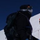
Old Ickabod standing at the notch.
A look over at a tower between the Peak and Needle from the notch--exhilarating!
Standing on the summit ridge just below the summit of the Peak.
We reached the summit in 2:05 minutes and descended in about 45 minutes. We packed up and headed to Broken Hand Pass. Once there, we dumped most of our gear and began our ascent of the Needle with the printer-friendly version of the route from 14ers.com!
Looking up the awesome nubby conglomerate near the start of the real climbing.
Old Ickabod nearing the top of the west gully preparing to gain the summit ridge.
I lost track of time during the ascent (I was focused on the climbing), but I think we summited from the pass in about 1:45 minutes. It is worth noting that the small amount of snow on the standard route can be avoided with little difficulty.
Looking from the Needle's summit down at part of the traverse.
Heading down the summit ridge preparing to carefully downclimb the Needle.
We were both pleasantly surprised to find the downclimbing fairly easy and we made good time. Again, we used the photos from the route report and made sure to locate all of the key points along the route. Cairns really helped, but the photos were invaluable. Thanks Bill for this wonderful site and all the great information.
Thumbnails for uploaded photos (click to open slideshow):
By the way, that picture you have of ”Crestone Needle” from the peak... that's not the Needle, that's a 14,000 foot tower Northeast of the true summit. In the picture after of your friend on the summit ridge, the Needle is behind him.
Congrats with both the Peak and Needle! It was nice to 'briefly' meet you on trail at Culebra, and again when we were coming down from the Peak!
Caution: The information contained in this report may not be accurate and should not be the only resource used in preparation for your climb. Failure to have the necessary experience, physical conditioning, supplies or equipment can result in injury or death. 14ers.com and the author(s) of this report provide no warranties, either express or implied, that the information provided is accurate or reliable. By using the information provided, you agree to indemnify and hold harmless 14ers.com and the report author(s) with respect to any claims and demands against them, including any attorney fees and expenses. Please read the 14ers.com Safety and Disclaimer pages for more information.
Please respect private property: 14ers.com supports the rights of private landowners to determine how and by whom their land will be used. In Colorado, it is your responsibility to determine if land is private and to obtain the appropriate permission before entering the property.


")