Download Agreement, Release, and Acknowledgement of Risk:
You (the person requesting this file download) fully understand mountain climbing ("Activity") involves risks and dangers of serious bodily injury, including permanent disability, paralysis, and death ("Risks") and you fully accept and assume all such risks and all responsibility for losses, costs, and damages you incur as a result of your participation in this Activity.
You acknowledge that information in the file you have chosen to download may not be accurate and may contain errors. You agree to assume all risks when using this information and agree to release and discharge 14ers.com, 14ers Inc. and the author(s) of such information (collectively, the "Released Parties").
You hereby discharge the Released Parties from all damages, actions, claims and liabilities of any nature, specifically including, but not limited to, damages, actions, claims and liabilities arising from or related to the negligence of the Released Parties. You further agree to indemnify, hold harmless and defend 14ers.com, 14ers Inc. and each of the other Released Parties from and against any loss, damage, liability and expense, including costs and attorney fees, incurred by 14ers.com, 14ers Inc. or any of the other Released Parties as a result of you using information provided on the 14ers.com or 14ers Inc. websites.
You have read this agreement, fully understand its terms and intend it to be a complete and unconditional release of all liability to the greatest extent allowed by law and agree that if any portion of this agreement is held to be invalid the balance, notwithstanding, shall continue in full force and effect.
By clicking "OK" you agree to these terms. If you DO NOT agree, click "Cancel"...
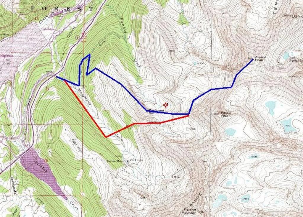
Route:
-Start at Mayflower Gulch TH
-Over Mayflower Hill
-Crystal Southwest Ridge
Blue: Ascent Route Red: Descent Route
Stats:
-Elevation Climbed: 3,200'
-Mileage RT: 8.0 miles
The Conditions and Route Choice:
Very high winds and moderate snowfall the previous 3 days to this climb called for a ridge run mountaineering route. No skis, boo hoo. Since Crystal was still on the 'to do' list and had reasonable access, it was a good option. I knew the avalanche danger would be high. The forecast for the day was for 4-8 inches of snow and moderate winds, but reasonable temps. With tender slabs already formed, additional loading of new snow through the day would mean certain avalanche activity. This made it an easy decision to go over Mayflower Hill instead of ascending the Pacific Creek drainage to avoid the danger. I was concerned about being prone to the avalanche slopes during the traverse under Pacific North Face, so an aborted mission was probable.
Mayflower Hill:
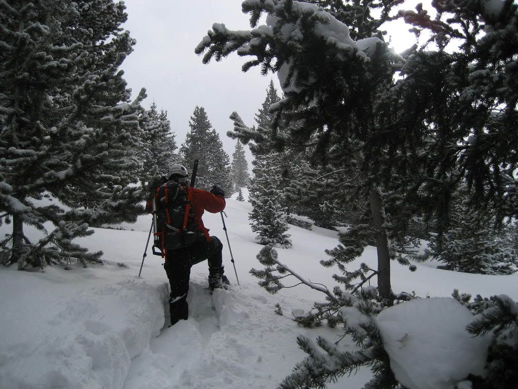
Going over Mayflower Hill was a nice addition to this normally simple route, especially in winter. To reach tree line, we used an old mining road which ran North from the trailhead. After reaching a switchback with a less used road, we turned back south were serious trail breaking began. Without the additional 20lbs of ski gear, I felt a light as a feather and ready to break, but the snow was very deep and painstakingly difficult.
Breaking trail up to treeline on Mayflower Hill East slopes
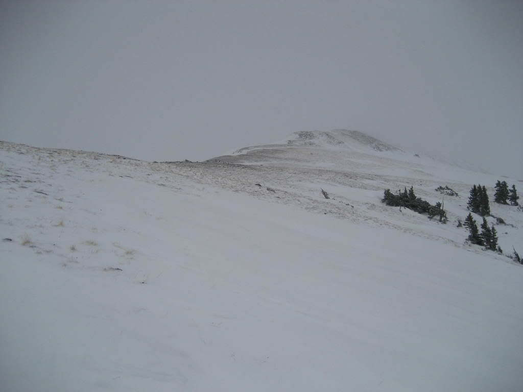
After reaching treeline, the going go much easier on tundra and talus.
On our way to Mayflower Summit
Before long we were on the 12,420' summit admiring the heavily corniced exposure to the North.
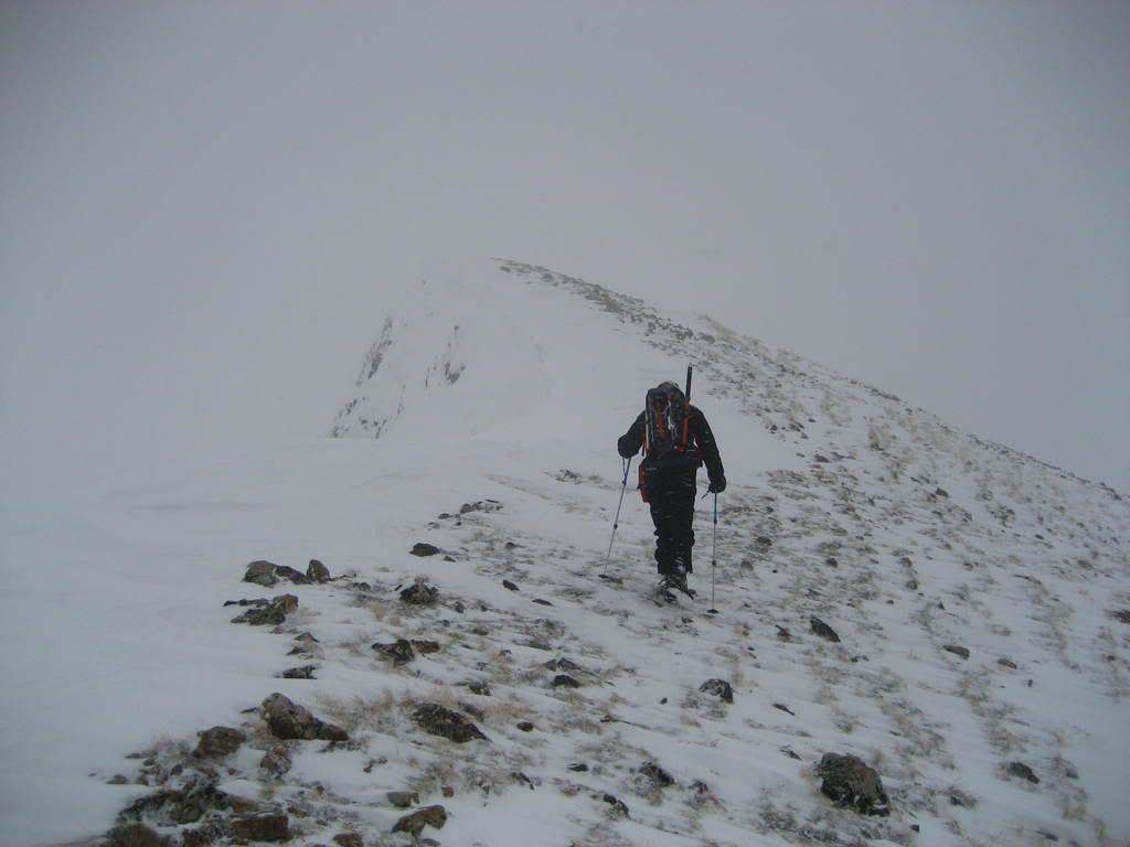
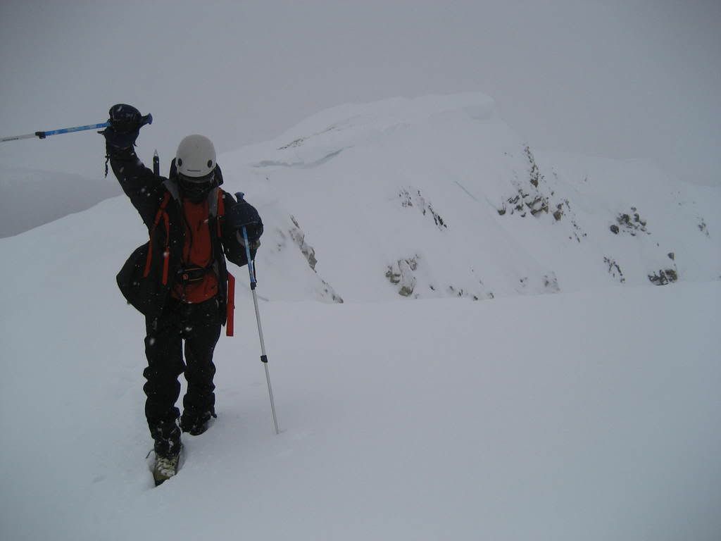
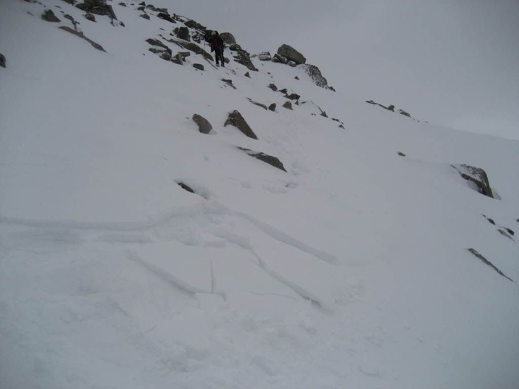
Prakash near the summit of Mayflower Hill
Climbing along the narrow ridgeline on the east ridge of Mayflower was a true winter climbing delight. The snow was clearly unstable, as small slabs built on either side of the snow spine ridge were easily sent down the mountain. Walking on a spine of snow like this is one of my favorite climbing experiences. This route was short, sweet and very effective in getting us to the base of Pacifics West Ridge without having to cross under any avalanche chutes.
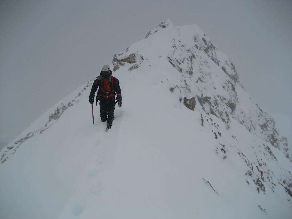
Prakash making his way down Mayflower Hill toward Pacific's West Ridge
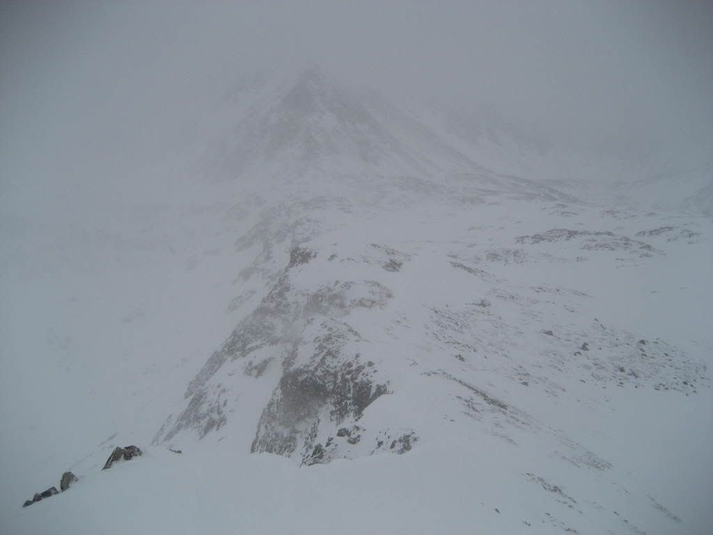
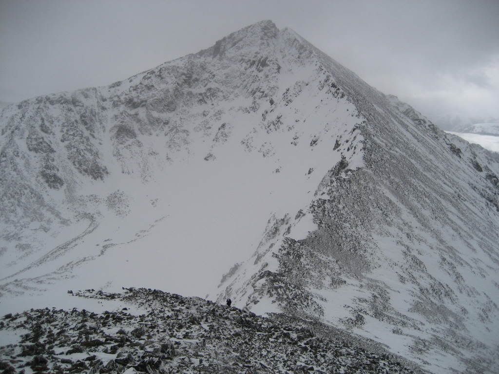
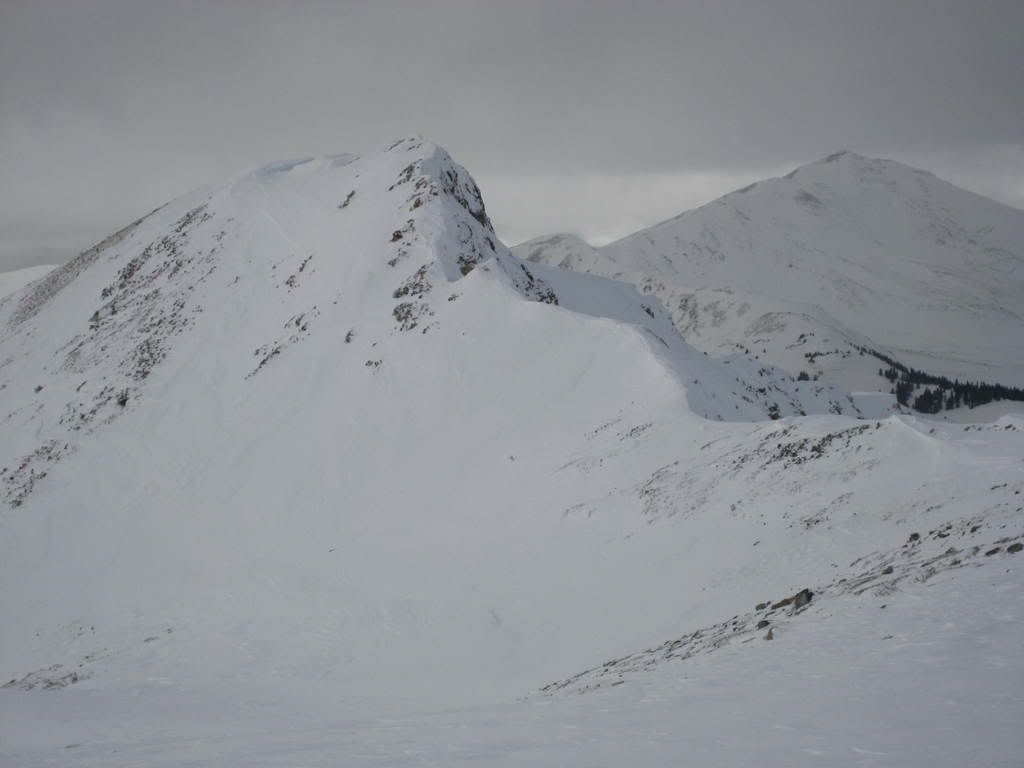
Looking toward Pacific's West Ridge from near Mayflower Hill summit
The visibility was very poor due to heavy wind loading off the ridge to the north. This made surveying the exit area from the ridgeline to begin the traverse toward Crystal a guessing game. To avoid potential avy terrain, we climbed 100' up the Pacific's West ridge to completely avoid this slide zone. Here are some pics of this area...
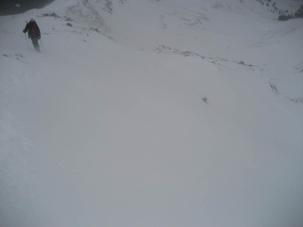
Prakash climbing above slide terrain at the base of Pacific's West Ridge
Descending around the avalanche slope, slabs disturbed by our trail can clearly be seen in the foreground
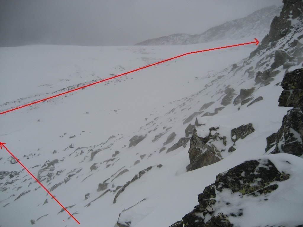
Once off the ridge and on the rolling low angled talus, we surveyed the danger of crossing below Pacific's NW slide paths. Here is the route toward crystal and the two largest paths from below...
The safe path
Largest slide paths on Pacifics NW face
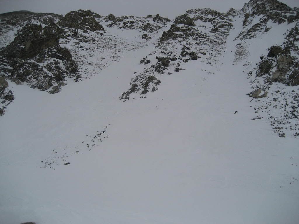
Luckly, there is a natural barrier you can walk on and be safe from these dangers above. It's a mini 30 foot tall ridge of talus running straight toward Crystal, with a significant cornice on its east side. Anything sliding off the face above would run south from the aprons of the couloirs. We had to ascend above several more smaller areas of avalanche terrain closer to the Pacific-Crystal saddle. Each one of these diversions added miles and vert to the climb. The weather was an enjoyable mix of ground blizzard and sunshine. Once we reached the saddle, it felt like all the hard work was over. Just getting to Crystal in these kinds of conditions is the challenge.
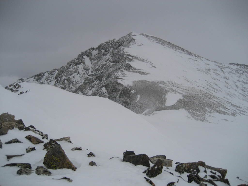
Saddle of Pacific and Crystal
At the saddle, we stashed our snowshoes under a pile of rocks. Climbing toward the false summit of Crystal was quick and easy. The views of Pacific from here are outstanding.
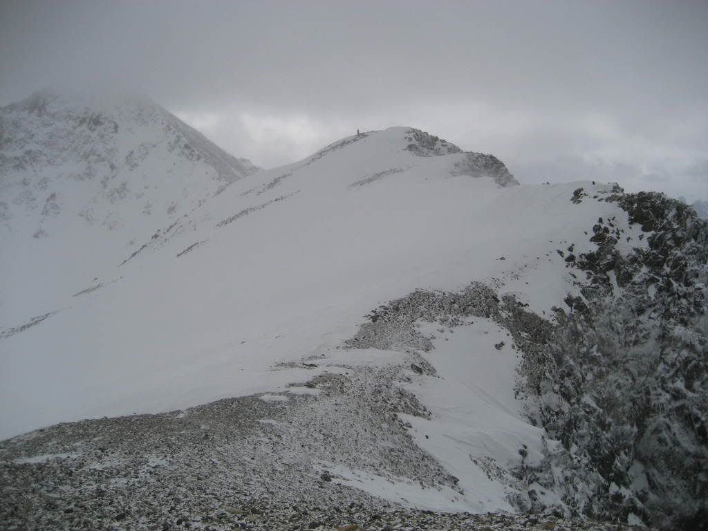
Looking toward the summit of Crystal from the false summit
With time running a little long on the day, I ran ahead and got the summit while Prakash waited in a windbreak on the false summit.
Looking back at the false summit with Prakash and Pacific visible
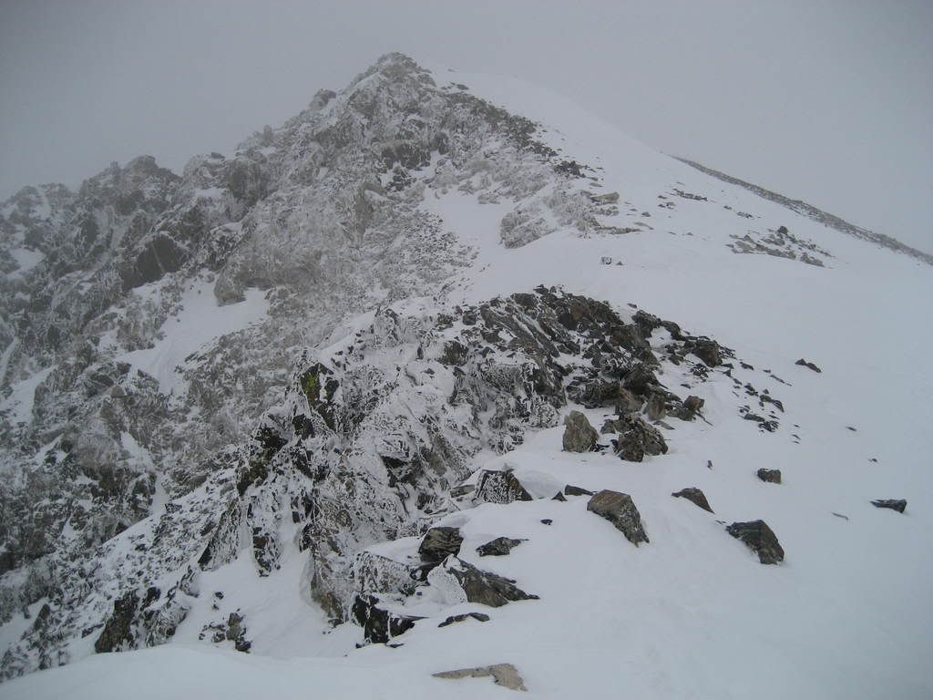
The snow conditions on the southwest ridge were quite different than elsewhere on the route. Several sections of ice and impenetrable snow fields make this very tame looking terrain somewhat interesting. Surface hoar frost grew heavy on the west face near the summit, a neat sight common to winter storms in the Rockies.
The final stretch to the summit on the SW ridge of Crystal
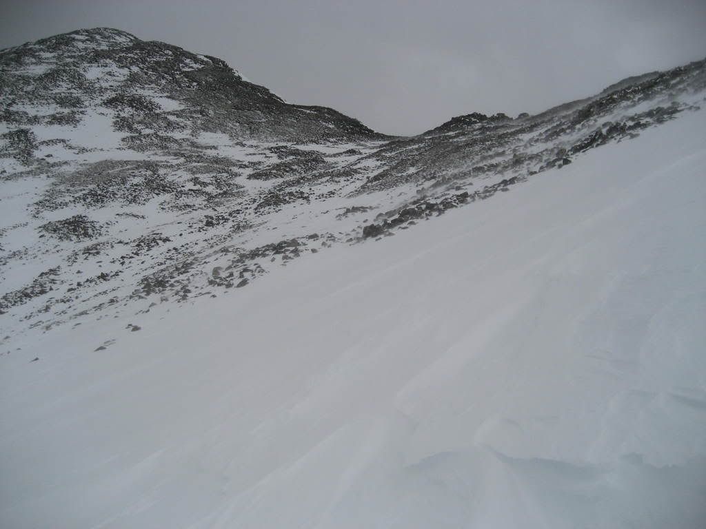
I summited, took some pics and headed back toward Prakash. From false summit to summit and back took me 23 minutes. I was happy to have an axe to glissade the ice/snow slopes. The way back to treeline went smoothly and we got a nice clear view of Mayflower. I also noted several natural slides on North aspects off the ridgeline. You can see our tracks on the ridge fin if you look closely...
Mayflower Hill in Febuary
Having witnessed the loading zones throughout the day, we knew we could take the Pacific Creek drainage as our descent route without being prone to a natural avalanche cycle. This saved some time in getting to treeline by not having to ascend Mayflower again, but once in the woods we realized our folly. The heavy snows of the past week or so had layed down a deep unconsolidated blanket of snow on top of the usual depth hoar cavity. 1+1 equal neck deep snow, no joke. At one point, I watch Prakash sink straight to his shoulders like a pencil into the snow. We tried rolling at one point it was so tough. The last half mile of trailbreaking through this area was possibly the most demanding hiking I have ever experienced, and it was DOWNHILL!!! The total trip took us 9 hours.
This route can be completed in high danger, but you must ascend above several avy slopes on the traverse below Pacific NW face. Know how to evaluate and avoid danger zones!
... you did sink to your neck, if only you wouldnt have freaked out and started floundering, I could have got a sweet pick Then again, you might have sunk completely under the snow. You had a beacon on though, I would have found you
A to-the-point, extremely accurate TR again as I've grown to expect from doumall. There were some tantalizing moments on this hike. The ridge leading up to Mayflower and off it were pretty sketchy with beautiful cornice formation. The pictures, as usual don't do justice to how exposed the ridge was, leading off of Mayflower's summit and if I wasn't in my usual high-altitude-daze I could have been persuaded by my couch-potato inner voice to turn back and forgo what was a terrific 9 hours of pure adrenaline. I would highly recommend not losing foothold on the ridge on either side of this summit. I did, at one point and slid 6 feet to the edge of a 10-15 foot drop onto the beginning of an avalanche-perfect slope that went all the way to the bottom. I managed to hook onto a rock with my outstretched leg and would not always count on this great fortune. However, this was the most exposed part of the climb and things got a little less nerve-wracking (exposure-wise) in the ensuing part of the climb towards Pacific's West Ridge.
Watching for avalanche zones seemed to be a never ending proposition on this hike and every section of the climb required careful analysis by an experienced hiker. I would not do this hike by myself if I were even mildly unsure of my avalanche training or winter-climbing experience.
The descent route was pure delight for every post-hole enthusiast out there . Actually Doumall is kidding when he says I sank to my shoulders... I sank to my neck... and would've kept going if I hadn't beaten about with my hands and tried to expose a larger body-surface area to the snow. This may be an extremely rare occurence, but if you're ever in it, I found that the approach you'd take to survive quick-sand works well here . We suspected that we'd walked over the creek. The snow was at least 6 feet deep judging by how far I'd sunk. I'm not sure if doumall was getting pictures of the route in this area considering we were half dead by this time. I would take steps to avoid the creek... in fact I would learn to ski prior to this hike.
If you like testing the fine line between adrenaline-rush and insanity, you will love this hike. It builds character .
Caution: The information contained in this report may not be accurate and should not be the only resource used in preparation for your climb. Failure to have the necessary experience, physical conditioning, supplies or equipment can result in injury or death. 14ers.com and the author(s) of this report provide no warranties, either express or implied, that the information provided is accurate or reliable. By using the information provided, you agree to indemnify and hold harmless 14ers.com and the report author(s) with respect to any claims and demands against them, including any attorney fees and expenses. Please read the 14ers.com Safety and Disclaimer pages for more information.
Please respect private property: 14ers.com supports the rights of private landowners to determine how and by whom their land will be used. In Colorado, it is your responsibility to determine if land is private and to obtain the appropriate permission before entering the property.