Download Agreement, Release, and Acknowledgement of Risk:
You (the person requesting this file download) fully understand mountain climbing ("Activity") involves risks and dangers of serious bodily injury, including permanent disability, paralysis, and death ("Risks") and you fully accept and assume all such risks and all responsibility for losses, costs, and damages you incur as a result of your participation in this Activity.
You acknowledge that information in the file you have chosen to download may not be accurate and may contain errors. You agree to assume all risks when using this information and agree to release and discharge 14ers.com, 14ers Inc. and the author(s) of such information (collectively, the "Released Parties").
You hereby discharge the Released Parties from all damages, actions, claims and liabilities of any nature, specifically including, but not limited to, damages, actions, claims and liabilities arising from or related to the negligence of the Released Parties. You further agree to indemnify, hold harmless and defend 14ers.com, 14ers Inc. and each of the other Released Parties from and against any loss, damage, liability and expense, including costs and attorney fees, incurred by 14ers.com, 14ers Inc. or any of the other Released Parties as a result of you using information provided on the 14ers.com or 14ers Inc. websites.
You have read this agreement, fully understand its terms and intend it to be a complete and unconditional release of all liability to the greatest extent allowed by law and agree that if any portion of this agreement is held to be invalid the balance, notwithstanding, shall continue in full force and effect.
By clicking "OK" you agree to these terms. If you DO NOT agree, click "Cancel"...
After spending the night in Buena Vista, we drove up the easy 4WD road (in a Hyundai Tucson, with no problems), found a spot in the crowded lot (bunch of campers), and then started up the trail at the North Cottonwood trailhead at 3:15 a.m.
The trail was pretty easy to follow, even in complete darkness. Although, there were a couple instances where some willows tried to beckon us off course, but we didn't take the trail bait and we were able to stay the course.
The morning air was cold, and because I was breathing heavily my lungs really began to burn (and continued to do so for hours). It kind of felt like my throat was coated in Mentholyptus.
Shortly after breaking above the trees it became light enough to turn off the headlamps. Then, moments later, I shot this picture of the ridge:
As we ascended past Bear Lake and up to a level area, we originally thought the 13er up to our left was Mt. Harvard. But after following the trail a bit further, we realized Harvard was right in front of us.
Harvard's south slope was pretty steep but the trail was pretty good. Then, close to the top, there was just a short rock scramble (easy class 3) to the summit.
Here's a shot looking back (from Harvard) down into the valley:
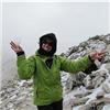
We were finally up on Harvard's summit at 7:45 a.m.:
Tired, but not beaten, we were ready to continue on to Columbia. After a careful inspection of the sky (crucial for this climb), we decided the weather couldn't be any better, so we pushed on down the ridge.
Harvard's east ridge was fairly easy and there was even a trail on some parts. I think we started on the left (north) side and then switched to the right (south) side after a break in the ridge.
Here‘s a pic of one section of Harvard's east ridge (the left/north side, I think):
Soon thereafter we made it to what I called a "grassy knoll," on the east ridge‘s "shoulder" (about a mile east of Harvard's summit). From there, the ridge turned to the south as we descended off the grassy knoll.
In the pic below ... Left: On the "grassy knoll," looking south. Columbia is in the distance. Right: Jen climbing down a loose gully. Some of those rocks way down below (upper portion of the photo) were as large as two-story homes.
After that easy section, the route became much less obvious and much more serious. I think we first traversed a steep, rocky slope, and then we descended a slippery, scree-filled couloir. It was rather nasty.
From that point, here's a pic of the rocky mess we had to contend with (keep in mind, the photo really doesn't do it justice):
At one point we found an overlook where we stopped for a few minutes to figure out a route. All of the options before us looked pretty grim. As I saw it, we had three: (1.) Descend far into the valley (where it was green) and then climb around the rocks and all the way back up to Columbia, (2.) Climb down until we could find a route to traverse across the boulders and talus, or (3.) Stay high, with the risk of cliffing out or encountering class 5 sections. We chose option 2, but it was an option filled with many more options along the way.
The route-finding quandary before us (I highlighted the general route we took):
We ended up going down to about 12,600' (according to my GPS) before traversing parallel to the ridge over some huge boulders. I can't recall ever seeing such a large pile of rocks. It was massive, and as I said, some boulders were as big as houses.
At one point we decided to take some grassy ledges to bypass a rock field that was below us. As the ledge narrowed I began to worry that it would cliff out. Thankfully it didn't, and it was a good route to take. But there were many more gullies to climb up and/or across. We just continued to slog up the mountain of rock toward Columbia. It was extremely grueling.
After finally making it up to a level grassy area, we easily regained the spine of the ridge and headed up the last pitch (about 700 feet) of rock to Columbia's summit. After huffing over one small false peak, we gained the summit at 11:20 a.m. Thankfully, the weather had been great all day, and it continued to be great throughout the day.
Me on Columbia's summit (Bear Lake in the background):
As we descended we saw a whole mess of goats on Columbia's east ridge trail. In the pic below ... Top: Goats on Columbia's East Ridge ... Bottom-left: Jen about to descend Columbia's west slope ... Bottom-right: Trail marker.
Had to be careful not to take the scree-filled couloir (Don't do it!). We just kept on walking to the more hump-like ridge, where we found a cairned trail down. We also noticed some bright orange trail markers (bottom-right photo above).
Hiking down Columbia's west slope (4 on Roach's map) was not fun at all. It was very steep and very loose (mostly dirt and gravel). On our way down we ran into the first people we had seen all day. Toward the bottom it was even more eroded. I didn't like contributing to that erosion problem, but at that point we had no choice. I didn't realize it was so bad.
After what seemed like an eternity, we made it down to the trees and found a single-track trail leading into the woods. The trail soon came to a V, which we took to the left (south). After passing through some campsites and hooking up with another trail, we continued on until we hooked up with the main trail (big cairn at the junction).
The last 3 to 4 miles were easy, but our feet - er, "blister nubs" - were killing us. I guess my lungs also burned, my eyes were dry and itchy, and just about every muscle in my body was sore. It kind of felt nice, though, in some sort of sick and twisted way.
We had planned to climb San Luis the following day, and I was wondering if that was going to be possible ...
At 2:30 p.m. we finally stumbled into the parking lot at the N. Cottonwood trailhead. Of all the 14ers and 14er combos I've done, the Harvard and Columbia combo has been the toughest and most time-consuming to date. Harvard on its own wasn't so bad, but getting up and then down Columbia was pretty grueling. I doubt I'll ever visit that summit again.
So just how much mileage and vertical gain did we encounter on this trek, you ask? Well, here it is broken down, as I see it:
MILEAGE: Trailhead to Harvard's summit (6.75 miles) ... plus ... the ridge between the two peaks (2 miles, "as the crow flies," but I don't know anyone that hikes like a crow - hence, you must add switchbacking, backtracking and meandering (1/2 mile, at least)) ... plus ... Columbia's summit back to the trailhead (5.75 miles) = 15 miles, as I estimate it. Not bad on paper, but keep in mind that a good portion of that mileage is on steep slopes, loose scree and unstable boulders.
ELEVATION GAIN: Trailhead to Harvard's summit (4,600') ... plus ... our lowpoint of 12,600' on the back of the ridge and up to Columbia's summit, which is 14,073' (1,473') ... plus at least 100' (being very conservative here) of gain from going up and down on the back side = 6,173 total feet gained.
If you are considering this route, I suggest keeping the following things in mind:
- Plan on hiking at least 14.5 miles and gaining about 6,000 feet or more ... over rough terrain that requires some healthy routefinding.
- Bring plenty of food and water. Three liters wasn't enough for me ... and we ate all the food we brought.
- Regardless of whether you do Harvard or Columbia first, when you reach the first summit take a really good inspection of the sky. When you're on the ridge, in between the two mountains, there really aren't any escape options if you run into bad weather.
- It took us 3-1/2 hours to get from Harvard's summit to Columbia's summit (we weren't going as fast as we normally do, but we weren't taking our time, either).
- For your reference: When we climb Longs Peak (Keyhole Route) it takes us about 8 to 9 hours. This combo took us about 11 hours.
- Columbia is an evil mountain. I can't speak for its east ridge route, but its north and west sides suck beyond belief.
- If you don't like steep scree slopes, loose talus, shifty boulders or unstable rock piles, this combo climb would be your worst nightmare.
Thumbnails for uploaded photos (click to open slideshow):
Aubrey, Thanks for the great pic‘s and even better route description and personal stats. We (Michiganders) were considering Harvard/Columbia double in July ‘08 followed by Shavano/Tab double a day or so later, but after reading your trip report I think we‘re going to forego Columbia.
For two of the guys this will be their first climbs so I want them to enjoy it and desire to return again next year. I‘ve only done five myself and have no desire for the 6th climb to be merely an endurance test. Thanks for the great TR!
Aubrey - great trip report! I printed it out when we did the Harvard-Columbia Traverse July 15, 2007. I would 100% agree - Columbia is an evil mountain and sucks beyond belief! Although I'm glad I did the Traverse, I don't see myself going back to Columbia ever again - Harvard definitely - Columbia definitely not...
Great Trip Report! I'm using this info to plan for the same route this weekend. I just hope the snow won't make it much more difficult.
Caution: The information contained in this report may not be accurate and should not be the only resource used in preparation for your climb. Failure to have the necessary experience, physical conditioning, supplies or equipment can result in injury or death. 14ers.com and the author(s) of this report provide no warranties, either express or implied, that the information provided is accurate or reliable. By using the information provided, you agree to indemnify and hold harmless 14ers.com and the report author(s) with respect to any claims and demands against them, including any attorney fees and expenses. Please read the 14ers.com Safety and Disclaimer pages for more information.
Please respect private property: 14ers.com supports the rights of private landowners to determine how and by whom their land will be used. In Colorado, it is your responsibility to determine if land is private and to obtain the appropriate permission before entering the property.