Download Agreement, Release, and Acknowledgement of Risk:
You (the person requesting this file download) fully understand mountain climbing ("Activity") involves risks and dangers of serious bodily injury, including permanent disability, paralysis, and death ("Risks") and you fully accept and assume all such risks and all responsibility for losses, costs, and damages you incur as a result of your participation in this Activity.
You acknowledge that information in the file you have chosen to download may not be accurate and may contain errors. You agree to assume all risks when using this information and agree to release and discharge 14ers.com, 14ers Inc. and the author(s) of such information (collectively, the "Released Parties").
You hereby discharge the Released Parties from all damages, actions, claims and liabilities of any nature, specifically including, but not limited to, damages, actions, claims and liabilities arising from or related to the negligence of the Released Parties. You further agree to indemnify, hold harmless and defend 14ers.com, 14ers Inc. and each of the other Released Parties from and against any loss, damage, liability and expense, including costs and attorney fees, incurred by 14ers.com, 14ers Inc. or any of the other Released Parties as a result of you using information provided on the 14ers.com or 14ers Inc. websites.
You have read this agreement, fully understand its terms and intend it to be a complete and unconditional release of all liability to the greatest extent allowed by law and agree that if any portion of this agreement is held to be invalid the balance, notwithstanding, shall continue in full force and effect.
By clicking "OK" you agree to these terms. If you DO NOT agree, click "Cancel"...
This was my second time to summit Mt Columbia by it's southeast ridge. I had climbed it the previous March, a week after calendar winter (not the smartest thing I've done), so I went back for the snowflake. This is a great winter Sawatch route with very little avalanche danger that is often overlooked. Physically, it's a relatively "easy" winter 14er to climb and the route is pretty straight forward. However, trailhead access can be an issue making it a pretty long day. Also, much of the route is highly exposed to wind adding to the challenge. Both my climbs featured high winds despite low wind forecast.
Day of Climb: January 4th, 2020
Trailhead: Harvard Lakes
Peak: Mt. Columbia
Route: Southeast Ridge
Mileage/Elevation gain: 13.3 miles and 4838 feet of gain
Walking the road to trailheadTrailhead
I arrived at first light for this winter climb of Columbia and parked about a mile below the trailhead. My progress was stopped here by a steep hill that I couldn't get traction on. I saw no evidence of other vehicles making it further. The road was pretty snowy to this point, but it wasn't too difficult for my 4wd truck. A lesser vehicle probably would have had to park a couple miles lower at the beginning of the dirt road.
After gathering my gear I started hiking up the road. Boots were fine here as the road was packed down by hikers and skiers. Once reaching the trailhead the snow was deeper and less traveled on, so I put on my snowshoes and ascended Northwest up the Colorado Trail. After a couple of switchbacks I left the Colorado Trail at about 10,000 feet and continued up the spine of the Southeast ridge. There was no trail or tracks to follow so I began trenching through the forest staying mostly center ridge or slightly right.
My trenchBeginning of Southeast ridge after leaving the Colorado Trail
Route finding was easy as the forest was pretty open and bushwacking was kept to a minimum. Occasionally, I came across rock outcroppings that were easy to go over or slightly around on either side. None of these obstacles were harder than class 2. The forest thinned out more and more as I approached treeline making progress easy. Staying center ridge continued to be the best path.
Working my way up the ridgeApproaching treeline
As I neared treeline I was able to ditch the snowshoes and left them in a secure place (I didn't expect anyone else to come along though). I continued up the ridge over mostly windblown terrain. Thus far I had encountered very little wind, but it picked up here and remained strong (despite the low wind forecast) for the entire ridge.
Treeline. Upper ridge can be see in the distance.Better view of upper ridge with the first view of the summit in the distance.
After climbing to a jumble of rocks at about 12,600 (which I skirted to the right) I came to the base of a small point that was easily bypassed on the left. I would not try to undercut the rock jumble or you'll just end up on steep, loose terrain and you need to get to the 12,600 foot contour line anyways. I continued across a flattish saddle like area before a short, steep climb to a rounded hill at 12,800 feet where the ridge turned to the west and steepened again.
Next, I easily crossed over 2 rocky outcroppings (going slightly to the right side of each) and reached the upper ridge at around 13,300 feet or so. The rest of the route could now be seen and the summit was still nearly 2 miles away. Thus far, not surprisingly (with the way the wind pounds this ridge), the ridge above treeline had been mostly windblown. This has been the norm for winter 14ers in my experience. Any snow I encountered was consolidated and easily climbed in boots. The rest of the ridge looked like more of the same.
Flattish area before climb to upper ridge. The summit is now easily seen over the hill where the ridge turns west.Rocky point marking the start of the upper ridge.Looking down ridge and the track I took across saddle at 12,600 feet.Climbing to the upper ridge with a great summit view across the Three Elk Creek Basin.
Once on the upper ridge the rest of the route was a breeze. There was still a long way to go though as I traveled around the cirque with many ups and downs (with most being skirted on the left). Even with the ridge narrowing some, the terrain was mostly easy climbing the rest of the way . Strong headwinds were persistent though as I traveled along this upper section, and they became annoying crosswinds after the turn north to the summit. At times I couldn't even see the summit with snow fiercely blowing across the ridge. It was easy to see why the ridge was so windblown.
Skirting a small bump here.Another bump here that I went to the left of.Beginning the turn north towards summit. The Southeast ridge route joins the standard route near here.Great view of Mt Columbia summitMore easy terrain as I get closer to the summit.Looking back down the Southeast ridge
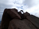
As I got closer to the summit there was a bit more class 2 scrambling along the ridge crest. The crosswinds were particularly bad here, and I kept a low profile to avoid getting knocked off into Three Elk Creek Basin. There's a small point just before the summit (which I skirted on the right), and then I finished the climb off with a short talus hop to the actual summit. This was my third summit of Columbia, and I always find the views of a snow covered Harvard amazing.
A closer look at summit as I make my final approachRocky scramble to summitMt Harvard from SummitYale to the south.SelfieSoutheast RidgeEast Ridge and Buffalo Peaks in the distance
After a short stay on the summit I started my descent back down the Southeast ridge. The winds picked up even more and were much worse on the return. I definitely reccomend climbing this route on a low wind day if you can find one. I made my vehicle just before dark. Curiously, there was a $10 bill on my windshield, and I had no idea why. I didn't complain though, stuffed it into my pocket and headed home extra happy. Halfway home though, I realized my shovel was missing from my truck bed lol. It was a $30 shovel.
On a side note, it's possible to descend the East Ridge and link back to the Southeast Ridge by the Colorado Trail. However, I wouldn't try this in the winter. I did this loop on a previous climb of Columbia, and it was a nightmare spending 3 or 4 hours trenching the Colorado Trail between ridges.
My GPS Tracks on Google Maps (made from a .GPX file upload):
...in this route in winter. Thanks for the really good report and photos. (unrelated 14er... will be really interested in another report of LB west ridge direct if you go back and downclimb that someday)
You overpaid for that shovel, no way it was worth $10, I thought I was being generous. If you'd like to buy it back let me know, I needed it to get my lowered miata up that hill.
Nice pics, this route is on my to do list this winter.
Thanks greenonion! You'll enjoy this route if you can avoid the wind...I'm hoping to get back to LB this fall before the snow piles up. Might be early summer though. Either way, I'll report back about that downclimb.
Thanks Will! You'll crush this route. Lol, I knew that lowered miata had something to do with the missing shovel. Leo and I will be looking out for you this winter for my 20. Our paths are bound to cross again.
Having descended the East Ridge in March of 2018, linking back up to the CT and back to the trailhead I can and 2nd the recommendation of DO NOT DO THIS UNDER ANY CIRCUMSTANCES. The wind was nicely shielded on the ridge for us, but once we dropped into 3 Elk Basin...I think I still have nightmares lol
Thank you dwoodward! Yeah the east ridge looks inviting and it is nice. It's more of a primrose path though with an untracked basin and Colorado Trail waiting for you.
I had some absolutely brutal trenching solo back in winter 2018, you photo brought back those memories. Still, an underrated Swatch winter route, and a nice route where you don't have to sweat avalanche danger too much.
Caution: The information contained in this report may not be accurate and should not be the only resource used in preparation for your climb. Failure to have the necessary experience, physical conditioning, supplies or equipment can result in injury or death. 14ers.com and the author(s) of this report provide no warranties, either express or implied, that the information provided is accurate or reliable. By using the information provided, you agree to indemnify and hold harmless 14ers.com and the report author(s) with respect to any claims and demands against them, including any attorney fees and expenses. Please read the 14ers.com Safety and Disclaimer pages for more information.
Please respect private property: 14ers.com supports the rights of private landowners to determine how and by whom their land will be used. In Colorado, it is your responsibility to determine if land is private and to obtain the appropriate permission before entering the property.