| Peak(s): |
Mt. Meeker - 13,916 feet |
| Date Posted: | 08/08/2020 |
| Modified: | 09/05/2020 |
| Date Climbed: | 08/08/2020 |
| Author: | trkl9 |
| Peak(s): |
Mt. Meeker - 13,916 feet |
| Date Posted: | 08/08/2020 |
| Modified: | 09/05/2020 |
| Date Climbed: | 08/08/2020 |
| Author: | trkl9 |
| The Route Less Traveled to Mighty Meeker |
|---|
|
Meeker Meadow and the South Ridge to Mount Meeker TH: Sandbeach Lake Miles: 12.65 Vertical Feet: 5,562' Time: 9 hrs 25 min It's funny that the only route description on this site is this route I took today but so many of the other classics to Meeker are far more traveled. There are so many routes I want to take to Meeker but I'll start with this one. This is my first summit of Meeker. I've bagged all the surrounding peaks so I had to get this done. I chose this route mainly because I would get the avoid the nightmare that is Longs Peak trailhead on a weekend morning. This was such an exciting route and I will likely come back again for the solitude and for training in the future. Although this is listed on the routes, I thought I'd put in my two cents and bring the beauty of this route into light. I started around 4:30 AM from the trailhead with a haze and thickness in the air and a strong smell of fire. I assume it's from the large fire on the western slope. I was a little worried about the views later on but continued on. The smoke got thicker the farther I went, even to the point it was burning my eyes for a bit. I was just hoping once the sun came up the wind would pick up and blow some of it out of the area. Luckily, it did and the day turned into a wonderful summit day. I met another hiker on the Sandbeach trail that was doing the same route. He moved on ahead of me but I met him later in the bushwhack again and we continued on to the summit together. We would be the only two people on the route the entire day. Continued on the Sandbeach Lake trail for ~3.4 miles before my turn off point. Here, there is a bridge crossing that continues on to Sandbeach Lake. Instead of crossing over there is another trail that follows Hunter's Creek to Lyric falls. 
I followed this trail as long as I could but it quickly becomes hidden by dead fall and vegetation. It becomes a full fledged bushwhack pretty quick. There are multiple faint trails through this section and most will get you where you need to go but it's pretty much an obstacle course the whole way. GPS was helpful. If in doubt, keep the creek within an earshot and follow it on its north side. It is just over 1 mile from the turn off until the first view of Meeker at the beginning of the Meeker Meadows area. 

After ~1.07 miles Meeker and some of the route come into view. This is the start of Meeker Meadows at ~10,500'. There are a few packed down areas where other hikers have obviously passed but they are not constant or that obvious. There are a few places with cairns that help but route finding was important through this section. There is a creek that winds through that I crossed a few times. As the description and my guide books suggest, this area is pretty marshy. I was glad that I brought my waterproof boots instead of my trail runners. The shoes got a little wet. 
The following pictures take you through my route through the meadows and even up farther along on the slope to the south ridge 


The meadow was calm and serene. Would make a perfect place for camping if RMNP allowed it. The meadow leads to the base of the slope where it really starts to get steep. At the base (next picture) it is 5.07 miles from the trailhead. 
From this point, it gets more strenuous. It is 1.2ish miles and 2,970 feet(!!!) according to my GAIA GPS. This almost doesn't seem right but it adds up perfectly with other route descriptions' miles and vertical gain. We went straight up the slope. No wonder we had to stop so often. Took us over 2 hours to summit from here. 
At the top of the clearing, we got our first taste of rock. All class 2 until the ridge but very steep. 

I didn't picture here but before you gain the ridge and bigger rock, there is a brief section of small, loose talus and scree over steep terrain. If you're in a group, It may be wise to use helmets here, or spread apart in case of rockfall. Otherwise the rockfall on this route was pretty minor. Continuing on after the loose section, the rock begins to get bigger and more stable, giving way to class 3 scrambling. 


A little bit higher, just before gaining the ridge there are some rocky ledges that require a bit more effort and in my opinion, easy class 3 moves. 

Gained the ridge at 5.89 miles from the trailhead. Took a short break here and took in amazing views to the south and west. 


After a short break, we continued on. From here we took a direct route up the ridge with mostly class 3 scrambling. Exposure increased the higher we got, most of the exposure was at the top near the summit. Less than .50 mile and 700 feet to the summit from here. 


Before going to the summit, we enjoyed some views of the loft and admiration for Longs peak, towering near by.


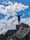
Made it to the summit at 6.27 miles from the trailhead and just after 5 hours. Last 1.5 miles were SLOW and I would consider myself in pretty good shape. Amazing views from the summit and actually may be one of my favorite views all time. Had the summit to ourselves. 


Wind started to pick up after about 15 minutes on the summit and it was time to go. Followed the same route back down. 40-50 mph wind gusts on the ridge on the way back, a complete 180 from the ascent. 
What a fantastic route up to Meeker's summit. If you're searching for more solitude, this is definitely the route to try. It's worth the extra mileage and effort. Happy to have bagged another classic Colorado peak. Thumbnails for uploaded photos (click to open slideshow): 


|
| Comments or Questions | ||||||||||||||||||
|---|---|---|---|---|---|---|---|---|---|---|---|---|---|---|---|---|---|---|
|
Caution: The information contained in this report may not be accurate and should not be the only resource used in preparation for your climb. Failure to have the necessary experience, physical conditioning, supplies or equipment can result in injury or death. 14ers.com and the author(s) of this report provide no warranties, either express or implied, that the information provided is accurate or reliable. By using the information provided, you agree to indemnify and hold harmless 14ers.com and the report author(s) with respect to any claims and demands against them, including any attorney fees and expenses. Please read the 14ers.com Safety and Disclaimer pages for more information.