| Peak(s): |
Mt. Massive - 14,427 feet |
| Date Posted: | 05/24/2020 |
| Date Climbed: | 05/22/2020 |
| Author: | Verticality |
| Peak(s): |
Mt. Massive - 14,427 feet |
| Date Posted: | 05/24/2020 |
| Date Climbed: | 05/22/2020 |
| Author: | Verticality |
| Mini Tour de Massive |
|---|
|
Hike Details
https://www.strava.com/activities/3495949353 North Halfmoon Creek TH -> North Massive -> Massive Green -> Mount Massive -> descent southwest slopes
Left Denver on a crisp Friday morning around 2AM. The dirt road to Halfmoon Creek Trailhead is very long and narrow. We got to within 0.3 miles of the trailhead before deciding to avoid rougher terrain and park. After a short walk to the trailhead, we began our hike around 5AM.
The trail starts off relatively flat while winding through the lower meadows of the Mount Massive Wilderness. Several dozen snow patches linger below treeline, while the powerful spring sun continues to melt out the snow across the trail. In the early morning most of the unavoidable snow patches can be walked over without too much distress. I was able to make it all the way to the summit without getting my shoes too wet.
Quickly past the trailhead we entered Mount Massive Wilderness and enjoyed the lush green environment around us in the midst of great spring weather.
The path has several water sections with some light flooding from the creek and the snowmelt. Most can be crossed without too much distress. Each stream crossing brought us closer to the west side of the Massive basin.
Closer to the steep slopes of Mount Massive, the angle increases and the terrain becomes more rocky. This was the best opportunity to get the legs worked and ready for the remainder of the hike. Routefinding here can be difficult before reaching the upper sections of the basin.
The valley began to open up as the snow became patchier and the hills revealed themselves in front of us. Several willow groves and thickets surround the trail but it is mostly a walk through the woods.
At 11,200 feet we hit the main junction of the Halfmoon Creek Trail. A right here will take the ardent hiker directly up the steep southwest slopes of Mount Massive. For our tour, we needed to first ascend North Massive and so we continued straight on the trail all the way up to Halfmoon Lakes.
Another half mile or so past this junction brought us into the icy upper reaches of the Mount Massive Wilderness basin beneath Halfmoon Lakes. Several large rock outcroppings block the way for some easy class 3 moves, or can be avoided entirely with some extra work.
We took each opportunity to stretch our legs and climb up-and-over these rock outposts. Nothing too difficult and they are not extremely tall, posing minimal risk.
After a few of these areas we quickly reached the lower Halfmoon Lake. At over 12,000 feet even the lower lake was completely frozen over. I hope to come back and see these lakes in the warmth of summer with the surrounding lush wilderness.
We traveled directly east of the lower lake, moving over some steep slopes and rock sections and towards the upper basin. At this point the morning glow of Mount Massive and North Massive rose prominently in front of us. We could start to pick out the distant challenges ahead as we moved over the hard morning snow and cold, rigid tundra.
From the above picture, the path we took hugged the right side of the slopes and talus fields directly underneath the rising ridge above. Without any traction or snowshoes, we were able to easily cross this remaining section of snow and talus to make it towards the upper basin.
Moving along the talus and snow, a majestic rock sits in all its morning glory.
The remaining hike into the upper basin is short and sweet from here. We walked directly up the low-angle slope and enjoyed the impressive views around us.
We reached the upper basin right as the sun breached the Massive ridgeline, and enjoyed a quick rest at this section around 13,000 feet.
The early morning sun reflected off the snow and filled the basin with a peaceful glow. North Massive was the palatial, contoured peak rising in front of us. Its twin-peak summit is steeper and more grandiose than it proposes from the depths of this upper basin. We were to ascend the south ridge directly west (left) of us. A nifty little ridge walk would take us to the edge of Mount Massive and up onto the final slopes to the summit of North Massive.
The route presents two interesting challenges here. The recommended way to reach North Massive is typically directly west (left) onto the south ridge, avoiding the aggressive tower on the south end of it. The more direct route to Mount Massive is to go directly northeast up the extremely steep and broken face. This massive rock chute leads up to between North Massive and Massive Green. For our adventure we wanted to ascend the steep slope up to the south ridge. This is a harrowing adventure in the late spring as the wet slab layer is thin but consolidated. The angle is not extreme but self-arresting capability is definitely recommended here until fully dry. Definitely at least microspikes, not sure how crampons would do in the wet snow.
Several hundred feet on less-than-ideal snow up and on to the southern ridge of North Massive. Aim for the lowest sections of dry rock and position yourself over the dry sections as necessary. Slow and steady here until safe ground is reached.
The line we took had a dry patch of rocks about 75% of the way up to the ridge, where we paused to catch our breaths and refocus. The final 25% might be the hardest part, depending on the line you take. Traction here is terrible. We reached the rocks at the top of the ridge and quickly scrambled to the relative safety of the dry south ridge. I took a picture looking back down towards the upper basin from the dry section at the top.
From this standpoint there was only one way to the summit. We followed the south ridge up all the way up on to the final slopes of North Massive. A few minor class 3 moves, snow on both sides of the ridge, and decent exposure abound. The ridge is relatively short.
Looking back on the south ridge from the conjoined saddle, we took a moment to acknowledge that the hike had definitely shifted gears.
Here we hiked over the quickly melting snowfields across the highest slopes to the North Massive summit. Several hundred foot sections can be easily crossed over dry tundra.
A few sections have a bit of snow coverage still there. Did not encounter any notable post-holing here.
As we crossed the stoic upper slopes of North Massive, we basked in the morning sun and enjoyed a direct view of Massive Green and Mount Massive.
The last hundred feet or so to the summit is quick and fun class 2.
The view is extreme and profound at the summit of North Massive. This peak is much less frequently traveled than the stout Mount Massive summit nearby. The summit of North Massive is actually two peaks of very similar height. The west summit (first one reached) is the tallest.
The hike/slide/scramble over to the east summit took maybe five minutes.
On the east summit we enjoyed ourselves and had a quick snack with a view.
The initial downclimb from the east tower of North Massive to the saddle is fun class 2 with a mix of class 3. Lots of snow on the north side makes the exposure seem worse than it really is. Lots of ways to go here, so pick your poison.
After the first hundred feet or so it mellows out and a tower feature comes in to play. This tower feature is the single obstacle between North Massive and Massive Green. When we reached the saddle we could appreciate the view on the other side of of our first peak.
After crossing the first tower obstacle we quickly moved up the easy class 2 to the summit of Massive Green. From here we could see the true summit of Mount Massive.
After a small descent we pushed up and over the ridge towards the true summit. We could see a triumphant hiker in the distance standing on top. Snow separated on the north side of the ridge.
At the summit this faceless hiker became our brief companion as we enjoyed a Massive view, together.
Large blocks across the ridge tease precipitously over the edge into the upper basin.
Another 10-20 minutes of hiking from the summit of Mount Massive over to the very top section of the southwest slopes route. From this rocky point the trail is easy to find and winds over to the steep upper slopes.
After our mini Tour de Massive, the steep but straightforward southwest slopes route was an absolute pleasant sight. We cruised down the steep section running much of the switchbacks.
The top section felt the steepest, but this may have been subjective because of snowfields below. The top section was mostly all dry. It was steep but the trail was very well constructed and easy to follow.
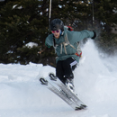
After the first main dry section we reached the snowfields below. Our companion at the summit had warned us of these lingering snowfields. The snowfields were extremely large and unavoidable, but the angle was not too much and the snow was soft by this point in the day. We were able to glissade with no gear quite easily down much of these slopes.
As we stumbled and slid down the southwest slopes, we took a moment to enjoy the epic view of the Sawatch mountains.
The southwest slopes are steep and unforgiving to the beginner hiker. You will want strong ankles and willpower going up this one. Coming down was much easier for us on our tour.
Back near the trail junction signs of spring were blooming around us.
The remaining miles back to the trailhead were much quicker on the the return trip. Our feet got soaked by the quickly melting snow that lingers all across the lower trail and wilderness sections. Near the bottom of North Halfmoon Creek we enjoyed the cascading falls.
Back at the trailhead we took a dip in the water to unwind and cool down after the 10+ mile hike.
Thumbnails for uploaded photos (click to open slideshow): 


|
| Comments or Questions | |||||||||
|---|---|---|---|---|---|---|---|---|---|
|
Caution: The information contained in this report may not be accurate and should not be the only resource used in preparation for your climb. Failure to have the necessary experience, physical conditioning, supplies or equipment can result in injury or death. 14ers.com and the author(s) of this report provide no warranties, either express or implied, that the information provided is accurate or reliable. By using the information provided, you agree to indemnify and hold harmless 14ers.com and the report author(s) with respect to any claims and demands against them, including any attorney fees and expenses. Please read the 14ers.com Safety and Disclaimer pages for more information.