Download Agreement, Release, and Acknowledgement of Risk:
You (the person requesting this file download) fully understand mountain climbing ("Activity") involves risks and dangers of serious bodily injury, including permanent disability, paralysis, and death ("Risks") and you fully accept and assume all such risks and all responsibility for losses, costs, and damages you incur as a result of your participation in this Activity.
You acknowledge that information in the file you have chosen to download may not be accurate and may contain errors. You agree to assume all risks when using this information and agree to release and discharge 14ers.com, 14ers Inc. and the author(s) of such information (collectively, the "Released Parties").
You hereby discharge the Released Parties from all damages, actions, claims and liabilities of any nature, specifically including, but not limited to, damages, actions, claims and liabilities arising from or related to the negligence of the Released Parties. You further agree to indemnify, hold harmless and defend 14ers.com, 14ers Inc. and each of the other Released Parties from and against any loss, damage, liability and expense, including costs and attorney fees, incurred by 14ers.com, 14ers Inc. or any of the other Released Parties as a result of you using information provided on the 14ers.com or 14ers Inc. websites.
You have read this agreement, fully understand its terms and intend it to be a complete and unconditional release of all liability to the greatest extent allowed by law and agree that if any portion of this agreement is held to be invalid the balance, notwithstanding, shall continue in full force and effect.
By clicking "OK" you agree to these terms. If you DO NOT agree, click "Cancel"...
trailheads: Little Cimarron East (start), Fall Creek (end)
additional equipment: bike
partner: solo
class: 3 (Did NOT do the east ridge of Silver, that goes class 4.psycho)
I have been wanting to do this route for a few years now, but it's not one you can just go "do". It takes a bit of endurance, planning and weather cooperation. With the injuries, this also took quite a bit of PT and training to get back to. Most of this route is off trail, which takes a bigger toll on the joints. It's also more mentally exhausting, since you can't just go on autopilot, you have to be constantly engaged in micro route finding (even if most of this route is easy tundra/talus).
As for the logistics, I didn't want to walk or run the road, like others have done. Nor was I going to be lucky enough to get a car shuttle. Finding partners that want this type of route, or are capable and have the time when the weather is right, are difficult. Most others have done the route starting at Fall Creek and end at Little Cimarron East, so that they are scrambling up the east ridge of Silver. But, I wanted a downhill bike at the end - less effort, just ride the brakes down 4 miles and 1,300'. Easy peasy, right?
So I decided to roll the dice that the "class 3" on the east ridge of Silver Mtn A would be #1 findable & #2 doable.
Lots of hunters up on the road this time of year, so I parked at the Little Cimarron East trailhead for the short night. I had planned to get up around 2am and get on the trail about 3. This didn't happen, since I kept rationalizing that this week was shorter than last weeks ~30 miler, so I could sleep in longer. I really should listen to not sleepy me, that one is smarter than sleepy me! So I got on the trail closer to 4 than I should have.
The trail starts off on an old 4 wheeler track, and is pretty flat and easy to follow. When it meets up with the regular Cimarron trail, it goes down to regular trail size as it enters into the Uncompahgre Wilderness. I ran into avalanche debris and snow, when I crossed the path of the drainage of the NE couloir on Sheep Mtn C. Thankfully, it wasn't difficult to cross the 2 swaths of destruction to get back to the trail in the dark. Old trails that haven't been reworked - actually follow the tracks I see on my GPS. Bonus.
When it came time to find the trail to go up to the Sheep Mtn C and 13,100 saddle, I had hoped it would be marked by a cairn, since it was still full dark. I passed by where the trail should be, as noted on my GPS, and went into the forrest a bit, hoping to spot it. Trails in meadows get overgrown and impossible to spot, especially if they don't get used like 14er standard trails! So I bushwhacked in the woods, traversing back to where the trail should be. It's just to the south of the stream, FYI. I follow the trail uphill until it becomes more or less a game trail, but by then civil twilight has started and I can turn off my headlamp.
The trees start thinning out, and I can see the easy route up to the first peak. I watch sunrise on the surrounding bumps, sad that if I had listened to myself on my wake up time, I would be on the ridge watching sunrise instead.
Slope up Sheep Mtn C
As I neared the ridge, I could see a simple traverse that would keep me just below the ridge and out of the wind, as I made my way to the summit.
Slope to summit of Sheep Mtn C, just below ridge
You don't have to go up the rocky stuff to the summit, just turn the corner and go up the easy tundra all the way. Nice on the feet.
The views as I got near to the summit were spectacular. I still haven't been to any peaks in the drainage to the west, so seeing them from this vantage point was spectacular. Another bonus to doing this route in reverse. MUCH better lighting on the peaks to the west!
Ooooo prettyRidge to the south
Sheep Mtn C pano
Sunrise on UncompahgreMatterhorn and WetterhornCoxcomb and Redcliff
After a quick summit break to snack and take a ton of photos, it was time to run this ridge!
I got to the saddle, and the views just stayed awesome.
Saddle pano
Nice grassy slope up 13,100
Slope up Sheep Mtn C (sorry my ISO wheel changed and I didn't notice it)
Quite the simple stroll up to 13,100 even with all the pretty distractions to the west to look at!
Ridge to 13,681
13100 summit pano
Another of Coxcomb and Redcliff, just because
The ridge over to the next peak, 13681 was much longer and more complicated. The first half was pretty with all the pinnacles and hoodos. The second half was talus and scree nightmare with a short section of class 3 mixed in.
Starting the ridge to 13681
Fun pinnacles
I contoured around this ridge bump on left
When I got to the saddle with this ridge bump, I knew I had to spot the arch along the ridge behind me.
Ridge off 13,100Arch!
South side of 13100Next ridge bump to climb
Looking back on 13100 and Sheep Mtn C
As I got closer to the rocky ridge bump, I knew I had to class 3 scramble up it. Thankfully there is a natural cairn that notes the route entrance.
Approaching the scramble sectionNatural cairn!
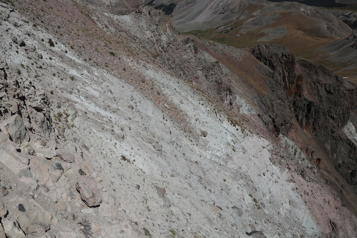
Once past the natural cairn, you walk on loose talus and scree to the southeast uphill, till you get to the main cliff face. West is more cliff, east more gradual. I went up the western-most class 3ish section. But you can go further east for a bit easier class 3 as desired.
Class 3 to 4 to 5 as you look from east to west
Once on top of the bump, you can get a view of the sucktastic talus and scree BS that is to come. There was crawling involved, it sucked.
Top of bump, looking at 13681
When you get down the ridge bump, you can take the ridge proper, or traverse below the first section as desired. Once the ridge goes uphill, you don't have much choice but to choose a side of the ridge. I went west, for the loose BS. I wonder if the east side would be easier?
Ridge of loose shite
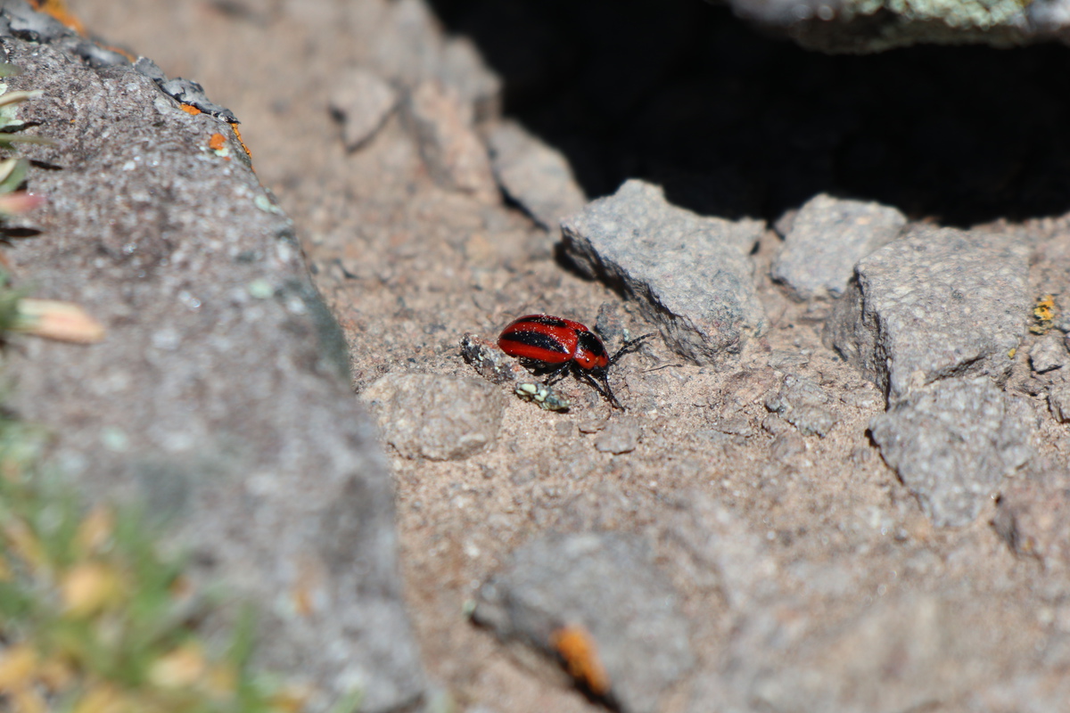
Entomologists... what is this? Not exactly a standard lady bug coloration
Looking back on route after the sucktastic scree is done.
The remainder of the route to 13681 is an easy stroll and goes much faster
13681 pano 1
13681 pano 2
13681 zoom pano, because pretty
Psychodelic tundra with Uncompahgre, Matterhorn and Wetterhorn
Matterhorn and Wetterhorn
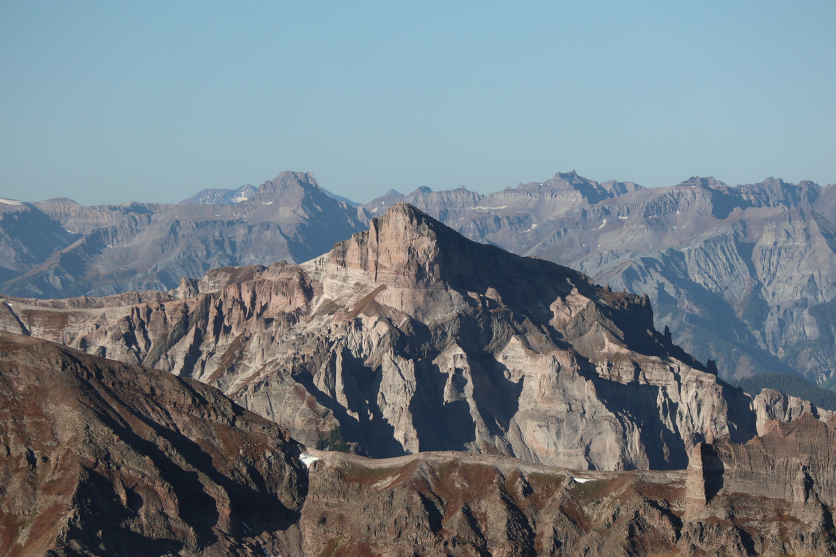
The route over to Silver Mtn A is easy, even if you have to drop significant elevation to get there.
Silver Mtn A13681 east flank
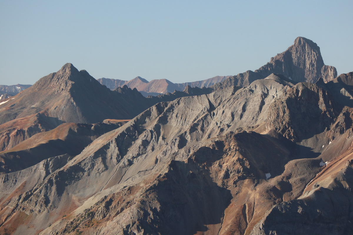
Once I get up onto the broad summit plateau of Silver Mtn A, I get a good view of it's east ridge difficulties.
Silver Mtn A and its east ridgeZoom of brown band on east ridge. Can see a route on the north side
Flat stroll over to the summit proper.
Silver Mtn A pano north
Last 2 peaks of the day: 13016 and 13051
I knew getting down Silver was going to be the crux of the day. I walked to the ridge direct and looked down. CLIFF. So I didn't even contemplate that a moment further. It's a cliff of loose rocks. I looked to my right, and saw a possible entrance on some white crumbly crap to traverse to the east ridge. I went down too far, then went back up to the "entrance".
Just getting to the narrow entrance was terrifying, since to the right was a 100' vertical drop off, if not overhanging. I tried to not envision myself slipping on the class 4 crumbly craptastic friable rock. After a few moments of panic, I said F this shit, I don't want to die.
ScaryOh HELL no. I ain't traversing that.
So.... now what? I started to go back uphill. Time to bail on the traverse. Just get out of here. Pick up your bike. Hike the other 2 tomorrow.
After a couple minutes of being off the terrifying loose cliffs of doom, my mind cleared. I stopped going uphill. Turned around and looked farther down the south ridge of Silver. Hmmmmmm.......
I noted 2 snow fields at the saddle with a ridge bump. That could go. So I decided to go explore. Worse case, I have to reclimb back up, again, and just go down Silver to the north. BUT I would have at least made a good effort to find another route that wasn't psycho.
As I progressed down the slope, I saw something strange. It looked like a cairn. I hadn't seen a single one yet on the upper ridge. So I kept walking closer to these strange cairns.
Is that a... cairn?????!!!?!?!
I walked up to these double cairns, getting more confused by the instant. They don't lead anywhere. There's a cliff below!!!
Cairns with 13051 in-between
I looked all around the cairns, no way down. So I kept going with my plan to drop the saddle.
Saddle descent between snowCairns above cliff
It would seem you could enter from either side of the saddle to get down, I chose the south side, since I had been viewing it for longer. I zipped around the snow and through some steep talus scree, then it was a simple traverse over to the Silver - 13051 saddle. Phew!
Down and traverse to 13051
Along the way to 13051, I was quite keen to get some good views from below of the east ridge of Silver. Also more of the strange cairns.
Cairns above cliffLooking back at descent and traverse from saddle
Start of east ridge zoomEast ridge start - super zoom
Traverse from saddle
East ridge zoom from furtherSilver from 13051 flank
East ridge of Silver, my thoughts: The first section looks doable. The problem is the white cliffs at top. There might be a way to go up it, but going down - I think is a no go. There are plenty of class 4.psycho routes I have done, that I would NOT reverse. San Miguel is one of these. I had to find a different route down. The good news is, there is a work around! It adds a bit of distance, but I would think it saves some time.
Once at the saddle of Silver and 13051, it was an easy stroll to the summit. The clouds that had been friendly, were starting to look less so.
13051 summit pano
I didn't want to stick around too long on 13051, since I had one more peak to go, and I didn't like those clouds. So much so, I forgot to take a photo of the route to 13016. No worries, it's all easy tundra, if a bit of elevation drop along the way.
Looking back on 13051 from saddle with 13016Silver Mtn C13016 in distance
I traversed over talus and contoured as fast as I could to get to 13016. Some snow flurries had started hitting me, and even though lightning wasn't forecasted, the wind and snow was cold!
13016 summit pano
I had originally planned to head further down the north ridge of 13016 and then drop the next saddle into the trees to get to the trail, but the wind and cold just had me turn back to drop a bit south of the summit. It was steep, but once on the grass, it wasn't too bad. Not the nice grass from the morning, but grassy talus scree combo.
Descent off 13016
I had hoped that the wind would get better the lower I got, but not quite. The snow flurries continued as well. The trail is on the other side of the stream, so I chose a high crossing to avoid the willows. More mileage, but less hassle.
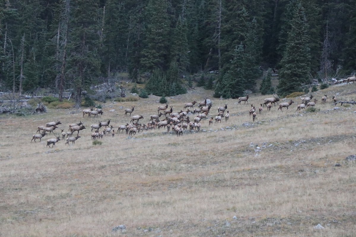
The trail is meager in spots, and mostly looks like bent grasses. Lots of horse prints, and cow prints that I followed. Plenty of marshy crossings until I got closer to the trailhead. As I approached the 3.5 miles left to go mark, the elk bugling became more and more prevalent. Looking at my map on my GPS, the trail crossed to their side of the stream and went close by to the herd. I didn't want to disturb them, but that's where the trail is. The males defended their herd and drove them up into the trees on my approach.
Once past the bugling Elk, it was a fairly quick trek out to the trailhead. I got across the stream an up the next slope before I needed to break out the headlamp again. With a mile left, I knew I wouldn't have any light for the bike downhill.
At the trailhead, a hunter camped gave me a look as I walked briskly past and over to my bike, attached to a horse hitch.
I jumped on my bike and started the 4 mile descent to my truck. For some reason the suspension on my bike felt a bit funny. The ride down was cold. I had to stop periodically to warm my hands up, despite my gloves. I was quite happy to see the glint of my truck bumper in my double headlamps!
I grilled up my dinner and crashed for the night. Woke up the next day and drove out. Happy to have completed a pretty sweet loop. Challenging and fun, despite things not quite going to plan.
Sheep Mtn C
My GPS Tracks on Google Maps (made from a .GPX file upload):
You'd probably have been back to your truck before dark if you hadn't stopped for all those pix - but I'm glad you did. Congrats on an impressive outing!
Ryan - Yes, setting up a rap off these cairns would be *the most* time efficient way to get down the cliffs, and great weight training!
PaulVee - It's always fun to see the 14ers from rarely seen angles!
Hoot - My photos would be much better if I took more time, but then I would have gotten back the next day.
DaveLanders - I define class 3 as being able to butt scoot (or face outwards) and class 4 as needing to face in. I didn't see any scootable terrain. If the route really was that friable white stuff, no thank you. I will choose the scramble 3/4 over loose/class 2 99% of the time, this day was 1%.
Mtnman200 - From a distance I have thought rocks were people, so snow goons would be possible.
Otina, you got some great shots of the more prominent peaks in that area - and the elk. Wow! I remember when I did that loop with Benners that I spent all morning marveling at Uncompaghre, Wetterhorn, Coxcomb, etc. in the red morning light (but we didn't get to see the elk). You captured a fine outing very well!
Caution: The information contained in this report may not be accurate and should not be the only resource used in preparation for your climb. Failure to have the necessary experience, physical conditioning, supplies or equipment can result in injury or death. 14ers.com and the author(s) of this report provide no warranties, either express or implied, that the information provided is accurate or reliable. By using the information provided, you agree to indemnify and hold harmless 14ers.com and the report author(s) with respect to any claims and demands against them, including any attorney fees and expenses. Please read the 14ers.com Safety and Disclaimer pages for more information.
Please respect private property: 14ers.com supports the rights of private landowners to determine how and by whom their land will be used. In Colorado, it is your responsibility to determine if land is private and to obtain the appropriate permission before entering the property.