Download Agreement, Release, and Acknowledgement of Risk:
You (the person requesting this file download) fully understand mountain climbing ("Activity") involves risks and dangers of serious bodily injury, including permanent disability, paralysis, and death ("Risks") and you fully accept and assume all such risks and all responsibility for losses, costs, and damages you incur as a result of your participation in this Activity.
You acknowledge that information in the file you have chosen to download may not be accurate and may contain errors. You agree to assume all risks when using this information and agree to release and discharge 14ers.com, 14ers Inc. and the author(s) of such information (collectively, the "Released Parties").
You hereby discharge the Released Parties from all damages, actions, claims and liabilities of any nature, specifically including, but not limited to, damages, actions, claims and liabilities arising from or related to the negligence of the Released Parties. You further agree to indemnify, hold harmless and defend 14ers.com, 14ers Inc. and each of the other Released Parties from and against any loss, damage, liability and expense, including costs and attorney fees, incurred by 14ers.com, 14ers Inc. or any of the other Released Parties as a result of you using information provided on the 14ers.com or 14ers Inc. websites.
You have read this agreement, fully understand its terms and intend it to be a complete and unconditional release of all liability to the greatest extent allowed by law and agree that if any portion of this agreement is held to be invalid the balance, notwithstanding, shall continue in full force and effect.
By clicking "OK" you agree to these terms. If you DO NOT agree, click "Cancel"...
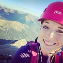
There are a lot of really good reports on this mountain, but I’m visual and like a lot of pictures so I’m adding what I have to what’s already out there…
In keeping with my “sleep is for amateurs” theme this month I made it home yesterday just in time to pack up the truck and make it to the campground before dark. I helped my daughter set up her tent and then walked around the campground talking with the other families (I was hosting a Girl Scout Family campout, which was pretty chill, seeing as how everyone was basically “family camping” at the same spot). We’ve done this for the past 10 years now so I know every family has their own routine. Most go off roading and a few go into town. Everyone canoes/kayaks. My daughter wanted to get her homework done the first day so she could enjoy the weekend, so I decided to let her do that and I’d go hiking. 4 hours away. (Hey, in my mind the trailhead was 6 hours from my house, and by combining it with this trip I knocked 2 hours of the drive there and 2 hours back).
I was able to fall asleep around 8:30pm and got up at 10pm to drive the 4 hours to the Mill Creek / Deep Creek Trail (please do not confuse this with the Mill Creek Campground: you won’t end up in the right spot).
While sleep may be for amateurs, I’d had less than 4 hours sleep in the past 48 due to my South Colony Lake hike yesterday, and I found on the drive to the trailhead I was more tired than I’ve ever been driving. This scared me, so I pulled over to the side of the road and spent 5 minutes trying to fall asleep. This didn’t work, but it did give me about another half hour of driving in before I felt too tired to go on and decided to set my alarm for 20 minutes. 20 minutes was the magic number, and I was able to effortlessly drive the rest of the way to the trailhead, hike all day, and make it back to the campground without feeling the need to sleep again.
I was surprised to find the trailhead is at the end of a shelf road, and even more surprised to find so many vehicles parked there.
I was on the trail at 2:45am, a little disappointed in how heavy my pack was containing all my gear (60 meter rope, harness, belay device, webbing , etc.). I put on my helmet at the trailhead before starting the hike. The trailhead was very easy to find. I followed it northeast along the Deep Creek Trail.
After about half a mile I turned left (west) at this junction and continued on the Deep Creek Trail
The trail switchbacked 5 or 6 times up the mountainside and then curved north around it, following a well defined trail
After a total of about 1.7 miles there’s another trail junction. I turned right (north) here
And followed the Sneffles Highline/Deep Creek Trail north through some aspen trees
And switchbacked another 8 or 9 times up the mountain, transitioning through pine trees and then tundra mixed with pine
I was enjoying the lights of Telluride as I hiked in the dark, but I wasn’t enjoying the soreness in my shoulders. I took an ibuprofen and trudged on. This is where the trail looses about 300’ of elevation for no good reason. Luckily it’s not too drastic of an incline because it’s dispersed over half a mile, but it still hurts on the way out.
This decrease in elevation will take you to the base of Dallas Peak. Here you leave the trail and find your own way up the grassy slopes towards the cliff bands. Here is the route I took:
I started this in the dark, and just followed the tundra north, which eventually led me to a gully and a rocky cliff area. There was a lot of loose rock and scree here that slowed me down quite a bit (that and I was tired from all the hiking I’d already done this week). This is also a good time to put on your microspikes. I’ve heard there’s class 3 scrambling here but was able to find a class 2+ scree route by following social trails.
Just before making it to the cliffs I turned right (northeast) and followed some cairns to the ridge
You continue following to the left (northwest)
Until you see a gully to your left. Ascend via the class 4/5 section to the right of the gully. There are plenty of hand/foot holds here, and at the top there are anchors to rappel down (I didn’t, but if the rocks were wet I could see how this would be useful).
Once I gained this section I made my way to the base of the summit block and changed my gear, putting on my climbing shoes (totally worth carrying them) and harness. At this point I was exhausted: My gear was heavy and that mile of scree/talus had taken a lot out of me. Here’s the first part of the route:
This was as fun class 5 chimney climb that took some fancy footwork (only because I’m short). At times I was pressing my back to the rock for leverage and using my palms for support.
Here’s looking back down on this section
Here is where the route gets tricky. Even though you want to summit by going straight ahead (west) this is not the way to summit. Continue right around to the north side of Dallas.
Cairns weren’t helpful here. I kept finding areas that looked ‘summitable’ but for me weren’t. It was getting frustrating but I refused to give up: I’d make it half or even three quarters of the way up a line only to find the hand/foot holds ran out, and I knew there had to be a safer way. In total there were two obvious areas I tried that didn’t work before before coming to the correct one at the bottom of a small dirt filled gully on the north side of Dallas
Here’s what it looked like from the bottom
I was able to climb up this area without ropes, although it was slow going and I was careful with every hand/foot hold. I was very glad to have my climbing shoes. I summited at 9:15am.
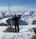
Dallas Peak:
I was quite thrilled with myself for making it up without ropes, and decided to spend a long time on the summit, enjoying my success.
The way off Dallas Peak is to rappel to the southeast
There was quite a bit of webbing already set up.
The only problem? This guy. He refused to move, and quite honestly I didn’t want to scare him and have him bite/sting/fly all around me. So I talked to him for a bit and told him if he didn’t move, I wouldn’t kill him. This arrangement seemed to work, as he never left his spot.
I set up my gear and threw my rope over the side. It got tangled, so I had to haul it back up, untangle it, and throw it again. Success! On the way down it’s instantly committing. You aim for the hole (the hole is the halfway point down).
I double checked my set-up, leaned back and felt secure, so I unhooked my slings and started down, aiming for the hole in the rock
When I made it down to the hole I found it was a ledge: I could have set up a second rappel from here if need be (but my 60 meter rope was more than long enough). Here’s what it looks like looking up and down from the ledge.
I leaned back one more time and started the rappel down through the hole, noticing there was a rope that had been left there. When I made it to the ground I saw a sign on the rope asking others to leave it as they found it, as its owner is coming back this winter to retrieve it.
I unhooked my belay device, pulled my rope through and recoiled it, mentally thinking through the rest of the descent. I felt confident I could descend the class 4 section without rope, so I put it away in my bag.
Here’s the way I rappelled down
I decided to keep on my climbing shoes until I made it back down past the class 4 section. I wasn’t disappointed, as the rock was easier to navigate than it had been on the way up wearing climbing shoes. I felt very secure down-climbing this area. Also, it looks very different on the way down
Here’s a look at the way down from the ledge. I stuck to the left (east) of the snow and just aimed for the obvious trail below that cut across the side of the mountain, so glad I was doing this now in the daylight
I made it back to the trail and all I could think about was making it back to the campground as soon as possible: I’d promised my daughter I’d make dinner. I found some raspberries along the way that were delicious, so that settles it: Raspberries in the San Juans just taste better.
I made it back to my truck at 1:30pm, making this a 12 mile hike with 5445’ of elevation gain in 11 hours
I made it back to the campground around 5:30pm and we stayed up and chatted around the lake/campfire until late into the night. This is how I spent the rest of my Labor Day weekend, relaxing in the beauty of one of my favorite Centennials…
Thumbnails for uploaded photos (click to open slideshow):
Don't know how you do it all! Amazing! Congrats on persistence, timing, and planned execution. Inspiration for all. Stay humble to the Mtns - none are worth the remaining time you should have with your family!
I have a lot of energy and have to run myself ragged to sleep much at all. I forget not everyone else has this problem when I write my reports I have a great respect for the mountains, and love the reminder to stay humble: you're right, the mountains aren't forgiving of mistakes.
You mentioned on the repel that there was a ledge down through the hole. Was that stance rigged for a rap as well so one could use a shorter rope and make two raps?
If you look at picture #32 you can see where the ledge is: just above the hole and it has room for several people to stand. There were at least two anchors set up at the halfway point, so yes, a shorter rope could have been used twice. I'm not sure how long that rope would need to be, but my 60 meter rope was excessive (something I wished I'd have known).
Shows what's left of my 60 meter rope after rappelling (it's still attached to the rappel at the top of Dallas in this photo). Mine is the blue one that looks purple in the shadows. I'm pretty sure I could have brought my 50 meter rope and rappelled the entire way... but it would have been close
"I set up my gear and threw my rope over the side. It got tangled, so I had to haul it back up, untangle it, and throw it again."
Rapelling always gets me on high alert status. Here's an approach that I've used when a tangle would be bad, like possibly pulling loose rock onto a party below:
0) If the area is high exposure, loose, crowded, etc. Tie yourself into the anchor.
1) "Stack" each half of the rope. You need to find the mid-point of the rope and thread the rope through the anchor rap ring.Then you stack. Make a pile starting with the rope next to the mid-point. Just make a pile as you hand over hand towards the end of the rope. Do this for both ends. You will end up with each rope end on top of each stack.
2) Prepare the first harpoon. Take the last ~10 feet of one end of the rope and hold the end in your hand. Fold it into a zig-zag with ~5 back and forth loops. Wrap the zig-zag fold a few times with the next couple of feet of rope from the stack. Wrap it tight. Now the wrapped zig-zag bundle is a harpoon.
3) You are going to throw the harpoon down the cliff like a spear. BUT! you don't want the mass of the rope to pull the rest of the rope through the rap ring. So either tie a loop of the rope to the anchor, have a partner hold it, etc.
4) Throw the harpoon at the desired rappel landing area. Don't make yourself fall off the cliff while throwing, don't get your leg caught by a loop of rope, etc. The stacked rope will un-stack and it will look like a miracle.
5) Make a harpoon out of the other strand, toss it, detach your retaining loop and slither down the cliff.
You can harpoon both ends at once to save time but it might tangle if you are unlucky. Be safe.
Thank you! I'd borrowed a friend's rope for this one because I thought I'd needed a 60 meter rope: it coiled a bit differently than I was used to and embarrassingly I had to try a second time. I appreciate the advice!
Girl, you are a sister after my own heart!
Crushing these peaks and doing so alone with little legs! I only hope that one day I can follow in your footsteps!
Caution: The information contained in this report may not be accurate and should not be the only resource used in preparation for your climb. Failure to have the necessary experience, physical conditioning, supplies or equipment can result in injury or death. 14ers.com and the author(s) of this report provide no warranties, either express or implied, that the information provided is accurate or reliable. By using the information provided, you agree to indemnify and hold harmless 14ers.com and the report author(s) with respect to any claims and demands against them, including any attorney fees and expenses. Please read the 14ers.com Safety and Disclaimer pages for more information.
Please respect private property: 14ers.com supports the rights of private landowners to determine how and by whom their land will be used. In Colorado, it is your responsibility to determine if land is private and to obtain the appropriate permission before entering the property.