| Peak(s): |
Gladstone Ridge - 13,212 feet Taylor Mountain - 13,655 feet Taylor Mountain - 13,655 feet |
| Date Posted: | 06/04/2019 |
| Date Climbed: | 05/26/2019 |
| Author: | bergsteigen |
| Additional Members: | BenfromtheEast, MonGoose |
| Peak(s): |
Gladstone Ridge - 13,212 feet Taylor Mountain - 13,655 feet Taylor Mountain - 13,655 feet |
| Date Posted: | 06/04/2019 |
| Date Climbed: | 05/26/2019 |
| Author: | bergsteigen |
| Additional Members: | BenfromtheEast, MonGoose |
| Never Summer |
|---|
|
Gladstone Ridge
With a fresh dumping of new snow, I wasn't going to attempt anything steep solo, so a simple ski of the north bowls of Gladstone Ridge were in order. With the road closed at the Denny Creek trailhead, I would have 1-2 miles of extra road walking to do unfortunately. A post sunrise start happened more because my sleeping arrangement was quite comfortable. I got started after at least 2 gals went up Yale. Soon after walking around the gate, a truck showed up and opened said gate! WHAT?!? I kept turning around, and hoping they would give me a ride, but they didn't drive immediately. A few minutes later 2 snowmachiners in their trucks showed up and offered me a ride, but I was already looking for a stream crossing by then. I should have taken them up on their offer to get up to FS 346, but I had grandiose plans to cut some distance and traverse up to the ascent ridge. This turned out to be foolish. 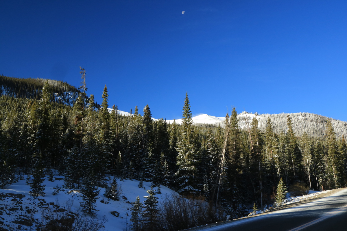
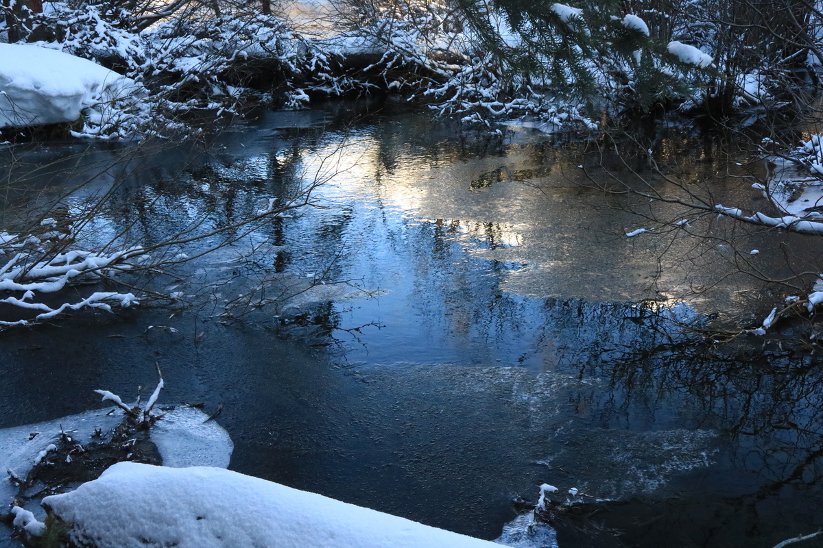
At a large pullout area, I decided now would be my time to cross the stream. Flatter area, meant wider but shallower stream. Too bad I didn't know the area directly upstream was called the Holywater Beavers. Great name. Should be a giant red flag for 'Don't cross here'. Somehow I managed to get lucky and cross the stream at the lowest beaver dam. It was tricky with skis on my pack and bush whacking, but somehow I crossed with out slipping off the snow covered logs and twigs! Most dangerous part of the day! 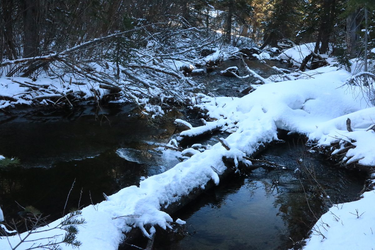

Once on the south side of the stream, the slope goes steeply up and through a zone of some deadfall. Not catastrophic, just slooooow going. At least once I had to take off the skis to boot up a 10 foot steep slope. It wasn't until near an old mining road, that the slope eased and travel speed went up. At this point I knew catching that ride up to the road and going the 'long way' would have been much faster! Silly me. Longer distance and fast steady pace > short cut up steep, treed slope. Once above the road, I got treated to a nice view of Turner and Mt Yale before making the last bit of elevation gain up to the ridge proper. Once on the ridge, it was a bit of in and out of the trees, before I got onto the upper ridge above treelike. Easy skinning from the road on up! If you count breaking trail solo through a few fresh inches of powder, easy... 

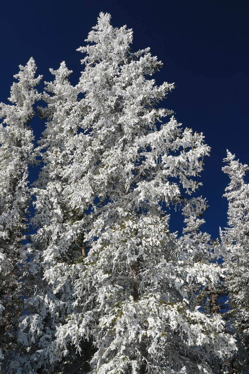


First views of the summit of Gladstone Ridge were nice. It looked like I would have options, if already wind effected ones. The snow only fell yesterday, but it was already looking loaded in spots. 

The wind really picked up to gale force strength once I reached the upper ridge. This in turn froze my camera battery, and I didn't bring the spare hidden in my car. So I beelined it for the summit, transitioned and skied back down to my entrance quickly. The wind while strong, only tried to knock me down a couple times. Still, I wasn't going to wait around longer for it to gust any stronger! 


I quickly got down the ridge to the saddle area. I figured this zone might have the better powder than directly off the summit. As you can tell by my tracks, I zig zagged that upper zone looking for the powder I had below in the trees. It wasn't quite there. So then I just chose a line and skied down it. I found some powdery turns in spots, but I still had to ski it pretty carefully in case the snow was too punchy. 


Once down to treeline, I followed the open zone to skier right and kept the traverse going until I knew I had to go into the trees and find that old mining road. I was NOT going to test the HolyWater Beavers or a lower crossing of the stream. I would rather go a further distance and walk an extra mile on the road! So I cut hard left into the trees and found the road, just above where I had crossed it in the morning. The switchbacks on the road were pretty long and flat, so I cut a couple of them where the snow looked good. Ran into a couple footprints a few tenths of a mile from the main road, so I knew I was super close then! Now I was really hoping for those snowmachiners to give me a ride!!! 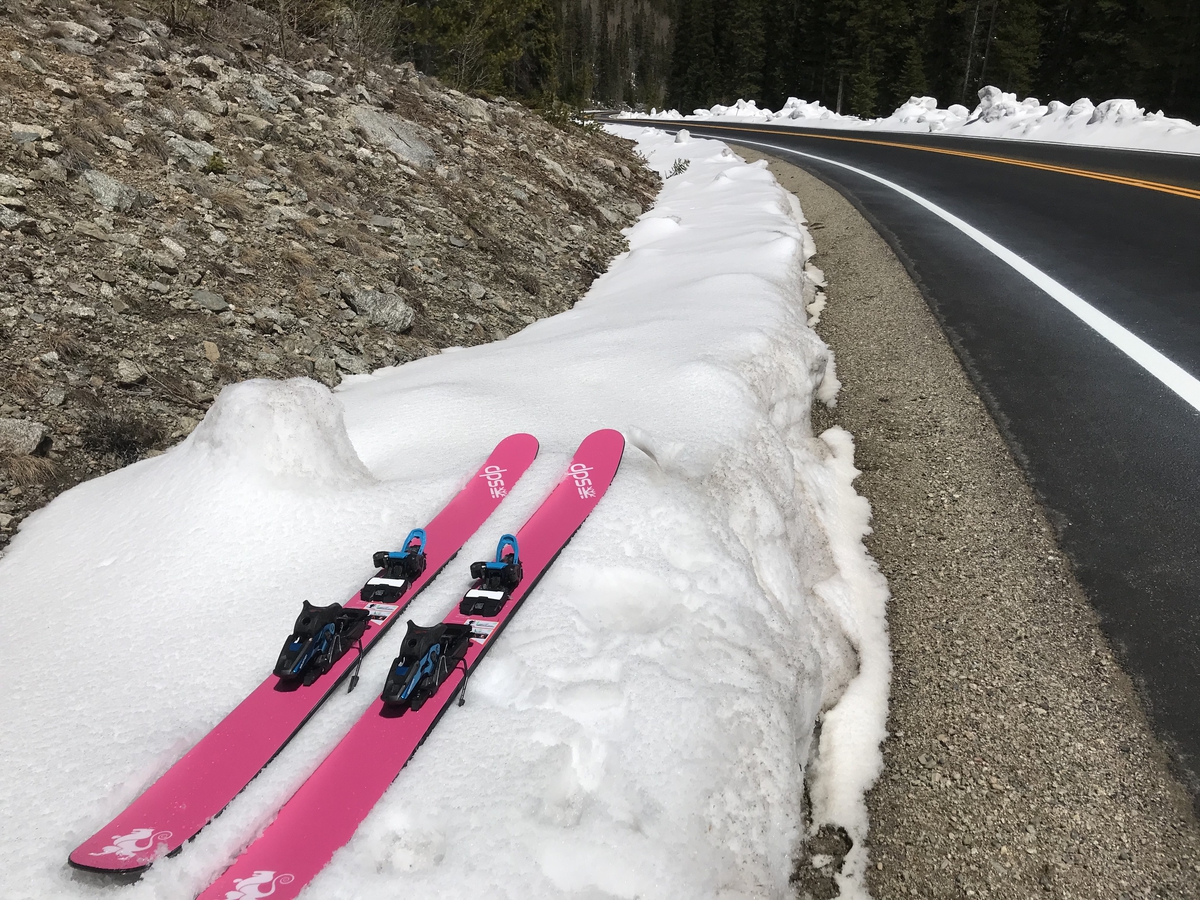
I put up my hot pink sticks at the side of the road, in case anyone came along, but they didn't. So I walked to the other side and skied the snow on the side for as far as it would go, maybe a quarter mile. Better than walking! Right as I was transitioning to the hot pavement walk, a motorcycle zipped past. Ha, no way I was getting a ride on that with my skis. Even an unmarked LEO came by in his SUV, but he just went up and down the road with only a slight wave/nod. 2 miles of hot road to walk, but at least now I would be going to a camp out with a group of friends, so I could dry my gear for the next day of skiing! Taylor Mountain A
With both of my partners bailing for the day, I decided to go with another easy lower angled line. I would go for something steeper with an advanced partner on Sunday (or so I thought). Plus after an evening of hanging out around the fire with friends, I also wasn't going to be setting any early morning starts! I'm not quite familiar with the 4wd roads in the area, and so I started up the 4wd road that I remember seeing on multiple passes up and over Monarch Pass, and from a couple ski trips in the area. I drove up to the first switchback, and realized ol 3.6R Subi wasn't going to have the clearance to make it to the next one. So I parked it. I also didn't know how far up the snow would start, and if there'd be a spot to park. One does NOT want to block the road for other 4 wheelers. So I figured I'd take the exercise and walk the extra distance. Unfortunately in my tired state, I also thought the switchback I was on, was the only one, and I ended up walking DOWN the road in the wrong directions. I eventually figured this out, after adding on a quarter mile. The road up to where the snow started was like a super highway compared the 4WD road I started on. I wondered if it started the same off HWY 50? (It does, it's just not signed, so you need a GPS to find it) When I got to the snow on the road 0.75 miles and ~600' up, I kept on booting up, since the snow was nice and firm. When I got to the mine and saw the FS road go downhill on a dry section, I knew transitioning earlier would have been wasted effort. 
Once on the east side of the mine, I put on my skis and skins, and started up the slope to the ridge. Encountered some avalanche debris from the record setting winter we've had. 
The slope up to the ridge started easy, but the fresh snow had iced up on top, and I was having difficulty with my skins gripping the surface. I also was using my old 105 width skins on my new 112 powder boards, so I had some trouble on the way up. So I put the skis on my pack and started booting up. Because of the punch crust, every step was a big effort, as I would punch though every time, except for maybe 3 steps. Now I was really annoyed that I didn't have a partner. That last section up to the ridge took longer than I would have liked. 
Once up on the ridge, I was able to skin a bit further, before finding more slippery icy snow, that I returned to booting again. Booted all the way to the summit, with crampons. 


I was treated to a nice sunny summit, once surviving all the booting up through fresh snow, that was still punchy in spots. 


Since the northern slopes of the ridge looked heavily loaded with sustrugi snow and I was solo, I figured I would just ski the face and then head down the ridge. That way there wasn't any extra uphill. I was also wondering how fast that southern gully would turn to slop. So I figured getting there sooner rather than later was in order. The snow started off firm and winter like with sustrugi galore. The DPS skis floated like a dream over the sustrugi! The face itself was still firm and hardback, and there the skis had a bit harder time edging, being so fat (112mm). But at least I was edging easily enough. Turning around, I could barely see my turns, as I wasn't displacing much snow at all! It was that wintery! Down on the ridge itself, the snow softened up and the winter sustrugi was smooshy. On the steeper section that was icy in the morning, that I had to boot, it was actually CORN. Like real spring corn! Relished those delightful few turns! 

The gully ski to the south got a bit surfy, as the top wintery snow was all sloppy and sliding a bit on the lower transitioned surface. Good thing it was low enough angle to NOT slide! Still, my turns were pretty wide and surfy as I headed down the slope, as a few times my tails started to spin out from under me. Hurray for powder skis! As I was skiing down the gully, I saw 2 Jeeps near the mine, and wondered how the heck they had made it up the deeply snowy road. As I crossed their upper tracks, they had barely sunk in at all. Below on the road, they had sunk in a foot or more! 
I took the road system to the east of the mine and made my way through the drainage, instead of going back up to the road. The drainage meets back up with the road at the mining ruins. From that point it was just a quick ski down the Jeep demolished road. The snow was still continuous enough, I only had to take my skis off once to cross a short dry patch. 

Once I got to the dry part of the road, I really regretted not dropping my gear and driving the 3.6R up further to this spot. The road was pretty steep for my hot feet in my damp ski boots, but once again, I would have a nice hot campfire to dry out at, with a bunch of friends! Taylor Mountain A
WHAT?!?!? I skied the same peak, 2 days in a row??? Yes, I'm that good of a partner. So what happened? Hanging out at the campfire all night happened. Like all night. Plus with sustrugi and hardback at elevation, I wasn't exactly liking the steeper Monumental east face ski with a partner that doesn't like steep. One partner that I was supposed to ski with, decided to go for Wheeler instead. So after a lot of back and forth trying to come up with an option the 3 of us would like, that would also allow us to sleep in, it was decided to go for Taylor, again. At least this time, I knew we could ski the full face as it would be safely transitioned now. At least a semi different line... Plus I knew the secret entrance to the road! Well, not so secret, it's on my car's GPS, but still. There is no sign marking or naming the road. So that's pretty sneaky IMO! This time I would also ski the peak in my Kastle T90's and get a really good compare contrast on similar snow and conditions. All season I've been learning completely new gear. Seeing which ski handles best in what conditions. I love the DPS for powder and punchy but the Kastle's are far superior on steep and firm. They suck in punchy, and are almost terrifying, as I found out on Guyot earlier. 
After spending sunrise still in camp, we were finally on the road to the peak, where I got a decent view of the face without the afternoon clouds of the day before. 
We drove right on up to the start of the snow, and parked at a mini campsite, well off the road. Just in case there were more monster Jeeps driving today. The snow was firm still, so we booted up till about the same place I started skinning the day before. I didn't think skinning around and through the Jeep tracks would be efficient. 

Today I could tell a lot of snow transitioning had happened in 24hrs of freeze-thaw. The skin up went easily, no need for booting as the snow was perfectly grippy! The guys skinned all the way to the summit, but I booted up using someones PERFECT booter from the day before. Oh yeah, that was my booter ;) 


As we approached the summit, the days storm clouds quickly moved in. The price we payed to sleep in. We also lost the bit of corn that had transitioned for us. Everything costs something, nothing is for free. 


Since there was no reason to wait much longer, we started skiing down after our summit break. The corn we had noticed on our way up, was now refrozen. The light was low and the photography difficult. But we still had a glorious ski down, if a bit icier than it could have been. 


From the bottom of the line, we did a quick skin back up to the ridge. 
We then ripped down the south gully in improving light, as one round of clouds had passed over head. We could have waited, but one never knows with sucker holes! 


Skiing down the drainage showed how much snow had melted lower down in one day. Sections that I could carefully ski through rocks, now were full on melted. Even the drainage ski to the mine was a bit harder. At least once back on the road, the ski down was pretty quick, even if there were more dry patches and a few more zones to carry the skis across 
Overall it was a good ski, and it was interesting to see the difference a day made in the the snow quality. The company made skiing the same peak a different experience, and it was nice to have the beta to shorten the trip as much as possible. As for the skis, I would have liked the DPS's on both days. Skiing the refrozen hardback up on the upper face was much easier with the Kastle's, but the lower sections were sloppy enough, that the DPS's would have shined once again. 
Thumbnails for uploaded photos (click to open slideshow): 


|
| Comments or Questions | |||||||||||||||
|---|---|---|---|---|---|---|---|---|---|---|---|---|---|---|---|
|
Caution: The information contained in this report may not be accurate and should not be the only resource used in preparation for your climb. Failure to have the necessary experience, physical conditioning, supplies or equipment can result in injury or death. 14ers.com and the author(s) of this report provide no warranties, either express or implied, that the information provided is accurate or reliable. By using the information provided, you agree to indemnify and hold harmless 14ers.com and the report author(s) with respect to any claims and demands against them, including any attorney fees and expenses. Please read the 14ers.com Safety and Disclaimer pages for more information.


