Download Agreement, Release, and Acknowledgement of Risk:
You (the person requesting this file download) fully understand mountain climbing ("Activity") involves risks and dangers of serious bodily injury, including permanent disability, paralysis, and death ("Risks") and you fully accept and assume all such risks and all responsibility for losses, costs, and damages you incur as a result of your participation in this Activity.
You acknowledge that information in the file you have chosen to download may not be accurate and may contain errors. You agree to assume all risks when using this information and agree to release and discharge 14ers.com, 14ers Inc. and the author(s) of such information (collectively, the "Released Parties").
You hereby discharge the Released Parties from all damages, actions, claims and liabilities of any nature, specifically including, but not limited to, damages, actions, claims and liabilities arising from or related to the negligence of the Released Parties. You further agree to indemnify, hold harmless and defend 14ers.com, 14ers Inc. and each of the other Released Parties from and against any loss, damage, liability and expense, including costs and attorney fees, incurred by 14ers.com, 14ers Inc. or any of the other Released Parties as a result of you using information provided on the 14ers.com or 14ers Inc. websites.
You have read this agreement, fully understand its terms and intend it to be a complete and unconditional release of all liability to the greatest extent allowed by law and agree that if any portion of this agreement is held to be invalid the balance, notwithstanding, shall continue in full force and effect.
By clicking "OK" you agree to these terms. If you DO NOT agree, click "Cancel"...
I’d attempted this peak a few weeks ago but had to turn back due to high winds above treeline. Today I was ready to try again, armed with a beautiful weather forecast and a full night’s sleep.
Since I’d been here 2 weeks ago and knew it had snowed here quite a big since then I didn’t even attempt to drive to the upper South Colony Lakes trailhead. I made it to the South Colony Lakes lower 2WD trailhead at 4am to one other vehicle in the lot. It looked as if someone was sleeping in their truck. I got together my gear and was on the trail around 4:15am. After hiking about 100 yards I came upon snow on the 4WD road and was glad I’d parked in the lower lot.
Unfortunately, it looked like someone had attempted to drive up the road in the past few days. When the road got too much snow on it they drove off the dirt road, kept driving parallel to the road, and then when they felt there was less snow went back to the main road.
This tears up everything people! Don’t do this! It also looks like they learned their lesson because they got stuck in a snow drift. I’m guessing there’s about 4 feet of snow here. Not only did they get stuck, they tore up the road trying to get out, which will make it more difficult for drivers to make it to the upper trailhead once conditions actually improve.
Caption Here
The road in was well packed in areas, soft in others, and covered in 2-6 feet of snow. It was still dark so I kept looking over my shoulder to see if anyone drove in behind me or was hiking with a flashlight but didn’t see anyone. I put on my snowshoes at the Rainbow Trail Trailhead.
This trailhead is still inaccessible by vehicle and covered in snow.
I had a map with me, but since I’d just done most of this hike 2 weeks ago I never took it out of my pack. From the Rainbow Trail I turned left (northeast) and followed the slope up to the ridgecrest. Here the tracks I’d put in earlier were still in place, and it looked like a few others had been here since then, so there was a faint trail to follow
At the top of the slope I immediately turned right and followed the ridge. The ridge looks mostly flat, but does gain in elevation, all except for one area where it dips down a couple hundred feet and then inclines again.
This was supposed to be a 7-10 mile hike, with about 3500’ in elevation gain, but for some reason it felt like a lot more than that. It seemed I was below treeline for much, much longer than I should have been, yet I knew I was still on track because as the sun rose I could see Humboldt peeking at me through the trees to my right
Finally (and I mean finally) I crested a vertical slope
And made it to treeline.
Here the snow was hard packed and I was glad I had snowshoes (crampons would have been necessary otherwise). I traded my trekking pole for my ice axe and started up the hill.
The wind picked up, and remained a steady 15mph until I made it back below treeline. In this area it was impossible to avoid the snow
But as soon as I was up over this hill I had the option to stick to the snow or hike on tundra instead. I was tired of the snowshoes, so I took them off and kept to the right, following the ridge.
The view of the Crestones and Humboldt was beautiful!
The rest of the route was pretty straightforward, but I was curiously more tired than I should have been for just 3500’ in elevation gain. I was seriously worried I was losing my touch, or that I was getting out of shape? As I neared the summit the terrain became more rocky and steep. I found myself zig-zagging my way up, doing my best to avoid the random snow patch that had me post holing up to my thighs
I summited to some amazing views of Humboldt, the Crestones, and a bunch of 13ers!
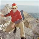
Here’s my summit photo
It was a beautiful day, but that wind made it cold and my fingers were starting to burn so I turned around and headed back down the slope. Here’s a look at the way I came
Here’s what it looks like just above treeline. Snowshoes were helpful (and here I put them back on). I appreciated the full coverage of snow
The ridge back once again seemed to take longer than necessary. It felt like I was in the trees forever! I was still glad I had my snowshoes
The wind stopped below treeline and the temperature increased dramatically. I took off my hat and gloves and noticed my hands had some minor damage, but nothing that wouldn’t heal in a few days. I saw a couple of early season mosquitoes on the ridge, which were easily distinguishable against the white backdrop of snow. I made it back to the Rainbow Trail and followed it to the Lower South Colony Lakes trail, noticing the temperatures had warmed up the snow quite a bit and once again praising my snowshoes: The road was becoming a slushy mess.
I fully expected to see people hiking up the trail or skinning, or something, but I never did. I didn’t see another person the entire day, and as I rounded the corner and could see the parking lot it became apparent why: my truck was the only vehicle in the lot! I’d had the entire mountain to myself today!
It had been a beautiful day to hike: Little wind, warm temperatures, and solitude. When I checked my tracker it said I’d gone 11.6 miles and gained 4682’ in elevation in 6.5 hours. No wonder I’d felt out of shape! I’d expected a 7-10 mile, 3500’ elevation hike. As I’d been hiking I’d begun to doubt my physical fitness, but these new numbers seemed much more accurate.
Here’s my Relive (which I like this time because it portrays the snow above treeline)
Dear WildWanderer;
I applaud your ambition and acomplishment here. I know Music Pass and Marble Mountain well, but I go up there in summer! I fish the high alpine lakes in that beautiful valley on the other side. I live in Rosita, near Westcliffe. First time I climbed up the slopes of Marble was to the pass between Marble and Milwaukee Peak. I was on a sad recovery mission with Custer County SAR. The recovery was on Pico Asilado, and the Team Captains felt that the best way to get to Pico was over Milwaukee. So to begin the day, we summited that 13er. So that was my first climb of the Marble slopes. Most memorable climb was with a close friend and climbing buddy. We have done many peaks together. We crossed Music Pass and hiked back up to that Milwaukee/Marble pass. That brought back memories, all right. Then we spent the day doing an entire circuit of Marble Mountain back to Music Pass (where you began your winter climb, looks like) and then back down to the high 4wd trailhead where I had parked my Jeep. Weather held beautifully. Fine climb, that. We had a great time. Nice to see you climbing in my neighborhood!--John (flyingmagpie)
Did you know that in the silly comedy "Continental Divide" Blair Brown takes John Belushi up to Music Pass just to show him that great panorama of peaks spread out across the valley below?
I've never seen "Continental Divide", but will have to just for this! Thanks
Caution: The information contained in this report may not be accurate and should not be the only resource used in preparation for your climb. Failure to have the necessary experience, physical conditioning, supplies or equipment can result in injury or death. 14ers.com and the author(s) of this report provide no warranties, either express or implied, that the information provided is accurate or reliable. By using the information provided, you agree to indemnify and hold harmless 14ers.com and the report author(s) with respect to any claims and demands against them, including any attorney fees and expenses. Please read the 14ers.com Safety and Disclaimer pages for more information.
Please respect private property: 14ers.com supports the rights of private landowners to determine how and by whom their land will be used. In Colorado, it is your responsibility to determine if land is private and to obtain the appropriate permission before entering the property.