Download Agreement, Release, and Acknowledgement of Risk:
You (the person requesting this file download) fully understand mountain climbing ("Activity") involves risks and dangers of serious bodily injury, including permanent disability, paralysis, and death ("Risks") and you fully accept and assume all such risks and all responsibility for losses, costs, and damages you incur as a result of your participation in this Activity.
You acknowledge that information in the file you have chosen to download may not be accurate and may contain errors. You agree to assume all risks when using this information and agree to release and discharge 14ers.com, 14ers Inc. and the author(s) of such information (collectively, the "Released Parties").
You hereby discharge the Released Parties from all damages, actions, claims and liabilities of any nature, specifically including, but not limited to, damages, actions, claims and liabilities arising from or related to the negligence of the Released Parties. You further agree to indemnify, hold harmless and defend 14ers.com, 14ers Inc. and each of the other Released Parties from and against any loss, damage, liability and expense, including costs and attorney fees, incurred by 14ers.com, 14ers Inc. or any of the other Released Parties as a result of you using information provided on the 14ers.com or 14ers Inc. websites.
You have read this agreement, fully understand its terms and intend it to be a complete and unconditional release of all liability to the greatest extent allowed by law and agree that if any portion of this agreement is held to be invalid the balance, notwithstanding, shall continue in full force and effect.
By clicking "OK" you agree to these terms. If you DO NOT agree, click "Cancel"...
Date: September 19, 2016
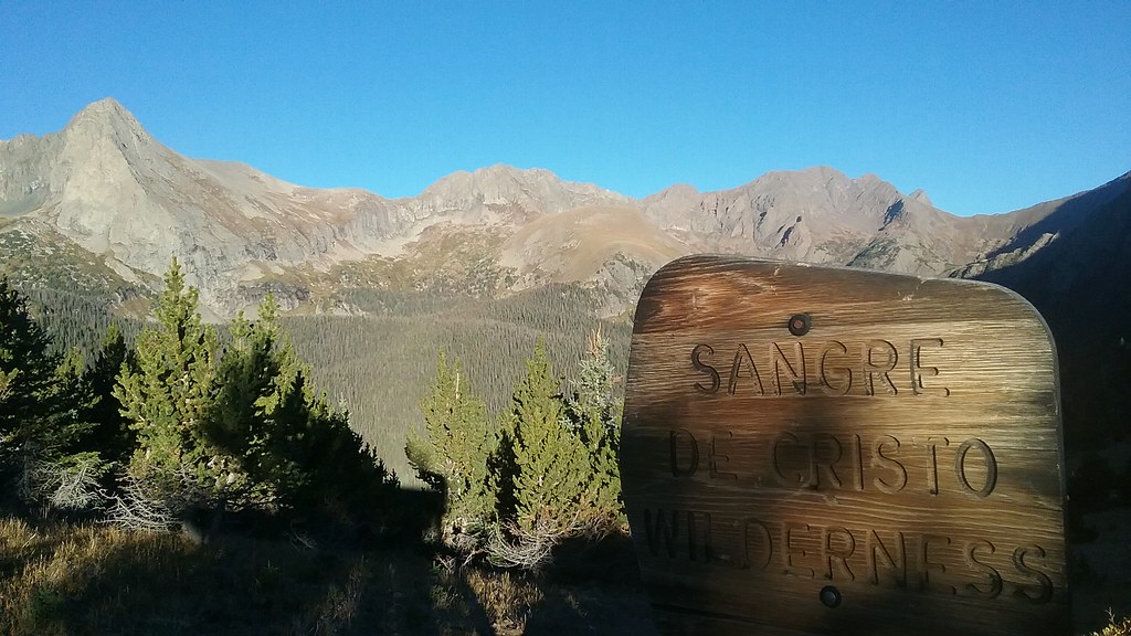
Trailhead: Music Pass TH 4x4
Mileage: ~ 9 miles
Vertical: ~3,900 ft gain
Time: ~11 hours
Partner: Will
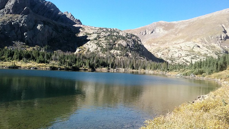
Will and I first attempted the Tijeras-Music group on August 22nd, but got snowed in shortly after getting to the Lower Sand Creek lake. We should have packed up and left the same night, but endured a windy night in our tents and hiked out in the morning. I was convinced that the route wouldn't be pleasant in wet/snowy and very windy conditions.
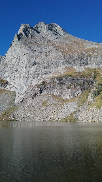
Fast forward almost a month. I was starting at the picture perfect forecast - sunny, warm and no wind. I pitched the Tijeras-Music redux to Will and he was on board. Since the hike in, even with the overnight packs, didn't take us too long last time, we decided to day trip it from the Music pass TH. We launched from the pass at 6.55 am and was at the lower lake less than 1.5 hour later. From there, our progress slowed as we picked our line through the lower cliffs and the willows (avoiding most of them).
Scissors from our prior campsite. No snow this time!
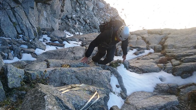
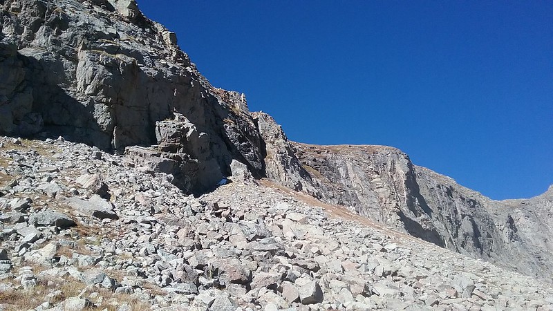
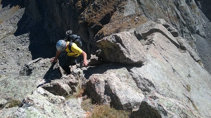
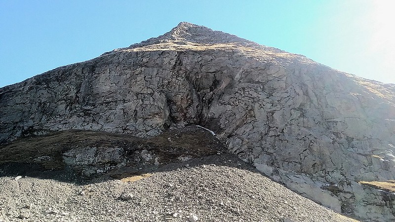
After reaching the upper cliffs, out progress stalled. I have done only scant research on the location of the 2 ramps, reasoning they will be obvious to see, but it wasn't the case. We popped out of the willows close to the left, harder ramp, but I wasn't convinced that the top part of it goes (we couldn't see the top-out from the ground). We ended up going further left, and then reversing our steps. After spotting a cairn at the bottom of the ramp we finally decided to give it a go. There was some snow (probably still lingering from Aug 22nd storm) on the lower part of the ramp, but it was mostly avoidable. Finding a rappel webbing was reassuring we were on route.
Instead of the top-out which I didn't think would go (it didn't) we found a class 3 option, which was out of sight from the ground. The rest was a grassy stroll to the ridge, where we dropped our packs, and then a gentle class 2+ hike to the summit.
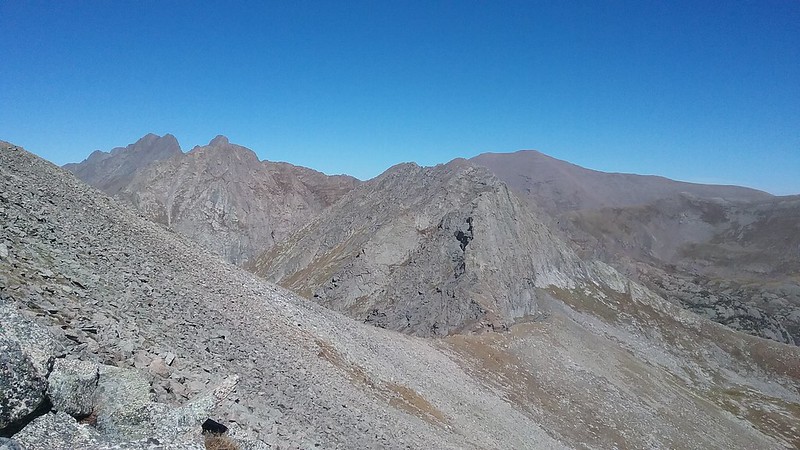
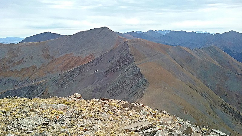
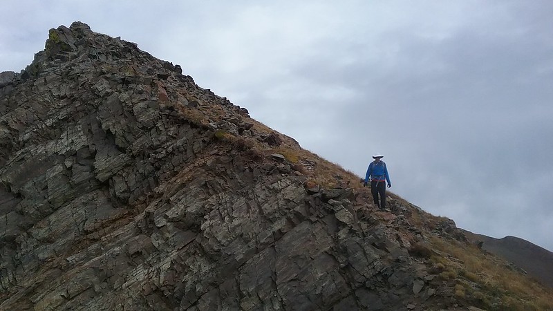
First look at Music's south ridge
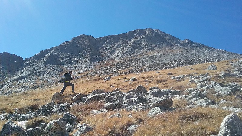
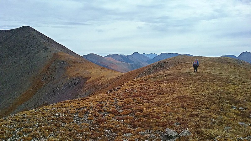
Will on the approach
and some big rocks
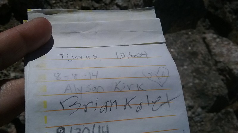
We found some paper
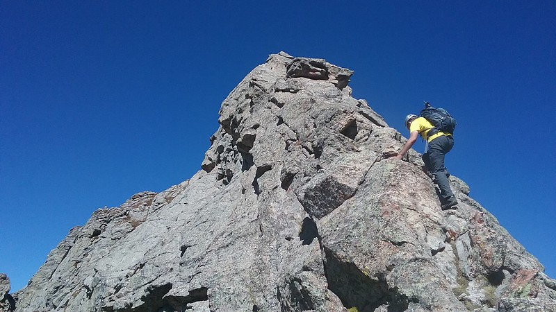
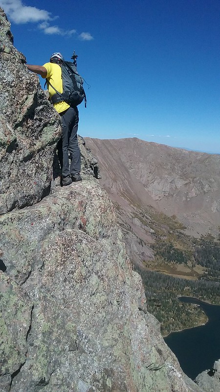
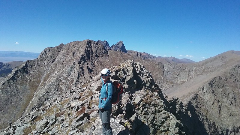
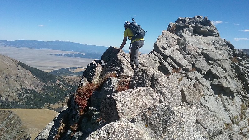
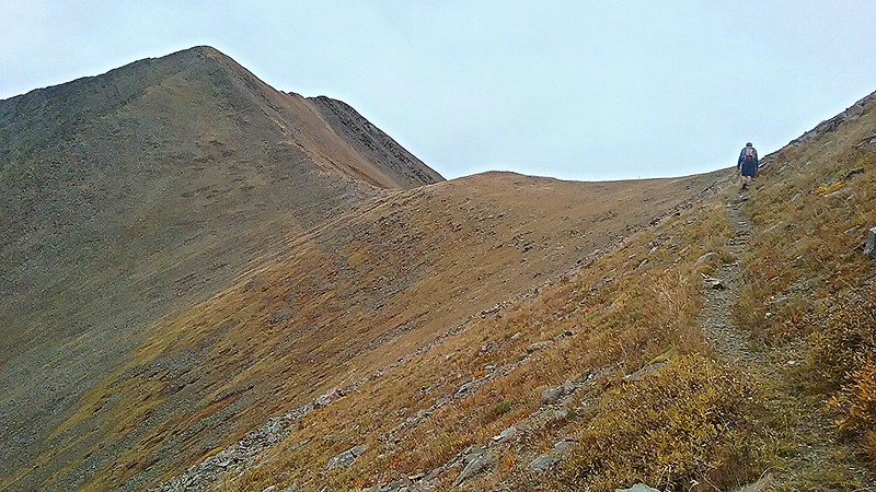
After picking our packs we traversed to the bottom of the Music's south ridge. The introduction was over. Although not very long, the South ridge lives up to its reputation. It is exposed and spicy and without careful route finding, you may find yourself on harder terrain.
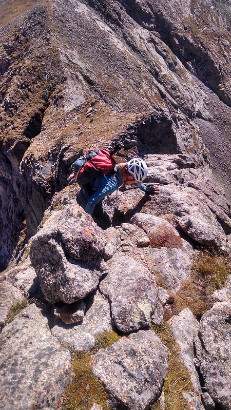
Early difficulties
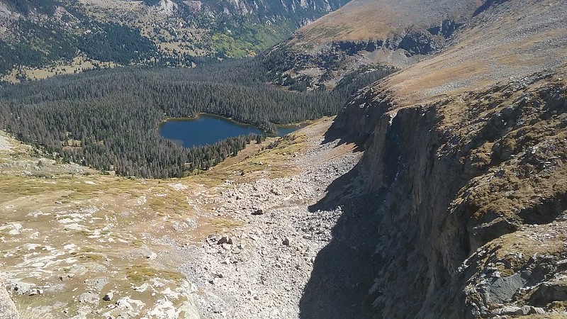
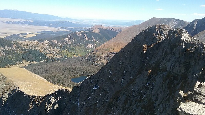
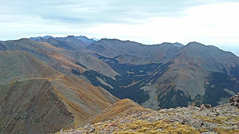
Lower lake and the cliffs from the ridge
Will channels his inner Alex Honnold. After seeing his option, I went up and over (still exposed, but good holds).
South ridge
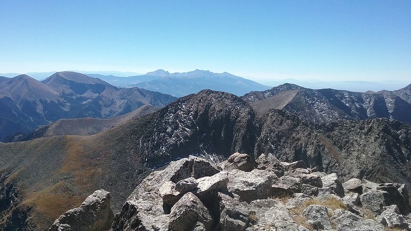
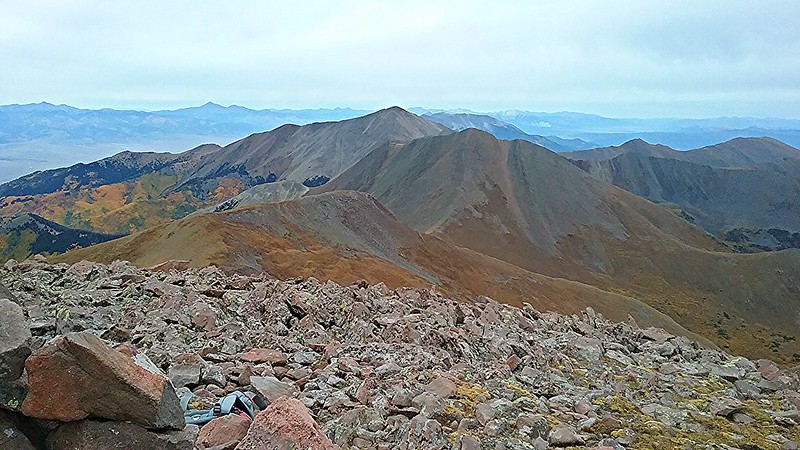
We made it! Pico, we see you!
We retraced out steps back to the false summit and descended a mellow East ridge, which looked pretty formidable from afar.
After 2 trips to the Lower Sand Creek lake, I really wanted to see the Upper lake and somehow convinced Will to give it a go. We haven't seen any reports on the descent to the upper lake, but the contour lines didn't look that bad. Will did ask the pertinent question - does it cliff out at the bottom? I didn't really have an answer to that one. But we did find out that it in fact does Not to sound overly dramatic, but we were happy to find a weakness in the cliffs, and had plenty of daylight and time to investigate. However tricky and cumbersome, the descent only took us about an hour. After we arrived at the upper lake, the look on Will's face was priceless. The lake was beautiful though, and we admired the view of Milwaukee from there. After catching a good trail, we were back at the car by 6 pm.
Major cliffage
Peaks: Electric and Lakes
Date: September 20, 2016
Trailhead: Major creek TH
Mileage: ~ 16 miles
Vertical: ~6,000 ft gain
Time: ~11 hours
Partner: Jason
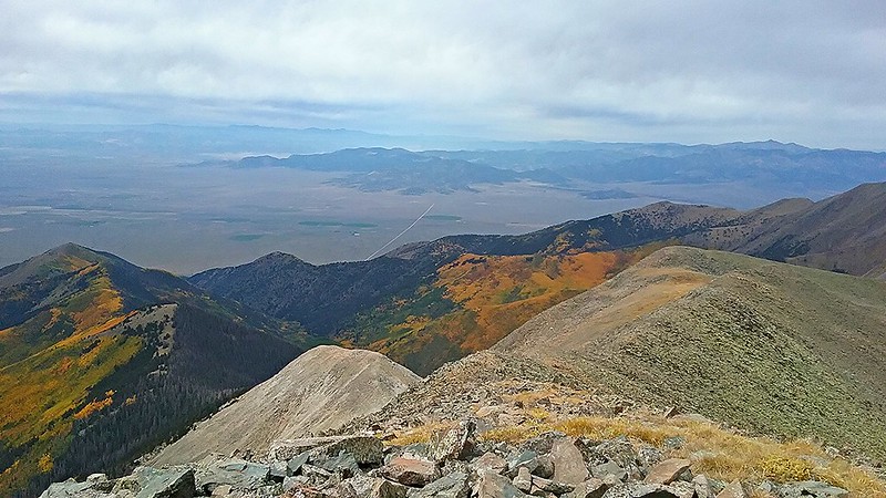
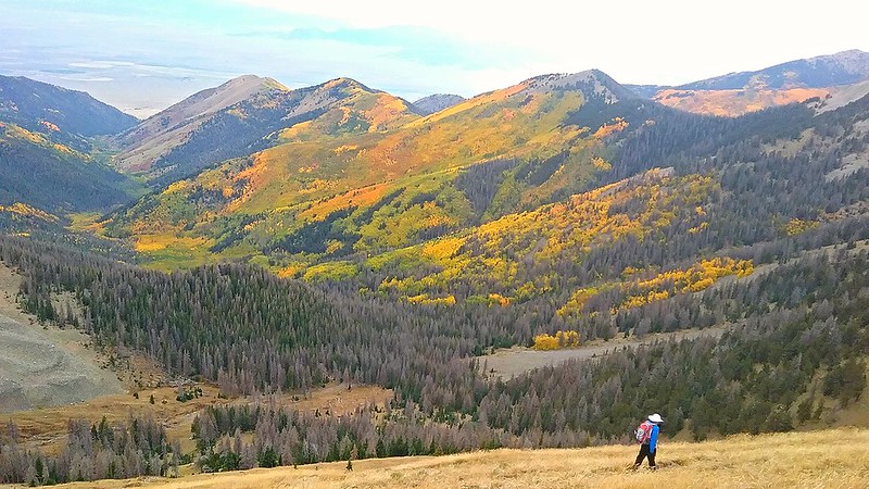
After parting ways with Will, I made my way to Salida where I decided to crash for the night. After getting supplies in the morning, I made a short drive to meet with Jason at the Major creek TH on the western side of the Sangres. I knew that today's route would be long but easy. We launched from the TH around 7.30 am under cloudy sky but with forecast of zero chance of precipitation. The hike was very straightforward, but we were excited to see the fall colors in the valley. We reached the summit of Lakes in about 4.5 hours, which we both were pretty happy about. After a 20 min break, we traversed over to Electric, where we stayed to close of 40 minutes, admiring the views. Somewhere around 3.30 pm we finally peeled ourselves from the summit and started the long half-jog to the car, arriving by 6.30 pm.
Jason approaches the saddle between Lakes and Electric
Some colors in the valley
Electric from Lakes
Approaching Electric
Looking back at Lakes from Electric
Cotton creek basin with its 7 13ers
On the descent from Electric
Starting the long descent back to the car
My GPS Tracks on Google Maps (made from a .GPX file upload):
Have seen a few trip reports for it, and it definitely looks spicy but fun! Looks like a great trip and variety of views/difficulty, thanks for posting.
What would you rate the decent down Music's east ridge? 2-3? I am looking a spending a couple days in the basin next summer and trying to gather as much information as possible Thanks!
Thanks for the great TR Natalie. Emiller, the road to the 4wd trailhead isn't too bad as long as you have good clearance. I didn't use 4wd and was in a 02 tundra. I would call that ridge class 3 max.
Will
...as always, a stellar TR. Music's south ridge looks super fun. Glad you guys had a nice long day on these wonderful peaks in the Sangres.
Caution: The information contained in this report may not be accurate and should not be the only resource used in preparation for your climb. Failure to have the necessary experience, physical conditioning, supplies or equipment can result in injury or death. 14ers.com and the author(s) of this report provide no warranties, either express or implied, that the information provided is accurate or reliable. By using the information provided, you agree to indemnify and hold harmless 14ers.com and the report author(s) with respect to any claims and demands against them, including any attorney fees and expenses. Please read the 14ers.com Safety and Disclaimer pages for more information.
Please respect private property: 14ers.com supports the rights of private landowners to determine how and by whom their land will be used. In Colorado, it is your responsibility to determine if land is private and to obtain the appropriate permission before entering the property.