Download Agreement, Release, and Acknowledgement of Risk:
You (the person requesting this file download) fully understand mountain climbing ("Activity") involves risks and dangers of serious bodily injury, including permanent disability, paralysis, and death ("Risks") and you fully accept and assume all such risks and all responsibility for losses, costs, and damages you incur as a result of your participation in this Activity.
You acknowledge that information in the file you have chosen to download may not be accurate and may contain errors. You agree to assume all risks when using this information and agree to release and discharge 14ers.com, 14ers Inc. and the author(s) of such information (collectively, the "Released Parties").
You hereby discharge the Released Parties from all damages, actions, claims and liabilities of any nature, specifically including, but not limited to, damages, actions, claims and liabilities arising from or related to the negligence of the Released Parties. You further agree to indemnify, hold harmless and defend 14ers.com, 14ers Inc. and each of the other Released Parties from and against any loss, damage, liability and expense, including costs and attorney fees, incurred by 14ers.com, 14ers Inc. or any of the other Released Parties as a result of you using information provided on the 14ers.com or 14ers Inc. websites.
You have read this agreement, fully understand its terms and intend it to be a complete and unconditional release of all liability to the greatest extent allowed by law and agree that if any portion of this agreement is held to be invalid the balance, notwithstanding, shall continue in full force and effect.
By clicking "OK" you agree to these terms. If you DO NOT agree, click "Cancel"...
Date: May 20, 2016
Trailhead: Mayflower Gulch
Route: North face couloir
Distance: ~7 miles
Elevation Gain: 3,500 ft
Vertical skied: ~3,700 ft
Time: ~ 6 hours (includes ~1 hour wait for snow)
Partners: Brittany and Scott
After stashing the car at the ski exit, we started from Mayflower gulch just before 7am. North facing line, chilly forecast.
Good morning Sunshine - always so much fun to ski with you!
Skinning towards the ridge with Pacific
Brittany and Scott decided to drop in and then reclimb back out at the Crystal-Pacific saddle. Myself, trying to minimize the vert, elected to traverse the Pacific's side to the saddle with Crystal. Either way is fine. We chilled about an hour at the saddle, waiting for the sun to come out and for temps to warm up a bit.
Pacific looked great - drool
Nearing the summit
Brittany drops in on the North side
Good conditions off the top
We skied off the summit, steep angle, but very manageable. I thought the toughest part was behind us. Then I saw the entrance into the couloir. It was very steep, probably around 55 degrees. Brittany tried to distract me, saying it was only 45 degrees. I wasn't fooled!
Brittany
Past the very steep section, things mellowed out, but still were respectably steep in mid-40ties
We were able to avoid the debris, for the most part - Brittany
Scott
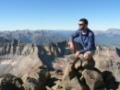
Great line, but even better company
Bushwhack out wasn't too bad and we were able to contour back to the stashed car in good time.
Square Top
Date: May 29, 2016
Trailhead: Guanella pass
Route: NE couloir
Distance: ~6 miles
Elevation Gain: 2,500 ft
Vertical skied: ~2,500 ft
Time: ~4 hours
That morning I drove up the road to ski Mt Evans only to discover that the gate is still closed. Oops. Need a quick Plan B. Square Top has been on my radar for a few years, ever since I skied Bierstadt and is a biCentennial. Thankfully, Guanella pass has just opened, so I drove over there and started hiking after 8 am.
Looking back at Bierstadt, Evans and Gray Wolf
Since I was late for the East-facing line, I pushed as fast as I could, making the summit in 3 hours. Good freeze the night before really helped to lock things up though.
Clicked in on the summit and were able to ski almost to the top of the chutes, before briefly removing skis for a short bit.
Picked the chute and after some snow testing (no rollerballs past 11 am), dropped in. Enjoyed very smooth corn all the way to the lake.
Really nice ski
Arkansas
Date: May 30, 2016
Trailhead: Switchback below Fremont pass
Route: Moonshine couloir
Distance: ~6 miles
Elevation Gain: 2,700 ft
Vertical skied: ~2,700 ft
Time: 4.5 hours
Partner: Matt
I was unable to dash out to San Juans for the Memorial Day weekend. What to ski? Matt, the enabler, suggested Moonshine, which looked good in Bill's recent photos. Gulp! Ok, I am in, but it's gonna be ugly. Matt is the type of partner that I can camp the night before at Mayflower gulch TH without cell reception and not worry if he shows up. Here he is at 4.57 am, right on time. After gearing up, we started skinning from the car by 5.30 am and made an excellent time to the bottom of the couloir. Since I just hiked Arkansas via the ridge with SarahT about 6 months ago, I was keen on checking out the couloir this time. Besides, I think it is a better choice for hiking in ski boots.
Gulp - photo credit Matt
What we see, doesn't look very encouraging - there is too much debris in the couloir already. Matt is commenting that the face to the left looks much better, and I agree. At the bottom of the couloir, we re-gear, and start hiking. Matt accelerates, as per usual.
Kicking steps
I top out around 8.45 am, with Matt sometime before. It's cold and windy on the summit, so not very conducive to spending much time there. Right on the dot, at 9am, Matt goes first (and quickly disappears).
In the couloir, it is a lot of "deliberate" skiing, as its steep and conditions are not that great. In fact, they are pretty difficult - with a lot of bumps and a runnel in the middle. We make it work, but agree it would be way more enjoyable a bit earlier in the season.
Couple good turns
We abandon the apron in effort to find cleaner real estate to the side. And we're done, a 30 min exit to the car notwithstanding. What an exciting and steep climb and ski!
Mt Evans
Date: June 2, 2016
Trailhead: Summit lake
Route: North face couloirs (D8, Crystal - D11)
Distance: ~3 miles
Elevation Gain: 1,400 ft
Vertical skied: ~2,500 ft
Time: 4 hours (2 laps)
Finally, a 14er! After closely monitoring 511 line for hours and days, I finally heard that the road is open to the summit. I drove up the very next day after the opening, making past the unmanned gate at 7.55 am. Got to the lake, chatted with Lodgling for a bit (nice to meet you Rob), geared up, and started hiking by 9 am.
So many options, so little time
Well, what to choose? Initially, I started going up the very left side (Crystal couloir), but coming down skiers forced me further out to the face. I traversed right, joined a booter already in place and headed up.
Staircase to heaven - and nicely frozen also
Top of the middle line
Once on the ridge, I strolled to the beginning of Crystal line, only to discover it required a short downclimb. U-huh.
Nearing the summit
Summit ~11am
Crystal line was in the shade most of the morning and still frozen, and not continuous, so I decided to ski the D8 line first, since it's been warming up in the sun and could be patched together. I skied off the summit, down the ridge. Some sidestepping on skis was required to get into the line. Some Mad Hippies on the ridge with big lenses somehow captured my efforts (~ 3.30-5.20).
Meat of the line - D8
After getting down to the lake, I decided to check out the other line. Drove the car to the top and hiked to the beginning of Crystal.
Short downclimb before the snow starts
Snowy ramp where I clicked in ~12.30 pm
This line was much more exciting - steep and fairly narrow.
All the way to the lake
Looking back at the first lap of the day
Nice cirque with lots of options
Back at the Summit lake, I caught a ride and was reunited with my car near the top of Evans by 2pm.
Twinning peak
Date: June 3, 2016
Trailhead: top of Independence pass
Route: Western gullies
Distance: ~5 miles
Elevation Gain: 1,700 ft
Vertical skied: ~2,500 ft
Time: 3 hours
Twinning (Blue) peak is a classic Indy pass spring ski and has been on my radar since 2012. In the past years I got distracted by Geisslers, Grizzly A, Igloo, Blarney and even Champion. I was determined not to miss it this year. Feeling sluggish even after easy day on Evans, I wanted a mellow ski. Western aspect, cold and windy again on the pass. Initially, I was planning to start with the lower switchback, but by the time I got there, all parking spots were taken. It's ok, since it would save me 800 ft of elevation gain I drove to the top of Indy pass and started skinning around 9.30 am.
East couloirs of Twinning as seen from the saddle with Blarney
No energy for the east side today (and late in the day anyway), but made a mental note for the next time.
Grizzly A always seems to steal the show for me
Geisslers and the Williams group
Start of Western gullies were pretty thin and rocky, and still frozen by the time I dropped in (11.50 am).
Lower half of the gully was much better
I skied all the way down to the lower switchback at ~11,200 ft. Total wait for the car to give me a ride to the top of the pass? 30 seconds. Awww, gotta love the spring skiing!
My GPS Tracks on Google Maps (made from a .GPX file upload):
Sweet report, indeed! How was it getting into Moonshine off of Arkansas with that gnarly looking cornice? Looked at that line earlier in the season when avy conditions weren't great but the cornice was quite smaller. Just curious. Thanks!
Caution: The information contained in this report may not be accurate and should not be the only resource used in preparation for your climb. Failure to have the necessary experience, physical conditioning, supplies or equipment can result in injury or death. 14ers.com and the author(s) of this report provide no warranties, either express or implied, that the information provided is accurate or reliable. By using the information provided, you agree to indemnify and hold harmless 14ers.com and the report author(s) with respect to any claims and demands against them, including any attorney fees and expenses. Please read the 14ers.com Safety and Disclaimer pages for more information.
Please respect private property: 14ers.com supports the rights of private landowners to determine how and by whom their land will be used. In Colorado, it is your responsibility to determine if land is private and to obtain the appropriate permission before entering the property.