Download Agreement, Release, and Acknowledgement of Risk:
You (the person requesting this file download) fully understand mountain climbing ("Activity") involves risks and dangers of serious bodily injury, including permanent disability, paralysis, and death ("Risks") and you fully accept and assume all such risks and all responsibility for losses, costs, and damages you incur as a result of your participation in this Activity.
You acknowledge that information in the file you have chosen to download may not be accurate and may contain errors. You agree to assume all risks when using this information and agree to release and discharge 14ers.com, 14ers Inc. and the author(s) of such information (collectively, the "Released Parties").
You hereby discharge the Released Parties from all damages, actions, claims and liabilities of any nature, specifically including, but not limited to, damages, actions, claims and liabilities arising from or related to the negligence of the Released Parties. You further agree to indemnify, hold harmless and defend 14ers.com, 14ers Inc. and each of the other Released Parties from and against any loss, damage, liability and expense, including costs and attorney fees, incurred by 14ers.com, 14ers Inc. or any of the other Released Parties as a result of you using information provided on the 14ers.com or 14ers Inc. websites.
You have read this agreement, fully understand its terms and intend it to be a complete and unconditional release of all liability to the greatest extent allowed by law and agree that if any portion of this agreement is held to be invalid the balance, notwithstanding, shall continue in full force and effect.
By clicking "OK" you agree to these terms. If you DO NOT agree, click "Cancel"...
Jonah and I going back and forth the night before given the forecast of grey and grey stormy pooh. So we decided to run from the upslope pattern east of the divide and shoot for a zone west of the divide. The day was excellent the clouds and slight wind kept the snow cold for most of the day, allowing us to ski 4 different lines, 2 from the summit. Both north facing lines were still cold pow, while the southeast facing lines were soft cream! A perfect day with a great crew!
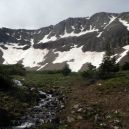
Thumbnails for uploaded photos (click to open slideshow):
Went up there this morning, and the direct SE lines off the summit already looked bony (though still skiable). Luckily, the bowl below the S ridge saddle is in great shape, so I rode the ridge a bit and took that. Great corn harvest in the bowl around 9:30. Otherwise, most of that basin still has great coverage on nearly every aspect...one could easily spend a day doing laps following the sun.
I've heard good things about the skiing Coon Hill and have been meaning to try it;however, the most logical access--parking near the Eisenhower Tunnel--is probably not a good idea due to security concerns.
What is the recommended approach for getting up there?
Caution: The information contained in this report may not be accurate and should not be the only resource used in preparation for your climb. Failure to have the necessary experience, physical conditioning, supplies or equipment can result in injury or death. 14ers.com and the author(s) of this report provide no warranties, either express or implied, that the information provided is accurate or reliable. By using the information provided, you agree to indemnify and hold harmless 14ers.com and the report author(s) with respect to any claims and demands against them, including any attorney fees and expenses. Please read the 14ers.com Safety and Disclaimer pages for more information.
Please respect private property: 14ers.com supports the rights of private landowners to determine how and by whom their land will be used. In Colorado, it is your responsibility to determine if land is private and to obtain the appropriate permission before entering the property.


")
")
")