| Peak(s): |
Redcloud Peak - 14,037 feet Sunshine Peak - 14,004 feet "Sundog" - 13,437 feet |
| Date Posted: | 08/14/2015 |
| Date Climbed: | 07/14/2015 |
| Author: | scottaskinger |
| Peak(s): |
Redcloud Peak - 14,037 feet Sunshine Peak - 14,004 feet "Sundog" - 13,437 feet |
| Date Posted: | 08/14/2015 |
| Date Climbed: | 07/14/2015 |
| Author: | scottaskinger |
| Sundog to Sunshine to Redcloud - Stormed off the mountain |
|---|
|
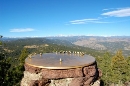
This trip report actually covers two days. Day 1 I was stormed off Sunshine and Day 2 I completed my objective. I've included both days in one report as there is information I would like to share from both days, just not enough for two separate trip reports. General Summary Day 1 -my original route is described in Roach's book as (28R5) Sunshine Peak - Northwest Ridge -the route climbs the 13er Sundog first, before taking the Northwest ridge to Sunshine, over to Redcloud and then descending Redcloud's Northeast Ridge route. -this is mostly a class 2 route with a short stretch of class 2+ climbing -the route is pretty easy to follow and route finding is not difficult -started from Silver Creek/Grizzly Gulch trailhead, where I also camped -on day 1 I made it to Sundog and then about 500 feet from the summit of Sunshine before a storm came in and I had to descend -I made several mistakes (which I describe below) that I learned from and that I wanted to share here with others Day 2 -pissed off about the day before, determined to get Redcloud and Sunshine -followed the Standard Northeast ridge route to Redcloud over to Sunshine and then back to Redcloud before descending the same route -camped at TH, started at 5am, done at 1pm -class 2, defined trail the entire way -13.12 miles, 8 hours (including about 45 minutes of summit breaks), 5000 feet of elevation gain -up high for 3+ hours, just make sure that you have a clear weather window if you're going from RC to Sunshine to RC (about an hour each way) Introduction I flew from Milwaukee into Durango arriving Monday evening. Unfortunately, my flight was delayed by about 5 hours, so instead of driving to the TH and camping Monday night I decided to stay in Durango and head out early the next day. Tuesday morning I left Durango at about 4:45, heading north to Silverton. From Silverton, my plan was to take Cinnamon Pass and get to the Silver Creek/Grizzly Gulch TH as quickly as possible. I made one wrong turn which cost me some time but overall this route was quicker than making the long haul east from Durango to Lake City. You definitely need a high clearance, 4WD vehicle to take this route. I finally got to the TH at 7:35 and started hiking by 8am. I started WAYYYY to late (which was the best I could do because of the previously mentioned issues) and I paid for it later. TH to Sundog First 1.5 to 2 miles is on trail and pretty straightforward. Look for junction with Silver Creek South Fork Trail. You will see a rocky area where you can easily approach the creek (like a beach of rocks). You will cross the creek here and then cross the creek again on the right (west). You are crossing the South fork of the creek. From here you will start ascending Sundog immediately, maneuvering your way through the trees. The route up Sundog is pretty straightforward; just keep heading uphill. Eventually, you will be above tree line and the route (and views) become even clearer. There is a good amount of talus to deal with but the climb goes quick. It took me about 2 hours and 40 minutes to reach the summit of Sundog (10:40am) from the TH.    Sundog to "Oh Shit!" I made it to the saddle of Sundog and Sunshine, approximately 13,115 feet, about 25 minutes later and started up Sunshine's Northwest Ridge. I was taking the route to the right (west), which is much safer, when I heard thunder at about 13,500 feet. Shit, now what do I do? The skies above me still looked pretty clear (my views to the South and West were blocked) and the thunder seemed far away. I paused for a minute or two and didn't give up any ground. I heard thunder again and decided to start heading down. I descended 100 feet and in that time did not hear any thunder and somehow convinced myself that a storm was not coming...so I started heading back up. It wasn't more than a minute later when I heard thunder again. Bad clouds were rolling in and soon after it started hailing, first small pieces then larger, "painful" pieces. I started descending in a hurry. My only real bailout option was to take the Sunshine Peak Northwest Face route. Heading back over the Sundog ridge would have been a bad option as I would have been high up for hours. I had reviewed the Northwest Face route and was generally familiar with it but when I reached the scree gully area at about 13,300 feet I was unsure how to get down. From above, nothing looked the same as the pictures I had reviewed. I followed the route marked by a cairn for a bit but it looked like a bad option down steep, loose rock. I couldn't see the bottom and wasn't sure if it cliffed out. At this point, the hail had turned into snow/sleet. I was getting wet, my hands were getting cold and the ground was covered with snow obscuring the route even more and of course making it slippery. The thunder continued to boom around me. I hadn't seen lightning yet but I was getting pretty freaked out. I went back and forth looking at the different descent options for about 20 minutes. Nothing looked right. The route is categorized as difficult class 2, well within my range, but everything looked very loose and like nothing more than a scree shoot. I started down one route and came back up...too dangerous. I finally chose a route and committed to it. The chute was filled with loose rock but had what I thought was solid rock on the edges. I started down the route and was pretty comfortable at first but the "solid rock" on the edges turned out to be typical San Juan crumbly rock. Even the big rocks were sometimes unstable. I eventually made it down this steep section and continued on, soaking wet, very cold and having to deal with 2 miles of loose talus in wet boots and then another 3 miles or so to hike out. Of course it was bright and sunny by the time I made it back to camp. Lessons Learned 1. Know your bailout route. Sure, it sounds obvious. But do you study your bailout options as much as your main route? I did not. In the future, I will know my bailout options well, have waypoints marked if I'm taking a GPS and an overall backup plan if things go to shit. I will also take more care on long ridge routes to ensure that my weather window is ideal. 2. Get raingear on quicker. I always bring a rain shell, warm hat and gloves. I usually bring rain pants if weather is even a little iffy. I hesitated on my rain gear because I wasn't getting wet at first and I wanted to get down the mountain. After about 30 minutes I realized that my clothes were pretty wet and my hands were getting cold. I should have immediately put my rain pants and shell on. I also ordered a pair of gloves that are warm AND waterproof. 3. Watch the weather better. The funny thing is that up to this point, I really thought that storm snuck up on me. As I was putting together this TR I noticed the picture from Sundog's summit above. There is clearly some bad weather off in the distance, I just wasn't paying attention. I also had summit fever and should have descended immediately once I heard thunder. Thumbnails for uploaded photos (click to open slideshow):  Lower incline on Sundog")
 Ridge to Sundog, class 2+ difficulties are on the North side of the ridge")
 Peak of Sundog with questionable skies in the background")
|
| Comments or Questions | ||||||
|---|---|---|---|---|---|---|
|
Caution: The information contained in this report may not be accurate and should not be the only resource used in preparation for your climb. Failure to have the necessary experience, physical conditioning, supplies or equipment can result in injury or death. 14ers.com and the author(s) of this report provide no warranties, either express or implied, that the information provided is accurate or reliable. By using the information provided, you agree to indemnify and hold harmless 14ers.com and the report author(s) with respect to any claims and demands against them, including any attorney fees and expenses. Please read the 14ers.com Safety and Disclaimer pages for more information.