Download Agreement, Release, and Acknowledgement of Risk:
You (the person requesting this file download) fully understand mountain climbing ("Activity") involves risks and dangers of serious bodily injury, including permanent disability, paralysis, and death ("Risks") and you fully accept and assume all such risks and all responsibility for losses, costs, and damages you incur as a result of your participation in this Activity.
You acknowledge that information in the file you have chosen to download may not be accurate and may contain errors. You agree to assume all risks when using this information and agree to release and discharge 14ers.com, 14ers Inc. and the author(s) of such information (collectively, the "Released Parties").
You hereby discharge the Released Parties from all damages, actions, claims and liabilities of any nature, specifically including, but not limited to, damages, actions, claims and liabilities arising from or related to the negligence of the Released Parties. You further agree to indemnify, hold harmless and defend 14ers.com, 14ers Inc. and each of the other Released Parties from and against any loss, damage, liability and expense, including costs and attorney fees, incurred by 14ers.com, 14ers Inc. or any of the other Released Parties as a result of you using information provided on the 14ers.com or 14ers Inc. websites.
You have read this agreement, fully understand its terms and intend it to be a complete and unconditional release of all liability to the greatest extent allowed by law and agree that if any portion of this agreement is held to be invalid the balance, notwithstanding, shall continue in full force and effect.
By clicking "OK" you agree to these terms. If you DO NOT agree, click "Cancel"...
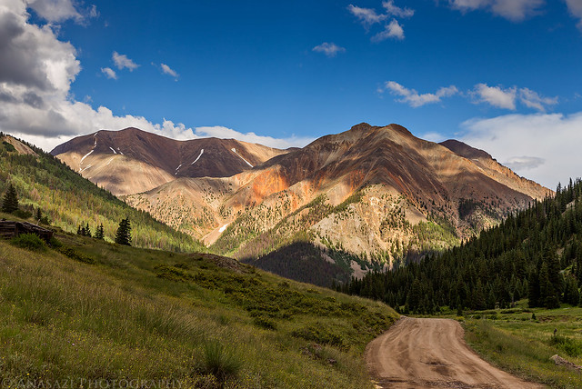
This weekend Diane had to stay home so I set out on my own into the San Juan Mountains to finally climb my first 14ers of the year. I planned to hike to the top of Redcloud Peak and Sunshine Peak bright and early on Saturday morning. I left work early on Friday and after stopping for a late lunch at Handlebars in Silverton, I continued up the Animas River to the top of Cinnamon Pass. I parked at the pass and took a short warm-up hike to the top of Cinnamon Mountain, an easy 13er. Short hikes at elevation and sleeping above 10,000 feet really helps me get acclimated quicker.
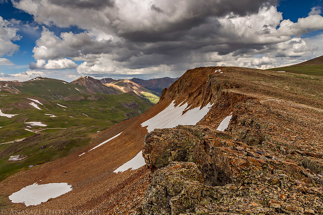
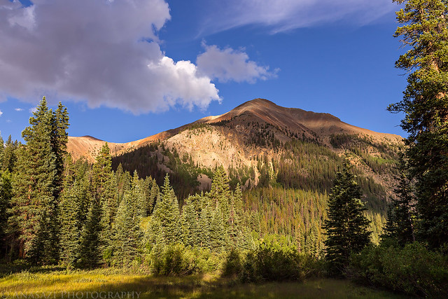
My first glimpse of Redcloud Peak seen from Cinnamon Pass. It would hopefully be my first 14er of the year in the morning.
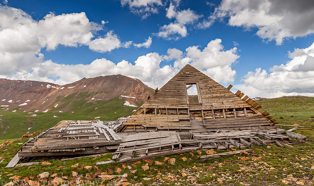
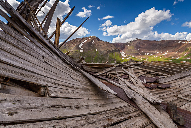
Not much left of this old building near the pass. Wood Mountain is in the background (13,660).
A different view of the ruins with Animas Forks Mountain (13,722) beyond.
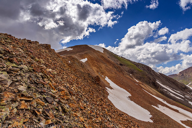
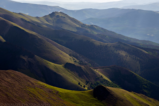
Cinnamon Mountain (13,328) seen from my hike up to the ridge.
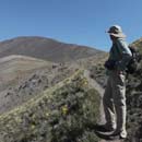
On the ridge.
Great views up here as I climbed to the summit.
View from the summit of Cinnamon Mountain.
Looking down over the ghost town of Animas Forks from the top.
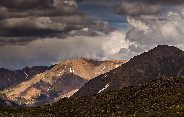
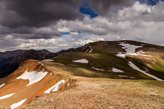
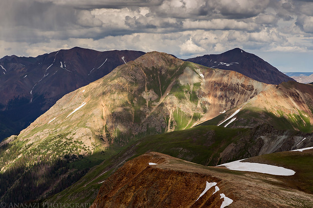
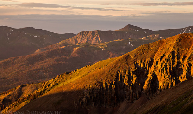
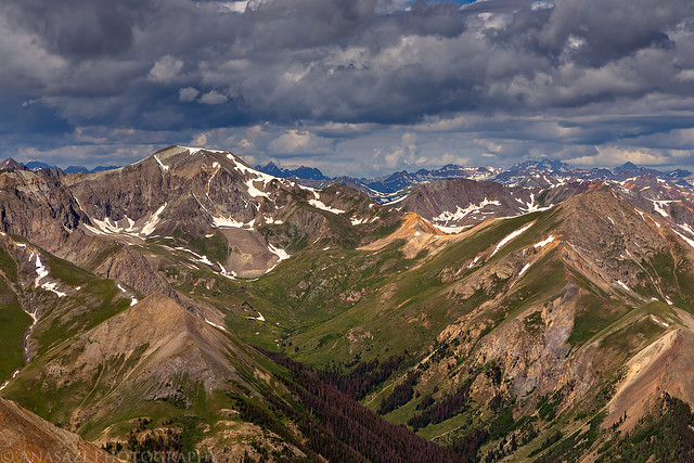
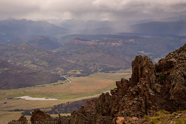
Whitecross Mountain (13,542) in the sunlight with Redcloud Peak (left) and Sunshine Peak (right) in the shadows behind.
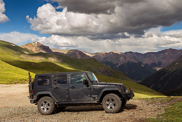
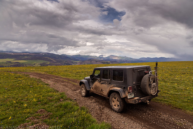
Back to my Jeep at Cinnamon Pass. It was time to head down the other side and find a campsite for the night.
Driving through Burrows Park along the Lake Fork of the Gunnison. Sundog (13,432) is directly in front of the road with Redcloud and Sunshine to each side in the background.
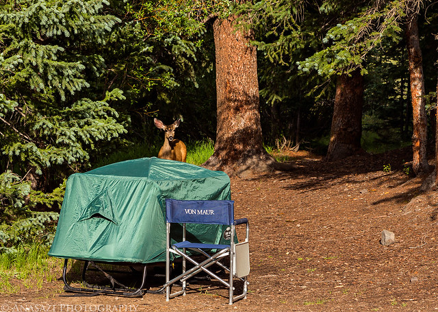
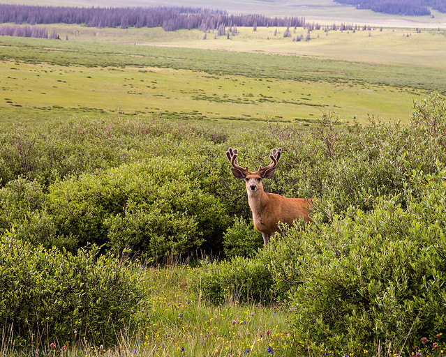
After setting up camp near the Silver Creek trailhead I had a visitor join me for a few minutes.
Great view from my camp this evening.
I was planning on an alpine start Saturday morning, so I tried to go to bed early. This never seems to work out as well as I hope and I typically just lay in my sleeping bag for a while before actually falling asleep. This night was no exception. I'm not sure when I fell asleep (I didn't want to know what time it was, so I never looked at a clock), but when my alarm went off at 3:30am I was wide awake. I guess that means I managed to get enough sleep. After a quick snack for breakfast I started hiking shortly before 4:00am. There was no moon out this morning and the sky was pretty clear, so I was accompanied on my hike by a canopy of bright stars above with the sound of Silver Creek rushing beside me. Since the stars alone did not provide me with enough light to see, I had to use my headlamp until shortly before sunrise.
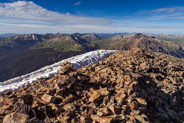
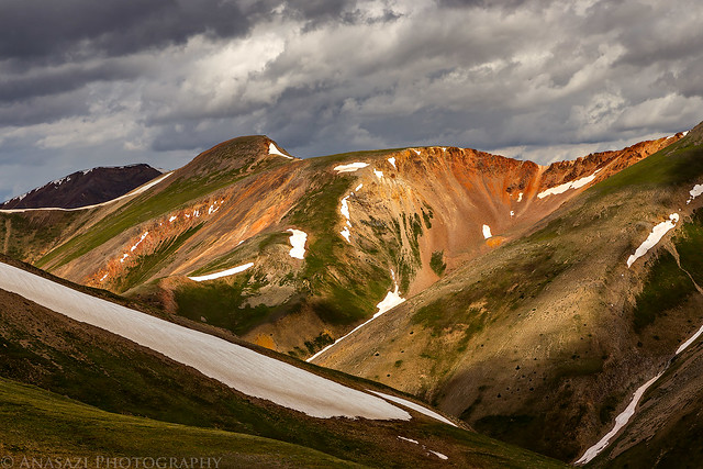
Not long after sunrise I made it to the saddle below Redcloud Peak and was finally able to start taking photos. Warm light strikes the mountain tops towards the Continental Divide.
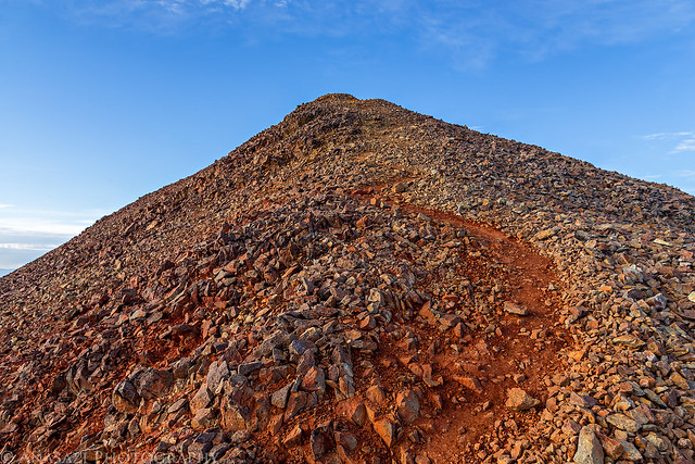
My first destination, Redcloud Peak, is on the left. Still over 1,000 feet to climb at this point...
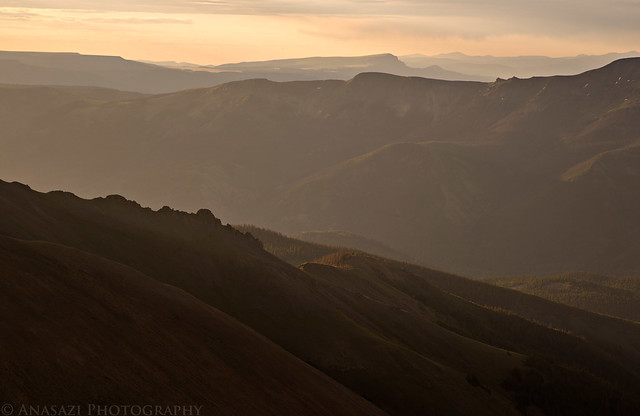
Morning haze with Bristol Head in the distance.
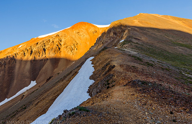
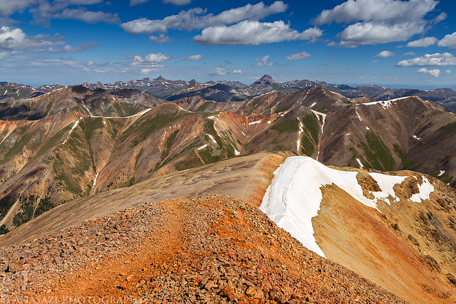
The final stretch to the summit of Redcloud Peak (14,034).
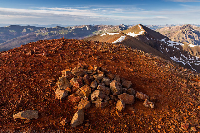
On the summit of Redcloud looking over to Sunshine Peak (14,001), my next destination this morning. It's about a mile and a half away and I'd have to lose about 500 feet of elevation and climb most of that again.
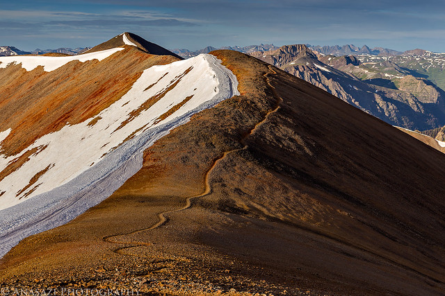
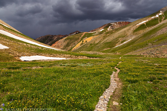
The obvious trail to Sunshine Peak.
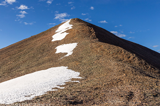
The final rocky climb to the top.
Nice views from up here.
Finally! The summit of Sunshine Peak, my second 14er of the day and the year. Sunshine Peak has the distinction of being the shortest of all the Colorado 14ers.
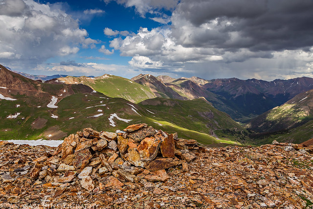
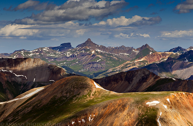
After reaching Sunshine, I decided to return the way I had come, which meant I had to go back over Redcloud again. After summiting Redcloud for the second time I was treated to great views of Uncompahgre Peak, Wetterhorn Peak and Matterhorn Peak.
A closer look at Wetterhorn and Matterhorn with Coxcomb in the shadow.
Looking up Grizzly Gulch to Handies Peak (14,048), which was my very first 14er.
Nice light down in Bent Creek.
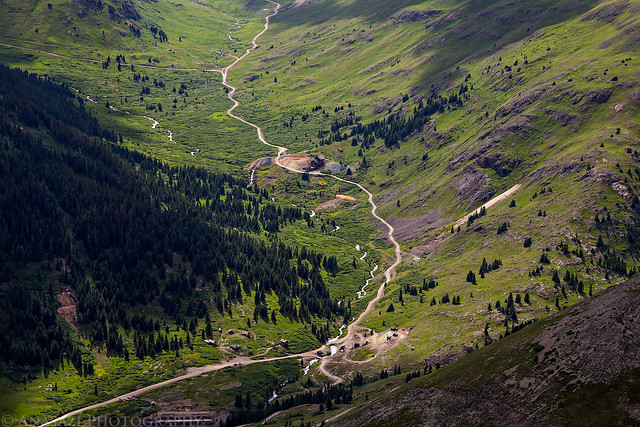
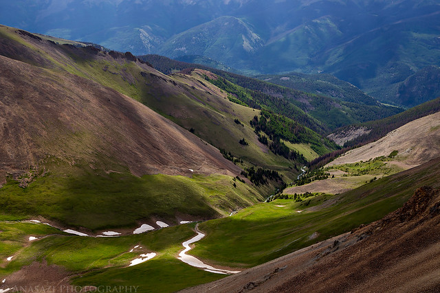
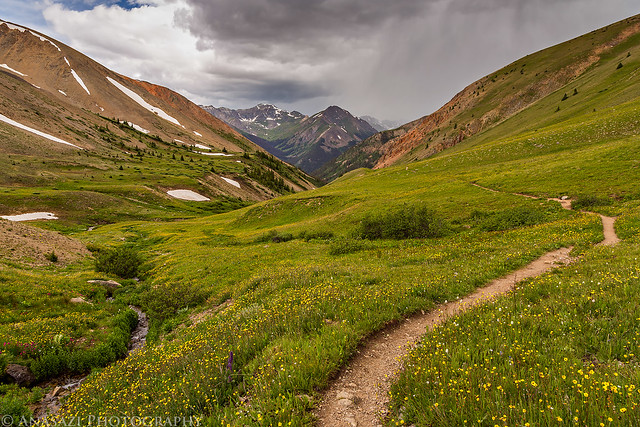
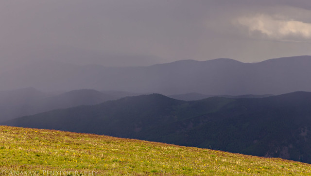
The nice thing about returning the way I had come was that I got to see what the hike along Silver Creek actually looked like since it was dark when I came through here in the morning. The afternoon storm clouds had already started building at this time.
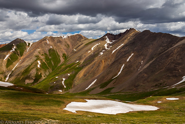
An incoming storm behind Whitecross Mountain. It would hold off until I reached my campsite and got everything packed up into my Jeep.
One last look at Handies Peak over Silver Creek.
After finishing the hike and packing up my camp I headed over to Lake City and then drove over Slumgullion Pass and Spring Creek Pass so I could drive to the top of Bristol Head. I thought it was going to be a quick drive to the top, but the road was longer and rougher than I thought, so it took a while to get there.
I made another friend along the way.
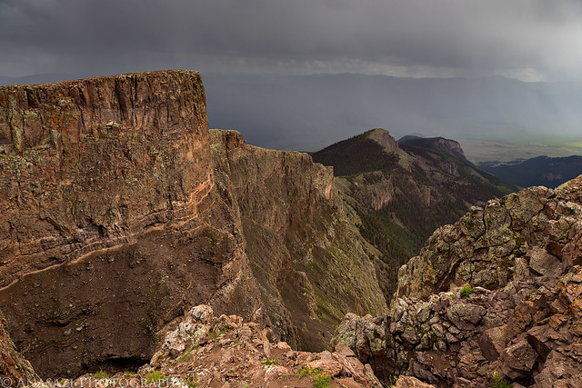
View from the summit of Bristol Head (12,706) with storms all around. After taking this photo there was a nearby lightning strike and I quickly got back into my Jeep.
Driving back down from the summit.
The gentle face of Bristol Head seen during my drive back down to the highway.
We’re planning a trip out there in a week – Handies will hopefully be the kids’ first peak –– Via Grizzly Gulch even though it’s a bit longer. Any signs of vehicle fortification needed at the lot? Everyone’s porcupine stories concern me unnecessarily. cheers
I’ve parked my Jeep at many trailheads for extended periods of time, both above and below treeline with no precautions taken without any issues with porcupines or marmots.
All my photos were taken with a Canon 6D and then the RAW files were processed in Adobe CameraRAW/Photoshop. Mostly just levels adjustments for contrast and a little vibrance/saturation.
I’m considering this in a few weeks if I’m first successful on Uncompahgre. How close was the creek to your campsite (thinking about water access)? I’m also curious about the difference between traversing back over to Redcloud as opposed to doing the loop route I see on a topo map. Do you have any thoughts on that (difficulty, distance/time)?
Caution: The information contained in this report may not be accurate and should not be the only resource used in preparation for your climb. Failure to have the necessary experience, physical conditioning, supplies or equipment can result in injury or death. 14ers.com and the author(s) of this report provide no warranties, either express or implied, that the information provided is accurate or reliable. By using the information provided, you agree to indemnify and hold harmless 14ers.com and the report author(s) with respect to any claims and demands against them, including any attorney fees and expenses. Please read the 14ers.com Safety and Disclaimer pages for more information.
Please respect private property: 14ers.com supports the rights of private landowners to determine how and by whom their land will be used. In Colorado, it is your responsibility to determine if land is private and to obtain the appropriate permission before entering the property.