Download Agreement, Release, and Acknowledgement of Risk:
You (the person requesting this file download) fully understand mountain climbing ("Activity") involves risks and dangers of serious bodily injury, including permanent disability, paralysis, and death ("Risks") and you fully accept and assume all such risks and all responsibility for losses, costs, and damages you incur as a result of your participation in this Activity.
You acknowledge that information in the file you have chosen to download may not be accurate and may contain errors. You agree to assume all risks when using this information and agree to release and discharge 14ers.com, 14ers Inc. and the author(s) of such information (collectively, the "Released Parties").
You hereby discharge the Released Parties from all damages, actions, claims and liabilities of any nature, specifically including, but not limited to, damages, actions, claims and liabilities arising from or related to the negligence of the Released Parties. You further agree to indemnify, hold harmless and defend 14ers.com, 14ers Inc. and each of the other Released Parties from and against any loss, damage, liability and expense, including costs and attorney fees, incurred by 14ers.com, 14ers Inc. or any of the other Released Parties as a result of you using information provided on the 14ers.com or 14ers Inc. websites.
You have read this agreement, fully understand its terms and intend it to be a complete and unconditional release of all liability to the greatest extent allowed by law and agree that if any portion of this agreement is held to be invalid the balance, notwithstanding, shall continue in full force and effect.
By clicking "OK" you agree to these terms. If you DO NOT agree, click "Cancel"...
This year I reached my goal of 100 new named destinations in Rocky Mountain National Park and 100 days mountain biking.
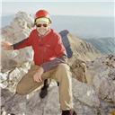
The story of this year starts last year, on Christmas Day in fact. I wasn't able to make it home to visit my family, my wife had work, and I was not looking forward to a day sitting at home missing everyone. I mentioned this to my friend and frequent hiking/climbing partner (though I've lost him somewhat to the evils of ultramarathoning), and immediately some ideas were sparked. In the end, we met early in Boulder, drove to Alma, and ended up doing Decalibron.
Already 3 miles and 1000 feet or so in.
This was the most memorable Christmas day of my adult life, and maybe number two overall. A perfect example of what the holiday is truly about.
It was so cold I didn't want to stop and get my camera out.
Yours truly, photo by DanR.
And the Grinch, with his grinch-feet ice-cold in the snow,
Stood puzzling and puzzling: "How could it be so?
It came without ribbons! It came without tags!
"It came without packages, boxes or bags!"
And he puzzled three hours, 'till his puzzler was sore.
Then the Grinch thought of something he hadn't before!
"Maybe Christmas," he thought, "doesn't come from a store.
"Maybe Christmas...perhaps...means a little bit more!
Christmas came, in a way it never had before, and a way it never will again.
1/22/14- Dundicking attempt.
I was kicking myself after walking right by this summit in summer 2013. I vividly remember Dan saying, "We should check this out." But it was obvious it wasn't Mount Dunraven, this peak wasn't named in Lisa Fosters book, and we of course didn't do any research beforehand. We walked right by the summit of this unofficially named and ranked peak on the North Fork Drainage.
Thus, a return trip was in order. And why not in January? Why not start from Cow Creek since the Dunraven TH was still closed? Why not!
A window pane in a tree burnt by the 2010 Cow Creek fire.
I found the "lost" Husted trail, and steadily gained elevation.
The few areas without snow were easy going, but the rest...
In the end I made it to around 10600 feet in 6.5 hours. I was still 2000 feet below the summit. It was noon. So, say 2+ hours more to the summit. Then that total minus 1 hour to get back to the trail head.
I made the educated and unfortunate decision and turned back. All downhill from here... Except those 600 feet or so of gain to get over the final hill before descending to the Cow Creek th. I was dragging ass up this final hill. But the top brought a reward.
A great view of Longs. I didn't get what I wanted, but this was almost as good.
3/12/14- Flattop, Hallett, Otis, and Taylor via Bear Lake.
I'd been saving this one for a snowy day since the avy risk on Flattop is nil. It didn't look bad on paper. Up I went, carrying snowshoes all the way up.
Hallett over Emerald Lake and lots of snow.
The Sharkstooth and Taylor. I was feeling ok so far, but that slope up to the summit of Taylor loomed huge. I spent every step up it thinking I should take my snowshoes off my back and put them on my feet, yet I just couldn't bring myself to do it.
We've all had those days when you just loose all motivation to go on, and this was mine. I had to go all the way back there? I was considering finding a cave to spend the night, swearing I'd invent a teleportation device when I got back home, and literally counting every single step I took as a method to will myself on. Blocks of ten worked the best. Then rest. Then ten more. Then rest. The minor amount of elevation gain to get back up and around Hallett Peak nearly did me in. But at least from there out it was all downhill.
Back at Bear Lake I saw the first four people I'd seen all day. I am sad to report the teleportation device has yet to become reality!
3/17/14- Beginnings at Boulder Valley Ranch.
The first mountain bike ride of the year at a place that is so smooth you could probably do most of it on a road bike. But it served the purpose: spin the legs and get the sit bones used to sitting again. The first few rides of the year always bring some pain.
3/19/14- Last day of winter and Longs Peak.
The king of RMNP. I'd stood on top before, but had not done the Keyhole Route. Time to get busy living.
It was five degrees at the trail head, and I could hear the wind whipping through the trees. But up I went. I'd just go up to the Keyhole and check it out. I was willing to turn back if things looked bad.
Once I hit tree line, I was able to look back down into the valley and see the insane amount of snow blowing nearly horizontally down. It was zero degrees at Granite Pass, and so windy I was having trouble moving in a straight line.
When I got to the boulderfield, things didn't look much better. I was doubtful it would go down today.
But then...
I used the boulderfield toilet...
this thing must control the universe...
the wind died in minutes...
the weather warmed markedly...
ONWARD!
(As this toilet controls the universe, please use its powers only for good)
Out came the ice axe, crampons, and helmet, up the trough, across the narrows, and up the homestretch, the only part of the route I'd done before. It seems like there should be some final difficult obstacle to surmount, but the summit comes uneventfully, and I had it all to myself.
I shall have peace, as leafy trees are peaceful
Astounding views from high in the trough.
Joy!
I lost the trail around treeline as is seemingly tradition for me. At this point, I'd yet to be up this trail in anything but winter conditions. Some postholing ensued, but I eventually found my way and got back on track and back to the car.
People talk about this peak like its a spiritual experience, and now I get it.
4/9/14- One life one chance.
Spent some time in the park on this day, obtaining some minor destinations on the east side such as Deer Mountain, Eagle Cliff Mountain, and Bierstadt Moraine. It became notable when I got home and drank alcohol for the last time in 2014.
4/16/14- High speeds at Hall Ranch.
This is possibly my favorite local trail. It has it all, from technical climbing and descending, to the smoother and flowier upper sections of Nelson Loop. This was my first real time trial attempt of the year, and rather early in the season for me. The rules I've made up are simple- start timing at your parking space in the lower parking lot, an attempt must be made to ride everything (you can't jump off and run over something you know you have difficulties with), if you fail you may dismount and walk or run your bike forward to the next logical place to restart riding, and no rests may be taken. This early season gave me 1:12:47 at 8.7 miles per hour, the fastest I've ever ridden this trail. And it was so early in the year.
4/23/14- Dundicking, 200th named destination in RMNP.
Again starting from Cow Creek. This time I wasn't going to let that last 600 feet of elevation gain get me.
Worked a forty hour week, slept five hours, and drove one hour to see this one beautiful second I will never see again. More sunrises and sunsets will come, but I was glad I happened to be at this place for this one.
The Husted trail. You can see it, right? No snow made the going way easier.
I was at and past my previous high point hours earlier. I'd carried my snowshoes the whole way and cursed them with every step. But now? I love you snowshoes.
It was quite windy as I got near the summit of Dickinson.
I wasn't going to walk by it again! (Note, I saw some bootprints in the snow here. Were they yours?)
Things to come...
From the summit, I immediately headed down toward the terminus of the Husted Trail (near the closed loop at 10400 almost directly south of the summit of Dickinson). Down, down, down. And then some up. I paid more attention to nutrition throughout the day, and those 600 feet were no problem this time.
5/3/14- Getting faster at Picture Rock.
It's been a several year goal to ride Picture Rock up, take a left at Wild Turkey, a left at Ponderosa, and then ride the outside loop back to Wild Turkey and then back down Picture Rock at an average speed of ten miles per hour. Today I got as close as I ever have, hitting nine mph for the first time. Within two weeks I improved my speed to 9.1, yet the all out effort to obtain that left me wondering if ten was just out of reach.
5/28/14- Mummy Mountain and Hagues Peak.
With two weather related turn arounds, May wasn't the best month for getting out. But a good day had finally come.
From far away...
I stayed on the Lawn Lake trail until the intersection with the Black Canyon trail. I took a right here and stayed on that for a few hundred yards before breaking left toward Mummy. This led to a second to third class scramble up over the south side of Mummy Mountain. To go up into the saddle (the route recommended by Foster) is easier technically, but this is more direct.
My second ascent of Mummy in a little over six months. And now on to Hagues...
Rowe Peak and Rowe Glacier/Lake.
On paper, the journey to Hagues doesn't look too bad. But while postholing in snow... It took me some time to cover this mile.
Something met its end here.
Back to Mummy from Hagues.
The oddest part of the day was this helicopter which buzzed through the area as I regained the summit of Mummy. It landed in the saddle between Mummy and Hagues and two people got out with gear. The helicopter took off. I'm not sure what they were doing, but they weren't looking for anyone. I found out later that this was the day a French-Canadian was almost rescued off of Longs. Perhaps these were some of the rescuers?
Nevermore.
Fairchild. By the time I got back to the car, I had over 6000 feet of elevation gain and had seen no one all day.
6/4/14- Almost almost.
Couloir season! Chiefs Head/Pagoda couloir that is.
Step step crunch. Rinse and repeat.
Ever photogenic from any angle. The couloir ends about .6 miles from the summit. Getting to the top is about 1000/mile on loose talus.
Descending the couloir was a fun but somewhat tenuous glissade, having to stop and down climb over that thin icy section, and through some of the narrower stuff.
I snapped this photo above Black Lake. It looks fake, like someone created it.
I paused at Sexy Lake to look back up. I really just climbed that? This day left me with one named destination in Glacier Gorge- The Spearhead.
6/25/14- Lil Matterhorn.
I headed up Ptarmigan Glacier, and then north along the divide. Got my first "for real" ice axe self arrest, which was slightly less terrifying than asking a girl out in sixth grade. At least the ice axe held my hand.
Thumbs up to alpine rock!
As you can see, this provided tons of fun route finding and scrambling. Oh, and it's not a 14er so there weren't hordes of very clearly uncomfortable with the exposure people there.
After hitting the tiny summit, I headed back and then dropped down into the valley to end up by Grace Falls. I contoured around and picked up the trail to Odessa Lake. I lost some altitude and then broke off northeast.
Peaks are great, but I find a big reward in some of these tiny bodies of water scattered throughout the park. Marigold Lake is in close proximity to a trail, though it takes a little work to get to it. It probably sees 10-20 people a year. I reveled in the solitude and quiet.
From there it was up and over to find another tiny body of water- Round Pond. Quiet and still.
7/2/14- Snowdrift Peak and its lakes.
Despite a good weather prediction, I could not see the stars as I made my way to Estes. Not the best sign. I started from Bear Lake, and as I ascended the Flattop Trail, I moved into heavy cloud cover. But then a glimmer of hope- some blue poking though the grey here and there.
In a short time, I had moved well above the cloud line and was treated to some mind bending views- the peaks I know so well like islands in water. From Ptarmigan Point, I headed west and dropped down to Ptarmigan Lake.
While not too exceptional other than being incredibly beautiful, this lake provided the gateway to a fun day without any trails. From this lake, I contoured down and around through forest, past unnamed waterfalls, over talus, down short cliff faces, and spent some time in a truly wild area of the park.
Snowdrift Lake was up next. My feet were soaked by the time I arrived here.
And then Wonderland Lake, which is a treasure.
Offering some great and unique views, Snowdrift Peak happened to be my 222nd named destination in RMNP. Which meant I was halfway there by the list I was going from at the time. A steep drop down over snow and talus got me to Murphy Lake, number 223. From there, it was simply head back to Flattop and then try not to make too much eye contact on the way down. Much to the disappointment of the several people who asked, I did not climb Hallett Peak and was unable to provide any advice. But I did get to spend alot of time in some beautiful scenery, visit some true alpine jewels of lakes, and climb a peak no one had heard of. Day seized.
7/12/14- A door opens...
I usually try to avoid the OSMP trails on weekends, but I was desperate. I headed to Picture Rock and concentrated on my breathing and felt good on the way up. Really good. When I hit Wild Turkey in under 40 minutes, I know I am moving. The outer loop came and went. There were alot of people coming up as I made my way down, and yielding the right of way meant alot of stopping and starting. I got back to the car and discovered I'd just ridden the trail at 9.8 miles per hour, significantly faster than ever before. And on a Saturday with lots of stopping and starting. And in the middle of the summer when I tend to go slower anyway. Maybe it was possible after all...
7/22/14- I don't believe in God, but if I did...
Shortly before my 24th birthday I was diagnosed with cancer. It's that weird in between age, when there aren't many people who have gone through the same. I happened to meet a breast cancer survivor named Liberty, who was less than one month younger than me. She proved to be a great person to talk to, and a tremendous inspiration when she fell ill again. She always had a smile on her face, and I can tell you going through cancer just hurts. Your body feels weird, you get sick easily, you get to run the full gamut of medical tests (my favorite: CT scan, least favorite: bone marrow biopsy). I got 8 different IVs in one hour. One hour! That is probably more than most people have had in their entire life up until that age.
Liberty passed away on July 22, 2010, age 29. I cried alot when she died. But every year I try to spend that day or a day around it doing something awesome in her memory. In 2013 I started at Rock Cut and dropped into and back up out of Forest Canyon. Over the course of a tremendously difficult day, I visited all ten Gorge Lakes. At Highest Lake I said a few words to her. On the way back I stopped at Inkwell Lake and looked up...
A rainbow cloud. Apparently a fairly common phenomenon, it took me nearly 33 years to see one, and I've yet to see another.
The peaks seemed like a good idea this year. Dan and I started from Poudre Lake and were above tree line in time to see alpenglow dancing on the Never Summers.
Remember me when I am gone away,
Gone far away into the silent land;
When you can no more hold me by the hand,
Nor I half turn to go yet turning stay.
Remember me when no more day by day
You tell me of our future that you plann'd:
Only remember me; you understand
It will be late to counsel then or pray.
Yet if you should forget me for a while
And afterwards remember, do not grieve:
For if the darkness and corruption leave
A vestige of the thoughts that once I had,
Better by far you should forget and smile
Than that you should remember and be sad.
She wasn't with us but her name is in the summit register on Mount Julian. In loving memory of Liberty Rebekah Dagenais, October 9, 1980- July 22, 2010.
8/6/14 and 8/12/14- Stones Peak and Lakes.
I started out from Bear Lake on the sixth looking at a day that would have me finish the Stones Peak area off. My plan was to drop down to the lakes, then take the gully from Hourglass Lake up to Stones, then Stapps, then back to the divide and Sprague Mountain before heading back. 20% chance of storms for the day. The best laid plans...
Once again, I moved into heavy cloud cover that did not break as I topped out Flattop. It was cold too, I had packed light and found myself jogging just to generate enough body heat to keep warm.
Finally the clouds started to break. I went around point 12277 and broke north off the trail. Since I'd yet to see Stones, my plan was to head north until I hit the rim of Spruce Canyon and then ring around it.
But things started to clear up. Rather than gain altitude toward Sprague Mountain and then descend to the lakes, I decided to take the nice grassy ramp (about dead center in this photo) and stay at the same altitude. This worked perfectly.
At Rainbow Lake, another one of the secluded gems of the park.
Stones looking impressive. You can see the top of the gully I'd take up from Hourglass Lake. I went to Irene Lake, and skipped Sprague Tarn as it wasn't labelled on the map I was working from. I should know better by now, but I am not upset about having to make a return trip to this area next year. From Irene Lake, it was simple to head down to Hourglass Lake, which is where my camera had its final hurrah and stopped working.
I went up the gully and was slightly below point 12358 when I thought I heard thunder. I sat and watched the sky to the west. It looked horrible, the same way it looks when it starts to rain and storm in about half an hour. I was 600 feet below the summit. My bail out plan was to go back down the gully and drop into Spruce Canyon. I made the decision and started down with regret in my heart.
In Spruce Canyon. My camera was having trouble focusing, and I felt somewhat blurry. The skies cleared up and I didn't hear thunder again of course. Spruce Canyon is rough and slow going. With lots of marshy area, large blocks of talus ala Chaos Canyon, and thick forest complete with tons of dead fall, it took me hours to bushwhack around Castle Rock and hit Spruce Lake. Once I was there, the going was decidedly easier, but I still had to take the Fern Lake trail up to Lake Helene, and then head back to Bear Lake. Going this way ended up taking me 3.5 hours longer than my estimate. But I did get to tour one of the most rugged and remote places in the park. I saw a single cairn near Castle Rock, and no signs of humanity elsewhere. It's wild and difficult to move in, but Spruce Canyon is a beautiful place.
Armed with a new camera, I set out for a quick day to get to the peaks. Stones looked very far away as I got above tree line.
A great place to be.
Stones and Rainbow Lake. The gully is nearly dead center here. There is a little bit of loose stuff, but it works.
From the divide to Stones Peak. I would recommend staying close to but south of the ridge line for the easiest travel.
I set my sights on Stapps Peak, the small highpoint northeast of Stones.
It was a pretty kick ass Alpine Sunflower season!
Hayden Spire and Lonesome Lake. I noted some clouds rolling in. Time to get moving. I was not going into Spruce Canyon again!
Clouds were building as I got back to Flattop, and I was now running in an attempt to get back below tree line before the inevitable. Of course, I passed more than a few parties still going up the trail. It was lightly raining by the time I got to Bear Lake, and in a full on thunderstorm by the time I exited the park. Some people got wet that day. With around 6500 gross gain, this day set a personal best.
8/26/14- TEN! KIND OF!
My wife and I went to Picture Rock to ride. I forgot my shoes at home. I left her there, retrieved my shoes, and then decided to ride as fast as I could to meet her. I caught her coming down around mile 4. The skies weren't looking great, but I decided to just hit the top of Picture Rock and head down. Something was going right. I got back to the car where she was waiting and had hit a flat ten miles per hour average for the first time ever! Now I knew adding the loop on while maintaining that pace was possible.
9/3/14- Inverse Mummy Kill/Madness/Mania/Slaughter.
Start at Lawn Lake th and end at Lawn Lake th? Six 13ers, 2 12ers, and the second highest named lake in the country? Where do I sign up?
I met up with Dan in Lyons and made the drive up. Some Elk greeted us near the th and I accidentally butt honked the horn of my car after pulling in next to someones camper. Sorry, it's got a mind of it's own.
We summited Mummy Mountain (my third time in the past ten months), and then headed toward Rowe Glacier/Lake.
Rowe Peak and Rowe Mountain were rather silly little high points that don't look like much from below or above, at least from the vantage point we had.
We set off toward Little No Name, which again looks like a small high point at the end of a flat field of tundra. From the other side, it looks pretty spectacular. Along the way we discussed the silliness of naming a peak 'Little No Name' since naming it no name in fact gives it a name.
So the peaks weren't spectacular, but the view into the North Fork drainage was. Pretty incredible.
We went up to Middle No Name, and then Gibraltar Mountain, before dropping back to Rowe Glacier/Lake for a nice snack.
ALS ice bucket challenge anyone?
We headed up to Hagues Peak, noting what looked like a small trail from it to the lake. The summit here is flat, with a few different blocks that all look to be about the same height. We had trouble picking one.
There was some third class near the top of Hagues as we dropped down to the saddle, but things quickly got easier. Stay on the east side of the ridge when descending.
We talked about the possibility of adding on Fairchild, but waited until we got to The Saddle to make the final call. We both felt game and went for it. Here is where things fell apart for me. I felt fine all day but I was dragging up this peak. I got a headache and then felt waves of nausea. Against my better judgement, I pushed on.
A great view of the Four Aces of Ypsilons Blitzen Ridge.
On top I tried to eat something but quickly decided that was a bad idea. We realized this was the last high peak in the Mummies for both of us. "I wish I could feel happier about that," I said.
By the time was got back to the trail I was feeling whole again, and felt some happiness about the day.
This ended up as my longest day in duration (slightly over 14 hours) and highest single day elevation gain (around 8400 feet). It was a great day with a good friend.
9/17/14- Ni-chebe-chii part 1.
I'd read about the loose and rotten rock in the Never Summers, but had yet to experience it first hand. I looked at the topo, and found a logical way to break the range into four pieces that would allow me to access the lakes and other named destinations in the area as well as the peaks. For day one I planned to start from the Colorado River th, take the Red Mountain trail to Grand Ditch, take that to Hitchens Gulch, and then hit Lake of the Clouds, Mt. Cirrus, Howard Mountain, Mt. Cumulus, Mt. Nimbus, and Red Mountain. Well, I'd planned for a little more than that, but made slower progress than I expected, so cut it "short".
After several hours of headlamp, dawn broke and it was a marvelous day.
Lead Mountain and Never Summer Peak from Hitchens Gulch. Eventually the trail disappears and you simply stay right of the exit waterfall from Lake of the Clouds to climb some solid talus to the lake.
A pretty awesome view.
My plan was to head up from here to the saddle between Howard Mountain and Mt. Cirrus. When I got there I found some snow blocking the way, so I went up a scree gully toward Mt. Cirrus. Here is where I got my first taste of the unstable nature of the area, as I was kicking chunks of rock off, and every step forward had me slide half a step back. I learned right away to really test any hand or foot holds.
Calling Bob Ross. Happy little clouds.
At the top of Mt. Cirrus, I was already running well behind schedule. It was going to be a late one.
Howard Mountain proved to have the most stable terrain of the day, and I tried to make the most of it, moving as quickly as I could.
Howard to Cumulus provided some pretty challenging terrain. It wasn't possible to stay on the ridge. It wasn't possible to stay next to the ridge. Rather it was something like, "It's flatish here. Ok, a deep gully. Go down that. Now back up. A small tower. Around that on the other side. Look another gully. Down again. Back up. Kinda flatish here. For a little while." And all of that on very loose rock where you are literally kicking and pulling foot and hand holds off the wall. The plus side was that my stone crushing abilities made me feel very strong.
At last I was there. A few hundred feet of stability and I was at the top. Going to Mt. Nimbus proved to be much the same. Along the way a murder of crows came to check me out. It was so quiet I could hear the air rushing past their feathers.
But it had the cutest register ever!
Getting to Red Mountain was easy enough at first, on some actual tundra and stable talus. But I could see it ahead...
I tried to stay right on top, but the first move had me pull a hand hold off. It was back down and around. I stayed on the north side.
Finally past the difficulties, it was smooth sailing to the summit of Red Mountain, and then a tenuous and sketchy descent down a gully on the north side. Don't go that way.
It was getting dark and my will to bushwhack was low, so I stuck to the road until I met the trail and headed back most of the way by headlamp. I was joined by the haunting and nebulous calls of Elk and thoughts of ever horror movie I've ever watched.
Back at the car, I set a sixty second exposure and pointed it up. I gained around 6000 feet, spend 15.5 hours in RMNP, and had a hour and forty five minute drive home ahead of me.
I felt alive.
9/19/14- Hall Ranch via Antelope trail.
I just had time for a short one. Up Antelope to Bitterbrush, to Nelson loop clockwise and back. It took me 46:10 car to car at 9.3 miles per hour. Another eye opening ride- both accesses to Hall gain approximately the same amount of elevation. Bitterbrush is obviously much more difficult technically. But maybe...
9/24/14- Ni-chebe-chii 2.
Day two saw me plan to once again start at the Colorado River th. On the menu for the day was Lulu City, Shipler Park Cabins, Mt. Richthofen, Static Peak, The Electrode, Thunder Pass, Lulu Mountain, Thunder Mountain, Mt. Neota, La Poudre Pass, and Little Yellowstone.
At Lulu City. It's hard to believe 500 people once lived here. All that remained was some mist and the mountains.
You'll reach an intersection that prompts you to go right to reach Grand Ditch or left to go to the Ditch Camp sites. Take a left. The trail picks up after the campsite on your right.
I found this small structure on the small section of trail between Ditch Camp and Grand Ditch. This section of trail also appears to get very little human use. I didn't see a single foot print, save for those of Elk. I headed up Skeleton Gulch and then cut right to head up Richthofen.
The beauty of this place is sometimes too much for my little mind to process. I have been moved to tears more than once this year simply from sights such as this.
Richthofen looked imposing, but the summit came easily enough, and the rock was relatively solid.
Now to head to Static Peak. There was a little bit of loose rock along the way, but nothing like what I experienced farther south in the range. I ate a snack on the summit and prepared for the next section of the day. At third class, this stretch would bring me the most technical difficulty.
It did not disappoint...
This was some of the most fun I had all year. I wish this were closer to my house. I'd do it every day!
I lost altitude until I was lower than the summit of The Electrode. I finally found a gully that I could see the bottom of and things looked fine the whole way down. I went directly at the cliffy faces on the west side of The Electrode, once again in some looser rock and third to fourth class. I'd probably just go around either north or south if I did it again. The register on The Electrode was again places by John and Alyson, though it wasn't as cute as the register on Nimbus!
I headed down to Thunder Pass and then up Lulu Mountain and then down and back up to Thunder Mountain. The going here was once again pretty stable, on tundra and talus.
I looked back and realized I could see every peak I'd climbed over the day. Pretty awesome.
A short loss and regain brought me to Mt. Neota. I tried to follow the NPS boundary signs down but lost them fairly quickly. The bushwhacking was of moderate intensity, and I finally stumbled upon a thin trail and the yardstick of civilization: an empty can of Bud Lite. Poudre Pass came shortly after, and then it was simple to loose elevation down and back to the trail head. I saw four people out looking for Elk near the trail head. They were the first and only people I'd seen all day.
I made it back to the car shortly before nightfall. What a day in a special place. I dream of it at night and during the day while I'm at work. I'm thinking of it right now and wishing I was there.
9/28/14- Secrets.
I have a secret trail I like to ride on Saturdays. While you can battle the masses at Heil, Hall, Betasso, or whereever, I am enjoying some mountain scenery. The most I've ever seen on this trail on a Saturday was six people. This Saturday brought me the best time of the year- 1:25:50, 6.7 mph. It's alot steeper with technicality to match Walker or Hall. Close to my idea of perfect in other words.
9/30/14- Ten and then some.
I went to Picture Rock and went for it. I hit Wild Turkey in ~35 minutes and knew it was on. I rocketed back down. At the car I saw 1:32:11, 10.2 mph. I'd finally done it!
October 2014- a month of suck.
There are 31 days in October. I lost eight to illness, and sat at home through two beautiful weeks of weather. I finally got out near the end of the month, ascending Signal Mountain and Pennock Peak.
And I rode my bike alot, 19 days to be exact. I set and then reset a personal best at Hall, 1:06:32, 9.3 mph. To do the math-
31 days
-8 sick
-1 hike
-19 ride
equals
3 days to do nothing.
To the extreme! at Buffalo Creek. Not too extreme as I had to ride this three times, progressively pushing myself farther back each time to make it look harder. I was going about 2 mph in this photo.
11/5/14- North Fork Basin.
The goal for this day was simply to finish the area off. Stormy Peaks (e+w), Sugarloaf Mountain, Ramsey Peak, Skull Point, and Icefield Pass. This is a much quieter area of the park, and incredibly beautiful. It is amazing and sad to see the amount of destruction in Glen Haven, where road construction is still in progress. The Dunraven trail sustained significant damage, so much so that a new trail was put in uphill of the previous. It is currently open to foot traffic. This trail is built to fly on.
Some old friends...
Stormy Peaks west and Sugarloaf Mountain. I saw a single Bighorn in between the two.
Hagues Peak, Gibraltar Mountain, Rowe Peak, Middle No Name, Rowe Mountain, and Little No Name all visible l-r. Gibraltar and the No Names certainly look impressive from this perspective and with a light dusting of snow.
Sugarloaf Mountain isn't much of an event. A broad and flat expanse of talus and tundra. Fortunately there is a summit cairn. Otherwise it would be rather easy to walk right by.
I dropped down to Ramsey Peak, not looking forward to going back up. But if not now, I'd have to come all the way back just for this. It provided some good views of the drainage between Stormy Peaks and it.
Elevation was gained and snow slowed forward progress as I approached Skull Point.
Icefield Pass ended up looking wind loaded and a little icier than I was prepared for. I found a safe route down on rock on its north side.
It continued to dominate the view in spectacular fashion. After spending some time talus hopping in snow (YAY!) I finally hit solid ground near Lake Louise and was able to get moving at a reasonable pace. Once again, darkness came hours before I got back to the car. The near full moon through the trees kept things interesting, as the most benign tree stump turned into a horrible face eating grizzly deer. All in this covered around 6300 feet and 23 miles. It feels easier here, since the gain is so spread out.
This day launched the idea for a ring the bowl hike which I am sure someone has done already but would be fun nonetheless. Start at Dunraven th and do Dickinson, Dundicking, Dunraven, Gibraltar Mountain, Middle No Name, Little No Name, Skull Point, Sugarloaf Mountain, Stormy Peaks (e+w), Pennock Peak, Signal Mountain (and south), and Bulwark Ridge. Anyone?
11/7/14- FTTW.
Hit the highest MTB speed of the year, a terrifying 29.8 mph at Hall Ranch on the downhill from the top of Nelson Loop.
12/2/14- 100 in RMNP!
With quite warm weather predicted, I set my sights on a few of the minor peaks in and around Estes. I first set out for Castle Mountain, Castle Rock, and Window Rock (just the window).
Castle Mountain provided some great views, including a look at what would soon become number 100- Deer Ridge East.
And of Lumpy Ridge.
Castle Rock and Window Rock provided some fun third and fourth class scrambling. A quick descent back to the car and a five minute drive and I was ready to head for Oldman Mountain and Deer Ridge East.
Meatwad? Oldman Mountain was short but had some fun slabby scrambling and a short section of third class.
Again.
I got to the point where the trail started to loose elevation and curve to the north around Deer Ridge East and set out on a contouring ascent to the summit.
No glitz and glamor. No one to take a photo or say congratulations. Just a quick snack, name in the register, and a few minutes for reflection as I listened to the wind and the lonely calls of a single Elk. But there it was.
12/3, 12/4, 12/5/14- 98, 99, 100.
A three day tour of some of my favorite local trails. On the third, I rode the Devils Backbone from Loveland to Blue Sky in Ft. Collins and back. The fourth was Picture Rock, Wild Turkey, and Ponderosa. The fifth had to be Hall Ranch. I started from Bitterbrush and took that up and then Antelope down to parking and then back up to Nelson and back down to Bitterbrush. 100 days mountain biking.
12/8/14- One too many.
101st ride of the year and I wiped out hard on Picture Rock, breaking my helmet, sustaining a minor concussion, and worst of all, spraining my AC joint. Which means no riding or carrying a backpack for 2-4 weeks and 2014 is over. In the meantime, I've taken up running, and am dreaming about Rocky Mountain National Park and the summer of 2015.
12/25/14
These are the things that make this person.
I have to reluctantly admit that I was once an English major at CSU, and my field of study got me some terrific jobs after I graduated. Ha.
Despite my major, I was unfamiliar with the lines of poetry quoted in remembrance of Liberty midway through the trip report, so I googled them. Turns out the poem was written by Victorian poet Christina Georgina Rossetti, sister of the better–known Dante Gabriel. The poem is titled "Remember."
andrewrose, you left out the most important part of this trip report! Would you mind repeating this journey and fishing all the lakes, letting us know which ones hold big fish?
Honestly, though––IMPRESSIVE! First photos of Icefield Pass I have ever seen, for instance. Looks like ancient ice.
I thought this was a TR on the Decalibron.. 12/29/2014 4:15am
...and then I realized it wasn’t! Andrew, this is pretty sweet man. Nice job out there in the park this year. Very impressive. And thanks for some ideas!
Such an awesome trip report! One of my favorites, for sure! Thanks for sharing!
Caution: The information contained in this report may not be accurate and should not be the only resource used in preparation for your climb. Failure to have the necessary experience, physical conditioning, supplies or equipment can result in injury or death. 14ers.com and the author(s) of this report provide no warranties, either express or implied, that the information provided is accurate or reliable. By using the information provided, you agree to indemnify and hold harmless 14ers.com and the report author(s) with respect to any claims and demands against them, including any attorney fees and expenses. Please read the 14ers.com Safety and Disclaimer pages for more information.
Please respect private property: 14ers.com supports the rights of private landowners to determine how and by whom their land will be used. In Colorado, it is your responsibility to determine if land is private and to obtain the appropriate permission before entering the property.


")