Download Agreement, Release, and Acknowledgement of Risk:
You (the person requesting this file download) fully understand mountain climbing ("Activity") involves risks and dangers of serious bodily injury, including permanent disability, paralysis, and death ("Risks") and you fully accept and assume all such risks and all responsibility for losses, costs, and damages you incur as a result of your participation in this Activity.
You acknowledge that information in the file you have chosen to download may not be accurate and may contain errors. You agree to assume all risks when using this information and agree to release and discharge 14ers.com, 14ers Inc. and the author(s) of such information (collectively, the "Released Parties").
You hereby discharge the Released Parties from all damages, actions, claims and liabilities of any nature, specifically including, but not limited to, damages, actions, claims and liabilities arising from or related to the negligence of the Released Parties. You further agree to indemnify, hold harmless and defend 14ers.com, 14ers Inc. and each of the other Released Parties from and against any loss, damage, liability and expense, including costs and attorney fees, incurred by 14ers.com, 14ers Inc. or any of the other Released Parties as a result of you using information provided on the 14ers.com or 14ers Inc. websites.
You have read this agreement, fully understand its terms and intend it to be a complete and unconditional release of all liability to the greatest extent allowed by law and agree that if any portion of this agreement is held to be invalid the balance, notwithstanding, shall continue in full force and effect.
By clicking "OK" you agree to these terms. If you DO NOT agree, click "Cancel"...
Looking for the Sunshine at the end of the Rainbow
Day 1: Pt 13,832 & Pt 13,811
Trailhead: Silver Creek
Mileage: 12.3
Elevation Gain: 4,631'
Gurlz: Me, myself and I
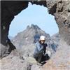
With friends bailing because of sickness and for better peaks, I wasn't sure if anyone else was showing up for the Ladies hike. Newbie Ladies don't tend to post at all, or even respond to pm's. So with the horrible (but incredibly incorrect) forecast, I waited around at the appointed meeting point, wondering. Once apparent I was on my own, I ditched the boring plans of yet another repeat on a 14er, to something that is more interesting to me - 13ers! Of course, I had done ZERO research on the nearby peaks lately (everything was at home on my laptop). I knew what I had left were all lengthy days, so I went with the least gnarly. Bonus, I had actually brought the Trails Illustrated map for the region! With screw removal surgery in a week, this was going to be my last weekend in the hills for a bit, so time to throw down and make it worth it!
So after a rapid gear change, since I don't hike solo in garish pink, I was heading up the trail at the rather late hour of 6:50 am. Better hope that 40% chance of storms after noon is on the late side! I was hiking as fast as my body would let me, and somehow I missed how horrible this trail is. I tried to use my graduated ND filter, but I don't think it was strong enough for the morning contrasts to get the colorful leaves in darkness with Handies in bright light. Further up, the tundra has started to turn colors and was a nice morning view.
Handies with early light Handies and the changing tundra
Once up at the saddle with Redcloud, I turn left and continue in the other direction from the other hikers I had been catching up to. Take that conservative ortho doc! While there is a pretty decent trail to use for these peaks, the trail doesn't actually go to the "summit". So it would seem humans just expanded upon the existing game trails in the area. So remember that, when it's time to summit - leave the trail! Don't keep blindly following the herd...
Redcloud Route to the first Centennial Nearing the first summit
Pretty good views from the summit, even the slightly disheartening one of the next peak, looking soooo far away. Glad for the GPS to tell me the distance. My 13er ridge running visual distance meter is obviously rusty!
A look back at Redcloud and Sunshine The steeper north side of the peaks Wetterhorn and Uncompahgre
On the way down the east ridge, I spot another *gasp* human on the trail below! Wow, that's unexpected. A bit too far away to converse much, so hope he was having a good day!
Once around the bump on the ridge, it was another fairly easy tundra ascent to the last Centennial. The trail becomes faint once again, as you need to summit. So just go up!
Nearing the second Centennial Looking back across the rugged north side
Sat for a short bit on the summit enjoying the views and all the leafy color surrounding me. Not used to the oranges and the reds on the Aspens! It's comes closer to the color I'm used to from the Adirondaks and WNY, but not exactly. The deep reds are still missing.
San Luis group with leafy color in front Another Centennial to do, sometime Sneffels in the distance The long route home...
Once back at the Redcloud saddle, it was all downhill on craptastic scree trail. The clouds were slowly building into something menacing, but I would be well below before they got too angry. Though 2 guys were still going up! All the way down on this horrid scree trail, I kept dreaming of a scree zamboni! Push all that horrid crap out of the way. With 2 miles left to go on the trail, and almost to the trees, my legs began to question picking up that gauntlet this morning. But a rumble in the clouds above gave me the needed motivation to get downhill before any rain had started. Forecast was 3 hours late, but I'm good with that. The sun even came back out while I was relaxing at the trailhead after a long 8 hour day on the trail!
Day 1: Sunshine Mountain A & Pt 13,039
Trailhead: Last switchback on road past Wetterhorn (high clearance 4WD)
Mileage: 6
Elevation Gain: 2,639'
Partner: Solo, with guest appearances by 3 other 13er hikers on the summit of 13,093
I wake up along the road to Engineer Pass to the pitter patter of rain hitting my topper shell on my truck. So I go back to sleep, ignoring my alarm. Doubtful hiking today! I comfortably slumber until it gets light out, and then the rain magically stops. So I decide that maybe I will just do some leaf photography instead of picking up the orphan 13er near Cinnamon Pass I have. I didn't exactly like what I saw from the road, and I hadn't looked at my beta shots beforehand (since I didn't realize I might do this peak). So I lackidasically drive around, pulling over, taking photos, hiking down to the waterfall overlook in my pj's. Off-roaders are not up yet, and hunters are already deployed, so I have the place to myself.
I decide that I'll drive up to the end of the road past Wetterhorn, since I had never done that before. See what kind of views of leaves I would get. Once up there, I take a good look at the sky, and notice that Uncompahgre is out of the clouds. Hmmm, the clouds are lifting, it hasn't rained since 6:30am or so, maybe a short hike could happen. I do have the nearby 13ers to do, some look really close to me on my map. What if I just hike up to treeline and decide then if I should go further?
Fog wisp in the valley Waterfall along Engineer Pass road Fog lifting Snow topped peaks with some color Fog and color Uncompahgre looking icy
So I change out of my pj's into my hiking kit, and start up the misty trail. We'll just see how far we get before it start raining again. Forecast calls for rain and gloom aaaaaaallllll day long. This must be a short reprieve. In a meadow, I hear a now familiar sound of yet another waterfall. So I leave the trail to explore a nice view. Too bad the mist was rising up from the lower valley to envelop me, just as I got to the nice view of the waterfall.
Hmmm... should I continue up a bit further? Maybe the fog will be gone by the time I reach treeline, get a better view of the area. So I leave the waterfall and start up the slope through a nice forest with lots of game trails to follow for a time.
Fog rising in the valley A misty morning waterfall
I get up to treeline and I see the spectacular Uncompaghre looking icy and misty, well worth the effort to hike up this far. But do I continue? The clouds don't look that scary right now. There's even blue sky peaking out. Maybe just a little bit further...
Fog and an icy Uncompahgre Pt 13093 Gentle grassy slope up Sunshine Mtn
As I get within a short distance of the summit of Sunshine Mountain, the sun starts to show itself! The clouds are continuing to break apart, weather is improving as time goes on. Guess I will make these 2 summits today!
Fog coming up from the Engineer Pass road side obscure my views of Wetterhorn and Uncompahgre, but the rest of my view is mostly unhindered. Even Handies peaks out to show it's white flanks.
The sun will come out, on the summit! Foggy view of Wetterhorn Window into the fog of Uncompahgre Handies looks very snowy!
I almost have to tear myself away from the summit, I only thought I would have to tag, before descending. I really wanted the shots of the nearby 14ers. But the weather could change, and I'd rather not be high up if it does! So onto the next peak!
13093 bathed in sunshine! Looking back on a sunny Sunshine Peak Route up Pt 13093 Wetterhorn and Uncompahgre with lifting clouds
The last tenth of a mile to 13093 was a bit of a steep loose dinner plate talus ascent, but at least it was short! On my way up, I look down into the valley to see a white animal. Hmmm a goat? That low? Then I see it's human, and a couple more. And they're coming right for me!?!!! Huh? Who else other than 13er hikers would beeline it for Pt 13,093 other than other weird types like me? And when they joined me on the summit, it turns out they are fellow 13er (and *gasp* 12er) hikers! Well met! Nice to chat with others on a solo day. I do enjoy my solitude, but to have it punctuated from time to time with other fellow enthusiasts is always nice.
Handies and American looking white. Redcloud and Sunshine with a dusting of snow Looking back on the route from Sunshine Mtn Some nearby 13ers and 12ers that look interesting Wetterhorn and Uncompahgre from my sun drenched summit
I had to tear myself away from this final summit. All I had to look forward to was a scree descent back to the valley below, a nice waterfall and then the looong drive home. So I lingered a bit longer on the summit alone. Then down below in the upper meadow. Since this view was much better than the one I have 5 days a week in my office (not quite special enough to get a window office). Then I mosey on down to the waterfall, and hang out for another half hour. Why not put off a long drive for just a bit longer...
Sitting for awhile, just enjoying the view Colorful waterfall
Some parting leaves on the way out. Look at those orangy-reds!
What a horribly inaccurate forecast for Sunday! 70% chance of rain and thunderstorms "likely" all day long? Haha, very funny weather dude! Glad I stuck around!
My GPS Tracks on Google Maps (made from a .GPX file upload):
Who needs them? It doesn't surprise me that you out badassed them all. Nice work Otina. Great shots, great write up, and I even learned an interesting new adverb
Oh, and I think I speak for all of us when I say I'd still like to see a shot of that garish pink outfit.
I was glad to see at least the start of the aspens turning before I left CO last week. Nice to see some more! The waterfall shots are especially beautiful! The leg must be getting strong. Thanks for sharing!
Mike - Not I! Always looking to increase vocabulary You know how I feel about selfies! But maybe if I'm especially drugged up after my surgery... though I'm not sure how I'd get into part of the outfit if I was drugged! Those pink hair extensions were tricky!
geojed - I was seriously sad that it looked so far away! Glad that the actual traverse didn't take that long.
SoCool - Life is better outside than on a couch! All these waterfalls makes me wonder if I should carry my tripod.
Nat - Lists and partners - peak complications, I know, it's the life we lead. Hopefully soon I can carry a rope! Maybe I'll start with a small one.
MtnHub - I'll be sad to miss this weekend's peak color, but the contrast with the green leaves is also quite pretty as well. The leg feels good and my PT says the bone should be pretty strong by now. Yay for progress!
Ryan - Glad it happened to be so timely! It may have been what I would have done at the Gathering, if I could go. Enjoy!
Great to read that you're back doing what you love!! The waterfall pictures are beautiful!! Print your report for your ortho doc....it's good for them!!
barbiesue53 - Thanks! It's great to be back. I think my ortho doc finally ”got it” eventually. At least my PT figured out quickly that holding back might be an issue for me!
Adventuregal - I have a Canon EOS-M camera, the newer mirrorless DSLR. My grandfather was a pro who worked for Kodak and for himself, so I was taught how to use SLR's and manual cameras as a kid.
I couldn't join you. Darn lists and partner cancelations on my end. I hope to make it up to you though, by carrying ropes maybe? ;) Fall colors look beautiful and the shot of the waterfall is amazing!
Caution: The information contained in this report may not be accurate and should not be the only resource used in preparation for your climb. Failure to have the necessary experience, physical conditioning, supplies or equipment can result in injury or death. 14ers.com and the author(s) of this report provide no warranties, either express or implied, that the information provided is accurate or reliable. By using the information provided, you agree to indemnify and hold harmless 14ers.com and the report author(s) with respect to any claims and demands against them, including any attorney fees and expenses. Please read the 14ers.com Safety and Disclaimer pages for more information.
Please respect private property: 14ers.com supports the rights of private landowners to determine how and by whom their land will be used. In Colorado, it is your responsibility to determine if land is private and to obtain the appropriate permission before entering the property.


 Handies with early light")
 Handies and the changing tundra")
 Redcloud")
 Route to the first Centennial")
 Nearing the first summit")
 A look back at Redcloud and Sunshine")
 The steeper north side of the peaks")
 Wetterhorn and Uncompahgre")
 Nearing the second Centennial")
 Looking back across the rugged north side")
 San Luis group with leafy color in front")
 Another Centennial to do, sometime")
 Sneffels in the distance")
 The long route home...")
 Fog wisp in the valley")
 Waterfall along Engineer Pass road")
 Fog lifting")
 Snow topped peaks with some color")
 Fog and color")
 Uncompahgre looking icy")
 Fog rising in the valley")
 A misty morning waterfall")
 Fog and an icy Uncompahgre")
 Pt 13093")
 Gentle grassy slope up Sunshine Mtn")
 The sun will come out, on the summit!")
 Foggy view of Wetterhorn")
 Window into the fog of Uncompahgre")
 Handies looks very snowy!")
 13093 bathed in sunshine!")
 Looking back on a sunny Sunshine Peak")
 Route up Pt 13093")
 Wetterhorn and Uncompahgre with lifting clouds")
 Handies and American looking white.")
 Redcloud and Sunshine with a dusting of snow")
 Looking back on the route from Sunshine Mtn")
 Some nearby 13ers and 12ers that look interesting")
 Wetterhorn and Uncompahgre from my sun drenched summit")
 Sitting for awhile, just enjoying the view")
 Colorful waterfall")