2013 ROCKIES PEAK HOPPING
On this year's adventure through southern and central Colorado I spent two weeks traveling from trailhead to trailhead to climb as many high peaks as possible; sometimes sleeping in my tent, sometimes in my truck, just trying to make the most of the available time.
I summited 20 peaks while hiking in the Sangre de Cristo, San Juan, Sawatch and Mosquito Mountain Ranges, the majority of them for the first time and also five repeats of some favorites. Most of those peaks were above 13,800 feet high.
The action started the evening of July 20. After a long day of driving from the Texas' gulf coast, I grabbed my big backpack and hiked the 7 miles up to South Colony Lake near timberline, arriving around midnight in the middle of a thundershower. This was my base for two nights.
July 21- Climbed the steep 14,294' Crestone Peak alone. Had great views there. With a storm developing overhead, I skipped an attempt on Crestone Needle. After a rain break in my tent the weather cleared and I summited 14,064' Humboldt Peak before sunset.
July 22- Attempt on 14,197' Crestone Needle. Decided to turn around 13,300' since my boots lacked good traction (I left my climbing shoes in the truck ) and there was no one else heading up the very steep technical terrain. Hiked down and out of the area then drove to Marshall Pass west of Salida.
July 23- Solo hike/scramble to summit 13,988' Mt. Ouray, then drove southwest for a few hours to Kilpacker trailhead, just south of Telluride.
July 24- Attempt on 14,159' El Diente Peak. Started out at 3:30 A.M. with 3 other hikers but after a six mile approach had to turn around from 12,600' shortly after sunrise thanks to monsoon rains that engulfed the area for several hours. We spotted a black bear on the return hike. I drove to the Rock of Ages trailhead that evening.
July 25- Long hike and scramble to the top of 14,017' Wilson Peak, then traveled to the Sneffels trailhead near Ouray.
July 26- Short but steep climb to 14,150' Mt. Sneffels; enjoyed the awesome views then drove south to Silverton to take the Durango Train to Needleton trailhead, from there hiked 5+ miles to beautiful Chicago Basin to camp at 11,200'.
July 27- Early start for a long day on the steep rocky trails among many mountain goats to summit 14,059' Sunlight Peak then 14,082' Windom Peak with incredible views all around. The developing thunderclouds cut my attempt on 14,083' Mt. Eolus short. Had off and on hail/rain for a while then steady rain all night long and the following morning.
July 28- Rainy day. Had to hike out, ride the train again then make the long drive to Creede, CO. arriving to Willow Creek trailhead at 10:00 P.M.
July 29- Windy and chilly day. Alone, in the dark and with early showers again, I hiked 3 miles on the wrong trail before finding the correct one to make for a long day to summit 14,014' San Luis Peak, then added Point 13,450' farther still to the east, just short of my other goal, 13,810' Organ Mountain which would've added 2 more hours but with darkening clouds I had to return making a painful traverse over loose talus to regain the Colorado trail and run back down. Later I drove to Como Lake trailhead east of Alamosa.
July 30- Finally had great weather for my longest day on the trails; 17 miles, after a 4:30 A.M. start and another bear sighting I scrambled to the summit of 14,042' Ellingwood Point then 14,345' Blanca Peak, the highest in the Sangres. Drove north to Leadville, where I was able to sleep in an actual bed the rest of my trip at a friend's house.
July 31- Climbed 14,336' La Plata Peak via the southwest ridge on tired legs. With good weather still holding I drove up the nasty So. Winfield road then climbed 14,003' Huron Peak. I had it all to myself. Solitude was my companion.
August 1- I wanted to attempt the French / Frasco / Casco peaks combo but wet weather and very tired legs after back to back double summit days limited my summit bids to one, 13,940' French Mtn. I literally had to run the entire 5 miles down to beat the bad weather moving in from the southwest.
August 2- Had cloudy weather to summit 14,421' Mt. Massive via the southwest slopes. We had a brief cool sighting of a full rainbow below our level to the west.
August 3- Last day. Headed up east of Leadville to do a tour of the entire skyline. Spent a long day above 13,000' on talus, ridges, over saddles and the summits of 13,855' Dyer Mtn.; 13,951' Gemini Peak; 14,036' Mt. Sherman; 13,898' Horseshoe Mtn. and 13,748' Mt. Sheridan, finishing just before the typical thunder showers moved in.
In all, I hiked - climbed - ran a total of 151 miles in which I gained 60,000+ feet of elevation.
Run far, climb high...
Francisco Garza.
Thumbnails for uploaded photos (click to open slideshow):
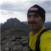
 Crestone Peak.")
 Humboldt Peak.")
 Mt. Ouray.")
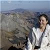
 Below El Diente.")
 Wilson Peak.")
 Mt. Sneffels.")
 Sunlight Peak.")
 Windom Peak.")
 San Luis Peak.")
 Pt. 13,450")
 Ellingwood Point.")
 Blanca Peak.")
 La Plata Peak.")
 Huron Peak.")
 French Mountain.")
 Mt. Massive.")
 Dyer Mountain.")
 Gemini Peak.")
 Mt. Sherman.")
 Horseshoe Mountain.")
 Mt. Sheridan.")
|