| Peak(s): |
Mt. Lindsey - 14,055 feet |
| Date Posted: | 09/23/2013 |
| Date Climbed: | 09/21/2013 |
| Author: | Tornadoman |
| Additional Members: | Trailrunner, ethanlion |
| Peak(s): |
Mt. Lindsey - 14,055 feet |
| Date Posted: | 09/23/2013 |
| Date Climbed: | 09/21/2013 |
| Author: | Tornadoman |
| Additional Members: | Trailrunner, ethanlion |
| Lindsey's NW Ridge- Falling in Love with a Sangre Lady! |
|---|
|
Prequel: (Skip to the Saturday, September 21st section if you are just looking for route pictures and don't want to read any fluff). Living in the Wichita, Kansas area it is always challenging to find the time to get out to the 14ers. My wife (Jess) and I had made an attempt on the Sawtooth over Labor Day weekend. On the summit of Bierstadt low clouds and off and on fog were over the summits (particularly toward Evans), and the rocks were slick from the rain the night before. We don't move quickly at high altitude and knew that we would be pressing our luck to continue, so we decided against attempting the Sawtooth. Although it was fun to get out to Colorado and enjoy the scenery and mountains, it was a disappointing "end" to our 14er attempts for the year, and the first time that we have made a trip to Colorado without climbing at least one new 14er (Bierstadt was a repeat for us). As we drove down Guanella Pass Road and relaxed for a bit in Georgetown, already a plan was starting to form. Maybe we could pull off a lightning quick trip to Colorado over one of the upcoming weekends. The only problem is that my wife has a normal weekend while I almost always have Sunday and Mondays off, and my schedule is set up several weeks ahead of time. Fortunately, a co-worker was willing to switch shifts with me, allowing me to have Saturday September 21st. With time off procured we begin to plan our quick trip. The Front Range and Sangres are the closest ranges to Wichita, and neither of us felt like trying Evans again so soon (my only remaining Front Range 14er), so we decided on the Sangres. Lindsey seemed like a good choice to me with its shorter distance and elevation gain than most Sangres. However, Jess has historically had a difficult time on class 3 routes, struggling with exposure and at times seeming to freeze up and losing confidence when it is time to ascend steep sections. She turned around on Longs Peak due to exposure concerns and had a real tough time of Castle and decided not to continue to Conundrum on that day. She has had some good days as well, most notably on Wetterhorn and Kelso Ridge where she encountered few difficulties and the exposure didn't seem to bother her much. Jess hadn't even attempted a class 3 route since 2011, so I was surprised with how quickly she was onboard with my suggestion of Lindsey via the ridge route with its class 4 label. Looking at trip reports and seeing a lot of positive comments about the ridge route seemed to give her a lot of confidence, and she agreed that the ridge looked more fun than the maligned gully. I sent a text message to my friend Ethan who lives in the Kansas City area, letting him know of our planned trip. He is usually pretty busy, so his response of "I have that weekend free, do you mind if I come along?" surprised me. Ethan and I had shared a Summer Elk adventure climbing North Maroon Peak and spending a miserable afternoon and night at a rainy Capitol Lake without a summit attempt. He was also feeling the need for one more Colorado adventure after ending with the disappointment on Capitol. I knew that he would be a solid addition to our team and increase the chances for success. Ethan also owns a Subaru Outback which eliminated the need to rent a vehicle for driving to the Lindsey trailhead (we didn't know if the Toyota Corolla would be up to the task so had been planning to go with a rental). After discussing the plans, we were of a similar mindset that the ridge was the way to go, and our party officially became 3. With only a few days leading up to the trip we saw reports and webcam pictures of a bit of snow in the Sangres. The weather still looked good for Saturday though, and the snow seemed to be melting. We were committed to making the trip, and hoped that everything would work out. Friday, September 20th: Jess and I exchanged a few emails about the trip and I continued to watch webcams and the few reports from the general area. Trying to instill confidence, I told Jess that she could "put a checkmark next to Lindsey on her 14er list, because our success is certain." Even as I typed it I was hoping I wasn't jinxing us. After what seemed like a long day, Ethan drove down from Kansas City and met us in the late afternoon. We loaded up the car and headed on the not so exciting trip west. At 11 p.m. we arrived in La Junta, Colorado and settled in for a few hours sleep at the Stagecoach Motel. A somewhat strange odor greeted us as we opened the door to our room. However, the beds were comfortable and it was quiet so I would say it is a fine motel for a short stay. Summit Day- Saturday, September 21st: One small issue was discovered as we were preparing in the hotel. In our haste to leave Wichita the prior evening, Jess' contacts had been left at home. Historically, Jess has done better with exposure when wearing contacts as opposed to glasses, but since there was nothing we could do at this point we just hoped for the best. We left our hotel shortly after 4:30 a.m. and headed toward the Lily Lake Trailhead for our date with Lindsey. The last 6 miles to the trailhead are rough and we were glad to have the Outback, although I think I *could* have made it within a mile of the trailhead in a passenger car. The last mile was steeper with a few more rocky sections and would be quite challenging for most drivers of low clearance 2 wheel drives. Reaching the trailhead and readying our packs at 7:30 in the morning our anticipated climb was finally underway. The trail is very mellow for the first mile, holding nearly steady in elevation. A beautiful valley greets climbers soon after the start of the trail.  After about a mile the trail crosses the Huerfano River. We looked around for places to cross and saw one small log that seemed to cross the river. It looked precarious and was over an area of rapidly moving water. We decided to just wade the river (about a foot deep and 20 feet wide) and continue onward. It was frigid and the rocks on the bottom were very slippery, but it was the best option. My pictures of the river crossing were blurry, sorry! After crossing the stream the trail weaves through some woods for a while, and is a bit hard to follow for a while (we had the most problems with this on the way down). At this point the trail actually starts to go uphill, and there are several beautiful waterfalls along the route.   Eventually the trail begins to open up into a high altitude basin and Mount Lindsey finally becomes visible.  There are also excellent views of Blanca and Ellingwood from this area.  At the top of the basin there was some cool fog and clouds which I thought made for some great photo ops.  After passing through an area of small talus/scree we reached the base of the ridge. From here the view of Lindsey (both the ridge route and gully) looked formidable. In fact it really looked vertical in the crux area, but from experience I know that looks are often deceiving with regards to steepness.  We headed up the ridge and stayed generally a bit left of the crest. There was plenty of 2+ and easy class 3 climbing in this area, and all of it was fun.  I ended up staying a bit too high as we approached the crux wall and found myself on the narrow, exposed area seen ahead. I felt that I could make this climb work, but it probably would be more difficult than necessary so I backtracked.  While I was trying to make the higher route go, Ethan spotted a cairn to the left which led to a little catwalk. There was some mild exposure to the left, with a steep and loose gully below. The little walk itself though was solid and seemed to be a better option to reach the base of the crux wall.  The climbing gets steeper and more sustained class 3 near the base of the headwall.  Ethan goes at the wall like a spider monkey!  Although steep there are plenty of holds and even nice places to rest. Although everyone took slightly different lines, we generally went in the crack for a while, and then a bit to the left for the last few moves. Most of the climbing was probably class 3, with just a hint of class 4 on the steepest moves near the crest of the headwall. (Granted the difference between class 3 and 4 seems pretty gray in my limited experience with it).  Jess making the last steep moves on the left side of the headwall and she is enjoying it!  Upon reaching the top of the headwall there was an exposed move to climb over a couple blocks to get back to the true ridge crest. It wasn't particularly difficult and we all made quick work of it, but it would be a bad place to lose your edge (no pictures as the focus was on the climb at this point). Back on the ridge crest we knew that the hardest climbing was behind us. Everyone felt great about that, but the altitude was becoming more and more of a factor. Ethan was fighting through a headache, and all three of us were feeling a lot of fatigue. The adrenalin rush from the hard climbing quickly faded and we settled in for a slow ascent up the remainder of the ridge. This part of the route is a lot of fun though, with nice 2+ climbing and a few class 3 moves sprinkled in if you look for them.  Finally we reached the false summit and could see our goal just a few minutes ahead!  Summit views were sensational, and the wind which had been our companion for much of the day almost completely died.  With our late start and slow pace we were behind all of the other groups except for a lone hiker who was gaining on us up the ridge. He allowed us to finish just ahead of him, (he most certainly could have passed us), and snapped a summit shot for us. He only has 5 14ers to go, if you happen to be reading this good luck with the rest of them!  After a bit of a rest it was of course time to head down. Everyone was happy with the ridge route and saw no reason not to descend the same way. We did briefly follow a trail which skirted below the false summit.  This trail would have led down into the gully and we quickly regained the ridge. There were a few loose steps in that area, reminding us of why we chose the ridge route in the first place! After a while we were back at the top of the headwall which looks quite formidable.  Ethan staring to work his way down.  Jess is doing her patented "5-point" descent. Although steep in this area, holds are great, and we were generally able to face out while downclimbing. Again there were no major difficulties.  Continuing down with the terrain gradually easing.  Back down to our little catwalk area.  This was a great route as even the descent was a blast. Nice solid rock here, with just enough exposure to make it fun!  A great spot for photos. Just a bunch of class 1 trail work from here.  Perfect blend of sun and puffy clouds made for great scenery.  Beautiful high altitude trail and basin.  Aspens are starting to turn a bit in spots. In another week or so, I imagine it will be spectacular.  The way down from the saddle was easy, but we were all tired and we kept a slow pace. We had just a bit of trouble with the trail kind of disappearing a bit before the stream crossing. I was all for crossing it a bit higher up, but the group decided to find the place where we crossed before. After about 5 minutes of finding various trail segments and losing them, the route became clear again and we found the main stream crossing. The water actually felt nice on my tired feet for about 1/2 second. After that I was freezing and just wanted to be done with it. By this point cameras weren't being used much and again I do not have pictures. Love this area!  Summary: For both Jess and I, Lindsey is our new favorite 14er. We had a great day and I think this route went a long ways toward helping Jess overcome her fear of exposure. Having a solid 3 person team where she could watch someone above and below her seemed to be ideal. The ridge is awesome with great solid rock, and the routefinding is pretty much straightforward (just avoid going to high when approaching the crux wall). Although the wall is steep, the handholds are great and it isn't nearly as difficult as it looks from a distance. Also, this route is not difficult to descend, we are not the world's most experienced climbers and still were able to downclimb it facing out. I don't personally know what actually climbing the gully is like, but from how fun the ridge is both ways, I would strongly encourage people to use this route! This is a very beautiful and underrated area. It seems that Lindsey gets forgotten about at times with its different access point then the rest of the Blanca group. I don't think this trip would have happened if we had been successful on the Sawtooth, as that disappointment spurred us to make this trip come together. I am glad that we didn't summit Evans that day, because this route is awesome and the quick trip to Colorado was a great way to spend a weekend! Thumbnails for uploaded photos (click to open slideshow):  Beautiful Valley")
 Descending mountain stream.")
 Awesome stream and waterfall")
 The goal is in sight!")
 What a perfect day.")
 Surreal clouds")
 Classic Lindsey view")
 Fun times on the lower ridge")
 Intimidating headwall")
 Finding the route.")
 Getting steeper")
 Spider monkey time")
 Resting for the last headwall push")
 Spiderwoman!")
 Not the summit")
 Almost there")
 Beautiful Blanca and friends")
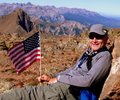
 Successful trio")
 Time to head down")
 Top of Headwall")
 Into the abyss")
 5 point descent")
 The hardest part is over")
 Traverse on the \"catwalk\"")
 Lower on the ridge")
 Great photo spot")
 Bluebird day")
 Love this area!")
 I see the Crestones!")
 Departing view")
|
| Comments or Questions | |||||||||
|---|---|---|---|---|---|---|---|---|---|
|
Caution: The information contained in this report may not be accurate and should not be the only resource used in preparation for your climb. Failure to have the necessary experience, physical conditioning, supplies or equipment can result in injury or death. 14ers.com and the author(s) of this report provide no warranties, either express or implied, that the information provided is accurate or reliable. By using the information provided, you agree to indemnify and hold harmless 14ers.com and the report author(s) with respect to any claims and demands against them, including any attorney fees and expenses. Please read the 14ers.com Safety and Disclaimer pages for more information.