| Peak(s): |
Mt. Sherman - 14,043 feet Dyer Mountain - 13,861 feet Mt. Evans - 13,591 feet Mt. Tweto - 13,683 feet Mt. Buckskin - 13,871 feet |
| Date Posted: | 09/22/2013 |
| Modified: | 04/20/2015 |
| Date Climbed: | 09/21/2013 |
| Author: | Steve Climber |
| Peak(s): |
Mt. Sherman - 14,043 feet Dyer Mountain - 13,861 feet Mt. Evans - 13,591 feet Mt. Tweto - 13,683 feet Mt. Buckskin - 13,871 feet |
| Date Posted: | 09/22/2013 |
| Modified: | 04/20/2015 |
| Date Climbed: | 09/21/2013 |
| Author: | Steve Climber |
| South Mosquito Ridge Run |
|---|
|
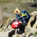
South Mosquito Ridge Run Four Mile Creek TH to Kite Lake Peaks covered - Mt. Sherman, Dyer Mtn, Mt. Evans B, Mosquito Peak, Treasurevault Mtn, Mt. Tweto, Mt. Buckskin Distance - 16.50 miles (12 miles at or above 13,000') Total Gain - 5800' When THE Mongoose invited me to join he and Marcia's finisher on Democrat, I jumped at the opportunity, but decided to make a full weekend out of my trip. I looked into some surrounding peaks and decided on a Four Mile Creek to Kite Lake solo for the sake of getting in some altitude, some mileage, some views I hadn't seen yet, and a check mark next to Sherman in the dreaded peak list. I arrived at Four Mile Creek TH at 11:30pm (3 hours later than I had hoped to thanks to a hectic work day and gear sorting (finding) nightmare) and climbed into the back of my cramped rollerskate of a commuter car for a few hours sleep. The alarm went off at 4:30 and I grudgingly rose to greet the morning. As soon as I opened the hatch, that all changed. 40mph winds and near freezing temps drove me back into the cozy depths of my sleeping bag. I lay awake for 2 more hours listening to the howling wind and seriously doubting my intinerary. About 6:30, I decided to sack up and deal with the wind long enough to hike Sherman and head back to the car for the drive of shame that awaited me to Kite Lake. I walked away from the car at 7:01am and set a moderate pace, enjoying some of the old broken down mining equipment along the trail. I passed a few parties along the blustery summit ridge, opting for a thrashing from the wind along the west side of the spine than to get stuck behind slower hikers on the leeward trail. It seemed a bit like I had stepped through a wormhole as I ran past several people, blanked out, then stepped onto the icy summit at 7:55. The wind had calmed a bit and by now the sun was warming my bones. I stepped into a windbreak on the north end of the summit and surveyed the remainder of my route. Mt. Buckskin shown in the distance, looking ever so close, yet so far away after tracing the ACTUAL ridgeline path back to where I stood. A few more minutes to gauge the weather, a sip of water and a shot of energy gel and I was off, decidedly commited to the full traverse.   The northern aspect of all the high peaks were slick with semi-fresh snow, but passable with little challenge even without any form of traction. I cruised down the north shoulder of Sherman, deciding along the way that since I was all the way out on this traverse, I was going to 'enjoy' slogging up and over EACH AND EVERY highpoint along the way. My first stop was a quick scramble of Gemini (13,951'), a chunky, talus ridden bump to the NW of the first saddle.  From Gemini, I jogged an unremarkable connector to the base of Mt. Dyer. Dyer (13,855') proved to be a bit of a grind as the loose stones were still coated in frost and put up quite a fight with the soles of my trail runners.  and Sherman (R) from Dyer") ")  While on top of Dyer, I was disappointed to see (and as a result, picked up and packed out) a solar powered sidewalk light. As peaved as it made me that someone left this thing planted atop a 13er, it did come in handy later that night in camp at Kite Lake.    After Dyer, the first challenge of my day greeted me in the form of an unknown (SURPRISE!!!) Class 3 ridgeline with narrow rocky towers and decent exposure on either side. Sticking to my 'every high point' mantra, I dove in and enjoyed some great scrambling and friction climbing. The nastiest tower -a white fang on the southern end of the ridge- proved to be the most demanding and had 20' (ish) hard 4th / low 5th class downclimbing with massive exposure underneath. I found most of the remaining obstacles quite easy enough to go up and over after that. On the far side of the ridge, I began an easy walk-up to Mt. Evans (13,577').  Just shy of Evans' summit, I ran across a party of 6-7 folks, headed to Dyer from Mosquito Pass. I didn't catch any of their names, but stopped to chat with them a few minutes about my trip, and to give them some beta on the 3rd class ridge they would soon be crossing. Between the unexpected route finding and scrambling along the ridge, and stopping to chat, I knew I had lost some serious time. I decided to turn the screws a bit and jogged up and over the summit of Evans, stopping for a brief second to snap a few shots of my surroundings.  and Sherman (L)") From Evans, the ridge grind-a-thon was in full swing, and I kept a 'sporty' pace downward to Mosquito Pass, where I saw a few Jeeps out for a morning cruise. I decided to follow the road they had just come down for a while, to give my ankles a rest from the baby-head infested tundra. The road contoured to the west of Mosquito Peak for a bit and lost some elevation. I was mindlessly enjoying the lack of uphill until I realized the road continued to drop, and wrapped all the way around the back of the mountain to an unknown path. I broke off the road and talus hopped up onto the south shoulder of Mosquito Peak and reached the summit in short time. I pulled off my pack, and plopped onto the ground to enjoy a PB&J 'smashwich' and some Oreos which had found their way into the bottom of my pack and been ground to an inseparable pulp.  While gumming my lunch down, I noticed several threatening cloud banks were darkening quickly and rolling closer on the ever blowing wind. I finished eating quickly, sped down through a saddle and gained Treasurevault's summit, not stopping for more than 2-3 pictures and a sip of water. I knew the toughest part of the traverse was the connecting ridge between Mt. Tweto and Mt. Buckskin, and with the clouds appearing, I knew I would have to make HUGE time gains to not get caught on the crux in a potential storm. Following the ridge was a painful test of my patience as it seemed to meander a bit too long to the NW prior to taking a hard right to yet another saddle leading to Tweto.  I set my legs to 'GRIND' and mindlessly pushed through the miles until I was finally pushing my limits up the southern shoulder of Tweto (13,672'). Once on the summit, I checked the clouds again, which seemed to be dissipating slightly. This gave me the confidence to stop for a few minutes and enjoy the view as well as a few more shots of water. This would be the last bit of enjoyment for a while.    Buckskin (C) Mosquito Pass (R)") The initial downclimb off Tweto was uneventful, until I reached the false summit and got my first FULL view of the ridgeline. Sheer cliffs and loose, icy gullies stood guard to the northern side, and slightly less sheer faces and sun covered, but wet and loose gullies sat to the south. I made an effort to stay on the more difficult, but MUCH more solid rock spine that defined the jagged ridge, but that was quickly squashed as I bumped into a 30' vertical wall at the first notch. Disappointed, I backtracked slightly and dropped to the south in order to contour under the notch. One loose rock after another shifted and slid under my feet making for a very unenjoyable time. Several times, I crossed gullies and lost as much elevation sliding with each four point side step as I traveled, only to hit the next rib and climb vertically back to my starting elevation. If you were to take a shot of my progress from due south, I think it would have resembled an EKG of a VERY unhealthy person. After an hour and forty minutes or so, I finally pulled out of the last sketchy gully onto what I thought was solid rock. No sooner had I exhaled in relief when the microwave size boulder I was perched on let loose down the face. I managed to surf on top of it for about 10' before I processed what was happening and made a desperate lunge onto some equally shady rocks. I turned around and screamed "ROCK!!!" into the valley below, should there be anybody down there (the only people I had seen there all day were on the other side of the valley riding ATVs up Mosquito Pass). I repeated the call for 10-15 seconds as the rock picked up speed and careened over a 80-100' cliff and exploded on impact, sending dust and small chunks flying further into the valley. I was ready to be in camp now. Once I regained my composure a bit, I turned around and set my sights on the headwall of Mt. Buckskin. I was extremely diligent in my foot and hand placements, checking everything before committing weight as I scrambled the remaining route. I found a very cool, totally bisected, dihedral-esque rock gully with chunky white quartz to the right and dark gray granite to the left. The quartz seemed to be a bit more open to hands and feet, so I followed it up until I ran into a 15' vertical face and crack, which under better circumstances I probably would have climbed. At this point in the day, I was not feeling it mentally or physically and decided on a bypass. Fortunately there was a perfect traversing ramp across to the granite side of things and I was able to sneak around a corner to the outside of the gully and continue upward, reaching the false summit about 5 minutes later. A short walk to the east and I found myself on the final summit of the afternoon.  from false summit of Buckskin")   FINALLY, I could see Kite Lake. Sun glinting off of 30 car windshields had never looked so appealing. I headed east along the summit ridge until I found a fairly stable and moderately sloped shoulder. Gingerly following it down, I eventually ran into an established trail and was finally able to fully relax, knowing that I only had to survive some light willows, a small creek crossing, and a mile-and-a-half stroll up the road to the Kite Lake TH. I arrived at the picnic tables at 3:40pm and immediately set my air matress on top of one, kicked off my shoes, and laid down in the sunshine. A short time later, Mike Weddell greeted me, asking if I was part of the group we were supposed to be meeting. I told him I was and where I had just come from; he kindly replied with "you want a beer?" I could have kissed him. While we were enjoying our beers and chatting, I was ecstatic to see Max, Jill, and Behuahua Jack arrive in The Vanimal (my home for the night). They found a nice level spot, transformed the rig from 'rock thrashing 4x4' mode to 'best camping vehicle ever' mode and waved me over. I pulled out the solar light I had packed off of Dyer earlier and planted it in front of the double doors as a patio light, and we all had a chuckle. Mongoose and several others appeared shortly after, and as the sun faded, they decided to build a fire to fend off the cold. I think I managed to stay awake long enough to see the fire lit, but retired to my bunk and was passed out by 8pm or so. At 4am (I don't remember it, but Jill swears it happened) Jack barked at an early party starting up the trail in the dark, to which I replied "It's OK Jack...they're just aliens trying to take over the world". Apparently sleep does amazing things to my imagination. We woke up a couple hours later and were greeted by the rest of our hiking group arriving at the TH. We left camp at 7:10am and I set off on a moderate pace again, feeling much better with 10 solid hours of sleep (not including my alien hypothesizing). I hit the summit at 8:15 and hunkered down in a windbreak to enjoy the views and drink some water while everyone worked their way up. Marcia and Nick reached the cold, windy summit and we passed a bottle of champagne around, snapped some shots, enjoyed some of Noel's traditional summit cookies, then decided to hightail it back to camp before the weather dropped too much further. I ran a majority of the trail down and was in camp 25-30 minutes after leaving the top. A quick and heavy snow storm landed in the basin, covering all the peaks in a new coat of white. Then, as if Ma Nature said "HAH! Just kidding!" the clouds separated, the sun came out and we had a gorgeous sky to cook hot dogs under. I was very grateful that Noel was kind enough to give me a ride back to my car at 4mi Creek on her way home to the Springs, and enjoyed chatting with her and hearing her account of her accident on Capitol Peak. I'm very happy to hear she is recovering well, and also happy to hear Chuck is recovering quickly from his knee surgery. I hope to see you both out there soon! Thumbnails for uploaded photos (click to open slideshow):  Looking north from Sherman summit")
 North aspect of Sherman from Gemini")
 Saddle to Dyer from summit of Gemini")
 Gemini (L) and Sherman (R) from Dyer")
 Remainder of route (Buckskin is large dark ridge running E to W)")
 Elbert and Massive from Dyer")
 I still have to go all the way over there???")
 Downclimb off northern false summit of Dyer")
 This is an easter egg just for Darrin")
 Looking back at Dyer and its false summits from start of surprise Class 3 ridge")
 The 'White Fang' - 20' of 4th/5th downclimbing")
 Looking back from Evans toward Dyer (R) and Sherman (L)")
 Looking back from just above Mosquito Pass")
 Looking back from Mosquito Peak")
 Tweto summit")
 Tweto to Buckskin ridgeline")
 Pano from Tweto, Democrat (L) Buckskin (C) Mosquito Pass (R)")
 Looking back at Tweto (and Arkansas R ) from false summit of Buckskin")
 Tired on way down to Kite Lake")
 I think I finally made it!")
|
| Comments or Questions | ||||||||||||||||||||||||
|---|---|---|---|---|---|---|---|---|---|---|---|---|---|---|---|---|---|---|---|---|---|---|---|---|
|
Caution: The information contained in this report may not be accurate and should not be the only resource used in preparation for your climb. Failure to have the necessary experience, physical conditioning, supplies or equipment can result in injury or death. 14ers.com and the author(s) of this report provide no warranties, either express or implied, that the information provided is accurate or reliable. By using the information provided, you agree to indemnify and hold harmless 14ers.com and the report author(s) with respect to any claims and demands against them, including any attorney fees and expenses. Please read the 14ers.com Safety and Disclaimer pages for more information.