Download Agreement, Release, and Acknowledgement of Risk:
You (the person requesting this file download) fully understand mountain climbing ("Activity") involves risks and dangers of serious bodily injury, including permanent disability, paralysis, and death ("Risks") and you fully accept and assume all such risks and all responsibility for losses, costs, and damages you incur as a result of your participation in this Activity.
You acknowledge that information in the file you have chosen to download may not be accurate and may contain errors. You agree to assume all risks when using this information and agree to release and discharge 14ers.com, 14ers Inc. and the author(s) of such information (collectively, the "Released Parties").
You hereby discharge the Released Parties from all damages, actions, claims and liabilities of any nature, specifically including, but not limited to, damages, actions, claims and liabilities arising from or related to the negligence of the Released Parties. You further agree to indemnify, hold harmless and defend 14ers.com, 14ers Inc. and each of the other Released Parties from and against any loss, damage, liability and expense, including costs and attorney fees, incurred by 14ers.com, 14ers Inc. or any of the other Released Parties as a result of you using information provided on the 14ers.com or 14ers Inc. websites.
You have read this agreement, fully understand its terms and intend it to be a complete and unconditional release of all liability to the greatest extent allowed by law and agree that if any portion of this agreement is held to be invalid the balance, notwithstanding, shall continue in full force and effect.
By clicking "OK" you agree to these terms. If you DO NOT agree, click "Cancel"...
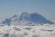
The North Face of Rainier. Curtis Ridge, Willis Wall, Liberty Ridge, the Carbon Glacier, Liberty Wall and Ptarmigan Ridge are
Liberty Ridge. Just saying the name conjures feelings of excitement, dread, awe and wonder in mountaineers immersed enough in the hobby to study the classics. The Grade III/IV snow-and-ice route on the insidious North Face of Mt. Rainier has earned innumerable superlatives; many consider it THE climb in the Pacific Northwest. An equal number of others, of course, dismiss it as overrated.
Featured in Roper and Steck's prestigious Fifty Classic Climbs of North America, the ridge splits the Willis and Liberty Walls -- infamous playgrounds for massive avalanches and falling rocks that are rarely climbed -- providing a relatively safe line to the summit at the cost of an arduous two-day approach across the broken Winthrop and Carbon Glaciers, sustained steep snow, at least one pitch of alpine ice (often more, as our team would discover) and an alternate descent route requiring climbers to carry heavy packs up and over the 14,411-foot summit.
"What next?"
It's an obsessive question for climbers of all ability levels. Immediately after summiting Rainier via the standard Disappointment Cleaver route in July 2012, I shot a private message to my regular climbing group about a big trip in 2013. The responses varied. As usual, however, Rob Jansen and I were on the same page. We knew it would take a year's worth of dedicated training to make ourselves worthy of the challenge, but Liberty Ridge became the object of our obsession. We also agreed on a winter trip down to Mexico's El Pico de Orizaba beforehand.
Sadly, Rob passed in late August 2012, before either trip progressed beyond the planning stages. Bill (wildlobo71), Matt (I Man), Emily (Emily) and Keegan (AlpineDude) accompanied me to Orizaba over Thanksgiving 2012, and as fate would have it, waiting upon my return was an invitation to another party gunning for Liberty Ridge the following summer.
James (Fletch) and Darrin (kansas) were my climbing mentors as I transitioned from East Coast beach bum to 14er finisher, and I count both among my closest friends. Getting invited by those two to join a Liberty Ridge attempt was a special moment for me. The reality, however, was that James is a good deal heavier than us, and the crevasse danger on the approach across the Winthrop and Carbon glaciers is real. Darrin and I would have problems if James took a fall. For that reason we added a second rope team to the party, consisting of four other climbers: Nao, Keegan (AlpineDude) and brothers Nick and John.
We devoted the early part of 2013 to ice climbing, long slogs with heavy packs, winter camping, crevasse rescue practice, planning sessions over beers and the longest e-mail chains known to man. To all of our great disappointment, Nick was forced to drop out a few weeks before the trip.
I applied for and was awarded a Live Your Dream grant from the American Alpine Club for the climb, and without such support this trip wouldn't have been possible. A huge thank you to everyone at the AAC for allowing me to live not only my dream, but one which Rob and I shared. I'm also indebted to Eddie Bauer/First Ascent Park Meadows, which let us demo a First Ascent Katabatic when we needed a second three-man mountaineering tent. Everyone loved it.
Climbing expeditions rarely go as planned. I'd posit that adaptability and a penchant for quick thinking are as integral to big mountain climbing as speed or skill with an ice tool. The trip I'd imagined as we boarded our plane on the morning of Saturday, June 8 was vastly different than the trip I'd experienced by the time I was on the return flight Sunday, June 16. I can say without a doubt, however, that the vacation was a success for our entire six-man team, and everyone made the correct decisions for themselves. We came home alive, we came home friends and we came home with summits.
PART 1: LIFE, LIBERTY AND THE PURSUIT OF HAPPINESS
Mount Rainier (14,411') - Liberty Ridge (Attempt)
Liberty Ridge basks in the morning light.
Weather windows in the Pacific Northwest are rare, especially in June, and we were graced with a beautiful one. Sunday and Monday were mostly sunny with no chance of precipitation during our approach, and Tuesday, our summit day, called for partly sunny skies with a small chance of precipitation toward the evening. A minor storm was forecast for Wednesday and Thursday.
The ranger at White River told us to bring snowshoes, which caused a communal groan heard as far away as Paradise. Previous parties reported chest-deep snow followed by bare ice from 12,500' to 14,000'. The latter was welcome news to some, notably the team's crack ice climber, John. For myself, I was already worried about our speed with six people, and that much ice would surely slow us down even more. My hope was for good snow before only a pitch or three of ice near the upper bergschrund. The chance of the weather window slamming shut Tuesday night also caused me some concern, since we'd have to move efficiently or face the possibility of being stuck high on the mountain in a whiteout.
Still, you can't succeed unless you try, so we started up the trail Sunday morning with too-heavy packs and high spirits. For anyone considering this route, aim for 45 pounds or lighter. Anything more is too much. Our group's packs ranged from 49 to 62 pounds, and they were the bane of our existence. Also, no matter what the ranger says, DO NOT BRING SNOWSHOES. That extra weight stayed on our backs for 98 percent of the trip. Thanks, lady.
The team hitting the trail at White River. (Note ****ing snowshoes.)
The meandering trail switchbacks ever upward, crossing streams and offering fleeting views of Rainier's upper reaches. We started encountering snow at around 6,000' and finally popped out above treeline onto the Inter Glacier after 2.5 hours of hiking. The views, while not quite as inspiring as from Paradise on the other side of the mountain, didn't disappoint.
Some donned crampons here, while I opted for snowshoes because I was pissed about having them on my back and figured the heel lifts couldn't hurt for the slog up to St. Elmo's Pass. We entered our own little worlds and formed a strung-out line on the crevasse-free Inter Glacier, rest-stepping up at various paces. Gaining St. Elmo's Pass meant traversing onto the Winthrop Glacier and the removal of ~10 pounds each worth of ropes and hardware from our packs. Motivation came easy.
Liberty Cap says hello.
St. Elmo's Pass.
The pass granted a window-like view of Liberty Cap, our objective. The overhanging seracs of the Willis Wall had a certain ... pucker factor.
Roped to Keegan and Darrin and followed by Nao, John and James, we set off across the glacier. The Winthrop is hideous up high, but our line stayed flat and even angled down toward Curtis Ridge. We crossed our fair share of crevasses, maybe 10-15, but all were less than a foot wide this early in the season. I peered into the first few as I sprang across, and the view into the abyss was enough to cause wide eyes and a skipped heartbeat. Clear blue faded to black with no bottom in sight. It was a very different feeling than the willow-wanded highway of the Disappointment Cleaver, where a road-width bootpack snakes around the one or two crevasses open in the early summer. I stopped looking down.
The lower slopes of Curtis Ridge are wide and deceiving. To make matters worse, a cloud and fog layer rolled in and obscured our views. Time and time again, we thought we'd reached camp, only to see more ridge awaiting ahead. The best advice I can give to prospective parties is when in doubt, angle down (right). The best campsites are around 7,200' to 7,400'. The Carbon Glacier is easily accessed by a 50-foot scree slope lower on Curtis Ridge, but you'll become cliffed-out by ascending too high.
We pitched our two three-man tents in the only flat spots we could find. The fog occasionally gave way to teasing glances of Liberty Ridge above. Every time we climbed a nearby cliff to scout a safe path across the Carbon, clouds reappeared. The routefinding would have to wait for morning. Our bellies full and snow melted, we crashed as soon as we could, with alarms set for 4:30 a.m.
The upper Winthrop Glacier.
Another view of the Winthrop/Emmons.
Camp 1 offers daunting views of Liberty Ridge.
Cue the best sunrise I've seen in my life. It took me a full 20 minutes longer than usual to get ready because I couldn't pick my jaw up off the talus. Finally ready to move an hour and a half later, we were ecstatic to find the short scree slope onto the Carbon Glacier within a stone's throw of our campsite. The early morning light on Liberty Ridge revealed our beta was accurate: everything above the Black Pyramid was a shimmering field of ice.
Some consider the Carbon Glacier the most dangerous section of the entire route. It's Rainier's thickest, longest and most active frozen river, with a reported depth of 750 to 900 feet. Massive crevasses yawned everywhere. The morning quiet was interrupted at regular intervals by the gunshots of collapsing seracs. A 30-second waterfall of rocks fell from the toe of Liberty Ridge itself, and hundred-foot-wide avalanches swept silently at speeds of 80 miles an hour down the Liberty and Willis Walls, threatening anyone who got too close. It was time to focus.
Despite the surrounding dangers, we raced across the Carbon. The flat, middle part of the glacier was remarkably lacking in open crevasses. But hey, that's why we were there in June and not July. Above the 7,600' level or so, the routefinding became more tricky. We routinely had to step over foot-wide crevasses, including one on an uphill slope that required the solid placement of an ice axe pick for most of us, and another that was actually two crevasses with a thin intervening bridge. We also trod through a small icefall, weaving around seracs and over a wonderland of snow formations. It was dangerous, sure, but my God was it beautiful. Even now I smile in reflection.
No words.
Ice.
The broken Carbon Glacier is Rainier's thickest, longest and most active.
Darrin and Keegan lead the way.
John, Nao and James follow across the Carbon.
Above the icefall, the glacier once again flattened out and we stopped for a break. The entrance to Liberty Ridge was less than an hour away. Another serac collapsed on the Liberty Wall, starting a minutes-long avalanche that appeared close enough to touch. We started again, but stopped a few hundred feet later to have a group meeting that would change the course of my week.
For several absolutely valid reasons, James didn't feel comfortable going forward. The rest of the group wanted to press on, though I personally admit to some trepidation over the amount of ice up high and the midweek weather forecast. Backtracking over the wicked Carbon and the milder but still broken Winthrop was inarguably roped-up terrain. James walking out alone, especially with the day heating up, would be taking an enormous risk (unless you're Ryan Kushner).
The discussion continued while precious seconds ticked away. With every minute wasted, the conditions were getting worse. James desired to go down, and at least one person had to go with him. I wanted the route more intensely than any I've attempted in my life and I couldn't have felt stronger, but it became clear no one else was in a hurry to volunteer, either.
I searched inward. This climb, for me, was as much about remembering my friend Rob as achieving personal success. Every step was one I should have been taking with him. I began to wonder what Rob would do in that situation, and I recalled a memory I shared during his memorial service. Long story short, he once told me, "You're my friend, and I'd do anything for you."
Well, James is one of the better friends I have. I understand how cheesy it sounds, but my choice was suddenly made for me. With only a touch of reluctance, I opened my mouth and blurted it out.
"I'll go down with you."
I know in my heart everyone individually made the right call there on the Carbon Glacier. James had good reasons for bailing, and I don't hold anything against him. He's a class act. Nao, Keegan, Darrin and John also had a solid basis for continuing. I may not have wanted to turn around at the time, but in hindsight I wouldn't change a thing about how my week-long adventure changed after I volunteered.
Before another half-hour passed we had the ropes reordered, the gear redistributed, and the respective teams of four and two were ready to go their separate ways. Darrin was already ahead, but as John, Keegan and Nao trudged by, I shared a moment and a hug with each of them. I wished them sincere good luck and lent John my camera. Then, it was time to go down.
Avalanche cascading down Liberty Wall.
Last photo from my camera before handing it to John and heading down with James.
(I don't know if the others are planning on a trip report, and though I've heard the outline of what happened, I don't know nearly enough to write about it here. All four successfully summited.)
Two-man glacier travel is a risky endeavor, especially nearing noon on the Carbon Glacier on an unseasonably hot day. With James able to anchor me but not vice versa, I suddenly found myself on the sharp-end of the rope team. Retracing our steps through the icefall was the most nerve-wracking section. I felt a little better once we were on the flats, though I kept looking over my shoulder with a certain sadness to track the others' progress.
We took our time crossing the well-traveled Winthrop, soaking in views that simply aren't available in Colorado. The ropes and gear went back into our packs at St. Elmo's Pass, and since I'd resisted the appealing urge to chuck my ****ing snowshoes into a crevasse, the loads once again became monstrous. Luckily, most of the Inter Glacier is glissade-able and the dry trail beyond went quickly. We reached the cars at 6:30 p.m.
I found myself asking the inevitable question.
What next?
PART 2: WEATHER, WAITING AND SOMETHING CALLED A COUNTY HIGHPOINT
Buck Peak (4,751') - via Pacific Crest Trail
Lost Lake.
The storm forecast to move in Tuesday night was expected to last until Thursday. Back at the car Monday night, James and I knew Tuesday would be a rest day. We also figured the other four weren't likely to get down until Wednesday, and then would need a rest day of their own. We decided to head for Mt. Hood, where the forecast was slightly better, hoping the guys would meet us later for another half-week of climbing.
James, understanding how crestfallen I was and proving his great friendship, graciously put us up in the historic Timberline Lodge on Tuesday night. Staying there was one of the highlights of my trip. I'm poor and don't often get to experience that kind of thing, haha. The initial plan was for a Hood attempt Wednesday, which would allow us to target Mt. Adams with the others Friday and/or Saturday. The weather looked OK on Wednesday, certainly doable, but a greatly improved forecast for Friday and the abundance of Mt. Hood beers available at Timberline persuaded us to bide our time. Besides, the climb would be much more enjoyable with the rest of our team.
The goal for Wednesday became a county highpoint near Lost Lake called Bush Peak. Or Buck Peak. Maybe Back Mountain. Who knows? James is one of those county highpointing weirdos. My interest was sufficiently piqued by the promise of a hike around secluded Lost Lake and along a section of the fabled Pacific Crest Trail.
The scenery was breathtaking. I grew up in central North Carolina, but after many years at the beach, in New Mexico and now in Colorado, I'd forgotten what a real tree looks like. My neck hurt from looking up so much. Even better, we were in a cloudbank for most of the five-hour trip, making for a quintessential Oregon dayhike in the fog and wet. I actually got to wear my rain pants. That never happens. I'm also pretty sure I saw Sasquatch.
So, this is what a forest looks like.
Doesn't count.
Back in cell phone range that afternoon, we received the tough news that the remaining Liberty Ridge team wasn't thrilled with the prospect of driving five hours down to meet us. In fact, they were catching early flights out Friday night. I was looking forward to hearing their story and climbing with them more, not to mention getting my camera back from John, but I understand the decision. My biggest regret from the trip was only being able to spend two days of a planned eight with Darrin, Keegan, John and Nao.
So, James and I called in the reinforcements. Bill (wildlobo71) had always wanted to climb Mt. Hood, and it would be a perfect precursor to his own planned Rainier attempt in August. It took some goading, but before long James and I had talked Bill into taking a couple days off work and catching a spur-of-the-moment flight to Portland.
Found at Powell's City of Books in Portland for $4.50.
We scooped Bill at PDX Thursday morning and, faced with another day of downtime, took one of the most rewarding one-and-a-half-hour drives of my life. Sean Wylam, who was tragically killed in a rockslide on Snowmass Mountain in 2011, was from nearby Centralia, Wash. His family still lives there. As one of the four climbers who spent Sean's last hours by his side, I've kept in touch. Mary and Gordon, his parents, are some of the most wonderful people I've ever met, and the few hours we spent in their company were as rewarding as any hard-earned summit.
Thursday night saw us back on the southern slopes of Mt. Hood, sorting gear in the Best Western and stoked about the Friday weather. It was going to be cold, sure, but when you read "clear with 5-10 mile an hour winds" as the summit forecast in the Pacific Northwest, you get excited.
PART 3: THE CONSOLATION PRIZE
Mt. Hood (11,249') - South Side Hogsback/Two o' Clock Couloir
Mt. Hood's South Side, taken after the climb (photo by Bill).
Yes, the title of this section is tongue-in-cheek. While Mt. Hood's standard Hogsback route pales in difficulty when compared with Liberty Ridge, the highest point in Oregon is no slouch. Hood, simply put, is aesthetic. It's often said that if you ask a kindergartner to draw a mountain, the picture you'd get in return is Mt. Hood. The slopes sweep upward from all directions to reach a perfect pinnacle, eternally capped with snow. From certain angles the mountain calls to mind Wham Ridge blanketed in white.
The perfect forecast was cast into doubt at 3 a.m. Friday. Outside the Best Western, the world was shrouded in mist. A startlingly chill wind whipped us from all directions. Regardless, we were there, we were awake and this was our one shot. We piled into the rental car and drove up to the trailhead at Timberline Lodge, finally setting off at 4:30 a.m.
I was on a mission. Most parties hit the trail closer to midnight, but we cocky Coloradans were lazy and aimed for a 4 a.m. start, which in actuality became 4:30. I was concerned about being forced to turn around by late-morning falling rocks or ice, or the cloudlayer rising with the day's heat. As has been proven time and time again in tragedy after tragedy, the upper slopes of Mt. Hood are no place to be in a whiteout. Though we carried ropes and a small rack as a precaution, the likelihood of needing them was nil. I bolted for the summit as fast as I could manage, with the mutual understanding I'd stop to wait for James and Bill if conditions warranted.
My personal goal was to top out by 9 a.m. Maybe it was my Colorado acclimatization, maybe it was my fear of leaving the Pacific Northwest without a summit (sorry James, Bull Mound or whatever it was doesn't count), maybe my ego wanted to pass the 15 or so climbers ahead of me, or maybe I was simply channeling my inner Rob Jansen, but I was shocked to find myself on the summit at 8:30 a.m., four hours after setting out.
The first 2,500' of the route is as boring as snow climbing gets. One literally walks up a ski slope, using a chairlift as a guide. The views we had that morning, however, made even that portion enjoyable. The entrapping cloudlayer leveled off at about 6,000 feet, the same elevation as the trailhead. We were soon above it. Sunrise hit early because of our late start, and it presented an astounding scene coupled with the low clouds, nearby Mt. Jefferson and Hood's own mountain shadow. I regretted handing my camera off to John. Most of these photos were taken by James or Bill, with my iPhone producing one or two OK shots.
Sunrise from just above Timberline Lodge.
Mt. Jefferson and the Three Sisters (photo by Bill).
Almost to the Hogsback (photo by Bill).
I caught a large group of several parties at the Hogsback, where everyone stopped to put on crampons. Here, only 700 feet from the summit, the route becomes spectacular. Fumaroles spewed wisps of steam that polluted the air with sulphur, singeing the nostrils; a single crevasse known as the bergschrund gaped wide; the Hogsback provided an aesthetic line of ascent and the final push beckoned as a fine snow-and-ice climb.
In years past, the Pearly Gates -- a direct line from the top of the Hogsback to the summit -- was the standard route. Recent shifts in weather have made this section steeper and icier, so most climbers traverse left to a snowfield known as the Old Chute. Now ahead of the masses, I took the middle ground, up a narrow tunnel of hard 45-degree snow called the Two o' Clock Couloir, embraced on all sides by towering rocks armored in rime ice. The other parties -- including a family of skiers from, you guessed it, Aspen -- followed up the same route with little trouble.
The top of the couloir revealed the summit ridge and views unlike any in Colorado. It was the Blanca Group on steroids. Mt. Hood, an ultraprominent peak, offers incomparable scenery in every direction. Mt. Rainier and Mt. Adams rose proudly to the north, while Mt. Jefferson and the Three Sisters were only slightly less impressive to the south. The neutered mound of Mt. Saint Helens was a harsh reminder of the fate awaiting these active volcanoes.
After turning around on Liberty Ridge, my chest swelled with the elation of success. I put on my puffy and was soon joined by the other groups, including the Coloradans, who skied from the summit. Bill and James arrived a short while later. Standing at the apex of a mountain like Hood is an awesome personal accomplishment, but it wouldn't mean nearly as much without friends such as these to share the victory. I spent a few minutes gazing longingly at Rainier, though I didn't dwell; I was happy where I stood.
We lingered on the summit until about 10 a.m., then started down. A combination of glissades and a good climber's trail saw as back at the lodge before noon, with beers in our hands by 12:30. A toast to success!
The bergschrund (photo by Bill).
Above the Hogsback, high on the route.
The Two o' Clock Couloir.
Bill and James approach the summit (photo by Bill).
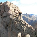
Group summit shot, L-R James, Jeff, Bill (photo by Bill's camera).
Descending the narrow summit ridge toward the Old Chute (photo by James).
Meanwhile, at Timberline Lodge...
CONCLUSION
The Liberty Ridge victors headed home Friday night, James also changed his itinerary to fly out Saturday to be home for Father's Day, and Bill's flight left PDX Saturday all along. By lunchtime Saturday, I was orphaned in the Pacific Northwest. I passed the remaining hours until my return flight driving back to Seattle, drinking local beer, relaxing in my hotel room, taking a few walks and doing other uninteresting things.
As I've said, the trip turned out very differently than I'd drawn it up. That doesn't mean I'd change anything. Long moments of reflection have convinced me I wasn't totally ready for Liberty Ridge in those conditions. With a team as strong as the one I had and as hard as I'd trained, I have full confidence I would have made it up, but it wouldn't have been in good style. I'd hoped for a predominantly snow climb. My one season of ice experience probably hadn't prepared me for the 2,000' of AI 2-3 the team encountered. A couple pitches of AI3 over the bergschrund? Sure, sign me up. A full day of simul-climbing ice with packs that were 10 pounds too heavy and snowshoes on my back? I have some progressing to do.
More philosophically, before the trip the prospect of succeeding on Liberty Ridge was almost a sad one. It was the last of many adventures I'd planned with Rob. Once it's done, I have a feeling I'll be a bit rudderless for a while, asking the eternal question without so easy an answer: What next? As long as Liberty Ridge remains a dream, something on the horizon and not yet behind, maybe I'll continue to feel this strong connection to my friend. I'm sure I'll be back one day. Lighter, with a smaller team, with more experience. That trip will come when it will. Until then, I'll continue living other dreams, remembering my lost friends in other ways and enjoying the friends that remain to me.
Thanks for reading. If you made it this far, you're a masochist.
Thumbnails for uploaded photos (click to open slideshow):
despite not making it up Lib Ridge! You still got to experience a lot of what the PNW has to offer (and that Colorado lacks)- glaciers, temperate rainforests, being above the clouds, etc., that makes it all worth it in my book. Sounds like turning around was the right call. Congrats on Hood!
....I'll stop skimming and really dig into the TR. But for now, this looks just awesome. Pretty cool how the out of state trips lend a new perspective. Glad to see you guys getting after it and brining back all kinds of new reflections.
Well done and definitely well said 6/19/2013 1:56am
That's what makes you who you are, Jeff - being there for your friends when it matters most. You asked yourself ”What would Rob do?” and you definitely answered correctly. So glad you got to experience such a great day on Mt. Hood. You deserved it.
Dancin' Jansen would be proud of you too big man. Excellent TR as always Jeffrey (even if I have to google words). Congrats to the whole gang out there!
You had me at ”when's your plane arrive? 6/19/2013 4:30am
Thanks for inviting me to summit with you on your consolation prize; I wouldn't miss spur-of-the-moment trips on credit for nothing! Great write up and congrats on your realizations; congrats to all the successful Liberty Ridge team members, and congrats to Rowan for having a daddy like James.
I really enjoyed reading all that. It's hard to turn around but all the more power to you by doing that and feeling good about your decision. I'm climbing the Kautz route on Rainier in about two weeks, can't wait! It will be my first climb in the PNW.
Huge props to you man. I am far more impressed that you went down with James than if you would have made the summit. Rob would be proud. Good call by James as well. There are some days where you just aren't feeling it and the thought of being with your friends and family again far outweighs pushing your limits out of your comfort zone. I am very proud to call all of you guys my friends.
summits or no summits, bluebird weather is hard to come by in that part of the world. County highpointing sounds a tad more interesting in the PNW as well.
Nice work on Hood. Was that bar in the lodge itself or in one of the nearby buildings for the ski area?
@Brian - It was on the mezzanine in Timberline Lodge. I believe it was called the Raven's Roost or something like that. There's another watering hole on the first level called the Blue Ox that looked fun but wasn't open during the day.
You know, Jeff......I don't know you personally, but it's truly my loss. Your decision to turn back on Liberty Ridge says a ton about you as a person, a climbing partner, and as a friend. It takes far more courage to step up to the plate and offer to descend than it does to go after something you've trained so hard for and something that was within your abilities. There are bigger things in life than a summit. Rob picked a good friend, and I'm sure he's proud of you everyday. I hope our paths cross sometime, and I hope if I'm faced with some of the decisions you've had to make in your climbing career - that I'm able to make the correct decisions you have.
Touching account, and another tribute to a lost friend and fallen hero. Rainier was not meant to be this time, but your outing was a victory in more ways than one!
It seems getting to the top in the PNW is often a tossup, but the consolation prizes up there can be pretty dang sweet. Congrats on Hood and nice report.
looks really, really interesting. I'll pepper you with some questions later. And Rainier is what it is...always an adventure. Congrats on a big weekend (and your presumably first county highpoint! ).
Caution: The information contained in this report may not be accurate and should not be the only resource used in preparation for your climb. Failure to have the necessary experience, physical conditioning, supplies or equipment can result in injury or death. 14ers.com and the author(s) of this report provide no warranties, either express or implied, that the information provided is accurate or reliable. By using the information provided, you agree to indemnify and hold harmless 14ers.com and the report author(s) with respect to any claims and demands against them, including any attorney fees and expenses. Please read the 14ers.com Safety and Disclaimer pages for more information.
Please respect private property: 14ers.com supports the rights of private landowners to determine how and by whom their land will be used. In Colorado, it is your responsibility to determine if land is private and to obtain the appropriate permission before entering the property.


")


.")

.")
.")
.")


.")
.")
.")

 The North Face of Rainier. Curtis Ridge, Willis Wall, Liberty Ridge, the Carbon Glacier, Liberty Wall and Ptarmigan Ridge are")
 The team hitting the trail at White River. (Note ****ing snowshoes.)")
 Liberty Cap says hello.")
 St. Elmo's Pass.")
 The upper Winthrop Glacier.")
 Another view of the Winthrop/Emmons.")
 Camp 1 offers daunting views of Liberty Ridge.")
 No words.")
 Liberty Ridge basks in the morning light.")
 Ice.")
 The broken Carbon Glacier is Rainier's thickest, longest and most active.")
 Darrin and Keegan lead the way.")
 John, Nao and James follow across the Carbon.")
 Avalanche cascading down Liberty Wall.")
 Last photo from my camera before handing it to John and heading down with James.")
 Lost Lake.")
 So, this is what a forest looks like.")
 Sunrise from just above Timberline Lodge.")
 Doesn't count.")
 Found at Powell's City of Books in Portland for $4.50.")
 Mt. Hood's South Side, taken after the climb (photo by Bill).")
 Mt. Jefferson and the Three Sisters (photo by Bill).")
 Almost to the Hogsback (photo by Bill).")
 The bergschrund (photo by Bill).")
 Above the Hogsback, high on the route.")
 The Two o' Clock Couloir.")
 Bill and James approach the summit (photo by Bill).")
 Group summit shot, L-R James, Jeff, Bill (photo by Bill's camera).")
 Descending the narrow summit ridge toward the Old Chute (photo by James).")
 Meanwhile, at Timberline Lodge...")