Download Agreement, Release, and Acknowledgement of Risk:
You (the person requesting this file download) fully understand mountain climbing ("Activity") involves risks and dangers of serious bodily injury, including permanent disability, paralysis, and death ("Risks") and you fully accept and assume all such risks and all responsibility for losses, costs, and damages you incur as a result of your participation in this Activity.
You acknowledge that information in the file you have chosen to download may not be accurate and may contain errors. You agree to assume all risks when using this information and agree to release and discharge 14ers.com, 14ers Inc. and the author(s) of such information (collectively, the "Released Parties").
You hereby discharge the Released Parties from all damages, actions, claims and liabilities of any nature, specifically including, but not limited to, damages, actions, claims and liabilities arising from or related to the negligence of the Released Parties. You further agree to indemnify, hold harmless and defend 14ers.com, 14ers Inc. and each of the other Released Parties from and against any loss, damage, liability and expense, including costs and attorney fees, incurred by 14ers.com, 14ers Inc. or any of the other Released Parties as a result of you using information provided on the 14ers.com or 14ers Inc. websites.
You have read this agreement, fully understand its terms and intend it to be a complete and unconditional release of all liability to the greatest extent allowed by law and agree that if any portion of this agreement is held to be invalid the balance, notwithstanding, shall continue in full force and effect.
By clicking "OK" you agree to these terms. If you DO NOT agree, click "Cancel"...
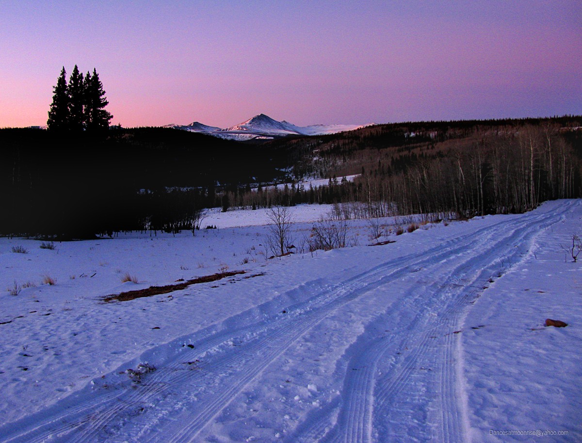
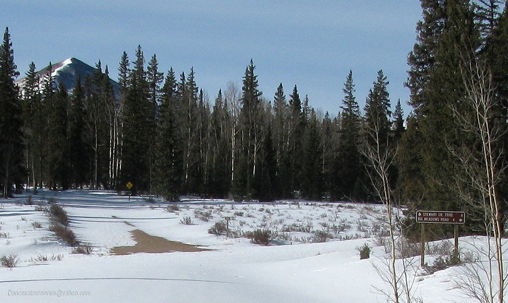
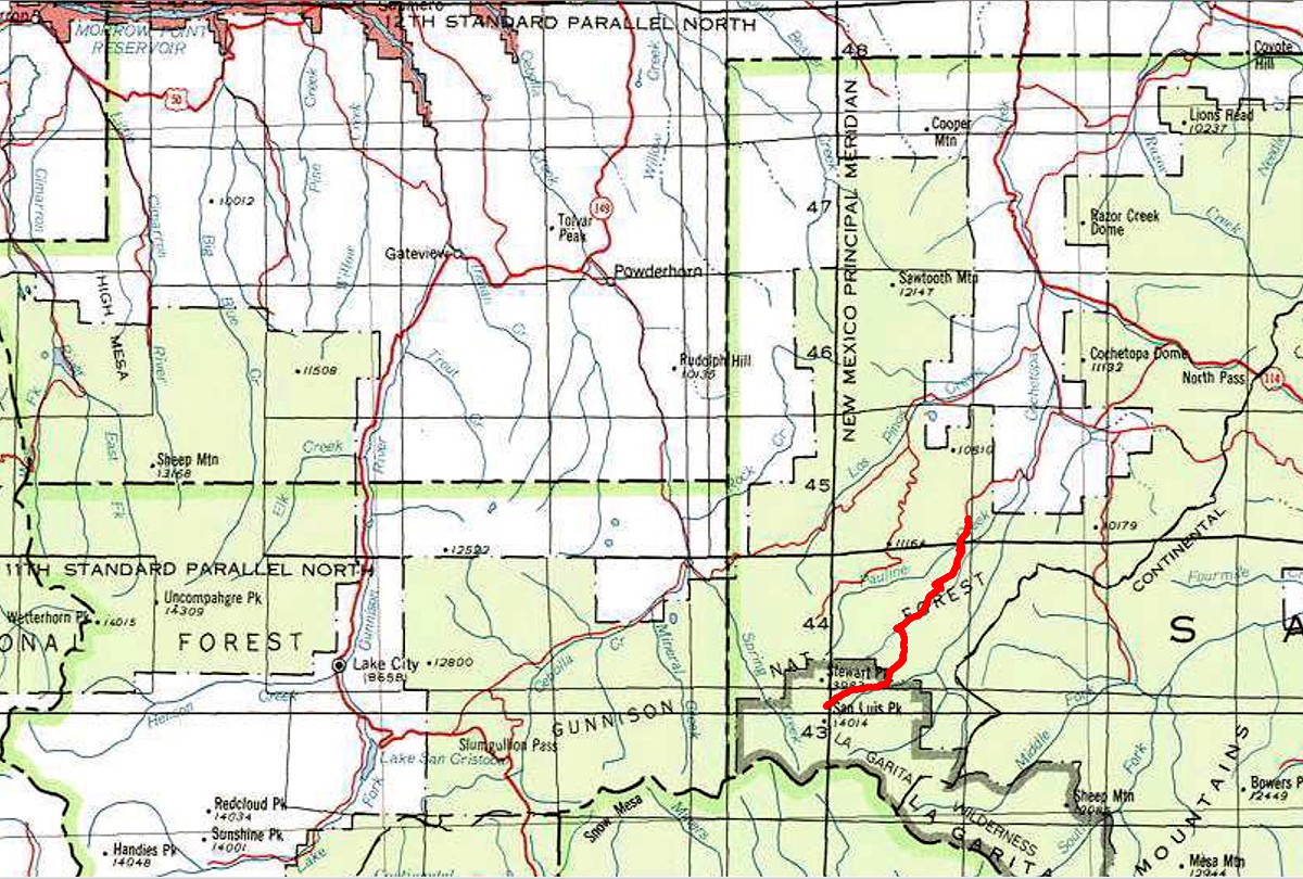
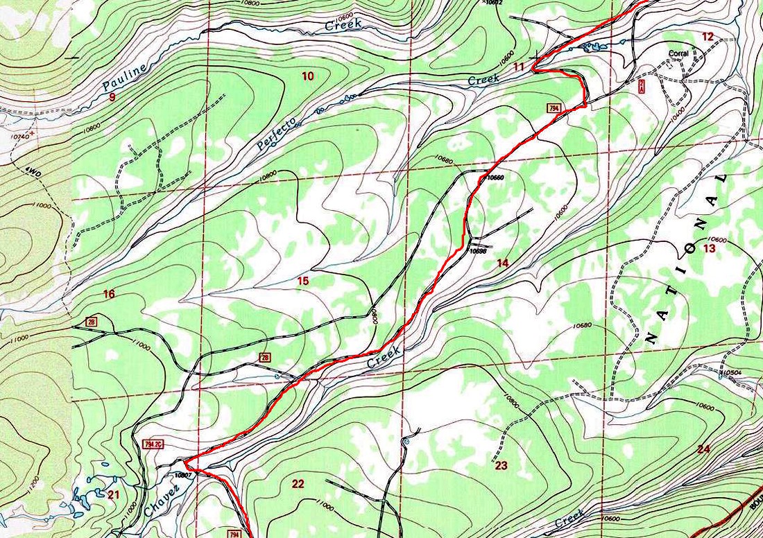
Ever since driving the 794 Forest Road from Dome Lakes to the Stewart Creek TH in June 2010, the thought of cross-country skiing the 53 miles in to
San Luis Peak becons. With mostly rolling hills, it seems doable, though would make for a long day. The idea is naturally relegated to the back burner...
January 18, 2013. I'm driving over to the Mill Gulch TH, to join Teddy and the guys for Redcloud and Sunshine. Somewhere after Monarch Pass, the
light bulb suddenly goes on: heck, it's Friday, and all I'm doing is car camping at Mill Gulch tonight. Plenty of time for a quick 50 mile detour.
The road down to Cochetopa and the Dome Lakes area is quiet and pleasant. Chains, shovel, ropes, and tarp, are standard winter-issue for the vehicle
of any winter-14er enthusiast, but I don't want to blow the Redcloud/Sunshine trip spending tomorrow digging snow, so I take it conservatively.
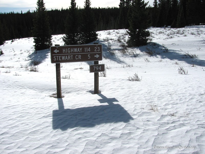
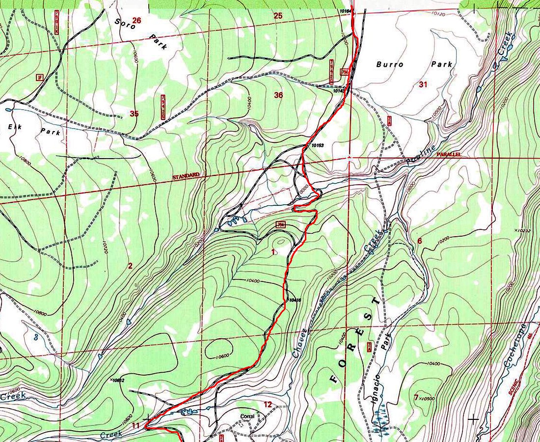
Getting back onto the 794 road, I'm pleasantly surprised to find low enough snow to get 6.5 miles in. This knocks 13 miles off the potential 53 mile RT
to San Luis. Sure, 40 miles is still long, but it's starting to sound more feasible. And I'm sure the car will get a couple miles further in. I'm off to Mill
Gulch, quietly enthusiastic, project preview in my back pocket.
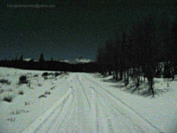
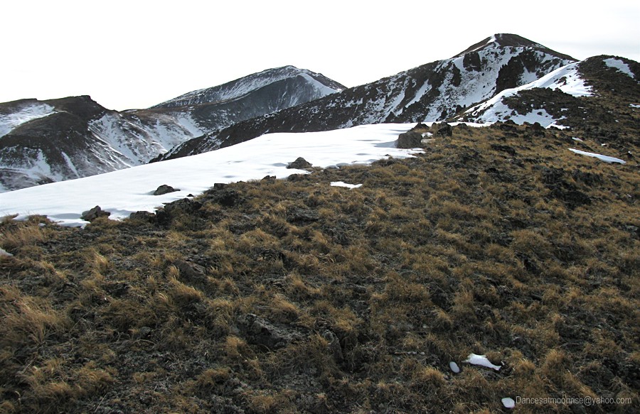
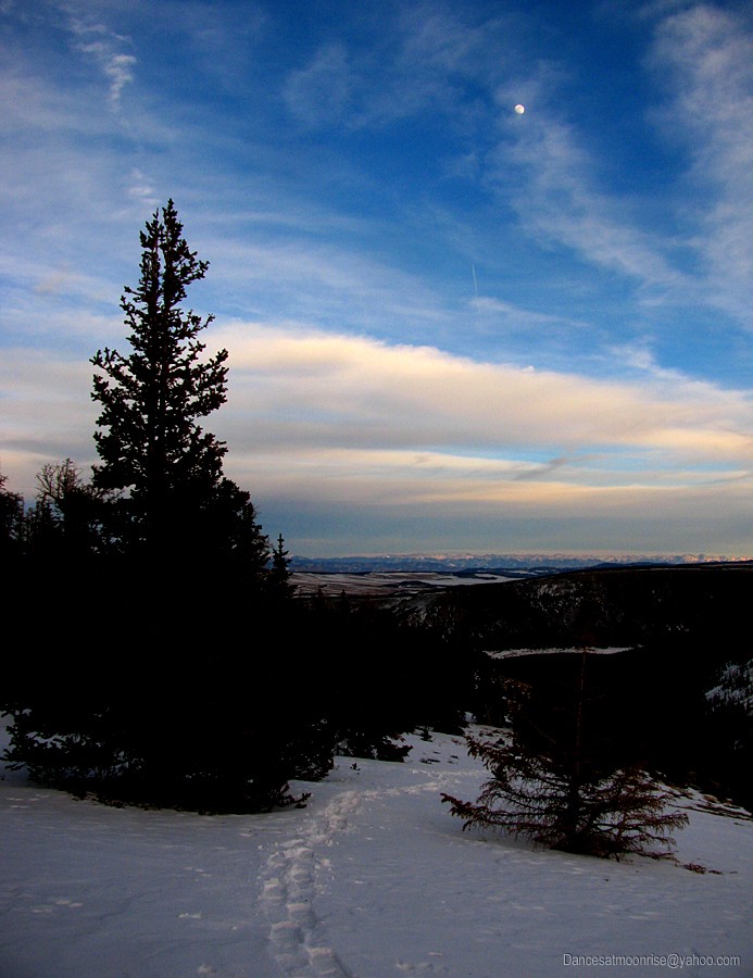
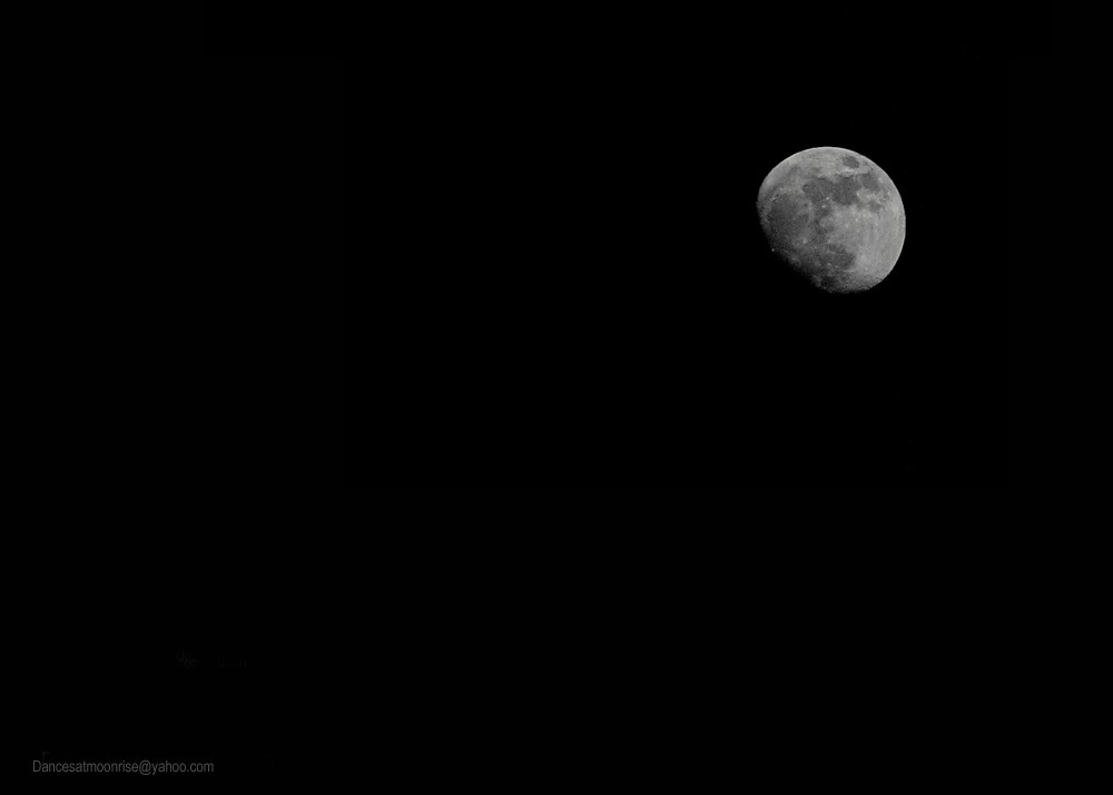
Is that Stewart Peak in the moonlight?
Wednesday is the last day of this nice 10-day run of good weather and some of the most reasonable avalanche conditions this year to date.
Ah... Wednesdays. Mid-week. Perfect. The lusty thought of stealing away unnoticed between the busy boulevards of the workaday world
to quietly emerge in the backcountry... it's too much to resist. When business is poor, the poor get down to business. Never mind the backlog;
it's winter. Work is for days of sideways snow and people who don't know how to fly fish; as the expression goes. OK, back to business...
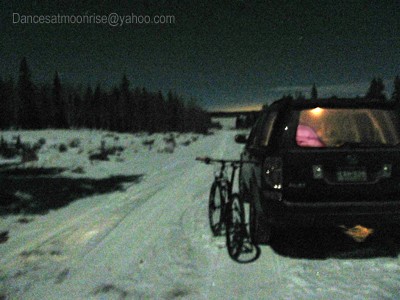
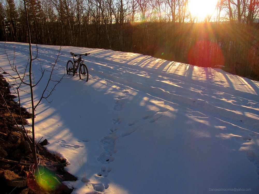
A bike, a full moon, the Honda Hotel.
Tuesday, January 22, 2013. Tuesday is supposed to be car-camp day, but phone calls, faxes, and fires to put out abound. I manage to get out to
Dome Lakes, drive in about 8.5 miles (as far as I dare) and get to bed shortly after midnight.
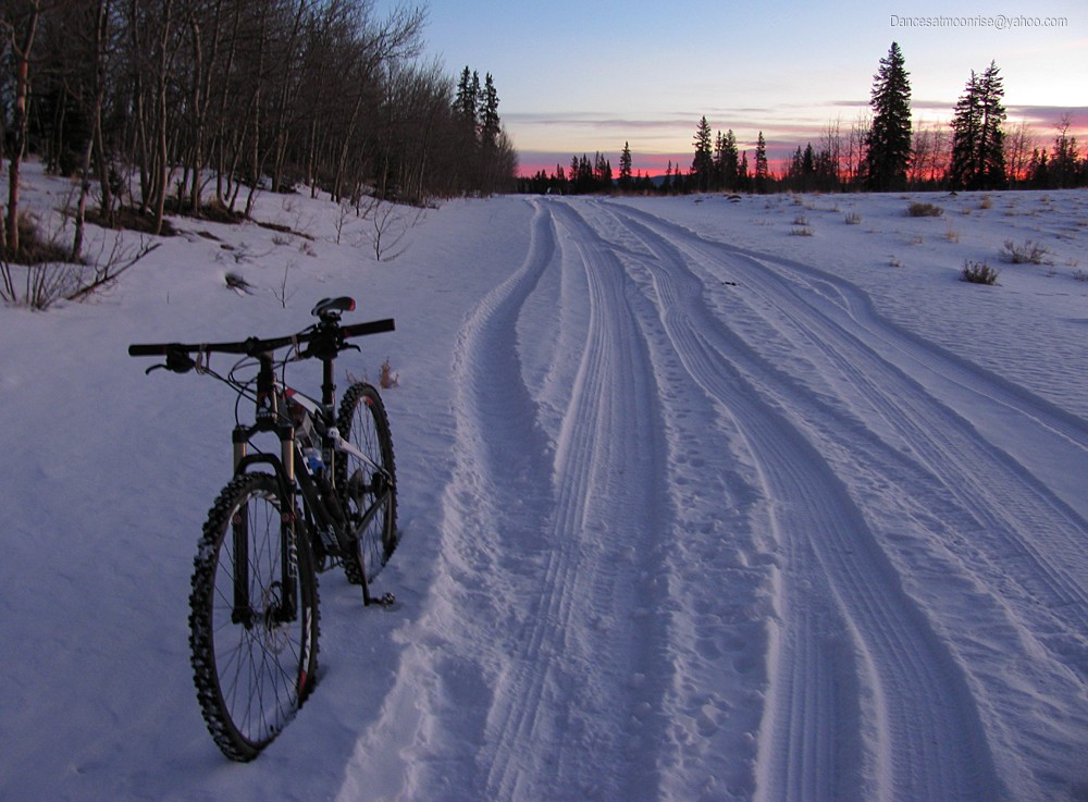
Originally, the idea is to ride the bike back as far as possible on Tuesday, then come back to the car to camp. This way, it would be clear whether skis
or bike would be better - I have both in the car. But given the way my Tuesday goes, I make a rather stubborn administrative decision. I know skis
would likely be more efficient, but I feel more like riding the bike. The bike it is.
No kickstand required.
First light comes too soon. Fortunately, winter is now in full swing and I remember the trick of burying a thermos of coffee deep within a down jacket,
all in a stuff sack. So there is coffee. And soon thereafter, intelligent life.
Seems no matter what the forecast, starting the TH this winter clocks in at a balmy 2 degrees above. The Shimano juice brakes run on mineral
oil - a great idea if you live in Japan. In Colorado winter, you loose all modulation at these temps. No matter, we'll be on the pedals more than the
brakes this morning.
Not as deep for 29" wheels.
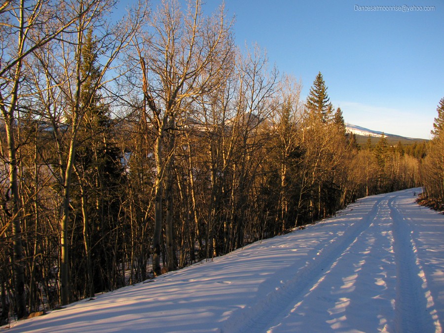
I'm lucky that my predecessor decides to chain up and drive back as far as he or she could. How far back? Don't know yet, but as long as the bike
stays in the track, the going isn't bad. Progress seems to move along at a great clip, but the map doesn't seem to want to cooperate.
Chain of fools?
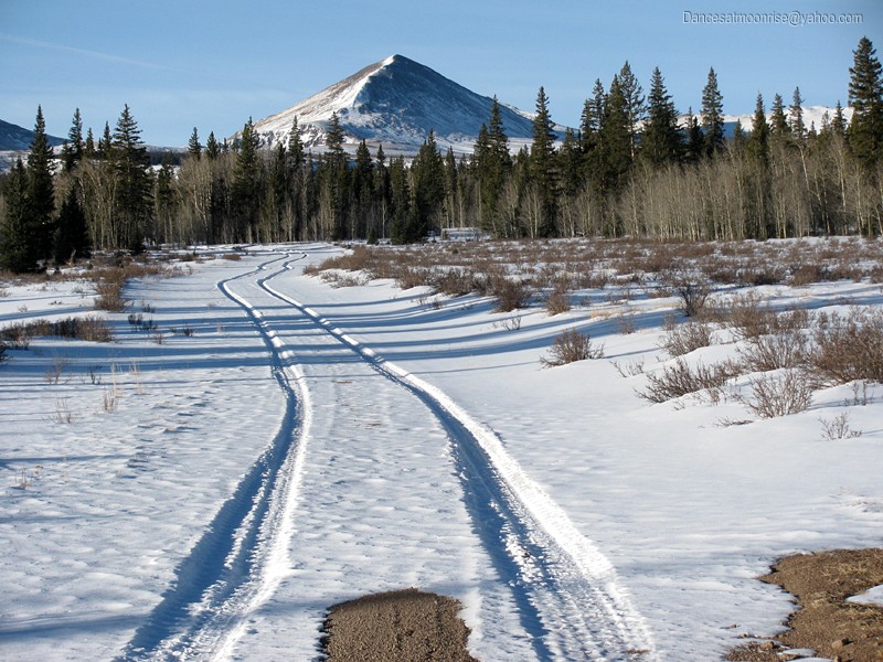
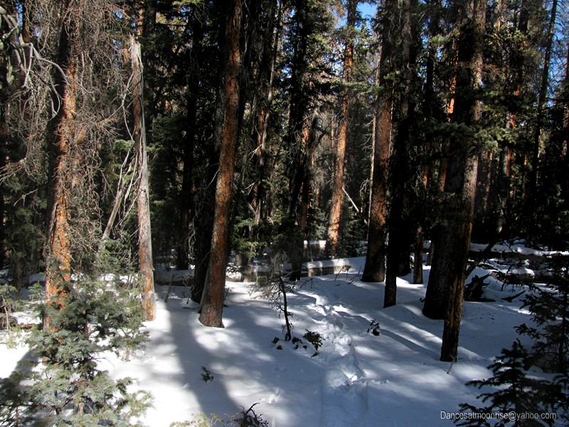
The lens is more generous than the trail: Stewart Peak is still 11 miles in the distance.
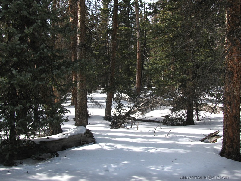
Shouldn't complain; got a track, right? Oops, complained too much - here's the end of the line. Time for snowshoes. I stash the bike, change out
to boots and beartraps, and start the long plod.
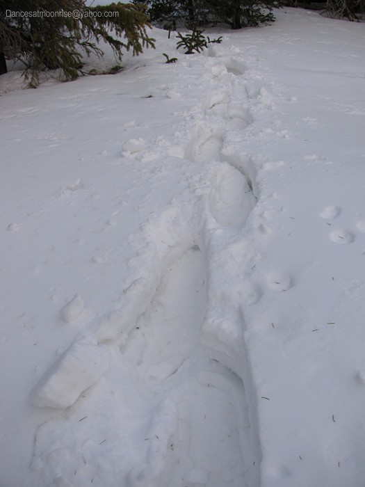
End of the line.
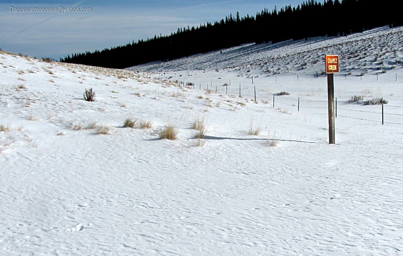
What's this? Stewart Creek summer trailhead 6 miles? Oh joy. A quarter mile later the sign says 5 miles. Let's hope this keeps up.
Stewart Creek, 6 miles.
Progress?
Map waypoint.
Guess the critters like to confirm their bearing, too.
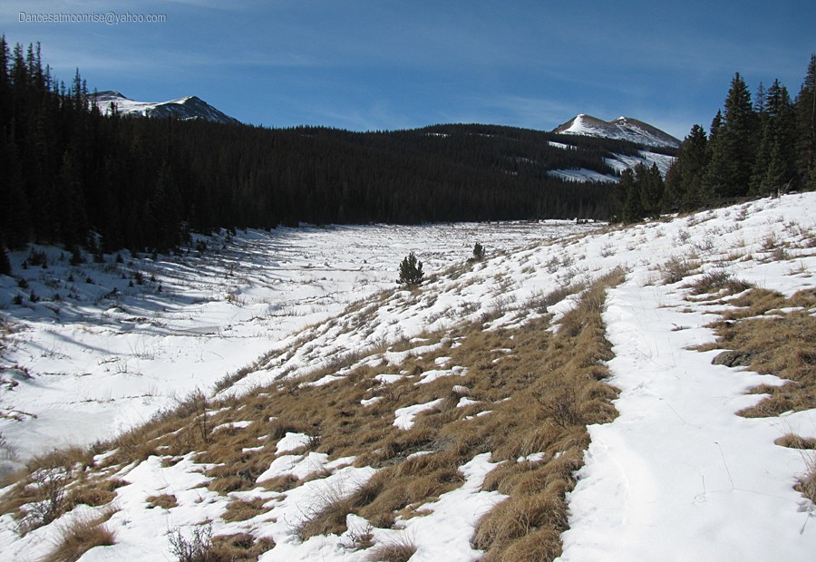
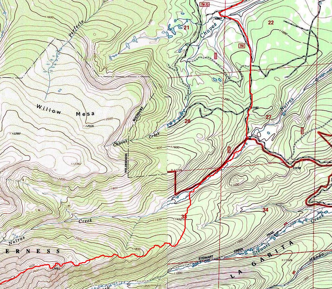
Finally at Nutras Creek, I make the decision to go in here. It should cut 4 miles RT, not having to go all the way to the Stewart Cr TH, plus the route
up Nutras should be 1 mile RT shorter than the Stewart Creek route. That brings calculations down to somewhere around 30 miles round trip.
The thought is, knocking 5 miles round-trip off the route is significant. Still, it is unknown which route may be more efficient, as there could be less
snow-breaking up the south-facing aspect of Stewart Creek. No matter, I"m tired of this road; time for some new scenery up the drainage. Besides,
the idea of trying this new route sounds appealing.
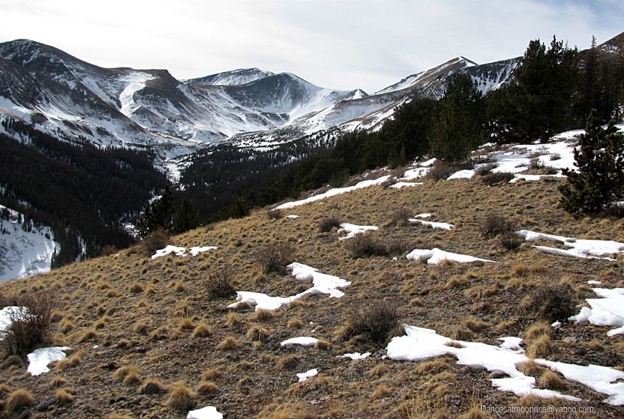
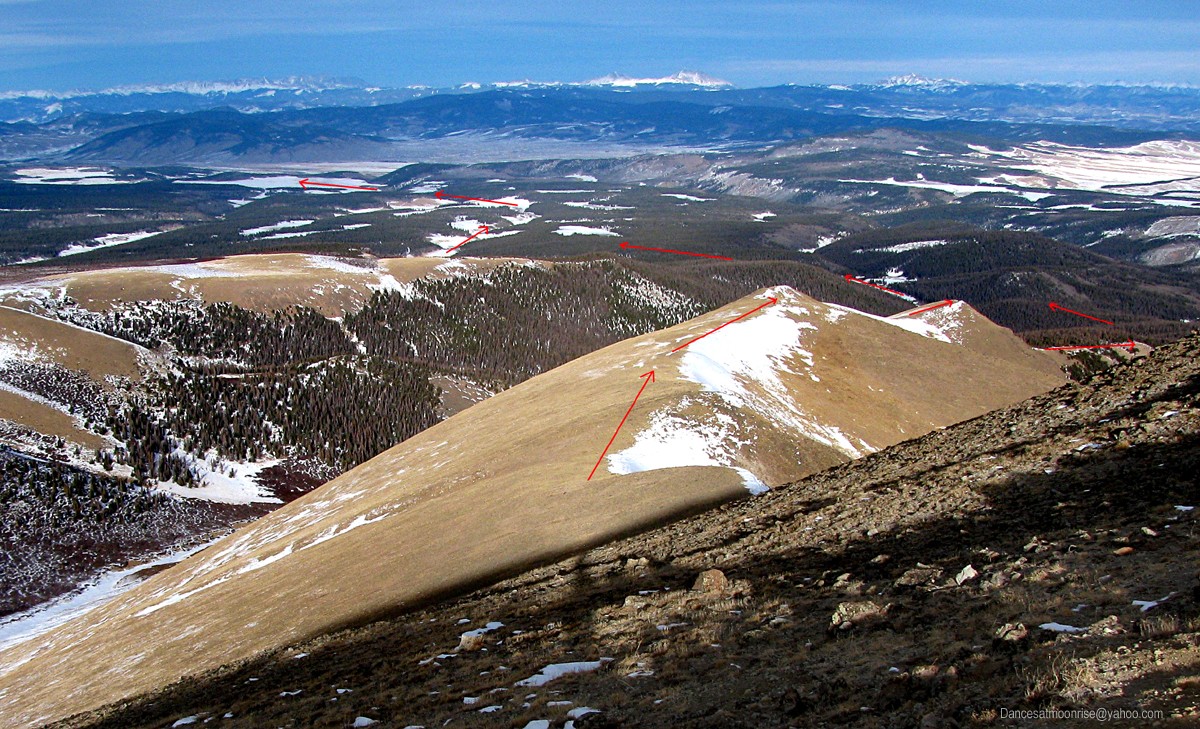
The Nutras Creek drainage. Stewart Peak at right; 13183 and Baldy Alto at left.
The Stewart Creek drainage on the other side of the calendar.
Route planning calls for taking the second bump to the left. The first is 11,400. The second bump constricts the drainage; it's easy to tell where
to hang a left. Unfortunately, the trees are thick with snow. One would think it's winter or something. Trailbreaking takes its toll.
Looking back: Kinda rough.
Which way is up?
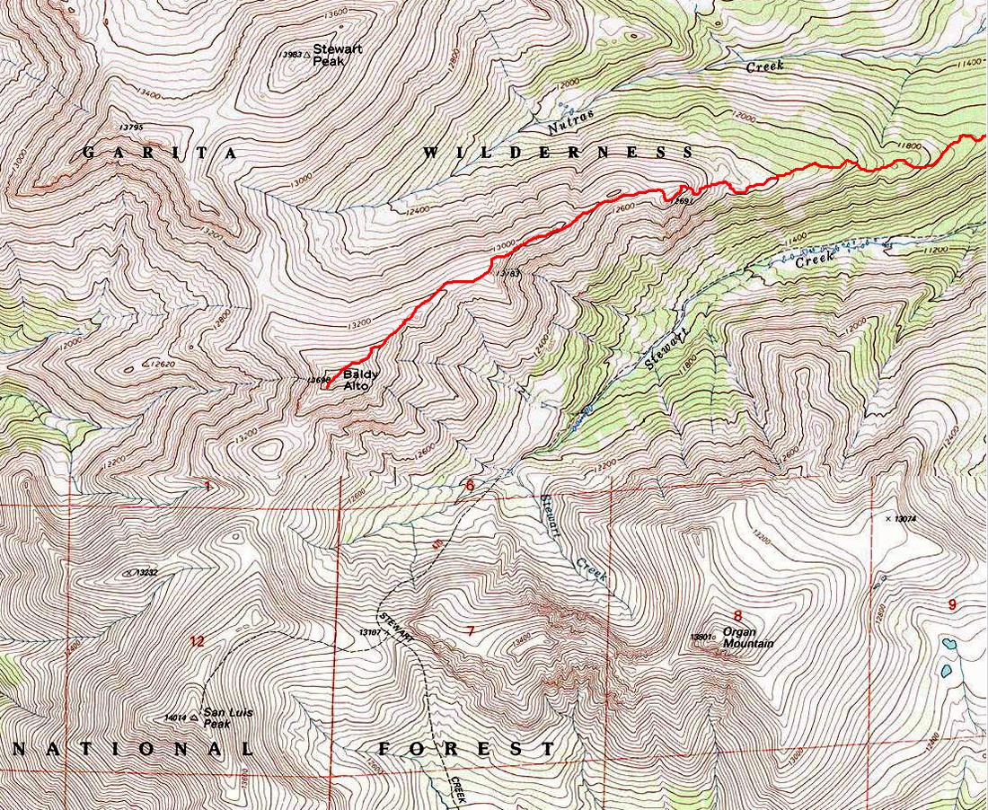
Soon the mellow ridge between the Stewart and Nutras Creek drainages makes it difficult to tell which way is up. I follow the compass, and lean
toward the south side. A warm day is nice, but south side snow is thick and goopy. Soon my snowshoes weigh about 10 pounds each. Back to the
trees and downed timber of the north side. Why did these hardy trees decide to grow all the way to 12,000 on my ridge, anyway?
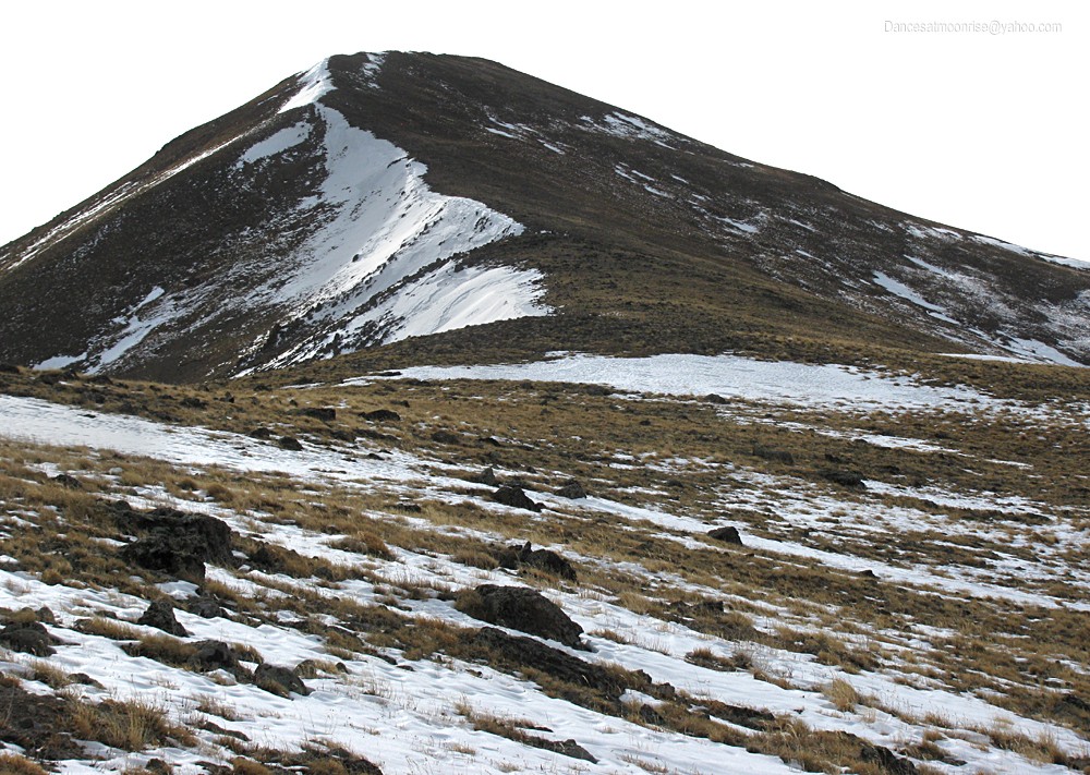
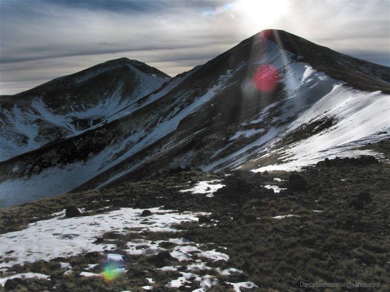
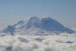
That's us: San Luis at center, Baldy Alto at right.
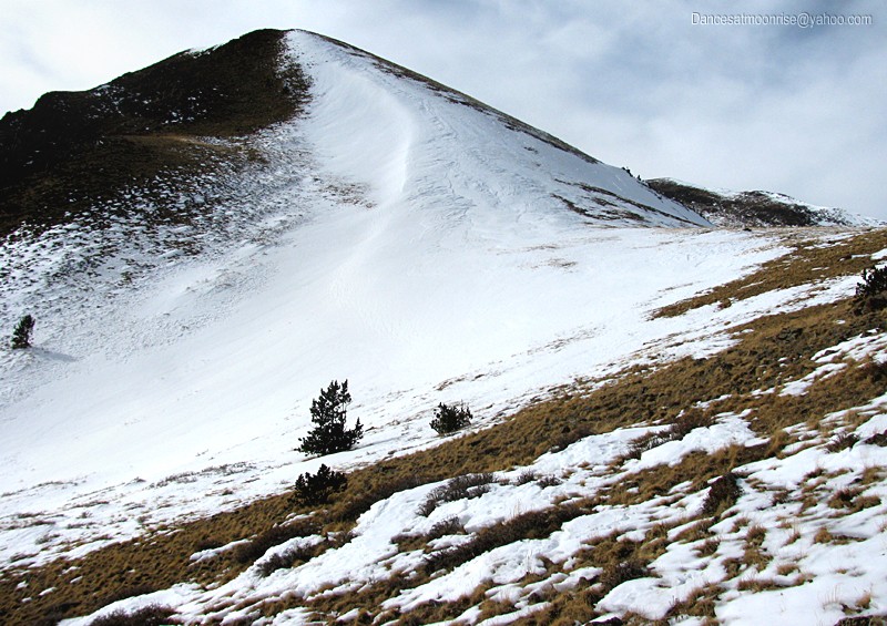
Steepest hill on the route. The NE aspect, at far right, is less than 30 degrees, and mostly bare.
Finally at treeline, I'm nearly out of water, and food as well. I push on for Baldy Alto. One would think four liters would be sufficient for a daytrip.
Getting closer.
Baldy Alto.
Extra credit: "Column Ridge" 13,795, shares the high saddle with Stewart Peak, unseen at right.
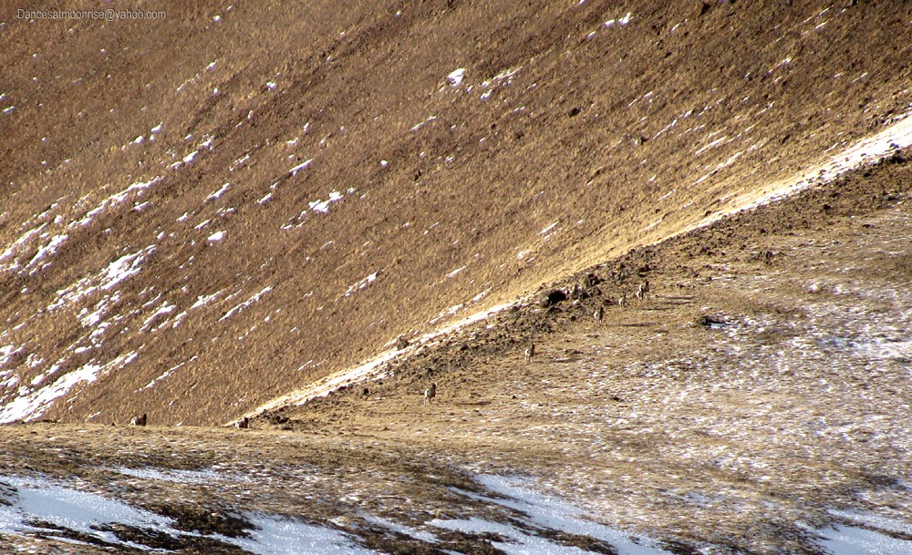
Excuse me, guys.
At the Baldy Alto summit, more than beat from six or eight miles of continuous trenching, I'm half-dead, but sure I can get San Luis - but not sure I
can get back at a reasonable hour. I've started carrying a stove, which will surely come in handy today to melt some snow. Prudence would suggest
paying respects and turning back here. Even if you don't care much for Prudence, it's best to listen to her; she'll kick your ass if you're not careful.
Besides, I've got a couple of friends waiting for an email when I get home - if it's not there by 6 am, I'll have the embarrassment of Search and Rescue to
motivate me. Some quick calculations suggest getting San Luis would put me on the ragged edge of that 6 am home-time. Mountaineering would be
nothing without desire. Especially the desire of summits unattained. I feel like Arnold. "I'll be back." OK, let's get out of here, and hurry up.
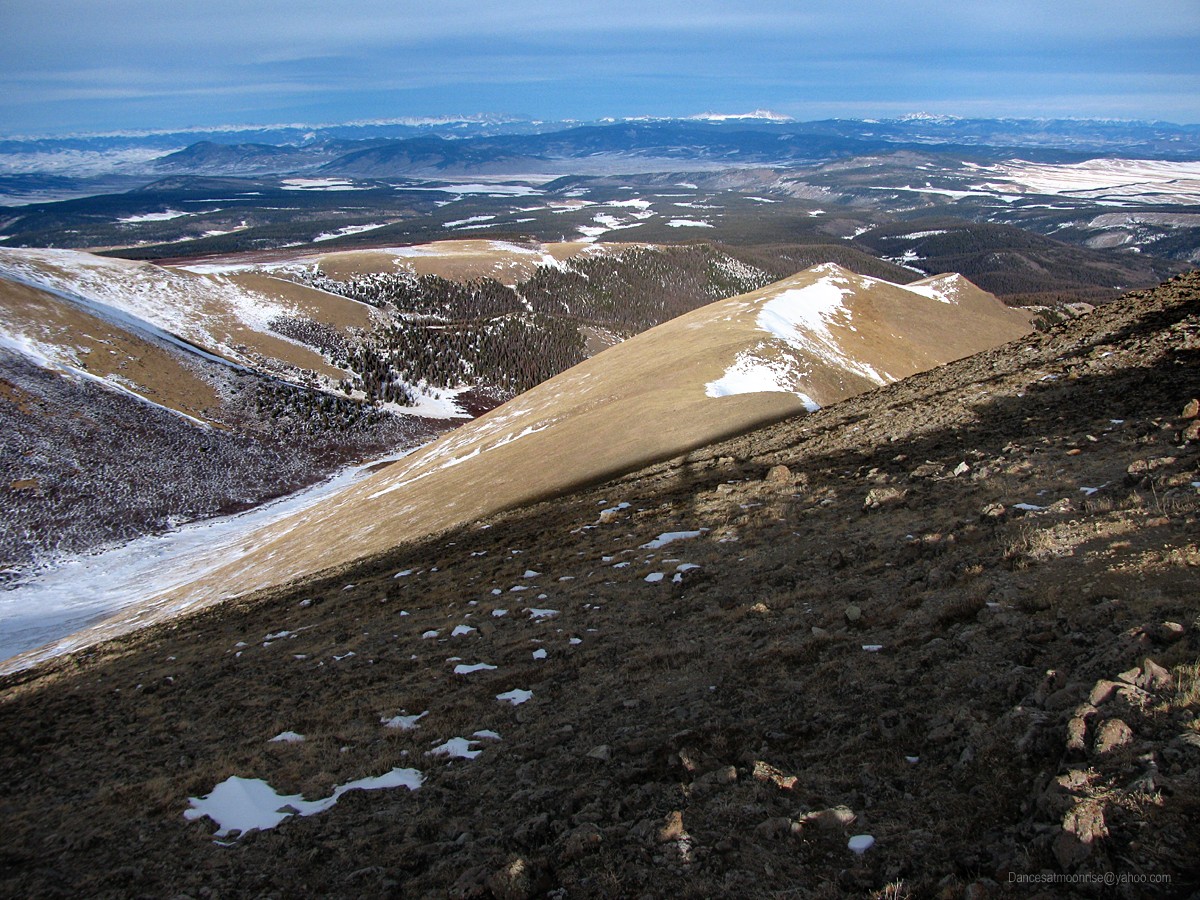
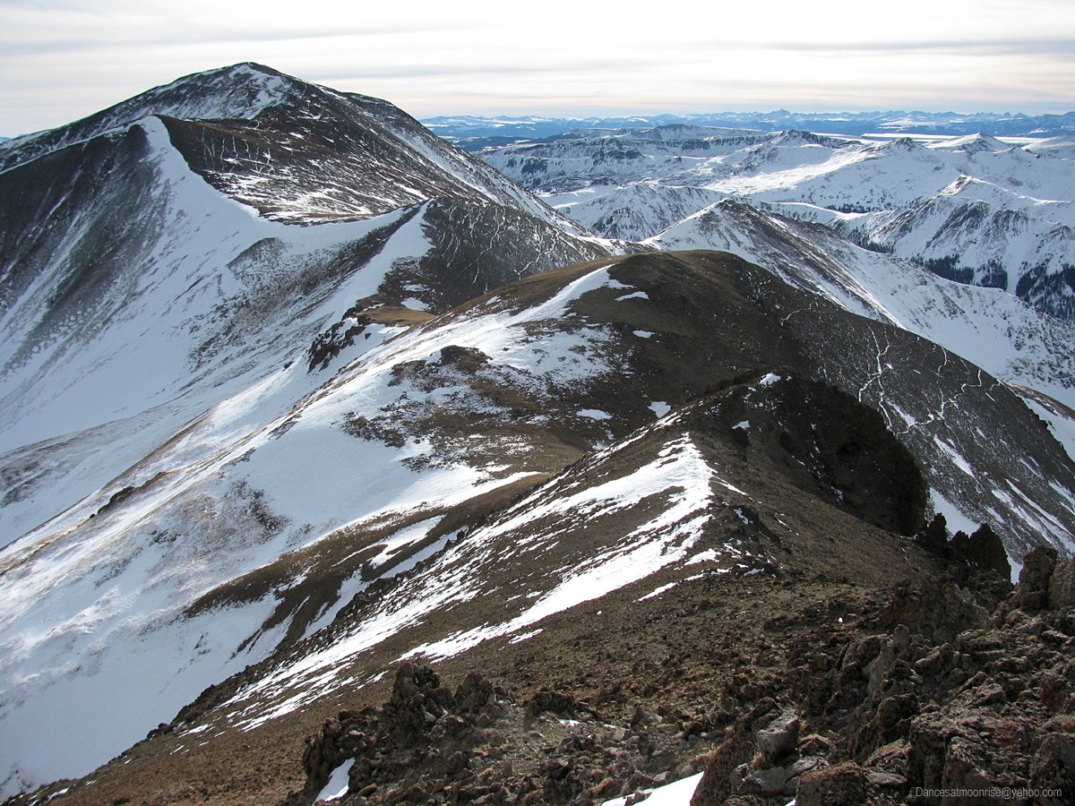
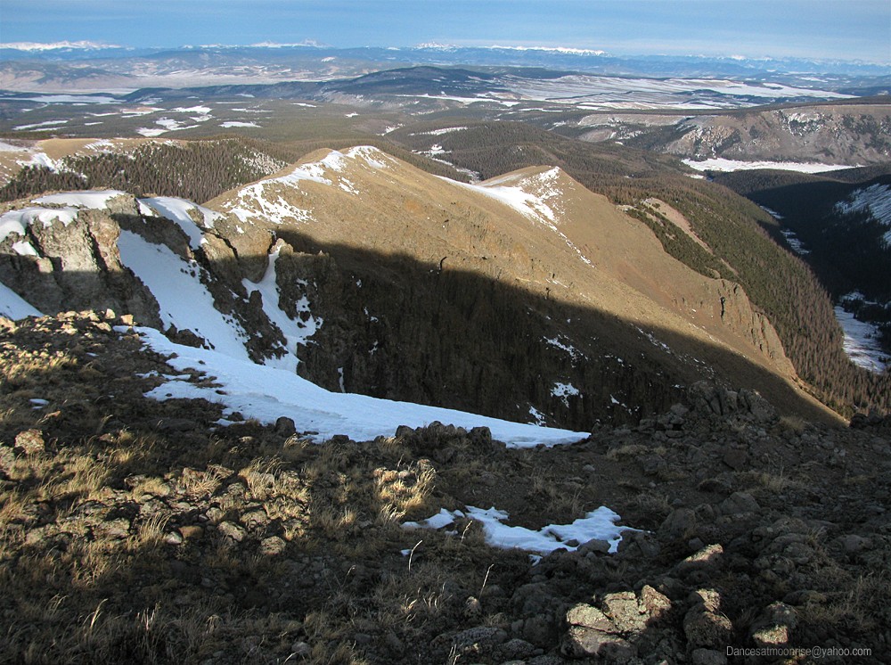
Looking down the ridge from Baldy Alto to 13,183 and the expansive Cochetopa drainage below. Shavano and Tabeguache appear on the distant horizon..
Long way home.
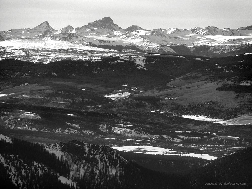
Wetterhorn and Uncompahgre looking closer than the car.
San Luis: so close.
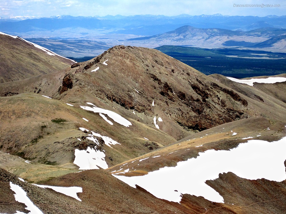
Other side of the saddle, other side of the calendar: What Baldy Alto looks like from San Luis in summer.
May as well start signing these things. Summit grafitti in a tube isn't all bad.
Still becons.
Rule One - The way back is always longer.
Farewell till next storm.
No batteries required.
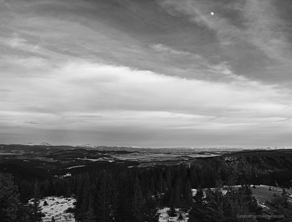
Treeline, a moon, a track. What more could a man ask?
A gorgeous evening in the San Juan.
At the corner of Nutras and 794, I stop to cook some snow. It's a long process, but gets an extra liter in me. Still not enough. Slogging along 794 in
the dark, I can't believe I finally get to the bike. Problem is, this ride is hard. The downhills keep things going and keep the front wheel in the track.
The occasional uphill is difficult. My erstwhile equine enigma bucks me off a few times. Makes it tougher with a pack. Gotta loosen up those new
pedals next time I think of it.
Soon I realize I don't have the necessary energy to pilot this pony. Pushing is not such a good idea - you're either walking in deep snow next to the
track, or pushing the bike in deep snow. No help for it. I do my best to ride. There is good news. There is no doubt that San Luis was not in the
cards today. Today being defined as the day that ends in a couple hours when the clock strikes midnight. Maybe with a little luck I can be back and
take advantage of my trench before the next big storm.
Soon I'm at the car. Another red-eye express home. I pull in to one of my favorite campgrounds along the way, fall asleep in the front seat, and
awaken refreshed. The clock says I've only slept 15 minutes. Amazing how much it can help. I get home, get the necessary emails out, and crash.
Ah, sweet winter sleep, and dreams of a quiet journey, far far away, in a place seldom traveled under January moonlight...
Your ambition and perseverance is inspiring. Completing a remote La Garita summit so far from any paved roads is nothing short of amazing. This is my favorite area in Colorado.
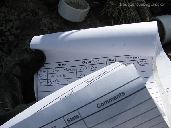
Seeing my name in your register photo brought a smile.
Totally missed the fact that the maps came up small. Had these big beautiful maps but forgot to post them that way. Problem now fixed!
Mike, there's probably at least an additional foot. Slumgullion got about 18” more since this trip. That said, yes, I'd like to go back in and get San Luis in the winter from this approach when the time is right.
That area intrigues me, especially after reading this TR. Way to persevere a long way in there and then make the right call when you had to! I always admire prudence displayed on this forum.
Caution: The information contained in this report may not be accurate and should not be the only resource used in preparation for your climb. Failure to have the necessary experience, physical conditioning, supplies or equipment can result in injury or death. 14ers.com and the author(s) of this report provide no warranties, either express or implied, that the information provided is accurate or reliable. By using the information provided, you agree to indemnify and hold harmless 14ers.com and the report author(s) with respect to any claims and demands against them, including any attorney fees and expenses. Please read the 14ers.com Safety and Disclaimer pages for more information.
Please respect private property: 14ers.com supports the rights of private landowners to determine how and by whom their land will be used. In Colorado, it is your responsibility to determine if land is private and to obtain the appropriate permission before entering the property.