Download Agreement, Release, and Acknowledgement of Risk:
You (the person requesting this file download) fully understand mountain climbing ("Activity") involves risks and dangers of serious bodily injury, including permanent disability, paralysis, and death ("Risks") and you fully accept and assume all such risks and all responsibility for losses, costs, and damages you incur as a result of your participation in this Activity.
You acknowledge that information in the file you have chosen to download may not be accurate and may contain errors. You agree to assume all risks when using this information and agree to release and discharge 14ers.com, 14ers Inc. and the author(s) of such information (collectively, the "Released Parties").
You hereby discharge the Released Parties from all damages, actions, claims and liabilities of any nature, specifically including, but not limited to, damages, actions, claims and liabilities arising from or related to the negligence of the Released Parties. You further agree to indemnify, hold harmless and defend 14ers.com, 14ers Inc. and each of the other Released Parties from and against any loss, damage, liability and expense, including costs and attorney fees, incurred by 14ers.com, 14ers Inc. or any of the other Released Parties as a result of you using information provided on the 14ers.com or 14ers Inc. websites.
You have read this agreement, fully understand its terms and intend it to be a complete and unconditional release of all liability to the greatest extent allowed by law and agree that if any portion of this agreement is held to be invalid the balance, notwithstanding, shall continue in full force and effect.
By clicking "OK" you agree to these terms. If you DO NOT agree, click "Cancel"...
July 14, 2012
~9.4 Miles, ~5,200 Gain
TH: Saddle 11,796 off of the Alamosito Road. (High clearance required)
It is very fortunate that the Cielo Vista Ranch allows climbing of these peaks. Thank you Cielo Vista as I would rather not poach these peak. Plus, I wouldn't poach any peaks; never. For 2012, the only date that these peaks were offered were July 14th. My normal partner in crime, Al, was highly interested in climbing these peaks as he is closing in on finishing his Sangre 13er list. With a little last minute notice, Ryan also decided to join our group.
Meeting up in various places, we started our carpool to the Alamosito Gate where the ranch allowed us to camp. To break up the drive, we decided to bag Point 9,044 and from our parking area for 9,044 we followed a dirt trail north for a short distance before starting a scrubby bushwhack to the summit. ~1.0 mile and 300 gain. A good short leg stretcher from the drive.
Directions for 9,044 parking:
From the summit of La Veta Pass on US 160, drive ~10.5 miles west and make a right turn onto an unmarked road. Drive ~500 feet until a T junction. Make a right turn at the T junction and drive ~2.7 miles. Near the top of a hill, make a right turn onto a dirt road and drive 100 yards to a flat area.
We arrived at the Alamosito Gate around ~9:00 PM and set up camp. Initially we parked at the wrong gate but our mistake was easily identified in morning as we were only 200 yards from the actual gate. Around 6:15 AM a ranch handler collected our liability waivers and ushered us through the gate where another ranch handler, Milton, collected our payment of $150. To keep things simple for the ranch, everyone was going to have to drive, lemming style, to the parking area and back out to the gate when everyone was finished with their climbing. Leaving at our own time wasn't going to be an option as we were bound by the slowest climber.
Milton led the caravan to our parking area at the 11,796 saddle directly west of Purgatoire. At the end of the day, if needed, people would be shuttled from Alamosito Creek back to the saddle by Milton. Personally, I would have preferred to park at Alamosito Creek and then hike to the Alamosito-Purgatoire saddle and complete the loop in that fashion.
From our parking area at 11,796, The group of 10 people started hiking up the grassy west slopes of Purgatoire's false summit of 13,265. Once at the summit of 13,265, I found a nice trail on the south side of 13,265's east ridge that bypassed some rocky sections on the ridge proper. The west slopes of Purgatoire were an enjoyable class 2 grassy ridge romp and we arrived on the summit at 8:40 AM.
Staring up towards Purgatoire. (Photo by Al)
False summit of Purgatoire.
Point 12,754 from the west ridge of Purgatoire.
People heading up the false summit of Purgatoire.
Looking down the west ridge of Purgatoire.
Rocky section from descending Purgatoire's false summit.
True summit of Purgatoire.
"Alamosito" and Culebra from the summit of Purgatoire.
Excellent views from the summit of Purgatoire but we could see some clouds building early so we headed down the steep class 2 north ridge of Purgatoire which was a mix of grass and talus. Our next objective was "Alamosito" which went quickly with all class 2 grass slopes, where we arrived on the summit at 9:20 AM.
Grassy south slopes of "Alamosito"
Since the building clouds didn't look good, our stay was short on "Alamosito" and we descended the grassy north ridge bypassing a few small bumps on the east side of the ridge. With building weather, we hurried up the mellow slopes of Vermejo and arrived on the summit at 10:15 AM. Just prior to our arrival back at the Vermejo-"Alamosito" saddle, it started to rain. From the saddle, we descended down grassy slopes towards Vallejos Creek to ~12,100 and then intercepted a grassy bench that took us to the "Alamosito"-12,754 saddle. Others, I noticed got trapped into traversing or descending on talus towards our grassy bench. An immediate descent into Vallejos Creek appeared to work the best.
Hiking towards Vermejo (Photo by Al)
Culebra and Red from the summit of Vermejo
Culebra and Red from the summit of Vermejo (Photo by Ryan)
Weather.
Al near the summit of Vermejo (Photo by Ryan)
Looking back at the south slopes of Vermejo as it started to rain.
We still had plenty of time, so Al, Ryan and I decided to add 12,754. The weather was questionable but we figured we could sneak in a 12ver since the weather seemed to be isolated to the higher peaks. From the 12,754-"Alamosito" saddle, we stayed on the north side of the ridge following small ledges working our way towards the summit. We took our time since the recent rain made things slick.
Hiking towards 12,754.
Reaching the "Alamosito"-12,754 saddle. (Photo by Al)
Looking at the east ridge of 12,754.
~100 feet below the summit, we waited about 10 minutes for the weather to clear since we didn't want to be exposed on the ridge during an electrical storm. Blue skies were close so we continued on the ridge proper towards the summit where some minor class 3 scrambling was required. The rocks were extremely slick due to the recent rain. We arrived on the summit of 12,754 at 11:55 AM. This 12ver had been the most interesting peak of the day.
Al starting some class 3 on 12,754.
Final stretch of class 3 on 12,754.
Al returning from the summit of 12,754 (Photo by Ryan)
"Alamosito" and Vermejo from the summit of 12,754.
Because the sun was shining, we returned back to the 12,754-"Alamosito" saddle via the ridge crest. Again, taking our time due to slick rocks. Once at the saddle we headed south towards Alamosito Creek. We got lucky with a good weather window and as we were hiking in Alamosito valley it started to rain again.
Descending the ridge proper on 12,754
Descending the ridge proper on 12,754 (Photo by Ryan)
Heading downward following close to Alamosito Creek, we found the old logging roads which took us back toward our cars. On our way back, we ran into Milton who advised us that 5 people were back at the cars waiting. There were only two hikers left and they were only about 20 minutes behind us. We decided to hike back towards the car and if Milton picked up the remaining hikers and caught up to us, we would take the shuttle to our cars.
Al nearing the "Alamosito"-12,754 saddle. (Photo by Ryan)
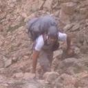
Poor chaps on talus descending from "Alamosito" (Photo by Ryan)
We didn't quite make it back to our car before Milton and the other two climbers ran into us. A short car shuttle later, we were at our cars at 1:15 PM. Luckily, everyone made it back to their vehicles at a reasonable time so we could all caravan back to the Alamosito gate. A fine day. Thank you Cielo Vista Ranch.
Roads back to the saddle where we parked.
Route Map.
Thumbnails for uploaded photos (click to open slideshow):
If Carlos still has that dog the size of a Kodiak bear, I'd think long and hard about stealthing anything on the ranch property. Let's face it, ain't nobody gonna hear you scream in the San Luis night.
I guess my biggest concern regarding access to these peaks is somebody pissing off the ranch and having them shut it down. Maybe I need to hit them sooner rather than later.
Thanks for the images and details. Piper's been pretty quiet this summer.
Looks like they changed it around since I was there, I will have to update my SP page as I think your route is the new standard route.
The experiences on the ranch have all been great, glad you were able to get the southern tour done with them as well! Our northern tour last year was a lot of fun.
of course that is the new standard route, which goes along with a number of other of Derek's new standard routes that I have been fortunate enough to have seen up close
thanks for posting
Caution: The information contained in this report may not be accurate and should not be the only resource used in preparation for your climb. Failure to have the necessary experience, physical conditioning, supplies or equipment can result in injury or death. 14ers.com and the author(s) of this report provide no warranties, either express or implied, that the information provided is accurate or reliable. By using the information provided, you agree to indemnify and hold harmless 14ers.com and the report author(s) with respect to any claims and demands against them, including any attorney fees and expenses. Please read the 14ers.com Safety and Disclaimer pages for more information.
Please respect private property: 14ers.com supports the rights of private landowners to determine how and by whom their land will be used. In Colorado, it is your responsibility to determine if land is private and to obtain the appropriate permission before entering the property.


")
")
")
")
")
")
")
")
")
")
")
")
")
")
")
")
")
")
")
")
")
")
")
")
")
")
")
")