| Peak(s): |
Mt. Sneffels - 14,155 feet |
| Date Posted: | 07/15/2012 |
| Modified: | 10/04/2015 |
| Date Climbed: | 07/08/2012 |
| Author: | SnowAlien |
| Peak(s): |
Mt. Sneffels - 14,155 feet |
| Date Posted: | 07/15/2012 |
| Modified: | 10/04/2015 |
| Date Climbed: | 07/08/2012 |
| Author: | SnowAlien |
| Mt. Sneffels via SW Ridge from Blue Lakes TH |
|---|
|
Mountains: Mt. of the Holy Cross (Day 1), Wilson Peak (Day 2), Mt. Wilson and El Diente (Day 3), Sneffels (Day 5) with a detour to the base of Lizard Head (Day 4) Party: solo Dates: 7/4/12 - 7/8/12 Trip Totals: ~56 miles, 20,600' vertical Day 4 - Lizard Head (hike)July 7th, 2012 Route: Cross Mountain TH (10,060 feet) Distance: ~4 miles RT, 1,600 elevation gain, 3 hours After being "done" with the Wilsons sooner than expected, I decided to stay & explore the area. I woke up on Saturday in Rico to the sound of rain (glad I did not wait an extra day for the traverse) and headed for a nice big breakfast on the main street. Wimbledon was on (one can find tennis matches live in strangest locales) and I watched Serena Williams cruise to victory (yay). It turned out Rico also has a public library, which is open on Saturday (but closed on both Friday and Sunday), so I buried myself there for a few hours. As I was typing away, I noticed that the daylight was getting brighter and brighter - there was no mistake - the rain had stopped and the sun came out. Sure it was time to head out to the Cross Mountain TH! But first, another meal (lunch) was in order, and as it is often the case with small towns, it took awhile. By the time I arrived at the trailhead, it was already after 3pm and the sun was just about to disappear again. My goal for the day was very simple - as per Robert Ormes "Guide to the Colorado Mountains" via Gerry Roach: "Climb... to the base of peak. Take a photograph and go away". So I started from the TH (just off highway 145) around 3.30pm. About 0.7 miles into the hike, it started hailing, so I hunkered down under a large tree to wait for it to pass. It did & I pressed on. My hamstrings were screaming, but it was a gentle trail, so it was a matter of putting one foot in front of another (and slowly).   After about 2 hours of hiking, I was finally breaking through the tree line and was greeted by an amazing view:  Nooooo! I probably let out the scream "Noooo!", however decided to wait a few minutes to see if things improve. This is what you get for a view if you are foolish enough to miss a 4-hour window during the monsoon season when it is not raining.  As good as it gets in the rain, I guess I did not go past the tree line, as I heard thunder in the area, but I lingered for a bit trying to get another glimpse if this amazing peak. Some day, I hope to develop enough skills to climb this peak (and in good weather, too!).  It is not raining. Somewhere.  Lizard Head from a highway Day 5 - Sneffels via Southwest RidgeJuly 8th, 2012 Route: Blue Lakes basin ascent, Blaine Basin descent Distance: ~12 miles RT, ~4,800 elevation gain, 8.5 hours Telluride is a long drive from Denver, so I decided to use my last day of vacation in the area to the fullest. Tony1 and I did Sneffels about a month ago via the standard (South Slopes) route, on a perfect weather day and I really, really enjoyed the scenery. There was another route on Sneffels that I was interested in - Southwest ridge, and another approach - Blue Lakes basin, and it was on the way home (near Ridgway), so it was no surprise that I found myself pulling into the East Dallas Creek TH on Saturday night, just as another bout of rain was intensifying. There were a number of cars at the TH. The East Dallas Creek TH is about 8 miles from the highway, and is an easy 2WD road. Unfortunately, I had trouble falling asleep that night, so when the 4am alarm went off, I just laughed and went back to sleep. The next time I woke up, it was 5.45am. I got ready & hit the Blue Lakes trail at 6.40am. There were half as many cars at the TH compared to the night before (maybe people got spooked by heavy rain and left) and no other hiker to be seen. At 9,340 feet, the East Dallas Creek TH is quite a bit lower than the standard trail on the other side, so it took awhile to get to the first (lower) Blue Lake, but the views certainly did not disappoint.   Soaked register case from the overnight pour  Blue Lakes TH sign 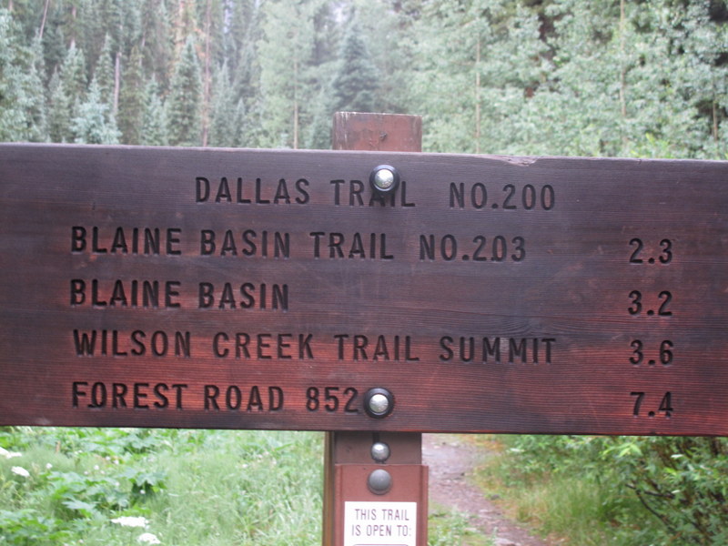 Blaine Basin TH sign  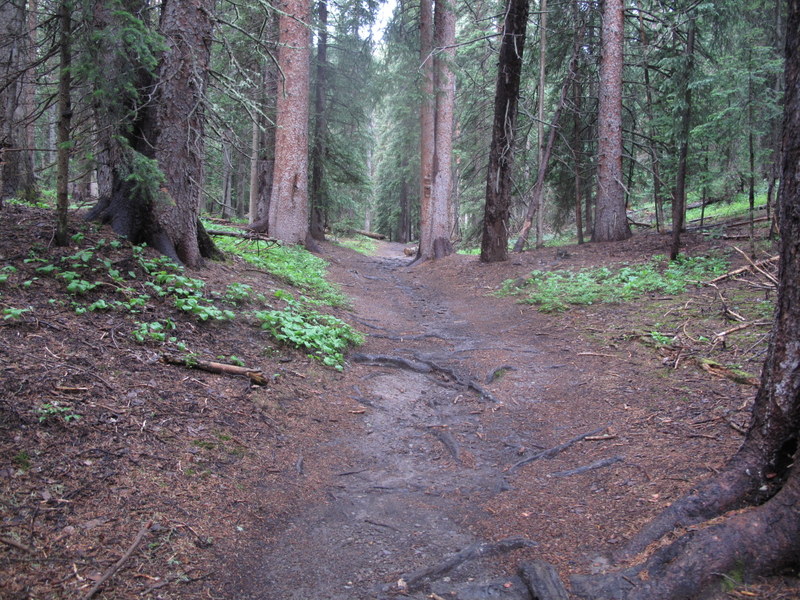 Blue Lakes trail (when it is not steep)  Multiple river crossings awaited  Looks like an avy area on the route  Sign near the lower Blue Lake  Multiple gorgeous waterfalls in the area  First/lower Blue Lake  Second (upper) Blue Lake At the 2nd Blue Lake near 11k, I finally saw some people who backpacked in the previous day and camped at the lower lake overnight. The weather still looked ok, but I knew that due to the late start, I did not have much time, and was pushing forward as fast as I could. The ascent to the Blue Lakes pass is quite steep, as the trail climbs about 1,000 feet in less than a half a mile.  It is not all doom & gloom!  Views of the lakes from Blue Lakes Pass  SW ridge begins Upon gaining the Blue Lakes pass ~13K feet, I was definitely feeling it, just as the weather started to deteriorate after 10am. I put my poles on the pack, donned the helmet and started the climb. Two people from the large group I met before, decided to take on the ridge as well, but they were much faster than me in my tired state, and we soon separated. <br) View of Yankee Boy Basin from the ridge
View of Yankee Boy Basin from the ridge Looking back at the ridge  Knife-edgy section (can be avoided on the right side if desired  High ridge stops clouds from rolling into the next basin The climb is very enjoyable and is an easy Class 3. Vews would have been stunning, were it not for the clouds, obstructing most of the horizon (save for the Yankee Boy quadrangle). I joined five other people on the summit at about 11.30am (three came from the Yankee Boy basin side), and was very happy to be done with vertical for a while. 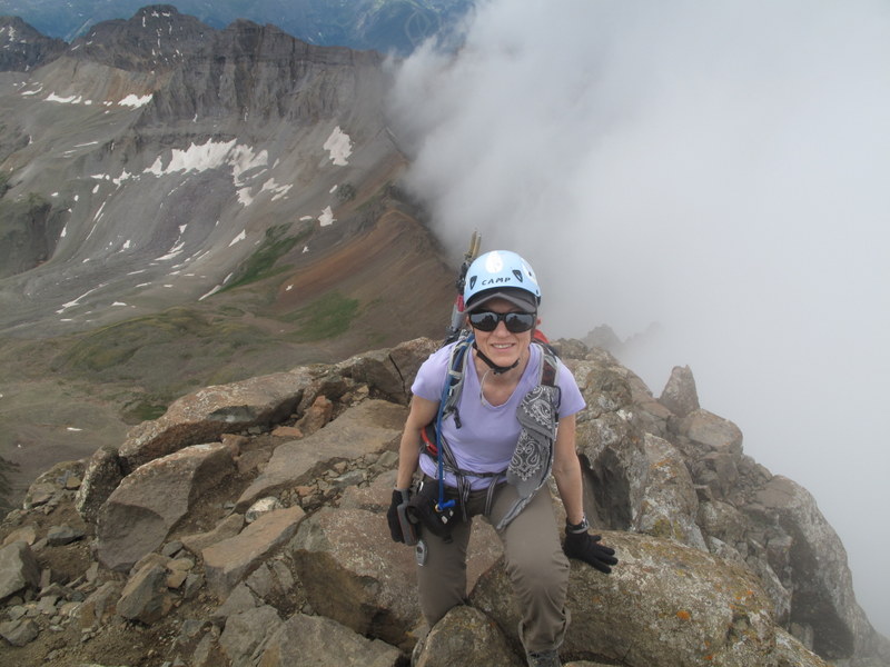 5th summit in 5 days My descent route was down to the Lavender couloir (completely melted out by now) and then through the Blaine Basin. My camera's battery died on the summit (that's what happens when somebody doesn't expect to be gone for 5 days and does not take a recharger), but visibility was pretty poor after the Lavender couloir anyway. Roach describes East Slopes/ Blaine Basin as "reasonable passage later in the summer", so I decided to check it out as a descent route, since it goes back to the Blue Lakes TH, making for a nice loop. After descending the Lavender couloir, turn left (vs right for the standard route). The first 1,000 feet is an easy scree, which makes for a quick descent (think Mt. Bross scree vs. El Diente scree). The next 1,500 feet are far less pleasant - there is about a mile of boulder hopping on an unmarked trail. There is also a rock band to be navigated around, lower in the basin. Being a north-facing basin, Blaine basin still has a few narrow snowfields, which I was able to milk for as long as possible, by glissading on foot when I was tired of seemingly endless talus fields. I can see how this route is more of a snow route that provides access to the couloirs on Sneffels' north face. The rain that started ~1.30pm was complicating things, making boulder hopping even less pleasant than usual (but that's what one gets for starting at 6.40am on a monsoon weather day). Still, after I reached the Class 1 mining trail ~11.5K and then the Blaine Basin approach trail, it was an easy coasting back to the TH, and rain can be damned. By the time I reached the car shortly after 3pm, I was completely soaked. After hiking a total of 56 miles and over 20K feet in elevation over 5 day span, I was finally ready for a long drive back home to Denver. |
| Comments or Questions | |||||||||||||||
|---|---|---|---|---|---|---|---|---|---|---|---|---|---|---|---|
|
Caution: The information contained in this report may not be accurate and should not be the only resource used in preparation for your climb. Failure to have the necessary experience, physical conditioning, supplies or equipment can result in injury or death. 14ers.com and the author(s) of this report provide no warranties, either express or implied, that the information provided is accurate or reliable. By using the information provided, you agree to indemnify and hold harmless 14ers.com and the report author(s) with respect to any claims and demands against them, including any attorney fees and expenses. Please read the 14ers.com Safety and Disclaimer pages for more information.


