Download Agreement, Release, and Acknowledgement of Risk:
You (the person requesting this file download) fully understand mountain climbing ("Activity") involves risks and dangers of serious bodily injury, including permanent disability, paralysis, and death ("Risks") and you fully accept and assume all such risks and all responsibility for losses, costs, and damages you incur as a result of your participation in this Activity.
You acknowledge that information in the file you have chosen to download may not be accurate and may contain errors. You agree to assume all risks when using this information and agree to release and discharge 14ers.com, 14ers Inc. and the author(s) of such information (collectively, the "Released Parties").
You hereby discharge the Released Parties from all damages, actions, claims and liabilities of any nature, specifically including, but not limited to, damages, actions, claims and liabilities arising from or related to the negligence of the Released Parties. You further agree to indemnify, hold harmless and defend 14ers.com, 14ers Inc. and each of the other Released Parties from and against any loss, damage, liability and expense, including costs and attorney fees, incurred by 14ers.com, 14ers Inc. or any of the other Released Parties as a result of you using information provided on the 14ers.com or 14ers Inc. websites.
You have read this agreement, fully understand its terms and intend it to be a complete and unconditional release of all liability to the greatest extent allowed by law and agree that if any portion of this agreement is held to be invalid the balance, notwithstanding, shall continue in full force and effect.
By clicking "OK" you agree to these terms. If you DO NOT agree, click "Cancel"...
This is my first trip report, as a request for beta on current conditions and the immensely good time I had on this climb has pushed me past the tipping point to write this (despite the fact that this report will be completely overshadowed by Dancesatmoonrise's finisher report).
Ben, Alli, and I started from the Capitol Creek trailhead about 3pm on Saturday in beautiful weather. The aspen colors are going to be amazing in this valley in a week or so. The snow on the north face of Capitol was a nice dramatic addition. We left the snow gear at home, figuring if there was enough snow on the route to warrant it, that we probably would save the mountain for another time. We packed a backup plan instead.
We had beautiful views the entire way up the valley, and met Connie and Brian on the way up. We would see a lot more of them. We also met chicagosky and freeflyfreek on their way back to the trailhead. They reported turning back at K2 due to the snow. We were glad we had our backup plan in case we got turned back early.
View from the trailhead Unbeatable scenery
We reached the campsites at Capitol Lake in time to setup camp, put the backup plan on ice, and take in some great views of the sun setting.
Backup plan front and center Alpenglow on Capitol Capitol on Capitol
After pumping some water, we started out from the lake about 5:45am. We didn't want to go back to camp, so we carried the water filter with us, which would come into play later. The sun was rising as we reached the saddle, but not before we reached our first snow crossing! We also met up with Connie and Brian again and did some joint routefinding down off the saddle into the basin, and walked and talked with them for a bit.
Yikes! Sunrise
We climbed down from the saddle through a gully with a good switchback trail. An up and leftward slanting crack gave easy access to exit (and reenter on the return) from the gully without having to lose as much elevation. This photo was taken on the return trip but shows the gully, taken from just past the top of the crack.
Gully down from saddle
As we climbed higher in the basin we had great colors and beautiful light on Mount Daly behind us.
Early light on Daly
Taken on the descent from K2, this image shows the location of some of the snow fields in the basin. Most of the snow is avoidable by climbing dry rock to climbers right while climbing out of the valley on the approach to K2.
Snow in the basin
After cresting a rise, K2 became visible. A familiar picture, but showing that the snow is limited on the approach to K2.
K2
Reaching the ridge, we found the west side of K2 to be pretty socked in with snow. We wanted to climb it anyhow, so we were not too worried. The snow was easily avoided on the climber's left side of the ridge.
Snow on K2
Reaching the summit of K2, we had some great views of the surrounding areas and the rest of the route, including the knife-edge.
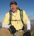
Snowmass Crew on K2
Seeing that most of the route was snow-free, we decided to press on, figuring we'd turn back if we reached something we didn't feel comfortable on. The backup plan was moved to the back of our minds. There was a short area of snow that needed to be climbed just past K2. The top of it is visible in the lower right corner of the shot showing the rest of the route:
Capitol from K2 Knife-edge
Getting down off of K2 was a little tricky. We started out SW down the ridge and quickly found that it didn't connect (read: overhanging cliff).
K2 cliff
Currently, the best route down to is probably to climb down a rocky rib northwest off of K2, then cross a flatter area and climb the previously mentioned snow back up to the ridge crest. We backtracked and did just this, and were shortly at the knife-edge. Climbing across this was a blast.
Knife-edge close-up
Full of adrenaline and smiling we pressed on. Here are some images showing the types of short snowy sections encountered on the rest of the route. Most was pretty easy to avoid. Spikes probably not required until it snows again.
Snow? A little snow Snow crossing Patches of snow on the ridge
We followed the cairned route most of the way up. At one point, as the cairned route circled to gain the steep east ridge of Capitol, it crossed some snow so we climbed a steep loose gully. This was the sketchiest part of the climb, in my opinion. Very exposed with terrible rock. We descended the cairned route and found it to be much better. Taken near the top of that gully, the cairned route goes right across that snow below in this picture.
Steep and loose gully
Great success! Stunning views from the summit, a 30 minute break, group photo, and then we began the long trek back down. Connie and Brian were approaching the summit right as we headed off, so they had it all to themselves as well. We congratulated them on their second to last peak. They were hoping to finish on Snowmass in a couple weeks.
Crew on Capitol summit The other Elk 14ers
The descent went well, but not quickly. As we finished crossing the knife-edge on the return, a friendly fellow shouted to us from near the top of K2, asking for beta regarding the overhanging cliff we had surveyed earlier from above and below. He went off K2 the same way we had and we met up with him near the top of the small snow field mentioned earlier. We chatted briefly about the route, the fact that this was his finisher, and a brief detour that he had taken up the snow towards Clark. Then he introduced himself as Dancesatmoonrise. He probably didn't recognize my user name, as I'm pretty new to the game and the forum, but I sure recognized his. We wished him luck and congratulations and then started back up K2.
About this time we started to run out of water. We had each carried about 3L, underestimating the heat of the day and the amount of time the trip would take us. As we descended from K2, we decided to follow the valley and look for snow melt. We found a pool and took a break to pump water and were really glad that we had the pump. That water was quite tasty. As we sat hydrating, our minds began to wander towards our backup plan.
While we sat hydrating, I was telling the crew how amazing Dancesatmoonrise's photos and trip reports are. A perfect and relevant example.
Shortly after resuming our descent, we found some mysterious tracks in the snow below Clark...
Dancesonsnow?
The climb down the low point in the valley took much longer as we tried to navigate through a slippery mix of snow and rock. It was difficult to regain the dry rock that we had climbed earlier. The lower valley is relatively snow free.
Daly in a different light
We powered through though and returned to the lake around 3pm. The weather had remained absolutely beautiful all weekend.
Amazing colors
We went about packing up camp, enjoying some of the backup plan and thereby lightening our load a little. Connie and Brian came down shortly after us and we chatted briefly again on the way out. Brian took up our offer for a cold can after a long day. The hike out was also beautiful. We got to the car shortly after nightfall, tired, hungry, and happy.
Stella advertisement? Sun setting on Capitol
Trip times:
Trailhead to lake - 3:00
Lake to K2 - 2:25
K2 to summit - 2:00
Summit to K2 - 2:30
K2 to lake - 2:20
Lake to trailhead - 2:30
Total time - 14:45
These times don't include a 30 minute summit break or 15 minute water pumping session
Thumbnails for uploaded photos (click to open slideshow):
Love it!
Always good to have a back up plan!!
Congrats on the summit - Cap is an amazing mountain.
One of the most strikingly beautiful mountains/areas in the state, IMHO.
Great job, guys! Yes, the mountain and the setting are simply amazing! Always fun to see and read another Capitol report! And a bonus to meet Dances! Thanks for the post!
We were going to make a special trip up this weekend to take pics of Capitol from the trailhead with the aspens (hopefully yellow/orange) in the foreground. But it looks like they are still green. Do you think they will be anywhere near 'peak' this weekend?
Smitty, they were starting to change in the area near the trailhead last weekend. I am sure that the colors will be great between this weekend and the following one. I think you should see some good colors if you go this weekend.
Great report. We had considered this a couple wks ago on our annual trip...right as the moisture had come in so we pursued our backup plan (in our case that was Belford, Oxford & Harvard). I was so jealous reading your report and seeing the pics - can't wait to give it a try next year on our annual trip from Ohio and South Carolina!
Caution: The information contained in this report may not be accurate and should not be the only resource used in preparation for your climb. Failure to have the necessary experience, physical conditioning, supplies or equipment can result in injury or death. 14ers.com and the author(s) of this report provide no warranties, either express or implied, that the information provided is accurate or reliable. By using the information provided, you agree to indemnify and hold harmless 14ers.com and the report author(s) with respect to any claims and demands against them, including any attorney fees and expenses. Please read the 14ers.com Safety and Disclaimer pages for more information.
Please respect private property: 14ers.com supports the rights of private landowners to determine how and by whom their land will be used. In Colorado, it is your responsibility to determine if land is private and to obtain the appropriate permission before entering the property.


 View from the trailhead")
 Unbeatable scenery")
 Backup plan front and center")
 Alpenglow on Capitol")
 Capitol on Capitol")
 Yikes!")
 Sunrise")
 Early light on Daly")
 Snow in the basin")
 K2")
 Snow on K2")
 Snowmass")
 Crew on K2")
 Capitol from K2")
 Knife-edge")
 K2 cliff")
 Knife-edge close-up")
 Snow?")
 A little snow")
 Snow crossing")
 Patches of snow on the ridge")
 Steep and loose gully")
 Crew on Capitol summit")
 The other Elk 14ers")
 Dancesonsnow?")
 Daly in a different light")
 Gully down from saddle")
 Amazing colors")
 Stella advertisement?")
 Sun setting on Capitol")