Download Agreement, Release, and Acknowledgement of Risk:
You (the person requesting this file download) fully understand mountain climbing ("Activity") involves risks and dangers of serious bodily injury, including permanent disability, paralysis, and death ("Risks") and you fully accept and assume all such risks and all responsibility for losses, costs, and damages you incur as a result of your participation in this Activity.
You acknowledge that information in the file you have chosen to download may not be accurate and may contain errors. You agree to assume all risks when using this information and agree to release and discharge 14ers.com, 14ers Inc. and the author(s) of such information (collectively, the "Released Parties").
You hereby discharge the Released Parties from all damages, actions, claims and liabilities of any nature, specifically including, but not limited to, damages, actions, claims and liabilities arising from or related to the negligence of the Released Parties. You further agree to indemnify, hold harmless and defend 14ers.com, 14ers Inc. and each of the other Released Parties from and against any loss, damage, liability and expense, including costs and attorney fees, incurred by 14ers.com, 14ers Inc. or any of the other Released Parties as a result of you using information provided on the 14ers.com or 14ers Inc. websites.
You have read this agreement, fully understand its terms and intend it to be a complete and unconditional release of all liability to the greatest extent allowed by law and agree that if any portion of this agreement is held to be invalid the balance, notwithstanding, shall continue in full force and effect.
By clicking "OK" you agree to these terms. If you DO NOT agree, click "Cancel"...
Starting elevation: 10,700
Start time: 5.15am
Summit of El Diente: 9.00am
Summit of Mt. Wilson: 12.30pm
Return to camp: 4pm
We had planned to do this trip a week or two ago during weekdays, unfortunately our cat had to go under teeth surgery (how ironic, his "dientes" are in bad shape), so we had to postpone it for later in the month. Our initial plan was to leave on Thursday and climb both peaks on Friday, however we took a look at the weather and finally decided to climb Saturday instead.
We arrived at the Kilpacker basin on Friday afternoon around 5pm, loaded our packs and hiked in to about 3.5 miles. The hike is very nice and soon we had magnificent views of El Diente in the distance, we got a view of a double rainbow!
Double rainbow at basin
El Diente and waterfall
We decided to start early, the plan was to get both peaks in the same day, but not to do the traverse. We did not feel comfortable with the traverse, and figured out it would take us almost the same amount of time to descent about a thousand feet and ascend again on the Mt. Wilson side. Also, we did not know how the weather was going to turn out.
We met only one hiker going up El Diente, R.C. (nice to meet you!), he was faster and got to the summit earlier than us. We met him on the way down as he was starting the standard traverse.
Here are some shots of our ascent of El Diente. Somehow we missed the turn to the organ pipes, and we ended up doing some class 4 moves just to the left of them. I later realized there was a cairn that was misleading the way.
Route finding...
route finding...
Then the route goes through a gulley which is pretty obvious and crosses the ridge to the north side. Again, it is a bit confusing where the trail goes, it goes down and then up, we probably spent more time here trying to figure out the way up than we should have. We climbed onto a rock on the left side that looked like the summit, but it was not! But, finally the real summit is there!
On top of El Diente
Wilson Pk in the distance
It was only 9am and our energy still going, so we thought we would attempt Mt. Wilson by just down climbing to about 13,000 feet and traversing from there. We had studied the nice trip reports that were described using the south slopes from Mt. Wilson (including the excellent TR from Carl and also the picture that Danceatmoonrise had included in his recent trip report to El Diente). So, we felt pretty confident that we would spot the route going up.
Oh, on our way down El Diente we met quite a few hikers coming from the north slopes, here is a shot showing some of them on the right and some others at the center of the gulley. This time we hit the organ pipes just right.
Pic. taken from the organ pipes
at the organ pipes
So back to our conquest to the summit of Mt. Wilson, we descended to about 13,000 and started traversing towards it. Just at the bottom of the slope that goes up Mt. Wilson we met R.C. again, he had completed the traverse and summited the peak and was on his way down, he was very fast! We chatted for a while we filtered some water and then we started up towards the gulley. We were surprise to find so much snow still in this area.
Here is a shot of the ascent on one of the snow slopes, I am hiking up, almost at the top of the snow field (middle of the picture). The route to the top can not be seen from here.
Snow field going towards Mt. Wilson
And this is a pic of the slope looking back, not bad, just some talus and loose rock, but we knew we were the only ones on the route, so we did not worry much about rock fall from above. This was taken at about 13,700 on the slope, so we were really close and the ascent had not taken too much time yet.
Looking back at the gulley
We kept looking at the clouds as they developed and I remember looking up and thinking "as long as the sky is blue we are in good shape...", and it was! You can see it in the next picture. But, that was not going too last long...
Ridge above
We spotted the gulley on the right side that would take us close to the summit and then remembering the route described by Carl we decided to tackle the summit by just going up straight to the top. Here is a shot of the summit section, we knew that if we went to the ridge too far to the left we would have to deal with the class 4 rock section, so we took a direct approach up. I think we ended up doing some tricky moves anyway. Sometimes it gets confusing when you are so close.
Final pitch
And finally got to the summit where a magnificent view of El Diente could be seen. It was about 12.30pm.
View of El Diente and part of the ridge
The funny thing is that there was somebody else on top of Mt. Wilson, he probably came from the north side. We said hi and tried to talk to him, but he spoke no words... not even eye contact... weird... that is the first time we encountered somebody like this on one of the summits. More funny yet is that we would see him again two days later on top of Wilson Peak! Same behavior... amazing...
And, as you can see in the last picture, clouds had already developed quite a bit and looked mean. We probably spent not even more than 5 minutes at the top and decided it was time to get down, the mountain was kicking us out. We started down the gulley on the right this time since it was more protected from the weather.
Till it got steeper and it was time to traverse to the next gulley.
Too steep, time to traverse over
And here we heard KABOOM, a lighting strike had just hit the ridge above us! Scary, but fortunate to have found a little hole in between some big rocks where we could hide for a while. We waited till the lighting storm passed, and amazingly there was no rain yet. After we heard no more thunder, we decided to continue down.
A look at the basin
Looking back at the peak and the gulleys we descended, there were no clouds and the sun was shinning again this is Colorado weather! No rain yet.
A look back at our descent
Back on the trail that leads to Kilpacker basin.
And we got to enjoy the views we did not see early in the morning in the dark.
So, our little traverse took us about 3 hours from el top of El Diente. We figured out that this was exactly the same amount of time it would have taken us if we had done the standard traverse. BUT we had an advantage doing it this way, we were not committed to go all the way to the summit in case the weather had been bad and I am glad we did it this way. There was always an escape from our route and we kept watching those clouds above us. Also, it was kind of fun to route find on our own and figure out the best way to go, there are so many options on a mountain...
Just as we got back to our tent the raindrops were falling... our feet felt tired from hoping from boulder to boulder... it felt good to rest for a day before we attempted Wilson Peak (coming next).
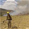
What a beautiful place!
Thumbnails for uploaded photos (click to open slideshow):
I knew you guys were going to make it! I thought about making an informative trip report covering the Mt. Wilson accent from Kilpacker, but this was much better than anything I could have thrown together. I was worried that you guys were going to get some of that noon time thunderstorm, but from your El Diente picture it looks like I was the only one that got to enjoy that downpour at my camp! It was best that way. Congrats on getting both peaks in a day without the traverse and a pleasure meeting you two! This report will help a lot of people with the Kilpacker accent. Happy climbing.
I like your traverse without doing the traverse! You commented on my El Diente report a couple weeks ago that you would be there soon. Glad that you got El D and Wilson!
For giving folks an alternate way of summiting ED and Mt Wilson in a day without the traverse. Some very valuable information in there.
Glad to hear from another cat fan. We've got 3 at home. Dogs and cats are both great, actually. Cats are so unlike their stereotypes though. Fantastic pets, for the most part.
Caution: The information contained in this report may not be accurate and should not be the only resource used in preparation for your climb. Failure to have the necessary experience, physical conditioning, supplies or equipment can result in injury or death. 14ers.com and the author(s) of this report provide no warranties, either express or implied, that the information provided is accurate or reliable. By using the information provided, you agree to indemnify and hold harmless 14ers.com and the report author(s) with respect to any claims and demands against them, including any attorney fees and expenses. Please read the 14ers.com Safety and Disclaimer pages for more information.
Please respect private property: 14ers.com supports the rights of private landowners to determine how and by whom their land will be used. In Colorado, it is your responsibility to determine if land is private and to obtain the appropriate permission before entering the property.


 Double rainbow at basin")
 El Diente and waterfall")
")
 Route finding...")
 route finding...")
 On top of El Diente")
 Wilson Pk in the distance")
 Pic. taken from the organ pipes")
 at the organ pipes")
 Snow field going towards Mt. Wilson")
 Looking back at the gulley")
 Ridge above")
 Final pitch")
 View of El Diente and part of the ridge")
")
")
 Too steep, time to traverse over")
 A look at the basin")
 A look back at our descent")
")
")
 What a beautiful place!")