Download Agreement, Release, and Acknowledgement of Risk:
You (the person requesting this file download) fully understand mountain climbing ("Activity") involves risks and dangers of serious bodily injury, including permanent disability, paralysis, and death ("Risks") and you fully accept and assume all such risks and all responsibility for losses, costs, and damages you incur as a result of your participation in this Activity.
You acknowledge that information in the file you have chosen to download may not be accurate and may contain errors. You agree to assume all risks when using this information and agree to release and discharge 14ers.com, 14ers Inc. and the author(s) of such information (collectively, the "Released Parties").
You hereby discharge the Released Parties from all damages, actions, claims and liabilities of any nature, specifically including, but not limited to, damages, actions, claims and liabilities arising from or related to the negligence of the Released Parties. You further agree to indemnify, hold harmless and defend 14ers.com, 14ers Inc. and each of the other Released Parties from and against any loss, damage, liability and expense, including costs and attorney fees, incurred by 14ers.com, 14ers Inc. or any of the other Released Parties as a result of you using information provided on the 14ers.com or 14ers Inc. websites.
You have read this agreement, fully understand its terms and intend it to be a complete and unconditional release of all liability to the greatest extent allowed by law and agree that if any portion of this agreement is held to be invalid the balance, notwithstanding, shall continue in full force and effect.
By clicking "OK" you agree to these terms. If you DO NOT agree, click "Cancel"...
Peaks: Day One: Wilson Peak, Mt. Wilson
Day Two: El Diente
Day Three: Maroon Peak
Routes: Standard, except El Diente via Kilpacker
Dates: August 7-9, 2011
Length: 37 miles RT, total
Vertical: 16,100 feet, total
Total time incl camping/driving b/t peaks: 56 hours
Ascent Party: Solo, except El Diente with Oldschool
The summit of Mount Wilson, looking west across the traverse to El Diente Peak.
Ah yes, the Wilson's... No Fourteener Rite of Passage is complete without them. They have a deserved reputation for being loose and dangerous.
Here's what I conclude from pre-ascent research:
1. The south side of El Diente (Kilpacker approach) is less unstable and safer than the north side, at least without snow.
2. The above is also true for Mt. Wilson.
3. The south side of the massif is generally less steep.
4. The traverse is not an unreasonable undertaking, though two lives were claimed in separate incidents last year.
5. Wilson Peak is short enough from the Silver Pick TH to do on the afternoon of the drive down, assuming good weather.
Based on the above, my original plan for the lowest-risk attempt: Day One: Drive down to Silver Pick TH, attempt Wilson Peak, drive over to Kilpacker, camp. Day Two: Attempt El Diente from Kilpacker, traverse to Mt. Wilson, descend Mt. Wilson back into upper Kilpacker, back to the car.
Wildflowers near the start of the new Silver Pick Trailhead.
I find it interesting that Jodi O'Hara says she is surprised I'd rather do the traverse than the north side of Mt. Wilson. I would think, in general, a ridgetop should have slightly more solid rock, if perhaps a slightly greater degree of technical difficulty. Technical difficulty is an easy trade for loose rock.
Still, Jodi doesn't like risk any more than I do, so she has me thinking. On the drive down, I estimate some times and figure maybe I can get both Wilsons out of the way the first day. This would make it more plausible to get Maroon Peak on day three. Which would be sweet, because I'd then come home with everything done but the finisher.
The new Silver Pick trail takes one into the Elk Creek drainage, one drainage west of Silver Pick Basin, then traverses back over to the Silver Pick Basin just above treeline.
I leave Springs at 6:00 am Sunday, and after an uneventful drive, get on the trail shortly before Noon.
Leaving on a Sunday makes more sense than traveling on a weekday, as this avoids the usual summertime road construction delays.
Plenty of scree on the new trail becomes somewhat fatiguing on the return.
Just beyond the crossover point and back into Silver Pick Basin, high above the private property owner's place. This is good. Congrats to all those whose hard work went into the negotiations and rerouting.
Nearly at the Rock of Ages saddle, looking roughly north. The upper section of the trail is still loose. It's safer to stay on the trail and not attempt to cut the switchbacks.
El Diente is seen from the Rock of Ages saddle.
At the saddle in about an hour and a half, things are still looking good to get a late day ascent of Mt. Wilson after after tagging Wilson Peak. The weather is holding nicely.
Looking back west to the ROA saddle.
Mt. Wilson to the south. Gladstone Peak is at left.
Looking back west into the upper SP Basin from the Wilson Peak summit ridge.
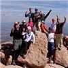
The day is quite festive. Lots of folks are on the mountain. Ryan (Baumgara) has his finisher on Wilson Peak today.
Baumgara presides over the finisher entourage, with Lizard Head Peak at his left shoulder.
Upper Wilson Peak summit ridge. It's not as hard as it looks. A little reminiscent of Wetterhorn's third class section.
Wilson Peak's false summit, high above the Navajo and Silver Pick basins.
Typical exposure on Wilson Peak.
By 2:40 pm I'm on the summit of Wilson Peak. The weather is holding beautifully, so I figure Mt. Wilson is in the cards today. Still, I know it will be a headlamp descent, at least from the ROA saddle.
Lizard Head is on the list for post-finisher climbs.
Up next: Main course.
Visual navigation gets a little tougher once on Mt. Wilson's north side approach.
I study the route description and photos from the ROA saddle before dropping into the Navajo Basin to attempt Mt. Wilson's north side. Identifying the summit and key features on either side pays off during the ascent.
In the photo above, I'm to the right of the route. I ascend here and cut left to the ridge, where a good trail is evident. Several descending parties describe no trail past the lower ridge. While the trail gets tougher to follow, staying on-route reveals identifiable trail segments the entire way.
Most summers, I imagine the lingering snow looks similar to the above photo. The trail goes just below the highest, left snowfield, then traverses up and right. The summit lies between the two obvious snow-filled couloirs.
Route-finding gets tougher above the well-defined trail. Which bump is the summit?
Higher up, the summit becomes even more elusive.
Be careful of parties above you. Two people died in separate accidents on this range last August, due to rockfall. While climbers generally know this, not all are experienced, and unfortunately some have an attitude. If you encounter parties above, call out, and ask for a response. If no response, try several times, and if still no response, strongly consider an alternate plan.
There are trail segments and cairns all the way, if one stays on-route. The terrain is loose here, but gets worse if off-route.
Continuing to aim for the visual landmarks, one reaches the notch, which joins the traverse route, below the last section of Mt. Wilson's beautiful, solid summit ridge. Though the mountain is generally loose, the summit blocks are solid.
Peering into upper Kilpacker Basin from near Mt. Wilson's summit.
This is the best part of the route. The summit blocks are sheer joy. I take it straight over the top. At the crux block, there is a sort of hidden right hand hold, up and right, very positive, which can be gained after stepping up on the first good foothold on the large block. A little committing, perhaps, but not hard. It is also not terribly difficult to downclimb this section on the descent.
Those beautiful summit blocks before a rising moon...
Exposure on the right....
...and exposure on the left.
At the crux block.
Please excuse the blown highs and out of focus image, below - I'm shooting with the left hand while the other three paws are in the middle of making crux moves on the summit block.
Getting one paw off to make a shot through the fourth-class crux.
Looking back north across the summit ridge.
If you've never been there, one point of confusion might be that while the traverse goes east-west, there is a notch just a hundred feet north of the Mt. Wilson summit, so this last section of the summit ridge is actually has a north-south orientation. The north approach (standard route) joins the traverse at this notch. Both routes then go south and up over the north-south oriented blocks.
There is a walk-off on the "back" side - to the southwest - which comprises a nice route to and from the upper Kilpacker basin. This route can be used to gain or descend Mt. Wilson via the Kilpacker Basin, which in retrospect, I feel is a less risky option, due to the loose nature of the standard route. See Benners' excellent trip report of July 2010, as well as LynnKH's report from about August or September 2010, for more details. Benners has a route description and line drawn in.
Another view of the summit blocks. The west side of the notch can be seen at lower left.
The descent goes quickly and efficiently. The goal is to make ROA saddle before dark.
Late day sun in upper Navajo Basin.
I figure climbing 800 verts out of the drainage is going to be fatiguing, but it isn't too bad. The new ROA trail gets a little old, though. Total vertical on the day is about 6500 feet and mileage, about 12 or 13 total.
I chuckle as I think about hiking out in summer by headlamp. Don't we get enough of that in winter? : )
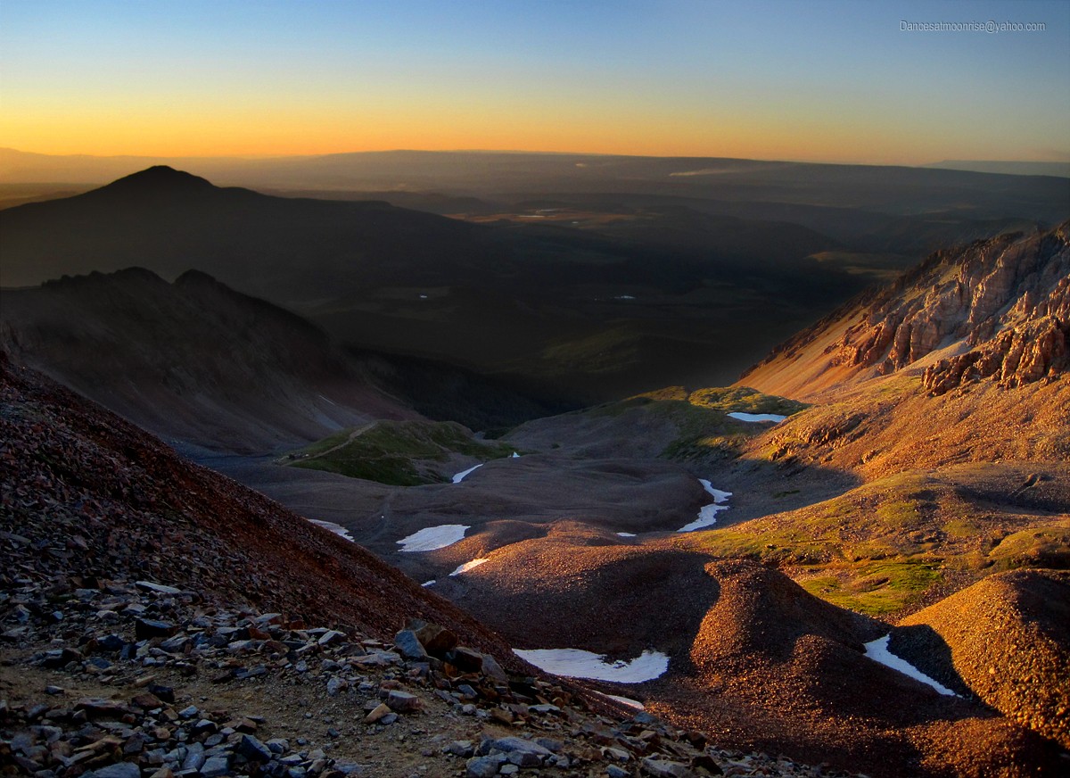
Moonrise over Mt. Wilson.
The solitude and beauty are outstanding this time of day...
Finally back to the car about 10pm, I slam down some food and water, and head over to the Kilpacker Traihead to meet Mike ("Oldschool.")
He's awake, so we tip a beer and chat a while. The next day we approach El Diente via Kilpacker.
(To be continued....)
The sun sets on upper Silver Pick Basin, August 7, 2011.
Ok all, I ran into Jim about 2:00pm while descending Wilson Peak. He then went on to do Mt. Wilson in the late evening; well done, I think a few would be timid to continue on.
Oh and good job going over the crux block on Mt. Wilson, that's some spicy exposure, right?; imagine doing it in mountaineering boots in May.
Nice meeting you on Wilson Peak. That's a great picture you took of our group. We had a much more casual day than you did. You needed some champagne to take the edge off. Have fun on Capitol.
It looked like you had a great day. I wish I could have joined you for these peaks. I will have to wait a little longer. 30 days away for me. Awesome pics too!! I am really looking forward to the Wilson's.
Nice tr. Now that I have done all three peaks, I woul rather do the traverse. Of course I have not done the travers so I guess I cannot vote yet. Thanks for the info pre-climb on eldent. Maybe I will actually get to hike with you some day. Fyi- I defended eldent in 3 1/2 hours.
I am going to use this to do nearly the same trip summer 2012. Thanks for posting. I think I will stay overnight at the TH to get an earlier start, then head over to Kilpacker on the next day arriving earlier. Well done. Vort.
Damn those last few pictures bring back some great memories. Spent a couple nights in Navajo Basin and did the Wilson Peak climb. Had to take last summer off due to knee reconstruction but looking forward to doing El Diente and Mt. Wilson this summer.
Caution: The information contained in this report may not be accurate and should not be the only resource used in preparation for your climb. Failure to have the necessary experience, physical conditioning, supplies or equipment can result in injury or death. 14ers.com and the author(s) of this report provide no warranties, either express or implied, that the information provided is accurate or reliable. By using the information provided, you agree to indemnify and hold harmless 14ers.com and the report author(s) with respect to any claims and demands against them, including any attorney fees and expenses. Please read the 14ers.com Safety and Disclaimer pages for more information.
Please respect private property: 14ers.com supports the rights of private landowners to determine how and by whom their land will be used. In Colorado, it is your responsibility to determine if land is private and to obtain the appropriate permission before entering the property.