Download Agreement, Release, and Acknowledgement of Risk:
You (the person requesting this file download) fully understand mountain climbing ("Activity") involves risks and dangers of serious bodily injury, including permanent disability, paralysis, and death ("Risks") and you fully accept and assume all such risks and all responsibility for losses, costs, and damages you incur as a result of your participation in this Activity.
You acknowledge that information in the file you have chosen to download may not be accurate and may contain errors. You agree to assume all risks when using this information and agree to release and discharge 14ers.com, 14ers Inc. and the author(s) of such information (collectively, the "Released Parties").
You hereby discharge the Released Parties from all damages, actions, claims and liabilities of any nature, specifically including, but not limited to, damages, actions, claims and liabilities arising from or related to the negligence of the Released Parties. You further agree to indemnify, hold harmless and defend 14ers.com, 14ers Inc. and each of the other Released Parties from and against any loss, damage, liability and expense, including costs and attorney fees, incurred by 14ers.com, 14ers Inc. or any of the other Released Parties as a result of you using information provided on the 14ers.com or 14ers Inc. websites.
You have read this agreement, fully understand its terms and intend it to be a complete and unconditional release of all liability to the greatest extent allowed by law and agree that if any portion of this agreement is held to be invalid the balance, notwithstanding, shall continue in full force and effect.
By clicking "OK" you agree to these terms. If you DO NOT agree, click "Cancel"...
The road to the trailhead is a fun road on the cliffs of the mountain. We drove up at night and we could not see the cliffs, though. On the drive out this is what we saw.
That is my truck under the overhang in the canyon.
We set out at 6 AM from the lower trailhead. Because it is a relatively short hike we decided to start at the lower trailhead to get the full experience of a hike.
Route finding was really easy at first, considering it is the road. As we climbed, and the sun rose, the green valley became more beautiful by the minute.
Once at the top of the road, we were graced with the beauty of the lake just below the upper trailhead.
We met two hikers, Chelsea and Amber, who decided to hang with us for the southwest ridge route. This calls for ascending the saddle, going around behind the pinnacles, and heading up the ridge. As we climbed, the view became astounding.
This is a view from just below the saddle at the pinnacles. We followed the route description as best we could. That called for going to the left side of the pinnacles.
Below is a view of the other side. We stayed below at the edge of the pinnacles towards the rocks ahead.
We followed the route description as best we could and made it up when needed.
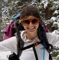
I hadn't taken many pictures of myself, so midsentence I snapped this shot of myself.
Jen had just ascended some steep stuff and was feeling strong.
The route description mentioned the kissing camels formation. We assumed this was it. Cute!
Another beautiful view!
Once we gained the actual ridge we stayed either on the ridge or climbers right of the ridge. The rock was loose in most places except right on the ridge. For this I preferred the ridge when possible. However, the exposure is high. For those with heights issues, the right side was preferred. We chose what we were most comfortable with and helped each other route find and build confidence.
We finally summited around 10 AM.
I did my ritual headstand.
After a little while we headed down. We decided to go down the standard route. Since we did not ascend this way, we were not familiar with the route. However, several other hikers came up the standard route and left the summit while we hung out. We followed in the direction they traveled and found some cairns here and there. It was decent rock and not as difficult as what we ascended. We liked the change of scenery. We followed this to the rock gulley and looked up at climbers attempting to down climb the gulley. I think that is the standard route, but what we came down was much better. When you get a chance to leave the gulley to gain better rock, I would recommend it. A group that left the summit 30 minutes before us was still in the gulley by the time we arrived there. I know you shouldn't leave the route, but we were following cairns and it was good rock to walk on.
When we reached the talus scree field we scooted/hiked down it. This was a less than desirable part of the route. However, we made it down unscathed.
The rest of the route was easy to spot and we made it back around noon. It was a beautiful hike with beautiful views.
On the way down, Matt decided to ride his bike down the road. Weather came in and dumped on me in my truck. However, Matt was just ahead of the storm and it missed him. He was cruising very fast. He met us at the hot springs in Ouray and we relaxed in the hot springs. It was nice. I would recommend going to the hot springs after hiking. It was very nice. Wilson Peak was on the schedule for the next day. To set up camp in daylight we left the hot springs at 5 PM. It was a nice, short hike up Sneffels.
Thumbnails for uploaded photos (click to open slideshow):
Good summary of the SW ridge. If I ever do this one agin that is the route. I bet the flowers were in peak form - what a great basin and location! Congrats to you, Jen and all...
Nice route...makes it a bit more challenging and scenic. Thanks for your report!
Caution: The information contained in this report may not be accurate and should not be the only resource used in preparation for your climb. Failure to have the necessary experience, physical conditioning, supplies or equipment can result in injury or death. 14ers.com and the author(s) of this report provide no warranties, either express or implied, that the information provided is accurate or reliable. By using the information provided, you agree to indemnify and hold harmless 14ers.com and the report author(s) with respect to any claims and demands against them, including any attorney fees and expenses. Please read the 14ers.com Safety and Disclaimer pages for more information.
Please respect private property: 14ers.com supports the rights of private landowners to determine how and by whom their land will be used. In Colorado, it is your responsibility to determine if land is private and to obtain the appropriate permission before entering the property.


")
")
")
")
")
")
")
")
")
")
")
")
")
")
")
")
")
")
")
")
")
")
")
")
")
")
")
")
")