| Peak(s): |
Mt. Audubon - 13,217 feet |
| Date Posted: | 02/19/2011 |
| Modified: | 02/20/2011 |
| Date Climbed: | 02/19/2011 |
| Author: | jameseroni |
| Peak(s): |
Mt. Audubon - 13,217 feet |
| Date Posted: | 02/19/2011 |
| Modified: | 02/20/2011 |
| Date Climbed: | 02/19/2011 |
| Author: | jameseroni |
| Audubon - SE Ridge Winter |
|---|
|
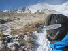
Well.. What a climb. I would call this a true mountaineer's route (winter) - easily. Everything was encountered. Class 1 snow showing through low class 5 mountaineering on a steep rock/snow/ice face. Surprisingly enough, we did it all without a rope - as was recommended by most folks who have done the route before. Here is some true beta - if you're going to attempt this route, be prepared for a long grueling climb. If you're going to attempt this route in the winter, please do not attempt it without an ice axe and crampons. I used Microspikes, leaning on some older beta I had uncovered. Let's just say it was was sketchy at the very least. Snow covered rock (with veriglass underneath) that sticks out just enough to make you stand there and think, how in the heck do I get around this one? Up until the notch the route is pretty straight forward. Gain the ridge one of many different ways - although I think picking a rock band above Mitchell lake is probably the best way. If you pick the rig ht rock band you'll come out on top of the ridge underneath a large snow hump, where just above lies the beginning of the ridge. Traverse around to the north (back side) of this hump then climb another rock band to access the ridge direct. On the ridge we encountered waste deep snow. This was a post holing nightmare, consuming up vital calories we would later need for the notch decent, exit. Lesson learned - bring more food, and the right kind of food! Once you gain the ridge direct, be prepared for wind blown snow covering talus, loose rock, narrow paths and a decent slog. The best way we found to down climb the notch was to down climb to the climbers right (north side) on a system of ledges. This was very sketchy with all of the snow we have had this winter. Also, the sun was high in the sky by this point causing enough melt off of the snow to expose the icy surface underneath. You'd think this would help with a foresight to secure footing but there aren't many options. After an inner anxiety building down climb, prepare to cross the notch and meet your maker. I made the foolish mistake of telling myself I had overcome the crux of the climb. I wasn't prepared for what was in store. As you'll see in the photographs, the exit from the notch is the most difficult part of the climb. This is where the snow covered talus/veriglass/loose rock and ice run outs really come into play. Without an ice axe and crampons I would say this is nearly impossible. I honestly don't know how I managed with simply micro spikes. I think this out climb would be much simpler with less snow. Almost the entire out climb face was covered with snow. What little rock was exposed was nearly vertical or very hard to gain a hand hold on. There also weren't many options for the ice axe. Several swings of the axe into bottomless snow would scarcely cough up a good hold. With some motivation (the thought that I must get up and off this mountain) and some focus, we were able to negotiate the crux of this climb without incident (other than a large sense of anxiety, a somewhat slight sense of panic at times and sheer thankfulness to our creator once we gained the class 2 ridge leading to the summit). So we set out at about 1935 hours on the 18th of February. Temperatures were perfect and the sky was crystal clear. There was to be a forecast for the 19th of a 9-12mph wind with maybe some blowing snow. The high for the day was to be 33 degrees on the summit of Audubon. These were fair conditions and we decided to give it a go. Here are our cheery faces as we prepare the long slog up to the Mitchell Lake Area. My wife told me I need to get one of those picture frames that holds two pictures for comparison. See last photo and compare with this one.  On the way to our campsite. Still a beautiful evening. Not a sound of wind. The soft snow must have been absorbing any noise coming our way. There is something very special about a quiet alpine evening.  We make it to camp at about 2200 hours if I remember correctly. A little over 2mph. A brisk pace but still slow enough to enjoy the evening. Time to brew up some cocoa, eat a little chow and hit the rack. Matt being over zealous with his jetboil. 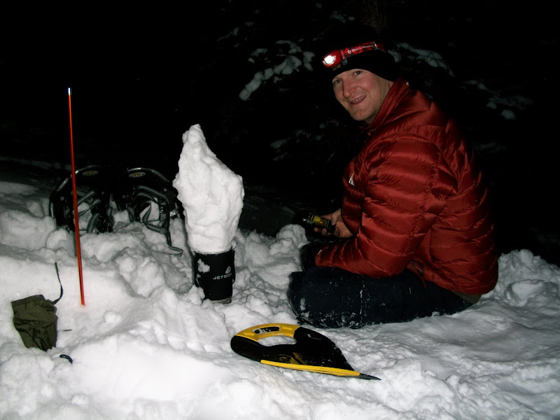 Camp is setup. Time to simmer down. 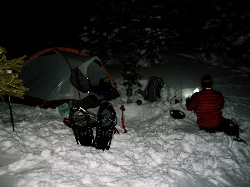 I'm enjoying the evening thoroughly. Not even cool enough for a large down parka.  So the night goes well and we sleep like babies from 2300 until revile at about 0500 hours. After about and a half jacking around in camp, we finally get started at 0630. What a great view of Toll in the center here. Also shows the SE ridge route of Audubon. Not a good picture for scale as the ridge appears to be gentle and gradually increasing when the fact is it's quite the opposite. 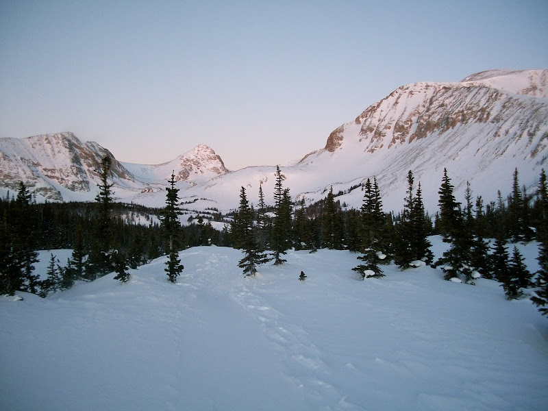 Can't see the summit (she's behind the false summit) but here's a morning view of Audubon. The SE ridge is slightly visible. We took the first large rock band on the right to access the ridge.  The wind was just strong enough for something to cover the f ace, but otherwise not too bad. Another great alpenglow view.  Great shot of the glorious Mt. Toll. 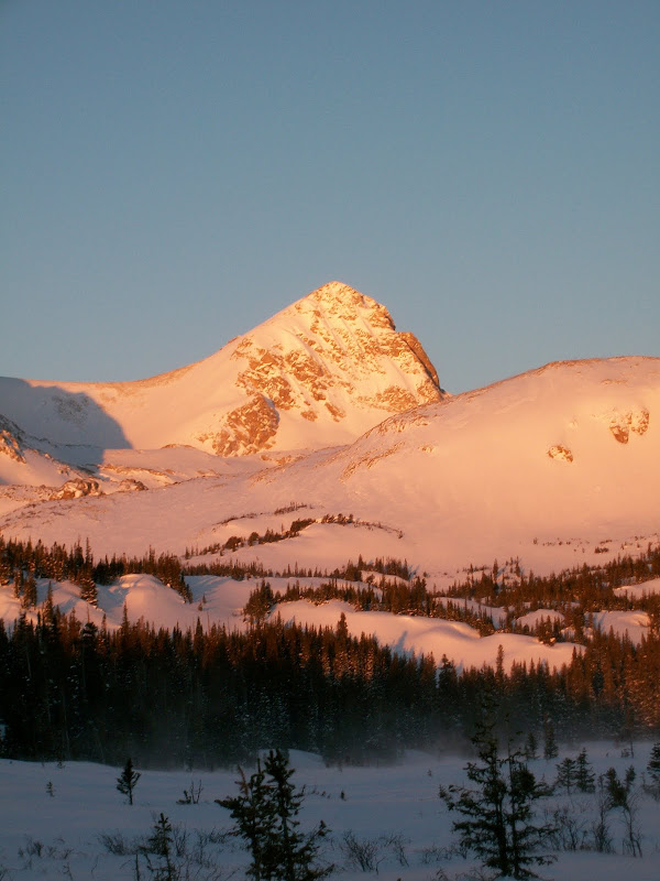 On the way to gain the ridge. 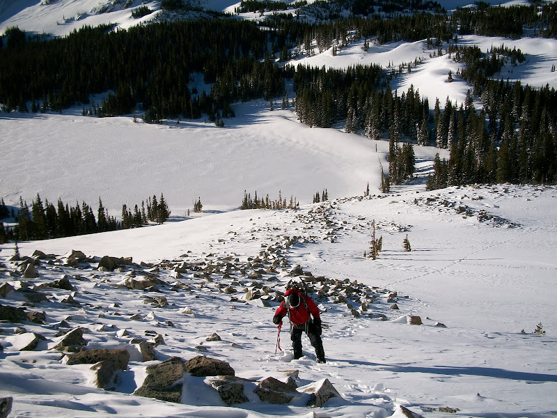 After gaining the ridge direct, the wind blown snow becomes somewhat of a nuisance. It's disappointing to expend SO MUCH energy post holing for an hour only to see you've gained minimal ground. 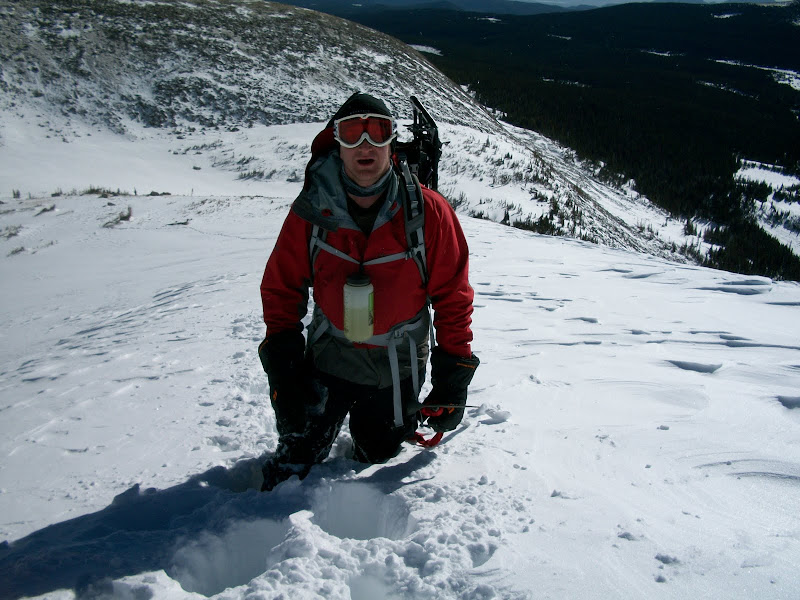 Pretty soon we start to talus hop along the ridge, after the nightmarish post holing. 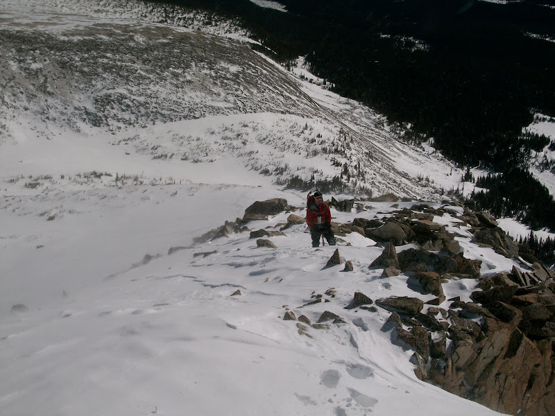 A photo depicting the rest of the ridge upward toward the notch. It was steeper than this, photo not good for scale.  A view of the out climb after the notch. We took the route on the left side of the photo, seemingly easiest. It was not easy. There were lots of "tiny" crux's. They were all tiring and demanded full attention. One of the problems I mentioned earlier was the sun had made for some interesting melting conditions. Things were not in prime climbing condition, that's for sure. If you look at the top center of the photograph you will notice a rock out cropping. This was another crux. The rocks in that photo are larger than a person, for scale. 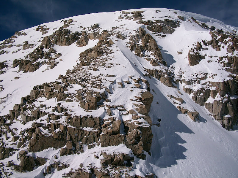 Matt down climbing part of the notch. He later states this was his crux. He had crampons- because he does not own micro spikes. I was wearing the spikes only, wishing I had worn my crampons by this point. 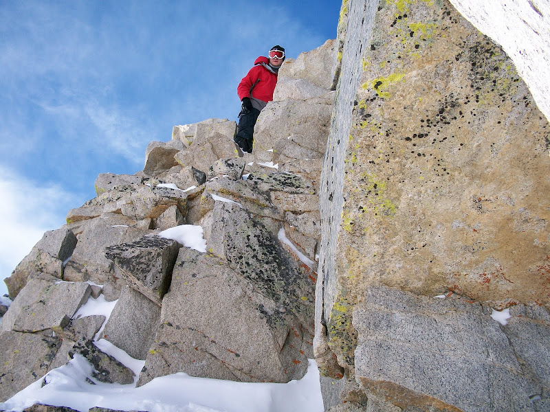 The down climb out of the notch. Notice the foot prints across the snow bridge.  Even though I had some anxiety at this point (this is one of the more demanding winter climbs I have been on) I still had the gumption to take a photo. Matt climbing up one of the steeper sections.  It was very steep.  Here is matt approaching the final crux. At the bottom center of the photo is the rock outcropping I was speaking of earlier. The rock pushes you outward and away from the face, making for some hairy moves. I lent my ice axe as a hand and he exited just a few moments after me.  Looking back down on the notch.  A well deserved break at the top of the out climb. From here, easy (ha) class 2 scrambling. 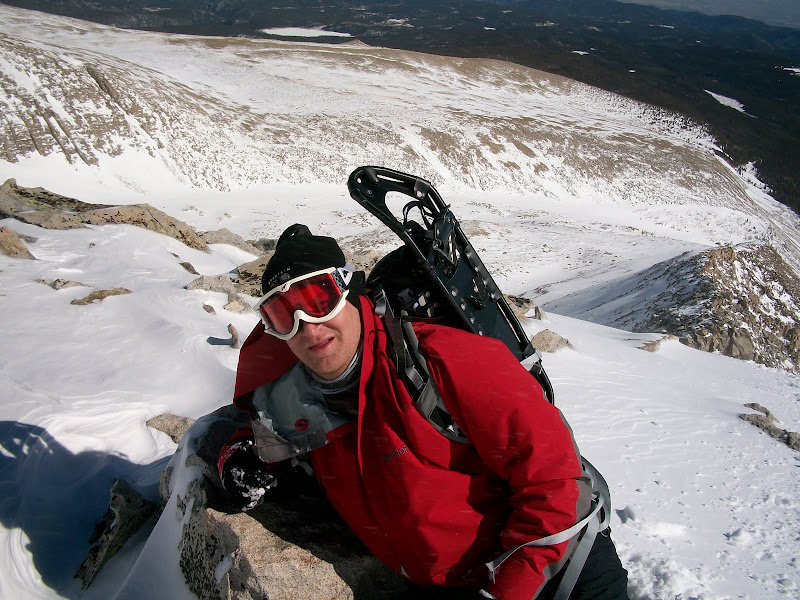 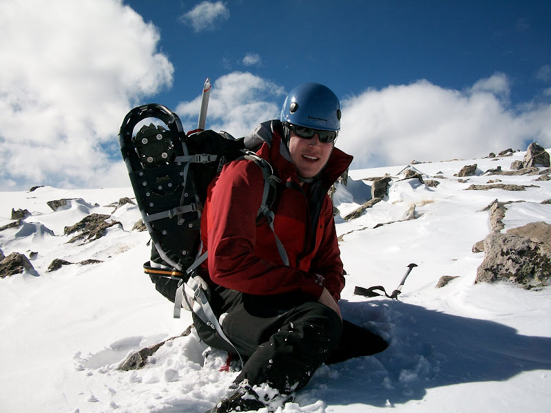 By this point we were pretty spent. Matt doesn't get out as much as he'd like to (work commitment) so he was definitely feeling the altitude. He had also injured his left ankle a few weeks prior and it began acting up again. After the rigors of the notch and the out climb, we took a brief break on top. It was at this point I noticed he wasn't feeling well. He had just run out of food and may have been eating too many sugary products on the way up. I ate a lot of high sugar content foods as well but I believe my body handles it differently than his. He was tuckered out and decided the top of the SE ridge would be his summit for the day. On my way to the summit I encountered a kind gentleman named Ian. I told him Matthew had just run out of food and hit his "summit" for the day. I had only sugary products left and this was adding to Matt's nausea. Ian is a great mountaineer - he gave Matt two granola bars and some gold fish. This helped him to find the strength to finish our trek. I don't like talking about myself so I'm not going to post my summit photo. I believe I topped out around 1pm. We hadn't anticipated the difficulty of this climb and it took a little longer than we had liked. Obviously, it was a great learning experience for both of us. We have not (and never will) attain. Never stop learning. The final slog to the summit 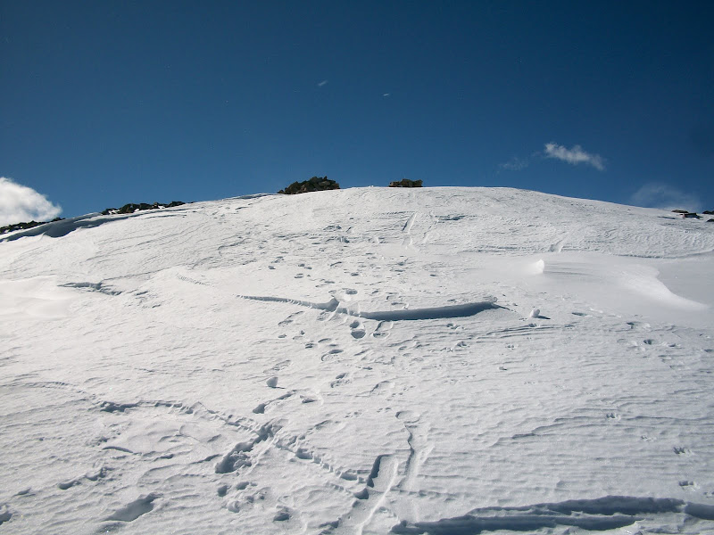 A view of Audubon after we reached the bottom. She's a big nasty. We descended part of the standard route, then dropped off into some steep snow slopes which led directly to our camp. The snow wasn't talking - we took the risk rather than go a mile or two around to have to post hole back through tree line to find our camp. On the very right of this photo, there is a band of trees. We descended in these trees. Our camp was just to the east of Mitchell Lake. 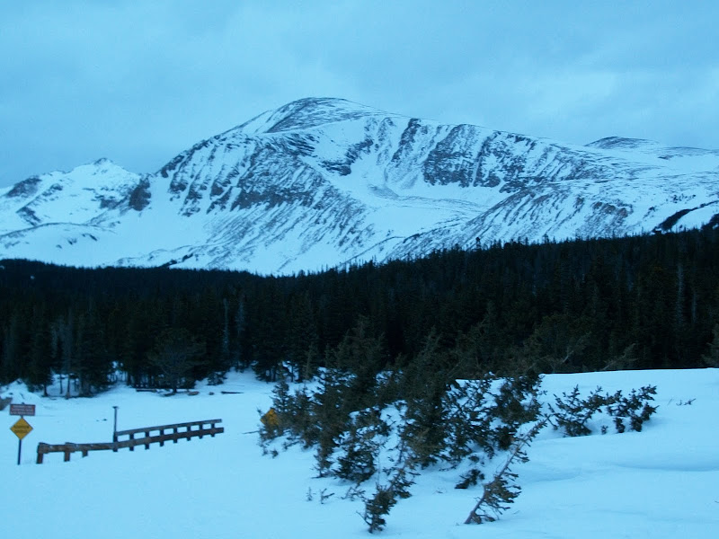 What a climb. A big learning experience for the both of us. SE ridge is a TOUGH route in winter. I don't care who you are. The risk is definitely there. It's a committing route and shouldn't be attempted on a bad day of weather if can be prevented. I would say ice axe and crampons are Mandatory. If you are at all not comfortable with scrambling, do not attempt this route. Down climbing on steep snow/veriglass covered rock included. Now for the final photo. Compare to the first for a laugh!  13+ miles round trip. Semper Fidelis. Here's a video of us on the ridge, before the post holing nightmare. |
| Comments or Questions | ||||||||||||||||||||||||
|---|---|---|---|---|---|---|---|---|---|---|---|---|---|---|---|---|---|---|---|---|---|---|---|---|
|
Caution: The information contained in this report may not be accurate and should not be the only resource used in preparation for your climb. Failure to have the necessary experience, physical conditioning, supplies or equipment can result in injury or death. 14ers.com and the author(s) of this report provide no warranties, either express or implied, that the information provided is accurate or reliable. By using the information provided, you agree to indemnify and hold harmless 14ers.com and the report author(s) with respect to any claims and demands against them, including any attorney fees and expenses. Please read the 14ers.com Safety and Disclaimer pages for more information.