Download Agreement, Release, and Acknowledgement of Risk:
You (the person requesting this file download) fully understand mountain climbing ("Activity") involves risks and dangers of serious bodily injury, including permanent disability, paralysis, and death ("Risks") and you fully accept and assume all such risks and all responsibility for losses, costs, and damages you incur as a result of your participation in this Activity.
You acknowledge that information in the file you have chosen to download may not be accurate and may contain errors. You agree to assume all risks when using this information and agree to release and discharge 14ers.com, 14ers Inc. and the author(s) of such information (collectively, the "Released Parties").
You hereby discharge the Released Parties from all damages, actions, claims and liabilities of any nature, specifically including, but not limited to, damages, actions, claims and liabilities arising from or related to the negligence of the Released Parties. You further agree to indemnify, hold harmless and defend 14ers.com, 14ers Inc. and each of the other Released Parties from and against any loss, damage, liability and expense, including costs and attorney fees, incurred by 14ers.com, 14ers Inc. or any of the other Released Parties as a result of you using information provided on the 14ers.com or 14ers Inc. websites.
You have read this agreement, fully understand its terms and intend it to be a complete and unconditional release of all liability to the greatest extent allowed by law and agree that if any portion of this agreement is held to be invalid the balance, notwithstanding, shall continue in full force and effect.
By clicking "OK" you agree to these terms. If you DO NOT agree, click "Cancel"...
Sorry for the late report, but I have had a few people ask about beta on some of the passes between drainages, and I was thinking about how much fun the trip was. I wish I was back there right now. Besides, Winter is over now. Time to start thinking about summer trips.
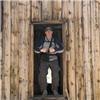
The infamous Columbine
Day One: Rich drove to my house for the drive to Silverton early in the morning. We arrived in Silverton around noon, bought our tickets for the 2:45 pm train to Needleton, ate a big burger for lunch, and enjoyed the people watching. We started hiking at 3:45pm headed up Ruby Cr. drainage to camp at the great meadow below Pigeon and Turret. The trail directions from Roach's book worked great, we never got lost, did not use a gps, and we even found the Columbine.
The lower north reaches of Pigeon pk.
It started to rain when we got to Ruby Lake. We decided to push on since we had 2 hrs. of sunlight left. How much time could it possibly take us to get to the upper meadow? We found out that it takes a lot longer that we thought it would. The trail is harder to follow, goes up and down to avoid deadfall, and traverses through a quarter mile of willows right before the meadow. Needless to say we were getting wet hiking through the headhigh willows. We finally got to camp around 8:30pm.
Sunset from the meadow- an awesome campspot.
Day Two: We woke up to clear skies. I hoped it would hold. The last trip I took to this area with my brother 2 years ago, it rained every day by 2pm for 6 days straight. It was tough to climb a peak and move camp in the same day. Often we were drying out the tent fly as we hiked. Rich and I gained the Pigeon Turret saddle with out too much difficulty. We started descending down the drainage to the bottom of the west face. It was a long way to descend. We spied a 3rd class traverse about half way down that looked promising. We gave it a go, but once we crossed the rib we could see in front of us, it turned into a 5 th class downclimb. Doh, since we were half way to the west face we stuck it out, but wished we had just descended the rest of the way down to skirt the cliffs.
East face of Pigeon Pk.
You can see the upper part of the route in the picture above. What a magnificent view from the summit. We descended all of the way down the west face this time, back up to the Pigeon Turret saddle, then up to the summit of Turret.
Peak 15 from the NE ridge of Turret. I'll have to go back someday.
Day Three: Another bluebird day greeted us in the morning. We hiked up Animas Mtn. via a weakness in the cliffs on the left side of the basin. Some 4th - 5th class moves on the south side of the summit blocks brought us to the top. The traverse over to the summit pyramid of Pk 13 was uneventful. Pk. 13 is a pile of kitty liter in a lot of places. We gained the top via the west ridge staying on the right side of it. We had to do a couple of easy 5th class moves to gain the ridge. An easier way with more exposure turned out to be a traverse from the right side to the left side lower down. From below it appers not to go, but I looked at it once we were on the other side. Down the east side of Pk. 13 on more kittly litter and then a traverse back to the Pk. 13 Monitor saddle. Then it was down 50 feet on the west side to cross a gully, then up 3rd clas stuff to the summit of Monitor Pk. We descended back to the saddle, then down a big ramp that traverses the west side of Pk. 13 down to the basin below.
Animas Mtn., Pk. 13, Monitor pk., Jagged behind from the summit of Pigeon Pk.
Twin thumbs pass from Monitor Pk.
We packed up camp, ate lunch, then headed for Ruby pass. We did a quick sidetrip up Pk. 12, then down to upper no name drainage.
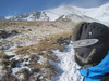
View of the north side descent of Ruby pass.
View of the terrain from upper no name to the lake (12,500) SW of Pk. 6
We ate an early dinner before starting up towards lake 12,500. There is a good trail up to the next meadow. We stayed on the trail until we got to a creek crossing, but it was too far, so we missed the trail that goes up left. We just bushwacked for a while, not too hard though, and regained the trail before the beaver ponds. A short scramble to the left of the waterfall, then back on its right side brought us to the lake. Another great campsite, and another great day.
NW face of Sunlight Pk. We met 2 guys who climbed the west ridge from this basin. They said it was a stellar 4th class route on excellent rock.
Knifepoint
View looking back at Animas Mtn., Monitor Pk., and Mt. Eolus from camp at Lake 12,500.
Day Four: We could not believe what great weather we were having. No rain or lightning since the first night! Today Rich climbed Jagged Mtn. Route finding was pretty easy for him. The first two cruxes were only 5' little boulder steps. The 3rd crux double crack is only about 15' long, and went pretty fast. The rest was fun scrambling with some great exposure. The trickiest part for Rich was the slabs down low before the grass steps along side the couloir that leads up to the left of the summit.
Jagged from Pk. 6
Another way into Sunlight Lake is from Chicago Basin then over this pass between Sunlight Pk. and Sunlight Spire. We did this in 2008. One could also gain Sunlight lake from Hunchback pass, then climb Sunlight pk. and windom.
Sunlight basiin from summit of Jagged. One of the prettiest places to camp.
I decided to climb Pk. 6 and then traverse over to Pk. 7. Pk. 6 was pretty standard 2nd class talus. The ridge between was not standard. It looked fairly flat on the map, without steep dropoffs on either side, but in reality there was a real ridge with gendarmnes and 200' dropoffs on the west side. I went to take a look. I climbed the first tower on some crummy rock, but the rest of the true ridge looked sketchy. Too many ups and downs on questionable rock that was at least 5th class. Not for me today. I started traversing on the east side following ledges and some 4th class steps, about 50-75 feet below the ridge. It was taking a long time, but eventually I made it to the saddle before Pk. 7s summit pyramid. I was glad that was over. On the return from the summit, I decided to descend at the saddle to the basin below to near Leviathon lake, then back up the east slopes of Pk. 6 and then back to camp instead of returning on my traversing route.
Ridge between Pk. 6 and Pk. 7
Saddle between Pk 5 and Pk 6
Rich was waiting for me back at camp. What now? The weather was still clear blue skies, but we were starting to get tired. We decided to push on to Balsam lake. Over another 13,000' pass, and down more talus to the beautiful Balsam lake.
North side of Pk. 5 Pk. 6 saddle
There is a great campsite on the west end of the lake. We took a break, but finally someone (I'm not sure who, or if we even knew them), pushed us on to the Vestal basin. Wait, we have not seen anyone since we left the meadow at ruby basin. Weird.
Balsam Lake, showing the route between Vestal and the 3 Trinities from Pk. 7
We traversed through the trees to a grassy slope, up until we could go left after a cliff band, then straight up to the pass. Down the other side (there was a good trail that traversed left down the slope instead of straight) to our new camp at Vestal Lake. There was room for our small tent on the NE side of the lake.
Vestal reflection
Day Five:What a treat to wake up with such a great view and virtually no approach. We started up the grass ramps of Vestal Pk. Easy going the whole way to the start of the real climbing.
View up the route from the end of the grassy traverse.
We started up the Wham Ridge. Beautiful rock, solid holds, and great exposure. This is a great route. It is hard to keep in mind that the bottom of the route is slabby. One could climb up just about anywhere.
The "crux" section
Looking down in the middle of the crux.
The crux is really not too bad. It all depends on your experience and your comfort level. It is only 50 feet or so, a solid crack to cliimb up, but lots of exposure beneath you.
Rich higher on the route
The route steepens the higher you get, there is loose rock sitting on the ledges, but it is easy to avoid knocking it off. The upper section took more care than the crux for us.
The work of withces, demons, and lightning?
Descent down Vestals S slopes.
The descent down Vestals S slopes was an eye opener. I'm sure we did not find the easiest way, but it was loose 3rd class for a while. Keep descending down for a long time until you get to cairns, or are almost the same elevation as the Vestal Arrow saddle. Traversing too soon will only get you in trouble. If I was faced with the decision to climb the S slopes on my own, or Wham ridge with someone, I would beg, plead, bribe with liquid, $, or whatever it would take to go up the Wham.
Arrow Pk.
We got down to the start of the route up Arrow Pk. Still blue skies. So upwards once again. The route is fun and unique down low on the slabs. Higher up, it got a liitle confusing looking for Roach's description of a traverse onto the face. We finally picked a place, but we ended up climbing 3rd and 4th class terrain. It would have been better to stay 5-10' to the right of the ridge as one is ascending. There is some pretty good exposure, and the "traverse" is only about 20' further into the face. We thought long and hard about doing the Trinity traverse that afternoon, or the next day. In the end we decided to have a relaxing afternoon around Wham Lake, and finish on Vermillion.
Fun with rocks
Day six: We got up and hiked out to Elk Park to catch the 12:00 train to Silverton. We ate some more fat burgers and chocolate chip cookies, toured the mining museum, and drove to camp up Mineral gulch.
Vermillion and Golden Horn
Day Seven:We started hiking around 7am. Ice Lakes basin is a beautiful place. I would go there again just to see the wildflowers. By 9am, thunderheads were already building to the west. We had become so accustomed to blue skies all day for the last week, that we picked up the pace as to not be denied a summit on behalf of the weather. On top by 10, and the storm was getting closer. We downclimbed the couloir, traversed over to the Golden Horn Saddle, then ran up to the summit and back down. We got to the valley below when the thunder and lightning along with intense rain hit. We donned our raingear since the first days approach, and slogged out to the lower lake. The storm cleared and treated us with some fantastic light on the wildflowers with some new waterfalls appearing around the basin.
What is the big deal?
We made the long drive back to Denver. We were sad to have the trip behind us, but we accomplished so much, it will remain one of our favorites.
Notes: We brought ice axes, but only dug catholes with them. Trail runners were the footwear of choice. As far as traveling north to south or south to north as we did, I would say it is about the same either way. It is a haul up Ruby cr. and would be a haul up Elk Cr. to Vestal basin. Both approaches have good trails, although both are steep. I think it is harder going South from Balsam Lake to the pk. 5/6 saddle versus going North from upper No Name basin. We did not bring any technical climbing gear, rope, pro, etc. We were both comfortable without it on the terrain we climbed. We had great weather, the only thunderstorms were the first and last afternoons. The main reason we were able to get so much done was because of the awesome weather. My pack weighed 26lbs at the start.
Please feel free to PM me with any questions about the routes/passes. I have tons more photos.
Thumbnails for uploaded photos (click to open slideshow):
Wow what a great TR. Most of those peaks are on my list...not sure when I will get to them, but the pictures and report really helped. Amazing job on climbing so much in just a week!
We were there the same time, just off a day. We did Pigeon/Turret on the 4th, and Monitor/13/Animas on the the 5th. I actually went up 12 after getting back to camp on the 4th, but by then you were probably gone to the next drainage. We may have even chatted at camp, I know there were other groups around and a few stopped by to say hi. Wish our group would have had more time to play back there, looks like you had a good trip!
Like Mike said, I think we might've chatted with you in Ruby Basin on one of those days, little did I know what you had in store (and that weekend might've been some sort of record for most people on Pigeon's summit ever, I think there was over 10 the day we were there, great group though). Me and 2 buddies did a similar trip (in reverse) in 2008. Those 2 lakes, the one just south of Pk5/6 pass and Balsalm, are some of the nicest places to camp on the planet and that view from West of Jagged looking down in to No Name is one to remember for eternity (specially when you get a solid vantage point for Knife Point). You have some awsome shots of the region throughout this report and the it brings back the fondest of memories. Simply awesome, thanks for sharing, belated or not.
...for posting this. Looking to head this way myself this summer, and seeing all of the amazing pictures makes me want to leave my house this very second!
running into you at REI on the eve of our trip to Weminuche. After my own 9 day trip, I came to appreciate the rampant peak bagging that you did so much more! Greg, you are an all-star.
Caution: The information contained in this report may not be accurate and should not be the only resource used in preparation for your climb. Failure to have the necessary experience, physical conditioning, supplies or equipment can result in injury or death. 14ers.com and the author(s) of this report provide no warranties, either express or implied, that the information provided is accurate or reliable. By using the information provided, you agree to indemnify and hold harmless 14ers.com and the report author(s) with respect to any claims and demands against them, including any attorney fees and expenses. Please read the 14ers.com Safety and Disclaimer pages for more information.
Please respect private property: 14ers.com supports the rights of private landowners to determine how and by whom their land will be used. In Colorado, it is your responsibility to determine if land is private and to obtain the appropriate permission before entering the property.


")
")
")
")
")
")
")
")
")
")
")
")
")
")
")
")
")
")
")
")
")
")
")
")
")
")
")
")
")
")