Download Agreement, Release, and Acknowledgement of Risk:
You (the person requesting this file download) fully understand mountain climbing ("Activity") involves risks and dangers of serious bodily injury, including permanent disability, paralysis, and death ("Risks") and you fully accept and assume all such risks and all responsibility for losses, costs, and damages you incur as a result of your participation in this Activity.
You acknowledge that information in the file you have chosen to download may not be accurate and may contain errors. You agree to assume all risks when using this information and agree to release and discharge 14ers.com, 14ers Inc. and the author(s) of such information (collectively, the "Released Parties").
You hereby discharge the Released Parties from all damages, actions, claims and liabilities of any nature, specifically including, but not limited to, damages, actions, claims and liabilities arising from or related to the negligence of the Released Parties. You further agree to indemnify, hold harmless and defend 14ers.com, 14ers Inc. and each of the other Released Parties from and against any loss, damage, liability and expense, including costs and attorney fees, incurred by 14ers.com, 14ers Inc. or any of the other Released Parties as a result of you using information provided on the 14ers.com or 14ers Inc. websites.
You have read this agreement, fully understand its terms and intend it to be a complete and unconditional release of all liability to the greatest extent allowed by law and agree that if any portion of this agreement is held to be invalid the balance, notwithstanding, shall continue in full force and effect.
By clicking "OK" you agree to these terms. If you DO NOT agree, click "Cancel"...
Date: 2010-08-28
Peak: Grizzly Peak
Tale of the Tape: 15.2 miles and 4090 vertical
Partner in high-altitude crime: wooderson
Another dead of night drive from the city. Subtle reek in the air. Lone wolf truckers with their short-wave cackles and carbon monoxide drawls are broadcasting the witching hour to an undocumented audience.
Red and yellow lights. Peepshow traffic cams. Shadowy roadkill. The soothing turns of Clear Creek Canyon.
Towns and exits and tunnels in my rear-view. Idaho Springs. Georgetown. Sinister Bakerville.
Somewhere outside of Leadville, I see a black Ferrari sitting in a makeshift junkyard window. It is just up the road from an old forgotten school on an unappetizing stretch of US-24 all garnished with dilapidated structures, broken glass yards, trash, muck, cigarette flicks, and a wayward pair of undergarments. This is what they call great living at 10,200.
Days or minutes or hours later, I pull into the La Plata Trailhead. I haven't day-tripped from Denver in three months and I'm feeling the effects despite numerous Diet Cokes. I doze for ten, then Wooderson says it's now or never. We hoist packs and are on our way. FS 391. McNasser Gulch. Grizzly Peak.
We reach a gate at 11,300 and pass a corrugated dive at 11,700. The shack is up on a hill with front door wide open. There appears to be a washing machine nearby and I'm instantly getting that Ed Gein vibe - body parts in the freezer, candlelight shrine for mother, sex mags and swastikas, rodents in cages, large menacing knives. We clear out quickly.
Papillon: I want to take a closer look on the way back.
Wooderson: Good luck with that...
At 12,000, we reach a mine and take five, devouring several orange gumdrops. We debate taking the grassy ramps leading up to the ridge on our right but decide to play the percentages and press on further into the basin. Garfield comes into view and I'm looking for an escape route if we choose to make a bid for the bicentennial. There is a faint scree trail but it looks steep.
After some side-hilling on obnoxious dinner plate talus, we ascend a shattered weakness and reach the ridge at 13,300. Drop-offs on the other side are endless. I hear rockfall and see goats making their way down an anonymous gully. Grizzly Lake comes into view below - crystal blue persuasion.
We ride the ridge up, occasionally dropping down 20-30 feet to skirt some geologic vagaries. Around 13,600, we opt for a feast and a snooze. When all you've got left are the class 2 blues, relaxation is in order. I doze in the talus as best I can, adopting a serpentine posture in order to avoid the sharp rocks. It is by no means 5-star but I feel more content with each breath.
The next thing I know we're on the summit. Views are spectacular - hanging tarns, craggy drop-offs, gullies of ill repute. But there are clouds in the distance and that descent off Garfield looks pretty wicked.
So we orphan the bicentennial (third this season) and make our way down to the grassy security of McNasser Gulch. Nothing left now but the long walk out.
McNasser Gulch
Casa de Ed Gein
The mine at 12,000
Grizzly Lake
Navigating the ridge
A feast of friends...
Ascent route
The final stretch
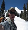
Surfer Girl is in the mountains...
Looking back
WTF???
Summit views
Psychedelic skylines
Reddish-orange flows
Tangerine dreams
If you're not drinking this after a day in the hills, you shouldn't be drinking at all.
Thumbnails for uploaded photos (click to open slideshow):
When we descended from near the Grizzly-Ouray saddle a couple months ago, we followed a trail that ended up leading to the back area of that shack. I remember feeling like we were walking into some type of booby-trap approaching the shack through the tree's like we were...
Nice report of a nice summit.
I love how this reads like a Dashiell Hammett novel... and the nod to Tommy James and the Shondells too. And Tangerine Dream, and Ed Gein. You're lucky there are old people like me on this site to fully appreciate your trip reports, Kevin! Nice job.
camp in a basin full of rabid wolverines than spend a night anywhere near the casa de Gein. I'd rather not wake up as a lamp shade. If you really want to see a post-apocalyptic hut, head up the Bighorn Creek drainage towards the Grand Traverse in the Gores. The closer you get, the higher the hair stands on your back.
Solid outing Kevin, some nice colors on the way down, makes the descent more interesting. And I guess a register from a group of Texans is better than no register at all. A good way to stick it to the BS LNT movement.
Interesting side note as well - The mine tailings pictures are from the ghost town of Ruby (circa 1840-60s) which also had a road over the mountains from Graham Gulch to Lincoln Creek that tied the Arkansas River and Roaring Fork River Valleys together before Independence Pass was built...
WTF is right - so if Texans ski in jeans, what do they climb 13ers in?
One of the most creative and well written TR's I've ever read...a true work of art. Thanks for sharing this unforgettable adventure. Keep the faith, and keep on climbing!
Thanks for the comments everyone, including the kind words and the history. After lurking for 3+ years, I found it very difficult to get over the hump and finally put up a TR. I hope this is the first of many. Maybe I'll see you out there...
What's up with that friggin' register? Never seen that before (and hope to never see it again ). So, that's a pepperoni, dill pickle, provolone sandwich? Nice to see Wooderson ... tangerine dreams indeed ... good on ya for showing us "duh Modus" ... happy trails!
You weren't far wrong about large menacing knives. When I got back to the TH parking there was a guy with a large menacing knife out, maybe he was the owner of that mining shack.
My first Papillon TR and ironically enough... I am very much enjoying my first Modus Hoperandi as well! Nice read and nice photos.
Caution: The information contained in this report may not be accurate and should not be the only resource used in preparation for your climb. Failure to have the necessary experience, physical conditioning, supplies or equipment can result in injury or death. 14ers.com and the author(s) of this report provide no warranties, either express or implied, that the information provided is accurate or reliable. By using the information provided, you agree to indemnify and hold harmless 14ers.com and the report author(s) with respect to any claims and demands against them, including any attorney fees and expenses. Please read the 14ers.com Safety and Disclaimer pages for more information.
Please respect private property: 14ers.com supports the rights of private landowners to determine how and by whom their land will be used. In Colorado, it is your responsibility to determine if land is private and to obtain the appropriate permission before entering the property.


 McNasser Gulch")
 Casa de Ed Gein")
 The mine at 12,000")
 Grizzly Lake")
 Navigating the ridge")
 A feast of friends...")
 Ascent route")
 The final stretch")
 Surfer Girl is in the mountains...")
 Looking back")
 WTF???")
 Summit views")
 Psychedelic skylines")
 Reddish-orange flows")
 Tangerine dreams")
 If you're not drinking this after a day in the hills, you shouldn't be drinking at all.")