Download Agreement, Release, and Acknowledgement of Risk:
You (the person requesting this file download) fully understand mountain climbing ("Activity") involves risks and dangers of serious bodily injury, including permanent disability, paralysis, and death ("Risks") and you fully accept and assume all such risks and all responsibility for losses, costs, and damages you incur as a result of your participation in this Activity.
You acknowledge that information in the file you have chosen to download may not be accurate and may contain errors. You agree to assume all risks when using this information and agree to release and discharge 14ers.com, 14ers Inc. and the author(s) of such information (collectively, the "Released Parties").
You hereby discharge the Released Parties from all damages, actions, claims and liabilities of any nature, specifically including, but not limited to, damages, actions, claims and liabilities arising from or related to the negligence of the Released Parties. You further agree to indemnify, hold harmless and defend 14ers.com, 14ers Inc. and each of the other Released Parties from and against any loss, damage, liability and expense, including costs and attorney fees, incurred by 14ers.com, 14ers Inc. or any of the other Released Parties as a result of you using information provided on the 14ers.com or 14ers Inc. websites.
You have read this agreement, fully understand its terms and intend it to be a complete and unconditional release of all liability to the greatest extent allowed by law and agree that if any portion of this agreement is held to be invalid the balance, notwithstanding, shall continue in full force and effect.
By clicking "OK" you agree to these terms. If you DO NOT agree, click "Cancel"...
I've been eyeing the Meeker/Longs combo ever since I hiked the Keyhole Route five years ago. After days of researching multitudes of route descriptions and trip reports, I was itching to hit the trail. Hoping to be somewhere in the mid-to-upper Loft Couloir by sunrise, I decided a 3am start should do the trick. The moon was only a few days past full and provided plenty of light for hiking without a headlamp. I was able to make out obstacles such as rocks and steps and horse shit well enough to keep my stumbling down to the frequency of a typical day hike. I switched on my headlamp when the trail ended in Chasm Meadows and began the ascent up the couloir. There was plenty of light by the time I reached the scrambling portion of the couloir, and the sunrise stopped me dead in my tracks in the middle of the exit ledge.
Looking down toward Chasm Junction
The hike up Meeker from the Loft was short and sweet, and I was on the summit ridge in no time.
Longs from Meeker
The combination of strong wind and my healthy fear of heights was enough to keep me from standing on Meeker's tiny summit block, but I did manage a brief low squat which was good enough for me. After my short visit to Meeker, I headed back down to the Loft to search for the magic cairn that leads to the gully down to Clark's Arrow.
White cairn in the Loft The Magic Cairn circled in red The Magic Cairn: Gateway to Clark's Arrow
Looking down from the cairn, the gully appears to drop off to oblivion, but the way down slowly reveals itself as you get closer to the edge. There was only one move right before the exit ledge to Clark's Arrow that seemed a little problematic, but even that wasn't too bad. I caught a glimpse of Clark's Arrow as I looked over my shoulder after crossing the exit ledge.
Looking back at Clark's Arrow
From Clark's Arrow I could see people approaching the Homestretch, and it was much closer than I had imagined. I made my way up the couloir to the exit ramp and joined the masses.
Blue Whale? The Notch
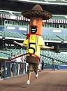
I've seen plenty of pictures of the Homestretch before, but never with awesome orange sweatpants.
I sat on the summit of Longs for about fifteen minutes engulfing food and imagining my
beautiful wife off in the distance hiking the Twin Sisters with her friends.
I love the narrows. I love how super scary it looks in pictures, but how tame it really is in person.
I reached the Keyhole around 10:30. The weather still looked good and my knees hadn't exploded yet, so I decided to make the traverse over to Storm Peak.
Approaching the summit of Storm
I was pretty beat by the time I hit the summit of Storm, but after looking across the Boulder Field toward Mount Lady Washington I knew I wouldn't forgive myself if I didn't do it. Hoping to get a little boost of energy, I decided to drink the two cans of V8 I brought along with me. They tasted like soap. The views from Mount Lady Washington were amazing...well worth the extra effort.
Longs from the Boulder Field Summit of Mt Lady Washington
From the summit I slowly made my way down the blocky east ridge toward Chasm Junction. The clouds were starting to form, but I couldn't convince my knees to let me go any faster.
Chasm Junction
Fortunately I made it to tree line before the rain opened up and the thunder started rumbling. I was back at my car at 3pm; a solid twelve hours of beautiful and painful hiking. I can't wait to do it again.
In the spirit of this being my first trip report, I'd like to add that the weather was great and there was lots of up and up.
Thumbnails for uploaded photos (click to open slideshow):
Looks like you had a blast! Thanks for the awesome photos and trail report. I have no idea how I'll ever find the Magic Cairn if I do this route--looks pretty hard to spot!
Nice job!! I cannot believe there was nobody at the Keyhole at 10:30 on a Saturday! I was up there on the Friday of the previous week and it was overrun. Unfortunately the top of the mountain was coated in black ice and I chickened out at the top of the Trough - a long way to go to miss by 200”!!
Caution: The information contained in this report may not be accurate and should not be the only resource used in preparation for your climb. Failure to have the necessary experience, physical conditioning, supplies or equipment can result in injury or death. 14ers.com and the author(s) of this report provide no warranties, either express or implied, that the information provided is accurate or reliable. By using the information provided, you agree to indemnify and hold harmless 14ers.com and the report author(s) with respect to any claims and demands against them, including any attorney fees and expenses. Please read the 14ers.com Safety and Disclaimer pages for more information.
Please respect private property: 14ers.com supports the rights of private landowners to determine how and by whom their land will be used. In Colorado, it is your responsibility to determine if land is private and to obtain the appropriate permission before entering the property.


")
")
 Looking down toward Chasm Junction")
 Longs from Meeker")
 White cairn in the Loft")
 The Magic Cairn circled in red")
 The Magic Cairn: Gateway to Clark's Arrow")
 Looking back at Clark's Arrow")
 Blue Whale?")
 The Notch")
")
")
")
")
 Approaching the summit of Storm")
 Longs from the Boulder Field")
 Summit of Mt Lady Washington")
 Chasm Junction")
")