Download Agreement, Release, and Acknowledgement of Risk:
You (the person requesting this file download) fully understand mountain climbing ("Activity") involves risks and dangers of serious bodily injury, including permanent disability, paralysis, and death ("Risks") and you fully accept and assume all such risks and all responsibility for losses, costs, and damages you incur as a result of your participation in this Activity.
You acknowledge that information in the file you have chosen to download may not be accurate and may contain errors. You agree to assume all risks when using this information and agree to release and discharge 14ers.com, 14ers Inc. and the author(s) of such information (collectively, the "Released Parties").
You hereby discharge the Released Parties from all damages, actions, claims and liabilities of any nature, specifically including, but not limited to, damages, actions, claims and liabilities arising from or related to the negligence of the Released Parties. You further agree to indemnify, hold harmless and defend 14ers.com, 14ers Inc. and each of the other Released Parties from and against any loss, damage, liability and expense, including costs and attorney fees, incurred by 14ers.com, 14ers Inc. or any of the other Released Parties as a result of you using information provided on the 14ers.com or 14ers Inc. websites.
You have read this agreement, fully understand its terms and intend it to be a complete and unconditional release of all liability to the greatest extent allowed by law and agree that if any portion of this agreement is held to be invalid the balance, notwithstanding, shall continue in full force and effect.
By clicking "OK" you agree to these terms. If you DO NOT agree, click "Cancel"...
The actual summit of Mt. Lindsey lies in Costilla County, but most of the approach travels through Huerfano, a Colorado county rich in history and culture, and endowed with a unique natural beauty. At one time, Badito, Colorado was a substantial settlement in Huerfano County, and was the official county seat, before it was subsequently moved to Walsenburg. The area has a rich history, much if which is summarized on the current Huerfano County website:
http://www.huerfano.us/
"The Spanish Peaks were sacred mountains to these people and they performed lots of ceremonies here. As far as they were concerned, this is where Mankind first emerged from the womb of the Earth into their version of the Garden of Eden (only, they weren't thrown out of Paradise until the Europeans arrived)."
It's true that the Spanish Conquest was rough on our ancestral cousins, a fact that has left its mark to the present day in Southern Colorado and Northern New Mexico. Regardless of one's feelings about the website's statement, one cannot deny that this area is indeed a paradise. At one point as I traveled the road in, marveling at the huge cottonwoods and lush tall grasses, it struck me that perhaps this is what our state looked like 100, 200, or 500 years ago, when there was more water and less asphalt. It felt like this is what our land was supposed to look like.
Historic Log Cabin seen along the Huerfano River Drainage
The Road
I was prepared for a slow, lengthy approach on bad roads. The pleasant surprise is that the roads are not bad at all. On a weekday, there were practically no other cars on the entire drive in. The dirt section is in excellent condition all the way to the Singing River Ranch. After this it gets a little rough, but certainly not 4wd-rough. To compare, the road to Handies Peak is far worse. Getting to the first stream crossing on the Castle Creek road is worse than anything encountered on this pleasant drive. The miles go quickly along this seldom-traveled route.
The Approach
The first section of the approach strolls through the pleasantly idyllic Huerfano River drainage. (Bring the flyrod for the return: fat brookies!) After about 30 minutes, steep climbing through the trees begins on the left side of the drainage, and ends, about an hour from the TH, at a pristine alpine meadow.
Guardian Angels in the Alpine
From here it ascends steeply again to gain the saddle between Iron Nipple and Mt. Lindsey, at about 13,200, about 1:40 from the TH. (I'm usually pretty fast, so depending on your speed you may want to adjust times accordingly.) Here one is presented with stellar views of the climbing ahead on Mt. Lindsey's NW ridge.
Mt. Lindsey's NW Ridge
The Climb
Class 3-4 section on Lindsey's NW Ridge
I was a little disappointed in myself. Admonitions to avoid going too far right, to stay left, and to veer left around rock ribs, kept me on what is a clear trail. The only trouble is that this trail leads directly to the base of the Class 2+ loose gully. There is some very loose rock on Lindsey, but the Class 4 route is cake-walk in comparison to the loose stuff on the "standard" route.
Getting Down to the Business at Hand
Like many ridges, Lindsey's NW ridge has a series of rock ribs extending perpendicularly down the slope, which are relatively solid, and between which are relatively loose sub-gullies. One really wants to stay high on the ridge from the get-go. Instead, the admonitions and the trail sucked me into the base of the standard route, the Class 2+ loose gully. This required trading off for a similar, though shorter, Class 2+ nasty loose gully leading up to the base of the solid stuff on the ridge. Just stay high on the ridge, and the climbing is so much less risky. This was clearly verified on the descent. The difficulty is, one must leave a clearly defined trail, and head for the ridge, at some point. That point is best attained sooner than later.
For me, the crux of the climb was the loose Class 2 stuff. The "Class 4" section was sweet, secure, and extremely satisfying. Climb it with confidence.
The short Class 4 section is seen near top center, left and right of the prominent chimney dividing the upper section at skyline.
Though appearing steep from a distance, the rock is solid, well-featured, and relatively low-angle.
Crux-Shot!
An example of the low angle and well-featured rock at the Class 4 crux area.
Like Pavlov's dog, I too was salivating, only my delightful visual delicacy was the Gash Ridge to Blanca.
Mt. Blanca and Ellingwood Point, east aspect
Had there been less than the 20-30% pops in the forecast, the plan was an ascent of the SE Ridge, with a little side-trip to the Winchell Lakes for some trout-viewing. Just to be completely prepared, 9.5 ounces of flyfishing gear made it to the summit with me, including a 4-weight fly rod (seven-section), reel with line, flies, and rudimentary tackle. I figured I could handle hauling an extra half pound if it was totally clear at the summit and I felt like making a round-trip to the south.
One of the two pristine and well-guarded Winchell Lakes, below the Blanca-Little Bear Ridge.
Unfortunately, there were a few grey-bottoms hanging around, and while my guess was that the weather would prove better than the forecast, I didn't feel like chancing it, solo, sight unseen, with chances of afternoon thundershowers in the forecast. I think Arnold said it best: "I'll be back."
The Whole Banana: Little Bear, Blanca, the Winchell's, Gash Ridge, and Ellingwood Point
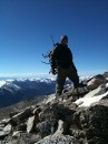
I always bring my stuffed teddy to place on the rocks for the summit shot
So here's the real route I chickened out on - the SE Ridge. Note it drops to treeline; from there it's west and back over to the saddle, thence north to the standard approach.
Some of our favorite Sangres...With dunes to the west...
The descent went well and was uneventful except for re-encountering some mammalian brethren; see photos below. Specifically, for those interested, in the crux section I had ascended directly up the chimney to the top. Minimal chimney moves were required, and liberal use of the left-sided face made short and relatively unexposed work of this Class 4 section. I reversed this on the downclimb, which proved slightly more invigorating, but all the moves were there. Facing in on the 10-20 feet or so of steeper rock, of course.
Below the technical crux, I stayed on the ridge, with no difficulty whatsoever, but eventually, again, found myself sucked down to the obvious trail. This was a mistake. The mistake was made in that I had failed to realize, until later, that the trail is really not the best route for the NE ridge, even though it's only a short distance below. On the descent, I stayed on the ridge until the trail was a tempting 50 yards below, when I descended one of the rock ribs to get there. It was a little rough and loose, and the crux of the descent. Had I stayed on the ridge (or just below it to the east) it would likely have gone even more smoothly. So the lesson for me, for Lindsey's NE ridge is, avoid the trail after the 13,200 saddle, and just take the ridge. It's much more solid rock, and when in doubt one is better off going a little bit left (on the ascent) from the ridge, than trying to go right from the trail. I'm curious to see this route in winter - I'm guessing the ridge is fairly scoured, early season. The south side may present opportunities as well, though further research is needed.
This was a really good trip for me. My ascent time was reasonably quick; the crux was far more relaxed than anticipated, and I got to see a lot of wildlife. I was truly blessed with about half an hour of watching and photographing the fellows in the image below, as they made their way from a high alpine meadow onto the grassy ridge in view the distant Crestones.
Four friends climb through flowers and tundra
I spent a little time at the Huerfano River, long enough to verify what's in it - and why I didn't get out the flyrod I carried all the way to 14,000 feet, is beyond me. Sometimes I just like to watch the trout - kind of like my dearly-departed Tasha (a shy, rescued bobcat kit that lived with me for 16 wonderful years.) She used to really enjoy her bird-watching. Only Tasha never figured out what the flyrod was used for, other than playing with the cat. Bless her heart, and may she RIP.
Columbine in early morning light along the Huerfano River drainage
I enjoyed some time with the camera on the drive back to Gardner, having started way too early given the eventual outcome of the day; hot and dry. Here's a shot of our domestic friends hanging out in the Badito Badlands.
Grazing the PJ
And lastly, from just beyond the TH on the way in.
Rich floral bouquet adorns the Huerfano basin
In summary, Mt. Lindsey's NW ridge is solid, pleasant, not terribly exposed, and affords some incredible scenery in a most pristine area, both on the drive, as well as the hike.
Hope you enjoyed the report and the photos.
Jim
.........
Thumbnails for uploaded photos (click to open slideshow):
Lindsey is my favorite hike so far. I thought that Huerfano drainage was one of the most rugged and beautiful places I've ever been. Once I get my experience level higher and get more tolerant of exposure, I would like to try the ridges on the ascent. Lindsey is a 14er I would have no problem repeating. Loved the pics too!
Beautiful pics as always and thanks for the history lesson behind the area. If you would have read my report first you would have learned that you can drive a civic backwards up that road... seriously. You are also lucky you didn't encounter thoese crazy mountain men that we did. Anyhow, I'm glad you saved Iron Nipple and Huerfano so we can have something else to climb later when we go back up to fish!
Hi Cutter, it's a Canon 1200 - only weighs about 4 oz. I also have a Canon SX110 that goes to 360mm - or ”10x zoom.” It weighs 9 oz and is bigger but it should be standard issue in my pack for summer, like to get better shots of some of the wildlife this trip.
I also shoot a Canon XSi with an assortment of glass; my favorite is the Tamron 28-75/2.8. No IS, but great fast glass. I've never taken the SLR on a 14er though. Too much to lug and too slow to whip out.
Some of the embellishment you see is not the camera but the Photoshop. I went cheap and bought a used version of 6.0 - ancient by today's standards but it gets the job done.
What a treat. While I normally don't like solo trips I appreciate the opportunity to have full control of your time and opportunities to really take in your surroundings. Well done.
Some of my favorite 14ers folks! Presto, Randal, thanks you guys! Matt and Ben - You guys are so accomplished... thanks so much for the complements!
Yeah, this trip was a blast, from the drive in to the drive out and everything in between!
Great pics as usual and a great write-up. I especially appreciate it because I'm heading out this weekend to hike Culebra and this route on Lindsey. Thanks for sharing!
I will be there on Saturday the 24th with KC0HEV. This report helps a lot.
Caution: The information contained in this report may not be accurate and should not be the only resource used in preparation for your climb. Failure to have the necessary experience, physical conditioning, supplies or equipment can result in injury or death. 14ers.com and the author(s) of this report provide no warranties, either express or implied, that the information provided is accurate or reliable. By using the information provided, you agree to indemnify and hold harmless 14ers.com and the report author(s) with respect to any claims and demands against them, including any attorney fees and expenses. Please read the 14ers.com Safety and Disclaimer pages for more information.
Please respect private property: 14ers.com supports the rights of private landowners to determine how and by whom their land will be used. In Colorado, it is your responsibility to determine if land is private and to obtain the appropriate permission before entering the property.


")
")
")
")
")
")
")
")
")
")
")
")
")
")
")
")
")
")
")
")
")