Download Agreement, Release, and Acknowledgement of Risk:
You (the person requesting this file download) fully understand mountain climbing ("Activity") involves risks and dangers of serious bodily injury, including permanent disability, paralysis, and death ("Risks") and you fully accept and assume all such risks and all responsibility for losses, costs, and damages you incur as a result of your participation in this Activity.
You acknowledge that information in the file you have chosen to download may not be accurate and may contain errors. You agree to assume all risks when using this information and agree to release and discharge 14ers.com, 14ers Inc. and the author(s) of such information (collectively, the "Released Parties").
You hereby discharge the Released Parties from all damages, actions, claims and liabilities of any nature, specifically including, but not limited to, damages, actions, claims and liabilities arising from or related to the negligence of the Released Parties. You further agree to indemnify, hold harmless and defend 14ers.com, 14ers Inc. and each of the other Released Parties from and against any loss, damage, liability and expense, including costs and attorney fees, incurred by 14ers.com, 14ers Inc. or any of the other Released Parties as a result of you using information provided on the 14ers.com or 14ers Inc. websites.
You have read this agreement, fully understand its terms and intend it to be a complete and unconditional release of all liability to the greatest extent allowed by law and agree that if any portion of this agreement is held to be invalid the balance, notwithstanding, shall continue in full force and effect.
By clicking "OK" you agree to these terms. If you DO NOT agree, click "Cancel"...
Peaks : Potosi Peak (13,786ft), San Joaquin Ridge (13,460ft)
Routes : North Couloir on Potosi, San Joaquin Couloir on SJR
Total Vertical for the weekend : around 8100ft
Food : Qudoba (bush league, will explain later), Chicken/Bacon Tortolini, Wings @ Smuggler's and the grand finale at the Fiesta Guadalajara in Montrose.
The second trip to the San Juans this season proved another excellent adventure for myself and my buddy Chris. Another sucker for San Juan backcountry potential, we had our sights set at various basins around the state earlier in the week. Figuring Rocky Mountain NP with its recent dumps would last longer into the quickly dwindling season, one last trip to the Southwest was in the cards.
Met Chris at my office around 5pm Friday afternoon, kind of disappointing he wasn't sporting his usual fu Manchu or any other facial hair, but I guess you gotta look professional from time to time. We loaded up on last second supplies and were on the road to Junction within minutes. I had mapquested the lone Chipotle between Silverthorne and Salt Lake City and tried to strategically plan our departure so we could arrive in Junction right at dinner time. Finding the restaurant was the "crux" of the weekend, I had more issues route finding Chipotle than any routes we climbed, kind of embarrassing, but I blame 99.9% of that to google maps and the town of Grand Junction, the assistant manager at the restaurant admitted that "he didn't know street names" when we were trying to get directions. He didn't know landmarks either. Long story short, we had to settle for Qudoba.
We merged with 550 and were in Ouray by 10:30 or so, found a spot off Camp Bird Rd around 10,800 ft, directly in front of the Governor/Yankee split. My Impreza is geared low and I couldn't get enough momentum right passed a deep dip in the road, so we decided to park before it. It made sense, anyways, cause our split off to Potosi from the road was a 5-10 minute walk in approach shoes.
Alarm went off around 4am, on the trail by 5:30 and at our cutoff to the Teakettle-Potosi saddle within minutes. AT boots went on, stashed the approach boots and began hiking up the slope. By the way, this is a "no skin" route, if you do it this way. I didn't use my skins or crampons the entire route, just a FYI.
Cross couloir looking point across the way. Very cool.
Around the upper section of the slope, Sneffels showed her sweet SE face and the Birthday Chutes
Sneffels from the East in the morning
The sidehilling got a tad steep around halfway up, booting got a little tedious to gain the saddle, but nothing too exciting, just great front row views of Yankee Boy Basin. The wind picked up a bit at the saddle direct, but not the 60-75mph gusts NOAA had called for. The views of the Weehawken drainage and the surrounding 13ers was, in the words of Gerry Roach, enchanting. Having never seen this separate basin before, the first thought that came to mind was solitude.
approaching the saddle
The reclusive Weehawken Drainage
Chris w/ Potosi behind him
You don't really get the same imposing look of the North Couloir from here as you would from say, Teakettle, but it was pretty obvious it was an aesthetic line, hidden from the views of Yankee Boy. We skied down to the base of the couloirs, trying to stay higher than usual to avoid losing too much elevation. We shouldered the skies again, stripped off our shells and began the trek up the chute.
Chris is a very strong climber and probably led 75% of the time booting up couloirs throughout the weekend. I was grateful for this, but tried to do my share of the booting. There'd be times when I asked if he needed a break, he'd say that's fine, but instead of waiting for me to catch up to him, he'd climb "slowly" assuming I'd eventually catch up to him and lead from there. Half the time I'd never catch him and demand he stop and allow me to lead for a bit.
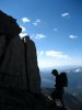
nearing the top of the N.Couloir
I'm not 100% sure on the length of the couloir itself. I guess, depending where you begin the bootpack, its between 800 and 1000 feet of gain. According to Chris's inclometer, it never exceeded 45 degrees, maybe a section of two near the very top, but it's a sustained 40 degrees and gets narrower near the col at the top. The views from the col were awesome. We both took a whiz and then proceeded towards the summit, which was a quick 5-10 minute stroll to a flat plateau with incredible expansive views in every direction.
Amazing views to the South from the col
Chris reaching the summit
The summit kind of reminded me of Longs, cept smaller and easier to reach. We took shots to the East of the Cimarron, to the West of Yankee Boy and the Wilsons, to the immediate North of Teakettle, Ridgway and Whitehouse and to the South of the heart of the San Juans. Again, the winds were tame, minimal clouds and lots of solitude. It was tough to figure out the "true" summit, I walked between the various spires jutting off the plateau, never found a summit register, took a lot of pictures, slugged a Red Bull, split a peppermint patee and prepared for the descent.
Yankee Boy from Potosi summit
One of these might be the "true" summit
Chris skiing off the top with the Cimarron to the East
Not overly concerned about summit descents, but this was a fun one and very feasible. We started off initially on the SE side to gain the col, some easy, open, semi-steep turns. Chris took the first couple turns down the couloir itself and the snow was really, really good the entire way down. We hit it in perfect conditions and at the right time of day. No dust on crust, no ice, no avy debris to content with, no hidden obstacles, nothing. Open turns on good snow on a bluebird day in the upper regions of a less travelled drainage, can't ask for much more than that in the month of May. Some turn shots....
Enjoying this nice May day, right off the summit of Potosi
Chris starting things off
Turns around here were sublime
Chris with one of a handfull of powder turns
regaining the saddle, not as bad as expected (300 feet tops)
We enjoyed turns all the way down to the avalanche rubble at the bottom of the chute, took a few turns and swung a hard skier's left to get as much momentum as possible up the slope towards the saddle we had to regain to get back into Yankee Boy. Since Chris had led most of the couloir, I decided to give him a break and boot up to the saddle, with surprisingly solid bootpacking snow. Wet slide potential was still moderate, we gained the saddle via a fun, sporty climb over and around the cornice guarding it, ate some more food and began the rest of the ski descent into the basin. The turns here were stress free, softening corn, a little dirt here and there, but a nice enjoyable ski to cap off a VERY rewarding day. 3 years ago, Potosi Peak was an unknown to my peaks interests. Dave Coopers picture in his snow climb book, as well as various pictures circulating around Summitpost spurred my interest. Having hit it from both the South and North sides with good snow, great climbing partners and great weather, I could safely say Potosi has become one of my favorite singular peaks in Colorado. I'm glad its 14 feet below the magic 13,800 number and doesn't receive the attention the other surrounding peaks get. It's a unique experience on a unique mountain that looks cool whichever direction you view it from.
We finished the already classic day with some Modus's at the car. Since this was going to be a car camping extravaganza, we whipped out some foldable chairs, used the snow banks as refrigerators and to avoid the now windy conditions, drove a little further down the road, found a nice spot along the creek, boiled some Beef and Bacon Tortolini w/ smoked tobacco, parmesean cheese, olive oil w/ a side of salt n' vinegar Pringles, IPA's, sweet and spicy trail mix and cranked some tunes to the likes of Zeppelin, Stones, Petty and Chris turned me on to a sick new sound, The Black Keys.
nice place for a rest stop
We pointed our sights to Telluride, arrived into town, found a nice car camping spot, right along the dirt road you turn off at the Shell station before you get into town. We would've had a solid view of the Wilsons, but what we initially thought was wind and dust storms, ended up being smoke from a fire in Norwood that had blown into the basin. Later, we got our bearings in town, found some parking for early Sunday morning at Bear Creek TH, grabbed some wings and an IPA at Smuggler's that tasted like the water had been filtered through someone's armpit (just a friendly warning), then called it for the night at our spot up on the northern side of the valley.
Day 2 - Bear Creek approach to San Joaquin Couloir in basin due East from Telluride Ski Resort
Alarm went off around 3:30am, packed up the car and were at the Bear Creek TH around 4:30am, on the trail soon after. We had to park on the road across the street from Smuggler's due to private parking issues. Given my track record with parking tickets, I figured safe than sorry.
After reading Alex and Rick's TR of San Joaquin from Ophir, Chris presented the idea of doubling the mileage, keeping the vertical gain the same and approaching from the North. It really wasn't that bad at all and gave us the chance to climb the couloir itself, which was VERY beneficial on this day, cause the couloir, in so many words, was un-skiable.
The trail was bone dry to the trail cutoff at Bear Creek Falls and the Wasatch Trail. We took the right and began the steep, switchbacking climb up the slope and finally, switched out of approach shoes, donned skins and began the side hilling fun.
Early morning along the Wasatch Trail. Our route when right up this section, way too icy on the right
We reached a waterfall section that had an iced over bridge crossing to the right, violently running river to the left and safe passage directly up the middle. We chose the latter, made an interesting rock maneuver and gained the upper slopes towards our objective. Above the waterfall was a flat section, followed by a face to consider. We decided to hug the slope on the right and climb up to the San Joaquin basin via a narrow gully. The views around here this morning were quite noteworthy.
Beautiful morning
in the upper sections of the basin
The gully we chose to reach the upper basin
1st solid view of the San Joaquin Couloir
We finally gained the upper reaches of the basin and had a good view of the San Joaquin Couloir. We proceeded on towards the base of the couloir. Somewhere along the way, while trudging along, one foot in front of the other, I all of a sudden felt like I was walking along a hilly beach and every time I crested a ridge, I thought the Pacific Ocean would be awaiting me. Well, it wasn't, just more dust covered snow. It was surreal, thinking you were at the beach but instead, being in the middle of the San Juan Range. Anyways, we reached the base of the couloirs, got out our helmets and axes and made quick progress up the steepening chute. Chris measured 47 degrees near the middle and it got even steeper towards the top. Around 2/3 up the couloir, we both agreed that the snow was crap and at the verge of being dangerous, borderline suicide in terms of skiing it. It was sheer ice in places, crusty, veriglass in others. No powder anywhere. We figured skiing down a 45-50 degree, narrow chute in these conditions would be irresponsible and foolish, so, upon reaching the summit, we scouted the surrounding lines, found a mellow slope off the south side of the ridge and decided to descend that way and live to find another steep and deep couloir before the season ends.
Of course the views from atop yet another San Juan peak were phenomenal in all directions. I particularly enjoyed the views of the West side of Ice Lakes Group as we skied down to the valley floor, as well as the Weminuche from San Joaquin.
Window to the Weminuche
Looks like a nice place to live
As we skied around the corner, we got our final glimpse of the couloir, which now got sun, which we figured would never happen.
parting view of San Joaquin
Regardless, we both agreed to not ski it and to save it for another day, sun hit or no sun hit, it would not have been as fun as Alex and Rick's TR from last weekend. What was supposed to be an aesthetic ski turned into a touring adventure in an amazingly aesthetic basin. If there is one place in the world where you will never regret your Plan B, the San Juans are probably it.
After skiing DIRTY snow, hucking off a little kicker above a waterfall and making it to snowline, we put back on our approach shoes and began the trek out. As much as I dreaded this, it was actually quite enjoyable and a lot easier than expected. We reached the car, parked along Pine St (not a TH), packed up and headed home. Around the south end of Ridgway, I asked Chris what he wanted to do for food. I threw out all the ethnicities out there (Chinese, Mexican, Thai, etc). He said a definitive NO to Chinese and a YES to Mexican. Just as he said that, we saw a billboard for a Mexican place in Montrose, Fiesta Guadalajara, just take a left at main st. After gorging ourselves in some Fajitas, Burritos, chips and salsa and a marg, we made the 3 hr and 45 min drive back to Silverthorne, door to door. Great weekend!
Thumbnails for uploaded photos (click to open slideshow):
Great success on Potosi Brian!!! What do you think of approaching from Weehawken instead of Yankee boy??
Sorry to hear the conditions in the San Joaquin Couloir sucked. Smart move to wait until another day, but overall, it sounds like you had a fantastic trip!!
Thanks bud, we never even touched Weehawken, we decided to just go at it from Yankee, since it was a more proven route for success. Had this been a recon of the region or just a simple backpacking trip, I‘d be all over it. Regardless, fantastic trip indeed. It wasn‘t surprising that San Joaquin had below average ski conditions, it was 75 degrees in Telluride the day before.
No regrets for Plan B in the San Juans 5/25/2010 6:27am
Great TR!
We got our Plan A, however, but didn‘t see you from the top of Sneffles. We also opted for Arby‘s in Montrose, sounds like you made the better choice! Awesome pics.
Glad you finally got that sweet looking line on Potosi! The pics probably don‘t do it justice. The San Juans are looking a bit dryer that I would expect given the ”heavy” snowfall year we had down there, no? And, Brian, are you still planning on Sneffels this year?
seekanddestroy - good to hear you had a successful day, did you do the Blaine approach? We ran into a guy from Junction and his buddy from Boulder who started from Yankee Boy, rapped the Snake and ended up in YB later in the day. And there is absolutely nothing wrong with Arby‘s big beef and chedder w/ curly fries and a mtn dew.
Caroline - Yeah, pics don‘t really do it justice, we really couldn‘t get a view like the one from Teakettle of the chute, but it was still an aesthetic line. SJ are definately melting out quickly, although the best snow seems to be around the 550 corridor. Tride felt like summer. In answer to your last question, this was my last trip to that area for the spring, so I‘ll probably save Sneffels for next season, although the SE face still has some potential for sure.
Alex - I‘ve heard rumors of that possibility. For comparison‘s sake, I thought N.Couloir on Potosi was equally, if not more aesthetic, of course the snow was better, so thats a tad biased. Highly recomended!!
Floyd - Just when you think you won;t make it down there, the pull sometimes is too strong.
dbaker - thanks man, easy to take nice shots around there.
Caution: The information contained in this report may not be accurate and should not be the only resource used in preparation for your climb. Failure to have the necessary experience, physical conditioning, supplies or equipment can result in injury or death. 14ers.com and the author(s) of this report provide no warranties, either express or implied, that the information provided is accurate or reliable. By using the information provided, you agree to indemnify and hold harmless 14ers.com and the report author(s) with respect to any claims and demands against them, including any attorney fees and expenses. Please read the 14ers.com Safety and Disclaimer pages for more information.
Please respect private property: 14ers.com supports the rights of private landowners to determine how and by whom their land will be used. In Colorado, it is your responsibility to determine if land is private and to obtain the appropriate permission before entering the property.


")


 Cross couloir looking point across the way. Very cool.")
 Sneffels from the East in the morning")
 approaching the saddle")
 The reclusive Weehawken Drainage")
 Chris w/ Potosi behind him")
 nearing the top of the N.Couloir")
 Amazing views to the South from the col")
 Chris reaching the summit")
 Yankee Boy from Potosi summit")
 One of these might be the \"true\" summit")
 Chris skiing off the top with the Cimarron to the East")
 Enjoying this nice May day, right off the summit of Potosi")
 Chris starting things off")
 Turns around here were sublime")
 Chris with one of a handfull of powder turns")
 regaining the saddle, not as bad as expected (300 feet tops)")
 nice place for a rest stop")
 Early morning along the Wasatch Trail. Our route when right up this section, way too icy on the right")
 Beautiful morning")
 in the upper sections of the basin")
 The gully we chose to reach the upper basin")
 1st solid view of the San Joaquin Couloir")
 skiing conditions non-existent, climbing conditions solid")
 looking up")
 Window to the Weminuche")
 Looks like a nice place to live")
 parting view of San Joaquin")