Download Agreement, Release, and Acknowledgement of Risk:
You (the person requesting this file download) fully understand mountain climbing ("Activity") involves risks and dangers of serious bodily injury, including permanent disability, paralysis, and death ("Risks") and you fully accept and assume all such risks and all responsibility for losses, costs, and damages you incur as a result of your participation in this Activity.
You acknowledge that information in the file you have chosen to download may not be accurate and may contain errors. You agree to assume all risks when using this information and agree to release and discharge 14ers.com, 14ers Inc. and the author(s) of such information (collectively, the "Released Parties").
You hereby discharge the Released Parties from all damages, actions, claims and liabilities of any nature, specifically including, but not limited to, damages, actions, claims and liabilities arising from or related to the negligence of the Released Parties. You further agree to indemnify, hold harmless and defend 14ers.com, 14ers Inc. and each of the other Released Parties from and against any loss, damage, liability and expense, including costs and attorney fees, incurred by 14ers.com, 14ers Inc. or any of the other Released Parties as a result of you using information provided on the 14ers.com or 14ers Inc. websites.
You have read this agreement, fully understand its terms and intend it to be a complete and unconditional release of all liability to the greatest extent allowed by law and agree that if any portion of this agreement is held to be invalid the balance, notwithstanding, shall continue in full force and effect.
By clicking "OK" you agree to these terms. If you DO NOT agree, click "Cancel"...
After not being prepared to hike Yale from the Avalanche Gulch Trailhead a couple weeks ago, I decided to hike La Plata on December 21st. When I got back from La Plata I had some help finding trip reports and information on Yale from the Avalanche Gulch Trailhead. I decided the weather was good enough and the avalanche danger was low enough to hike it.
I started at the trailhead at 6:20. It was still dark, but the trailhead is easy to find.
The first part of the trail switchbacks up the mountain side. The trail had some packed snow on it, however you can walk next to it for the most part. On the way back down, the snow was slushy and the trail was muddy next to the packed snow.
After the switchbacks, the trail moves along the mountain. The snow is more consistent here and I decided to put on my snowshoes. There are sections that are side-hill and hard packed. The section below was the worst of them and required some traction to get across.
After that section, the trail climbs away from the side-hill, getting more level and not as steep.
The mountains were peeking through the trees which made for some great photographs.
The trail winds through the trees and was very relaxing. I was thankful for snowshoes through the trees. The morning was very quiet and calm. There was no wind, however the temperature was 2 degrees on my thermometer.
The trail finally emerges from the trees where you can get a glimpse of the East Ridge.
This photo is a shot looking back to where the trail emerges from the trees. The view is to the East.
The East Ridge has some snow on it, but much has blown off. I chose routes to avoid as much snow as I could. Even though it looks mostly dry, the snow had collected in the rocks which made the hike a little more interesting.
The East Ridge is LONG. This view is about half way up the ridge.
The ridge is filled with several different types of terrain. You will see large rocks, small rocks, flat areas, steep areas, and cliffs.
This section is very hard packed and steep. Crampons or other traction device is recommended. I put on my snowshoes for this section. You may be able to see crampon tracks going up.
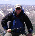
The day was good. The summit was very windy. I stayed at the top for about 40 minutes enjoying the best view I have ever seen from a 14er. I definitely recommend this hike to anyone who wants great views and a challenging hike. If it is not on your winter 14er list, you had better make it a priority.
Here are several pictures of the surrounding areas/ridges/14ers in case others want to hike a different route, wanted ski information, or want make a round trip down another ridge.
Thumbnails for uploaded photos (click to open slideshow):
Total ascent time was 6 hours 20 minutes (couldn‘t stop taking pictures - 140 total). Time down was 3 hours. I think the RT mileage was around 11 miles with about 5000ft elevation gain.
Looks like it was a great day, thanks for posting. I tried this route last January and only made it to the saddle, but seeing this trip report makes me want to give it another shot.
we‘ve been debating about tackling the East Ridge since we found out we can‘t get to the Denny Creek trail without hiking an additional 3 miles each way. You clarified a lot of our wonderings, thanks for a good report!
I did this route late last July, doing a loop by descending down to Denny Creek. A wonderful climb, and now a favorite of mine! Very interesting to see the same route in the winter with snow! Thanks!
Exact same month and route that MtnHub did here too. The east ridge was long, but it was such an awesome route with beautiful views in summer that it was extremely enjoyable. In winter this must be really awesome. Can you comment on what grade you would give the route in winter? Seems like there were definitely some class 3 sections depending on how you true you stayed to the ridge.
Agree, Yale has a very photogenic summit. I‘ll have to give that East Ridge a go this winter.
Nice photos. Love that summit shot. : ) Good TR!
Caution: The information contained in this report may not be accurate and should not be the only resource used in preparation for your climb. Failure to have the necessary experience, physical conditioning, supplies or equipment can result in injury or death. 14ers.com and the author(s) of this report provide no warranties, either express or implied, that the information provided is accurate or reliable. By using the information provided, you agree to indemnify and hold harmless 14ers.com and the report author(s) with respect to any claims and demands against them, including any attorney fees and expenses. Please read the 14ers.com Safety and Disclaimer pages for more information.
Please respect private property: 14ers.com supports the rights of private landowners to determine how and by whom their land will be used. In Colorado, it is your responsibility to determine if land is private and to obtain the appropriate permission before entering the property.


")
")
")
")
")
")
")
")
")
")
")
")
")
")
")
")
")
")
")
")
")
")
")
")
")
")
")