Download Agreement, Release, and Acknowledgement of Risk:
You (the person requesting this file download) fully understand mountain climbing ("Activity") involves risks and dangers of serious bodily injury, including permanent disability, paralysis, and death ("Risks") and you fully accept and assume all such risks and all responsibility for losses, costs, and damages you incur as a result of your participation in this Activity.
You acknowledge that information in the file you have chosen to download may not be accurate and may contain errors. You agree to assume all risks when using this information and agree to release and discharge 14ers.com, 14ers Inc. and the author(s) of such information (collectively, the "Released Parties").
You hereby discharge the Released Parties from all damages, actions, claims and liabilities of any nature, specifically including, but not limited to, damages, actions, claims and liabilities arising from or related to the negligence of the Released Parties. You further agree to indemnify, hold harmless and defend 14ers.com, 14ers Inc. and each of the other Released Parties from and against any loss, damage, liability and expense, including costs and attorney fees, incurred by 14ers.com, 14ers Inc. or any of the other Released Parties as a result of you using information provided on the 14ers.com or 14ers Inc. websites.
You have read this agreement, fully understand its terms and intend it to be a complete and unconditional release of all liability to the greatest extent allowed by law and agree that if any portion of this agreement is held to be invalid the balance, notwithstanding, shall continue in full force and effect.
By clicking "OK" you agree to these terms. If you DO NOT agree, click "Cancel"...
Mt. Herard 13,297
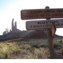
NE Ridge Route from Medano Lake Trailhead
I know many of you have observed this Sangre de Cristo peak from Sand Dunes NP. It's impossible to ignore, brooding at the northeast of the dunefield. I've seen it aptly described as the Sentinel of the dunes. It is the first Colorado mountain that fascinated me back in 1996 shortly after I moved here. I've had a postcard of Mt. Herard living on my fridge since early summer. Last weekend I stood on the summit and had the best day I've had in the mountains all year.
There is signage all the way to Medano Lake Trailhead. Take highway 69 from Walsenberg north towards Westcliffe for about 33 miles to FS Road 559. There are a few rough and steep sections on road 559 and one very rough section just before the pass. A high clearance 4wd is most helpful to get to the trailhead, and mandatory if you want to drive down the west side of the pass into the Park after the climb. There is camping on the east side of the pass. On the west side you can only camp in designated NP backcountry sites. These are first-come and free, and there are 2 of them within 1/4 mile of the trailhead. There is space for 6 or 7 cars at the parking area.
The trail starts out smooth and gradually climbs through many aspen groves, some very large, comparable to those at the beginning of the standard route on Shavano. It is a leisurely 15 minute stroll and a few creek crossings to the Sangre de Cristo Wilderness Boundary.
-Just for the record: dudes on the trail with heavy artillery and random orange hankies hung in the trees usually freak me out more than anything else in the mountains. Wear your blaze orange flags.
-The trail gets steeper as you get closer to the lake and you can start to see the bulk of point 12,925 peeking out from the trees. I lost the trail in the snow but the valley gets tight and finding the lake is not a problem.
I took this shot on the return.
-After 3.2 miles, you arrive at Medano Lake and the view of the magnificent Herard cirque smacks you in the face. (note that face smacking doesn't always translate to digital images well....)
If you just quit here, the drive and climb would still be worth it. The cliffs to the south twist and loom and the main couloir leading to the summit dominates the upper valley. The rest of the route is obvious to the north. There are cairns leading from the lake up to the saddle between Mt. Herard and point 13,153. Getting to the saddle is mostly on a grassy ramp. From the saddle head southwest to the summit up a steep, rocky ridge.
view from the saddle to the top of the couloir
There was not much exposure right on the ridge except for one spot immediately before the top of the main couloir where the snow had piled up into a 6 foot gap in the ridge, with the north face dropping off to the left and a steep, rocky slope to the right. After that, it was very exciting to creep up to the top edge of the couloir and look down to the lake. From here it was a few more minutes of moderate uphill through a partial bowl to the broad, gently curved summit plateau. With warm temperatures and light wind, I was able to lounge around for 2 hours - not what you normally expect in October. Lounge isn't the right word though, I mainly gawked; at the dunes, at the Crestones, at the Blanca group, at Zwischen and Mt. Carbonate, the Spanish Peaks, Culebra, and San Luis.
Do any of you ever summit by yourself and still vocalize your wonder? That was me, exclaiming "Wow!" and "holy ----" and "I can't believe it!" Like a dork, and happy. I've been all over that dunefield but it looks tiny from the summit.
closer view of the Blanca massif
the Crestones
I descended the way I came. I considered making a loop to the northeast and descending the northwestern face of point 12,295 but I spent so long on top I decided to head back the way I came up. A loop looks doable as long as you stay high over the cliffs and go far past the lake before dropping in.
I think this route has approximately 3,700 ft of elevation gain and is about 10.5 miles long. I took 9 hours but you could cook through it in 6.5 or 7.
To reiterate, this is a most gorgeous summit. The combination of the views of the dunes and the Sangre 14ers is inspiring and most definitely unique. On the summit I felt like I sometimes do in southern Utah: there is so much to look at it's impossible to really get it all in. Awesome.
If you continue down the 559 road into the dunes, the adventure keeps going. Call the NP visitor center about recent road conditions. (719-378-6399) The upper pass is rocky rocky rocky and steep, and then there are 9 river crossings before you get down to the dunes. Even at low flow, if you're not used to river crossings it can be a bit unnerving. Finally, when you are contouring along the base of the dunes, the last two miles of road are sandy with long pockets of deep sand. Throw in several mudholes and a couple of narrow squeezes between battered pine trees and you have a fun 4wd trail. I made it down to the .7 campsite just before dark. There is a large meadow to the east of the campsite and I recommend it for superior stargazing. Last Saturday there was no moon so I stayed up as late as I could manage looking at the milky way and counting satellites.
I really can't recommend this peak enough. The dunes are a great place to play also. Visiting them has never gotten old for me.
Mt. Herard from dunes
Mt. Carbonate from Medano Creek
lucky shot
Thanks for reading.
Happy trails!
Thumbnails for uploaded photos (click to open slideshow):
I‘ve been looking for some trip reports on this mountain. Planned to head up there this summer but a family camping trip to SDNP got canceled at the last minute. Next year...
Thanks for the comments everybody. 10/26/2009 9:03pm
Presto, I didn‘t see any skewered teddy bear on the summit stick. There‘s an old leather glove living on it now. I‘m impressed you climbed Herard from the dunes, it looks like a lot of steep bushwhacking. I was back in the Cold Spring drainage several years ago and saw more bear tracks in that area than I‘ve ever seen in Colorado. You must have had fun.
kimo - Thanks. i got that shot using my $11 homemade wide angle lens. Google DIY wide angle lens and you‘ll see what I mean - you put together a slip-on lens using a security peephole and some pvc pieces. The optics are crap but the price is right.
Presto - Cool details on the route from the west side. I‘ve added your report to my Sangre folder because I‘d definitely like to climb Herard from the dunes one day. I think the drainage to the NW of Medano also has a route. I try to demonstrate calm competence to skeptical rangers, considering the crazy lack of preparation or experience they must see in some visitors. I used to try and convince them but now I just politely smile and say thank you. Up in the Snowy Range, no one had heard of an alpine start -two of three rangers kept loudly asking why I was going to ”climb in the middle of the night.”
I did this one over memorial day weekend. I biked from the oasis campground south of the dunes up to the lake trail and parked my bike at the wooden wilderness sign. I hiked the rest of the way up to the snow covered and windy summit. I enjoyed passing many drunken jeep outings during my descent of Medano pass which involved 18 crossings of the raging torrent Medano creek becomes each spring.
Trip report ... did this one many years ago from the actual dunes. I'm assuming the stuffed teddy bear skewered to the summit stick is probably gone . It is special to have a summit to yourself (which happens a lot on 13ers). Thanks for posting. Happy trails!
Yes it was! But, well worth the effort and a unique way to approach that summit (didn't see another soul). I've posted an excerpt from the short trip report below ...
May 7-9, 2004. This trip was ideal for this time of year for many factors: 1) This part of the Sangre De Cristo range in Colorado is far enough south that it melts out earlier than most parts of Colorado (especially when entering from the San Luis Valley side); 2) As the trailhead starts in the Sand Dunes, the mild spring made for better cool hiking weather; and 3) There is still water flowing down the drainages this early in the year (which is not the case later on). Mt. Herard sits by itself in its own massif (actually along with an unnamed 13,135 peak) between the Crestones and the Blanca massif. My husband and I picked up our parking permit from the visitor center (the parking areas are within the Sand Dunes National Monument and therefore overnight parking does require a free permit). The ranger was skeptical that we would be climbing Mt. Herard from the west side of the Sangre's, and then from the south ridge (no trail). No problem, we told him. We backpacked in the approx. 4-1/2 miles on the sandy rolling trail that goes behind the Dunes until we came to the Little Medano Creek drainage. We slogged our way up that drainage and found a forested, hidden and cool campsite along the creek and down away from the sand (which permeates this drainage right up to the base of the mountains). As we were backpacking in, we picked out what appeared to be a pretty direct route along a southern ridge that connected to the western sub-peak of Mt. Herard. The next morning, we arose and followed (amazingly) the most direct route exactly as it had appeared to us. We approximate we were about 3-1/2 miles (and about 4,200 feet elevation gain) from the summit when we started and it took 11 hours roundtrip. The entire route (sans the ridge above treeline) was bushwacking. Some in snow ... some in sand ... some on rock ... all in the trees. Route finding skills were an absolute must as there were many cliffy areas and staying high was the key. The summit view from Mt. Herard is unmatched. The Dunes look surreal and their awesome size is apparent. Lots of snow still everywhere.
Thanks for the TR and pictures! That coulior in the center of the mountain looks inviting.
Caution: The information contained in this report may not be accurate and should not be the only resource used in preparation for your climb. Failure to have the necessary experience, physical conditioning, supplies or equipment can result in injury or death. 14ers.com and the author(s) of this report provide no warranties, either express or implied, that the information provided is accurate or reliable. By using the information provided, you agree to indemnify and hold harmless 14ers.com and the report author(s) with respect to any claims and demands against them, including any attorney fees and expenses. Please read the 14ers.com Safety and Disclaimer pages for more information.
Please respect private property: 14ers.com supports the rights of private landowners to determine how and by whom their land will be used. In Colorado, it is your responsibility to determine if land is private and to obtain the appropriate permission before entering the property.


")
")
")
")
")
")
")
")
")
")
")
")
")