Download Agreement, Release, and Acknowledgement of Risk:
You (the person requesting this file download) fully understand mountain climbing ("Activity") involves risks and dangers of serious bodily injury, including permanent disability, paralysis, and death ("Risks") and you fully accept and assume all such risks and all responsibility for losses, costs, and damages you incur as a result of your participation in this Activity.
You acknowledge that information in the file you have chosen to download may not be accurate and may contain errors. You agree to assume all risks when using this information and agree to release and discharge 14ers.com, 14ers Inc. and the author(s) of such information (collectively, the "Released Parties").
You hereby discharge the Released Parties from all damages, actions, claims and liabilities of any nature, specifically including, but not limited to, damages, actions, claims and liabilities arising from or related to the negligence of the Released Parties. You further agree to indemnify, hold harmless and defend 14ers.com, 14ers Inc. and each of the other Released Parties from and against any loss, damage, liability and expense, including costs and attorney fees, incurred by 14ers.com, 14ers Inc. or any of the other Released Parties as a result of you using information provided on the 14ers.com or 14ers Inc. websites.
You have read this agreement, fully understand its terms and intend it to be a complete and unconditional release of all liability to the greatest extent allowed by law and agree that if any portion of this agreement is held to be invalid the balance, notwithstanding, shall continue in full force and effect.
By clicking "OK" you agree to these terms. If you DO NOT agree, click "Cancel"...
Trailhead: South Mineral Creek TH (trailhead)
Approach: Ice Lake Trail
Route: SE (southeast) Ridge
Distance:
Day 1: ~1.75mi (to Lower Ice Lake Basin)
Day 2: ~2.75mi (from camp to summit)
Total: ~9mi RT (roundtrip)
Elevation Gain:
Day 1: ~1,600' (to Lower Ice Lake Basin)
Day 2: ~2,400' (from camp to summit)
Total: ~4,000'
Prologue
I first visited Ice Lake Basin in 2004, while on a CMC (Colorado Mountain Club) trip led by Marlyn and Mary Peet. On that trip, we climbed Pilot Knob and US Grant as day hikes using S. Mineral campground as our base camp.
I always think back on that trip as one of my favorites.
For one, the people on the trip (Carson Black, Janet Rose, Steve Gladbach, Denise Snow, and Marlyn & Mary Peet) made it a great experience for me. At the time, I was still fairly new to climbing the high peaks of Colorado, but that didn't matter to them. They welcomed me while at the same time shared their knowledge and personal experiences with me. What a learning experience that turned out to be!
Secondly, that first trip opened my eyes to peaks other than 14ers. Wow! I had no idea at the time that 13ers could be so fun and equally rewarding, in many cases, more rewarding than a 14er. Not to say I don't like 14ers, because I still climb them and will continue to do so. In fact, I haven't finished climbing all the 14ers yet.
Last of all, that trip in '04 introduced me to one of my favorite areas in Colorado, Ice Lake Basin! When we were there in July of 2004, it was probably peak season for the wildflowers. I was amazed! It was a kaleidoscope of color, with waterfalls to accentuate the beauty!
But the beauty doesn't stop there, for the surrounding peaks that tower over the basin will instantly beckon a climber to challenge themselves to new heights.
Now, five years later, I find myself (finally) returning to Ice Lake Basin to climb Vermillion Peak. After a successful climb of Teakettle Mountain on Saturday, I made the drive over Red Mountain Pass to the trailhead, so I could pack into the Lower Ice Lake Basin to bivy for the night.
In the morning, I would go for Vermillion and maybe Golden Horn too.
Saturday The Approach to Lower Ice Lake Basin
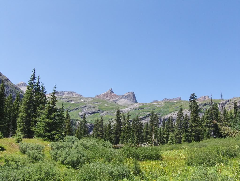
I was on the Ice Lake Trail by 3:35 Saturday afternoon. The trail was busy with day hikers making their way back to the TH. The trail winds its way up, switch backing up through the forest with an occasional crossing of an avalanche slope.
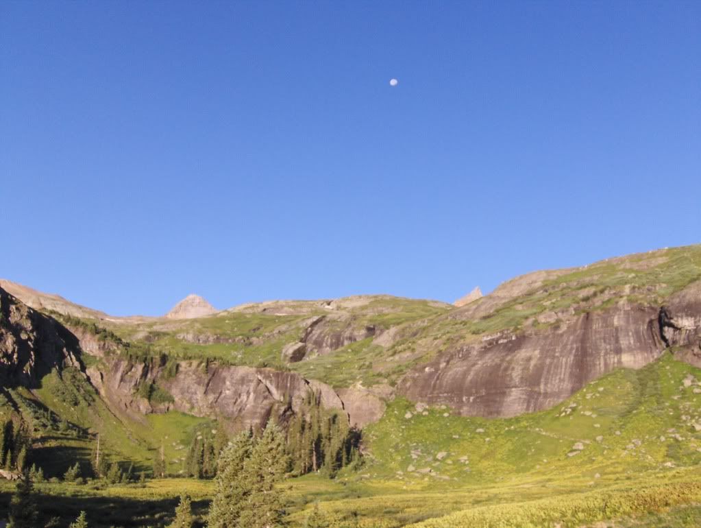
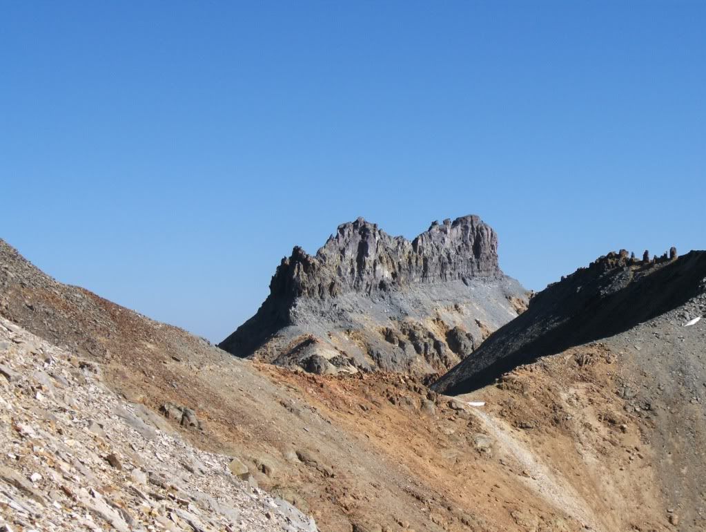
Finally, I get my first glimpse of the peaks hovering over the basin.... (Picture was taken on Sunday while hiking out.)
I was in the lower basin by 4:50 and started to think about camp. Originally I thought I would go to the upper basin to camp, but I was tired from climbing Teakettle earlier in the day, and now this backpack.
So once I was to the west of the first lake in the lower basin, I scouted for a campsite for the night. I found a small pre-existing site, which was suitable for what I needed since I was bivying for the night.
I crawled into it by 6:30pm for an early bedtime!
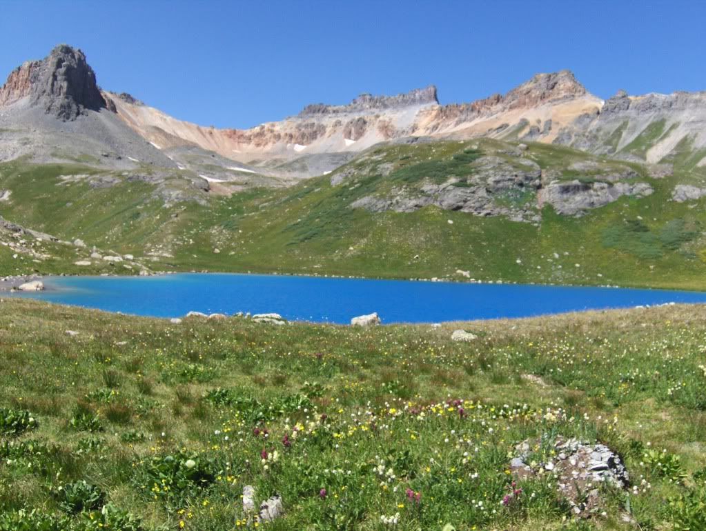
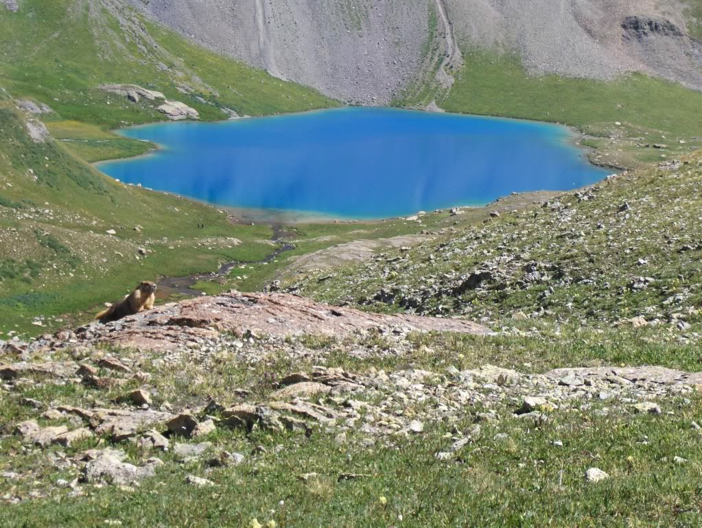
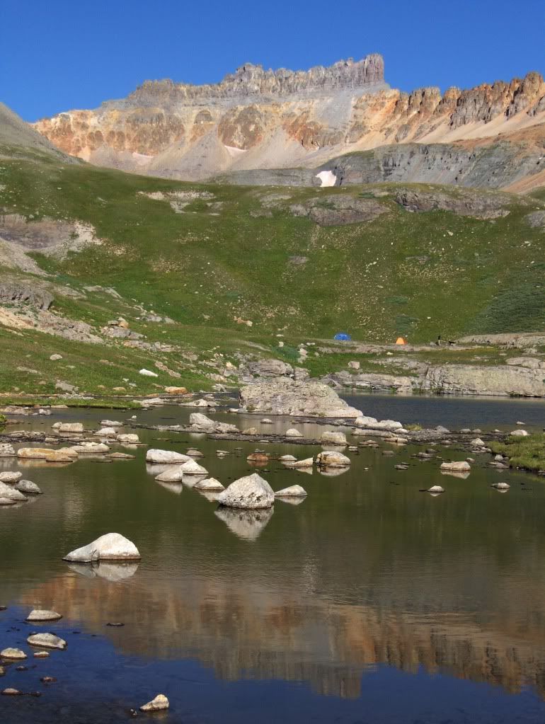
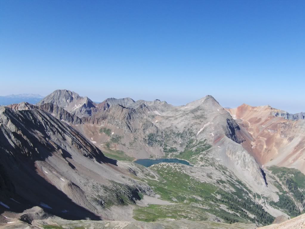
Some pictures of (upper) Ice Lake Basin area, which were taken on Sunday:
Ice Lake with Pilot Knob centered above
Marmot watching over Ice Lake
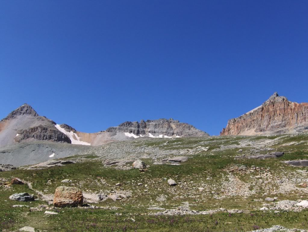
Fuller Peak, Vermillion Peak, and Golden Horn (l. to r.) Taken from the ridge above Fuller Lake.
Sunday Approach to Vermillion
I was on the trail at 6:55am, with another day of clear skies to start the day!
The start in the lower basin is flat until reaching the headwall of the basin that separates it from the upper.
The headwall of the lower basin. The trail can be seen far right of center below the rock face, as it cuts up and to the left (south).
Once above the headwall, the trail meanders back to the north before heading west. I was at Ice Lake at 7:40, where I took my time going through this area so I could enjoy the early morning light on the peaks.
I also noticed ice on the edges of the second lake. Dare I say summer in the high country is nearing its end?
Pilot Knob above the second lake.
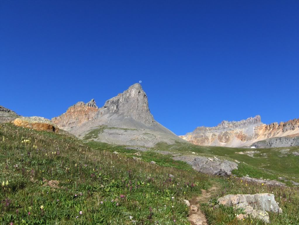
Full moon leftovers...
I made my way to Fuller Lake and remnants of a cabin that is up there. I stopped for some snacks and sunscreen before heading towards the saddle of Fuller and Vermillion.
The Climb
Looking up at the saddle. There's a fairly good climber's trail that zig-zags up on the right side.
Pilot Knob framed between the saddle of Vermillion and Golden Horn
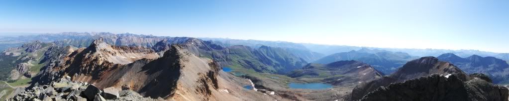
I got to the saddle at 9:15am, and took in the views to the west and northeast before taking on the southeast ridge of Vermillion.
Lake Hope and area 13er's Grizzly Peak B and San Miguel Peak (highpoints l. to r.)
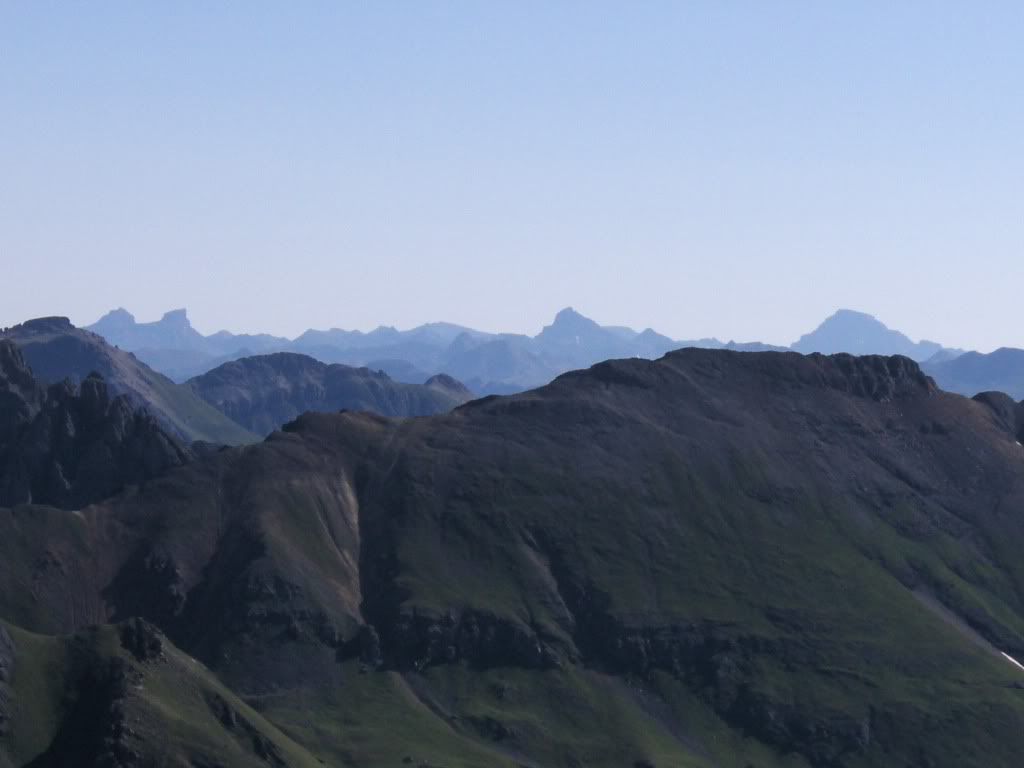
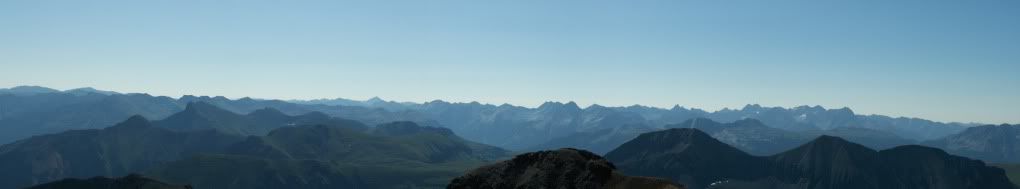
Views to the northeast....with Redcliff and Coxcomb to the left, Wetterhorn right of center, and Uncompaghre to the right.
From the saddle of Fuller and Vermillion, there's a decent climber's trail that goes northwest, and generally stays on the west side most of the time. It's an easy route to follow.
The trail along the west side of the ridge line.
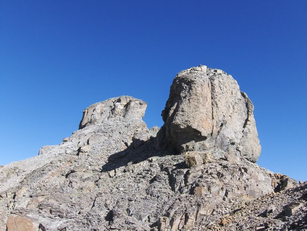
Two more towers to skirt along the westside. Vermillion's summit can be seen between the towers.
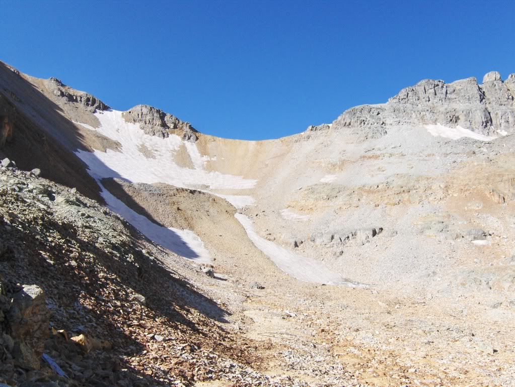
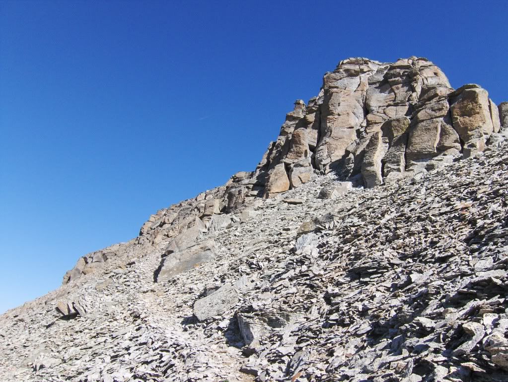
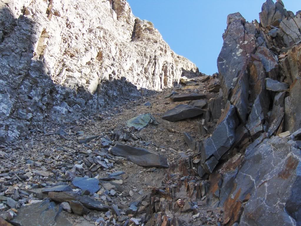
Looking up the last gully before the final stretch to the summit.
This last gully was probably the worst part of the whole climb because it's a little loose, but not all that bad. The entire ridge is an easy class 2+ walk. This is the only area I might get concerned for rock fall if someone was above me. I had my helmet with me, but I didn't think it was necessary to put it on since no one was above me.
Once above this gully, I turned left and the next thing I know I was on the summit! Sweet!
Two consecutive days with no clouds in the sky! What a treat for high summit seekers this weekend!
I left the summit at 10:05, with plans to head to camp and pack out.
The idea of going over to Golden Horn quickly faded throughout the morning, in favor of getting on the road at an earlier hour for the long drive back to Manitou. Plus, I'm lazy!
I was back in camp at 12pm, was packed up by 12:30 and then headed down the trail.
Almost an hour later, I was at my truck to make the long drive home.
Hindsight and Personal Notes
Ice Lake Basin is a destination that any day hiker, backpacker, or peak climber should put on their list. I can't imagine anyone being disappointed with what they'll find there, any time during the summer hiking/climbing season.
The basin does see a lot of traffic, but not nearly the crowds you typically find on some of the busier 14ers (e.g., Bierstadt, Quandary, Grays).
If you're a peak climber, you have plenty of peaks to choose from. Vermillion is a straight forward hike with some of the best views of the San Juan's. Climbs of Pilot Knob and US Grant are a little more challenging but are great climbs too.
For the other peaks in the area, well, I will return one day to find out about those!
Golden Horn definitely deserves my attention!
Thanks for reading,
Darin
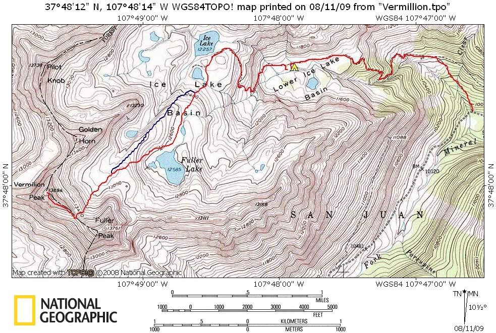
The map above is my approximate route. The red is the ascent and descent, with the exception of the detour on the descent, which is the blue line.
the other info I‘ve seen about Vermillion make this peak look looser and more technical, but you seem to feel that it was a Class 2+ hike rather then a climb. Is that true, and how difficult do you think it is in comparison to other San Juan 13ers?
kaiman, going up to the saddle I was on a climber‘s trail most of the way. It‘s not solid ground like a 14er trail, but I wouldn‘t call it horrible either. The ridge also has a good trail and is easy to follow. No navigation problems at all. I never pulled out Roach‘s description. The last gully is grungy, but still not bad.
Comparison? Not sure.
What have you climbed down there?
What a great weather weekend. Great pictures and cool story. You weren‘t lazy. The drive home after dark is tedious. Golden Horn for another day. Are you going to write up TeaKettle?
Ice Lakes is one of my favorite place in CO, so I don‘t mind it that I missed Pilot Knob the first time! Kudos on 2 new centennials, Darin.
Kaiman, Vermilion is pretty easy compared to most San Juan 13ers. It is no worse than 2+ and there is a trail most of the way. There is a fair amount of exposure on the last bit on the ridge to the summit.
What nice photos! It‘s been a long time since we‘ve climbed those two peaks ... your report brings back nice memories. Thanks for posting. Happy trails!
Uwe, I might get to a Teakettle TR next week. I‘m waiting to get pictures from my climbing partners to add to it.
And Kevin brought up a good point about exposure. The summit ridge does have a narrow but short walk-way to a cool summit!
As long as you‘re not drunk, hypoxic, or there‘s not a big gust of wind, you should be fine crossing it. ;-)
There‘s also another semi-exposed section just before the last gully (pictured in the TR), but a miss-step there would result in a slide without serious consequences.
Caution: The information contained in this report may not be accurate and should not be the only resource used in preparation for your climb. Failure to have the necessary experience, physical conditioning, supplies or equipment can result in injury or death. 14ers.com and the author(s) of this report provide no warranties, either express or implied, that the information provided is accurate or reliable. By using the information provided, you agree to indemnify and hold harmless 14ers.com and the report author(s) with respect to any claims and demands against them, including any attorney fees and expenses. Please read the 14ers.com Safety and Disclaimer pages for more information.
Please respect private property: 14ers.com supports the rights of private landowners to determine how and by whom their land will be used. In Colorado, it is your responsibility to determine if land is private and to obtain the appropriate permission before entering the property.