Download Agreement, Release, and Acknowledgement of Risk:
You (the person requesting this file download) fully understand mountain climbing ("Activity") involves risks and dangers of serious bodily injury, including permanent disability, paralysis, and death ("Risks") and you fully accept and assume all such risks and all responsibility for losses, costs, and damages you incur as a result of your participation in this Activity.
You acknowledge that information in the file you have chosen to download may not be accurate and may contain errors. You agree to assume all risks when using this information and agree to release and discharge 14ers.com, 14ers Inc. and the author(s) of such information (collectively, the "Released Parties").
You hereby discharge the Released Parties from all damages, actions, claims and liabilities of any nature, specifically including, but not limited to, damages, actions, claims and liabilities arising from or related to the negligence of the Released Parties. You further agree to indemnify, hold harmless and defend 14ers.com, 14ers Inc. and each of the other Released Parties from and against any loss, damage, liability and expense, including costs and attorney fees, incurred by 14ers.com, 14ers Inc. or any of the other Released Parties as a result of you using information provided on the 14ers.com or 14ers Inc. websites.
You have read this agreement, fully understand its terms and intend it to be a complete and unconditional release of all liability to the greatest extent allowed by law and agree that if any portion of this agreement is held to be invalid the balance, notwithstanding, shall continue in full force and effect.
By clicking "OK" you agree to these terms. If you DO NOT agree, click "Cancel"...
Left Denver at about 5:30 a.m. Was almost exactly a 2-hour drive. On the way up to the TH, we saw a mule dear (actually, a pronghorn):
...and a Moose!
Started hiking at about 7:45 a.m. Here's are a couple photos about a 1/4 the way up. Notice the blowing snow and fog!
Here's a view of the cornice most climb to get to the ridge. Very navigatable. Seems pretty steep, but the snow is packed well enough and has plenty of boot holes to follow.
We didn't take many pictures on the ridge or on the final stretch to the summit - mainly because the wind was ridiculous. Probably 60-70 mph winds. So, we were focusing mostly on making it a quick ascent and a very quick descent. Luckily the sky had cleared and it was sunny while we were on the ridge, otherwise the wind probably would have made the trip much worse.
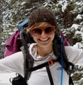
Here's a photo of me getting to the summit, trying to focus on not getting blown off the mountain.
Normally we hang at the top for a while, but today it was a quick photo, and down we went.
Glissading is still possible on the way down, but when we tried the snow had become quite soft, so it wasn't as fast as a trip as we would have liked. But, nonetheless, a free ride.
All in all, it was a good hike. In my opinion, Sherman is a good spot for an early-season climb. The snow is manageable without any special equipment. We had waterproof hiking boots and were fine. Didn't use trekking poles or gators. Both wouldn't been handy, but not necessary.
Our recommendation, if doing this hike anytime soon, would be to check weather reports closely and if there is wind in the forecast, be prepared and dress appropriately.
We got back down to our car at 11:15 a.m., making it a 3.5 hour climb. Not bad considering the elements.
Thumbnails for uploaded photos (click to open slideshow):
I‘m thinking about hiking Sherman on Tuesday. How much snow is there really? Having trouble gauging from your pictures. 100 yards at the end? A full mile? I haven‘t done Sherman before and I am trying to determine if I feel comfortable doing it by myself. My snow experience is pretty much limited to hiking for turns in ski boots. I‘ve never glissaded or use crampons, etc.
If I am not mistaken, a pronghorn is a type of antelope. We have tons in the panhandle and in between Clayton and Raton. But a good shot of the moose and a good report with some pictures of the route conditions.
lanternrouge08 is correct. They are technically not an antelope but have been referred to as pronghorn antelope for many years. I learn something new everyday!
I definitely don‘t know my animals too well, and we assumed it was a dear! Regardless, it‘s a very pretty animal.
friscogirl, there‘s not a ton of snow. The photo of the cornice (just before getting to the saddle)is at about the first point we encountered snow, and I‘d say it was about halfway through. After the cornice, though, it‘s all snow until the summit. Some is mixed with rock (which I think actually makes it a nicer climb), so it‘s not like you‘re hiking in pure snow the whole way. We are not very experienced hiking in snow either and had a relatively easy time (except for the wind).
If you‘re interested, I can send more photos. Just email me at mosheahan at yahoo dot com and I‘ll send a link to a Kodak Gallery.
We used no special equipment, just water-proof hiking boots. I‘d definitely recommend those. But, no need for anything special. Trekking poles would be handy, especially if there‘s wind. But, we didn‘t use them and we were OK.
So, all of the above is to say that I think you‘d be fine going on your own. There were probably about 10 other cars in the lot when we got to the TH, and while it wasn‘t a crowded hike, there were definitely others around. I think it‘s safe to say this isn‘t a secluded 14er destination and you‘d probably be able to ask advice of others on their way down as you‘re headed up as well.
that is neither a mule deer or antelope, but a pronghorn.
Caution: The information contained in this report may not be accurate and should not be the only resource used in preparation for your climb. Failure to have the necessary experience, physical conditioning, supplies or equipment can result in injury or death. 14ers.com and the author(s) of this report provide no warranties, either express or implied, that the information provided is accurate or reliable. By using the information provided, you agree to indemnify and hold harmless 14ers.com and the report author(s) with respect to any claims and demands against them, including any attorney fees and expenses. Please read the 14ers.com Safety and Disclaimer pages for more information.
Please respect private property: 14ers.com supports the rights of private landowners to determine how and by whom their land will be used. In Colorado, it is your responsibility to determine if land is private and to obtain the appropriate permission before entering the property.


")
")
")
")
")
")
")
")