Download Agreement, Release, and Acknowledgement of Risk:
You (the person requesting this file download) fully understand mountain climbing ("Activity") involves risks and dangers of serious bodily injury, including permanent disability, paralysis, and death ("Risks") and you fully accept and assume all such risks and all responsibility for losses, costs, and damages you incur as a result of your participation in this Activity.
You acknowledge that information in the file you have chosen to download may not be accurate and may contain errors. You agree to assume all risks when using this information and agree to release and discharge 14ers.com, 14ers Inc. and the author(s) of such information (collectively, the "Released Parties").
You hereby discharge the Released Parties from all damages, actions, claims and liabilities of any nature, specifically including, but not limited to, damages, actions, claims and liabilities arising from or related to the negligence of the Released Parties. You further agree to indemnify, hold harmless and defend 14ers.com, 14ers Inc. and each of the other Released Parties from and against any loss, damage, liability and expense, including costs and attorney fees, incurred by 14ers.com, 14ers Inc. or any of the other Released Parties as a result of you using information provided on the 14ers.com or 14ers Inc. websites.
You have read this agreement, fully understand its terms and intend it to be a complete and unconditional release of all liability to the greatest extent allowed by law and agree that if any portion of this agreement is held to be invalid the balance, notwithstanding, shall continue in full force and effect.
By clicking "OK" you agree to these terms. If you DO NOT agree, click "Cancel"...
Monday morning I was getting my stuff together for a solo jaunt over to the Sawatch the next day, before the weather moved in on Wednesday. Jcwhite called a little before noon and asked what I thought about Longs. I had skipped out on a trip to Longs the previous Friday to ski Tabeguache. I emailed my friend that had climbed and attempted to ski it. His report was that they dropped skis at the top of Lambslide, summitted and then skied down. He didn't seem to think the top was quite filled in enough to connect a line from the summit. Jcwhite had been in contact with Media Dude who had been up the Trough over the weekend and thought the summit ski could be pieced together. Hmmm, well there had been more snow between the two trips. I was skeptical. Jcwhite was optimistic. Only one way to find out the truth.
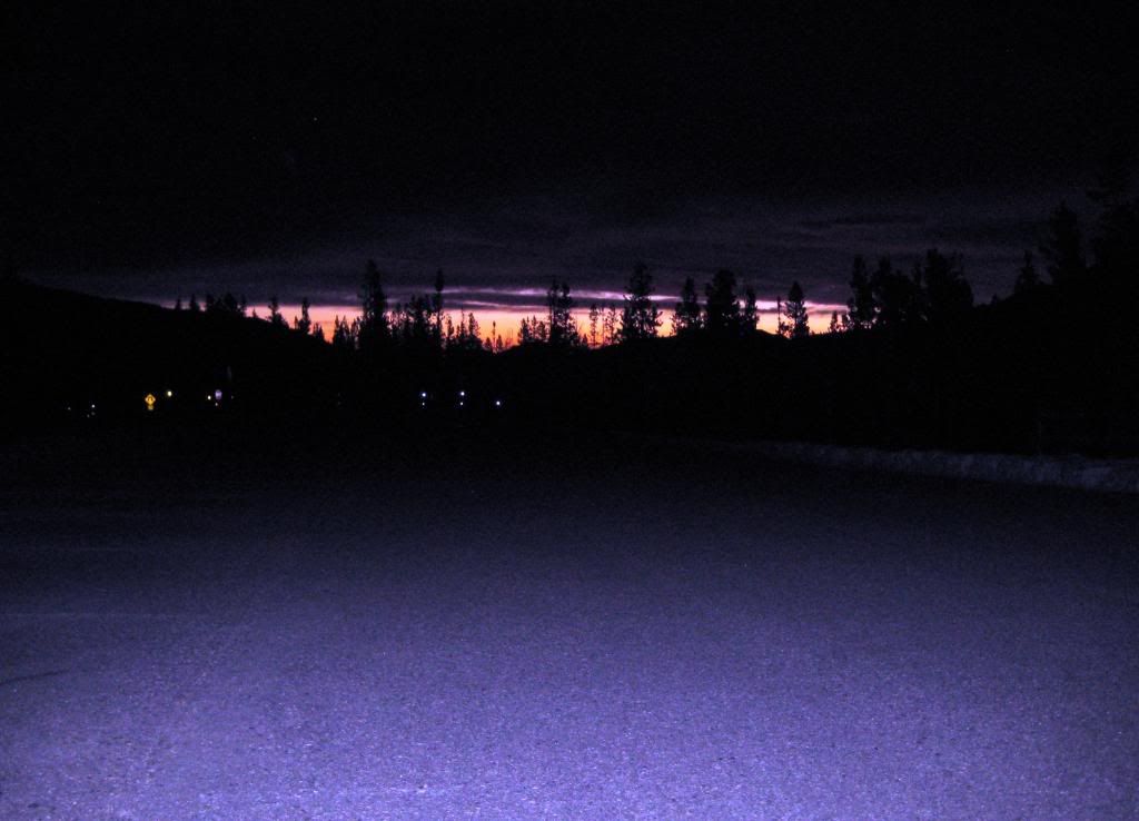
Jcwhite and I met at my place around 3:45am and headed up to the park. The forecast was for clear skies early, deteriorating to snow later in the day. The stars were out as we descended into Estes Park, which provided early motivation.
photo by Jcwhite
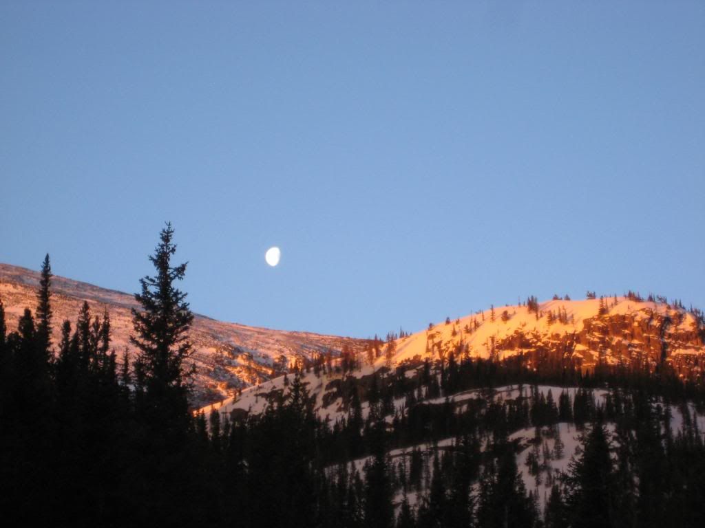
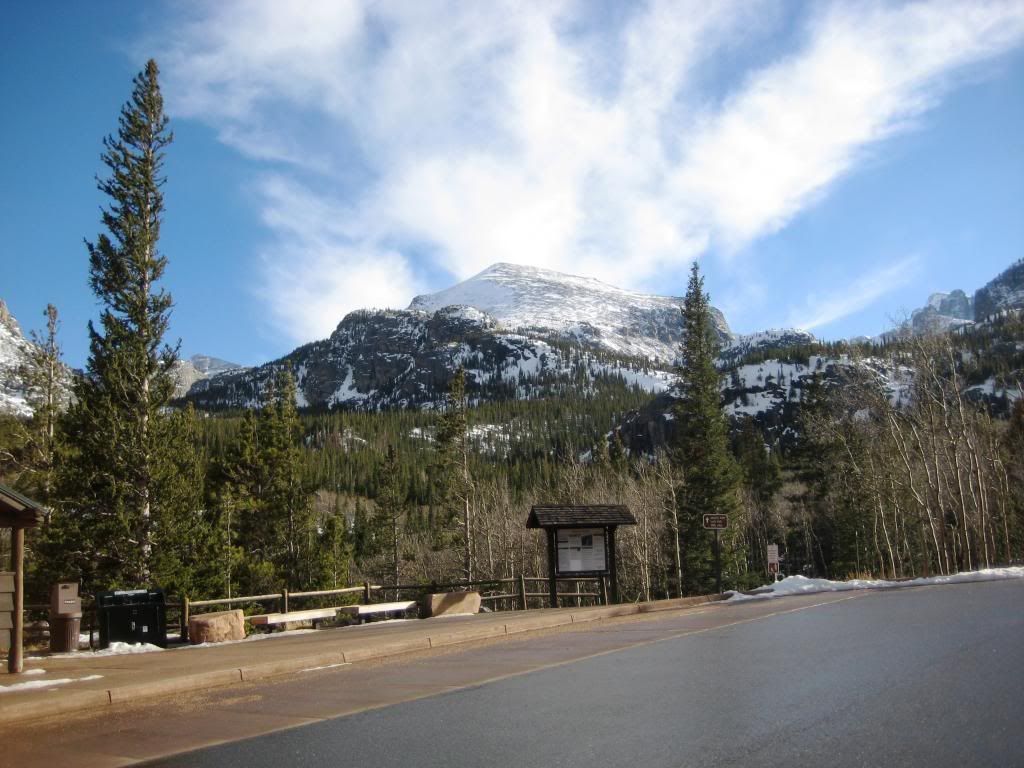
We were skinning from the Glacier Basin TH by a little after 6am. It was quite warm with no wind below treeline and the trail was in good skinning shape.
photo by Jcwhite
We took the winter shortcut after the second bridge and made good time up to Black Lake.
photo by Jcwhite
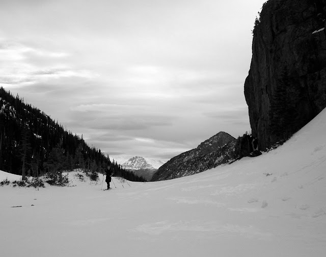
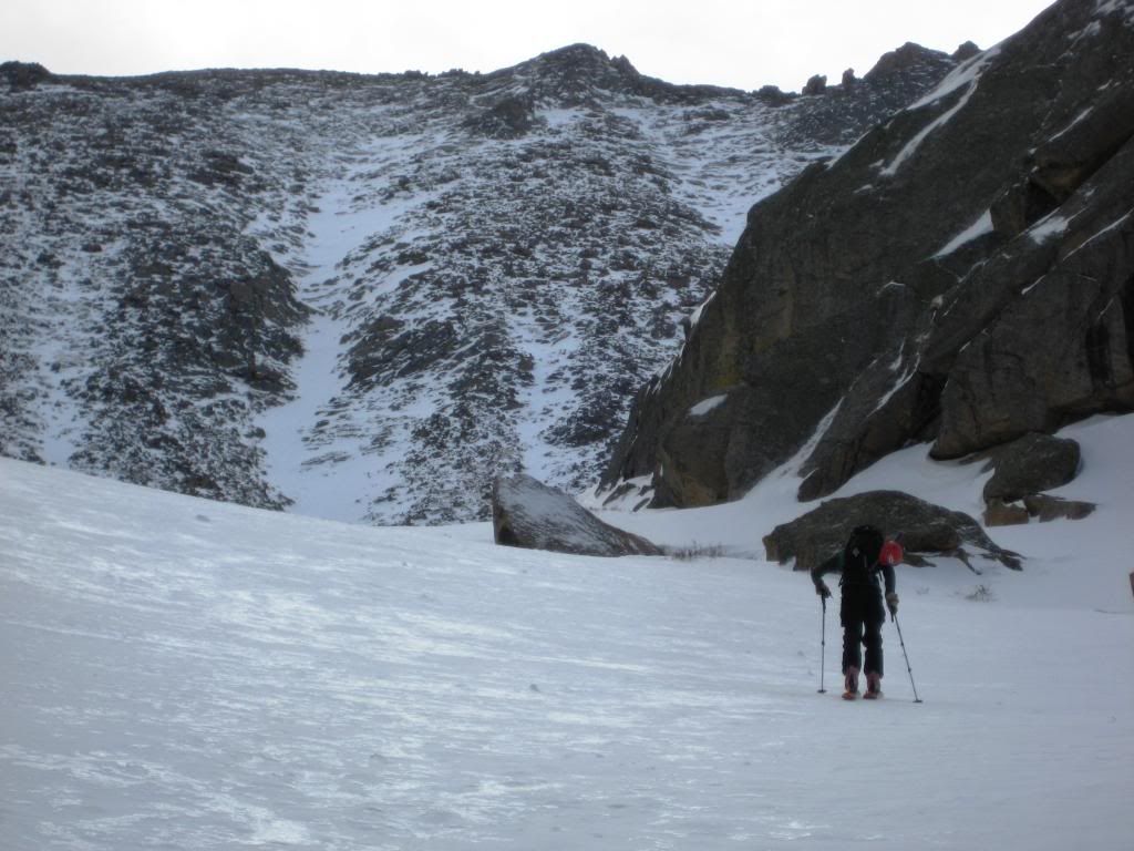
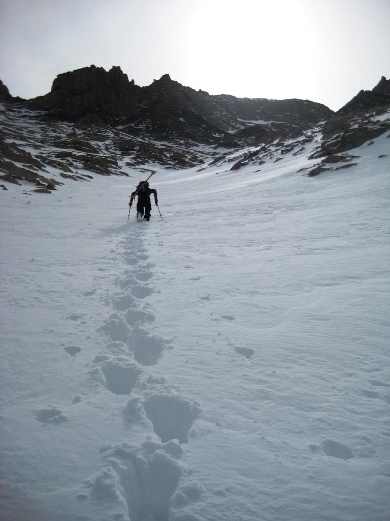
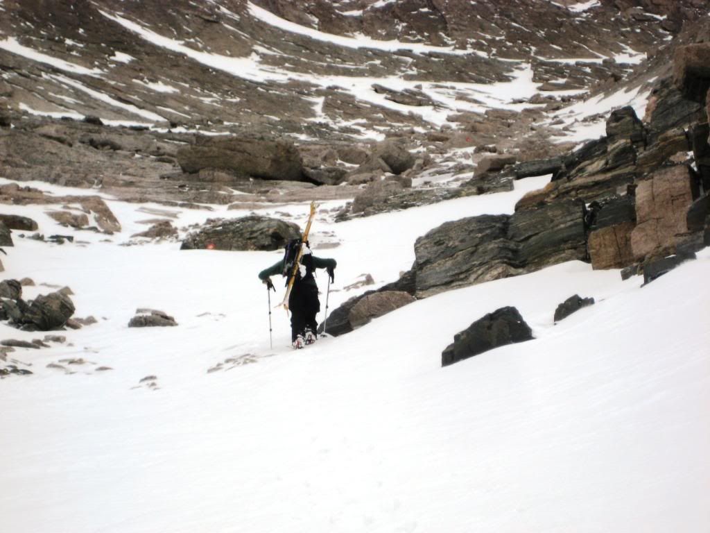
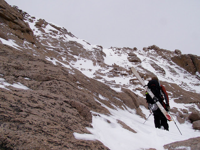
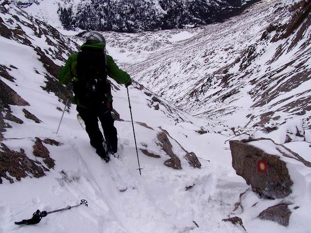
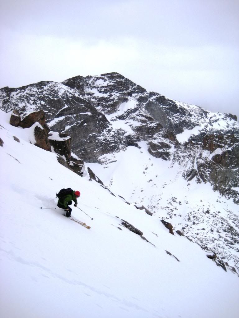
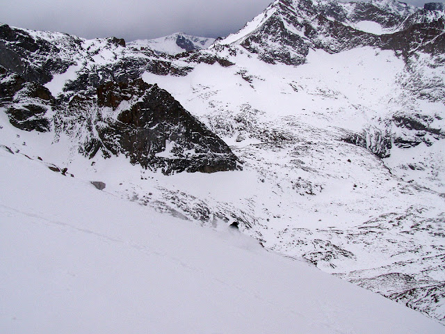
We found ourselves at the base of the Trough at around 8:30am. After some food and beverage, we transitioned from skins to crampons for the long boot pack up the Trough.
The cliff section at the bottom of the Trough reminded us that this was Longs and we better plan on some hand to rock combat.
photo by Jcwhite
The sun was up by this time, but barely visible through the increasing clouds over the summit. The lower section of the Trough held good boot packing snow, recycled powder with a thin wind crust on top.
photo by Jcwhite
Media Dude's tracks from a few days prior were completely covered. This suggested that it must have been windy the last few days, though there was only a slight breeze as we ascended.
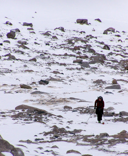
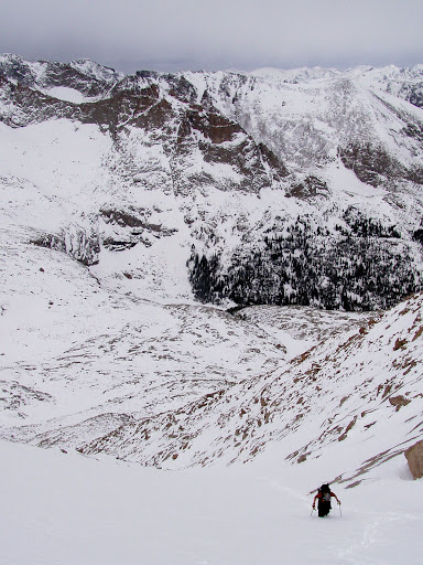
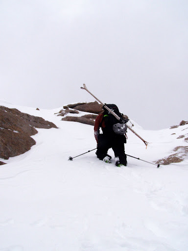
As we moved higher, the wind crust disappeared and the recycled powder depth increased significantly, slowing our progress.
We began noticing a graupel layer appear just under 2 inches of recycled powder at about 12,800ft. This graupel layer increased in thickness to about 4 inches as we moved higher. This gave us some concern. It is spring, but the snowpack high in the Trough is still a very much a winter snowpack. We altered our boot pack line toward the edge of the snow and made note to check stability on the descent. Note: If a lot of additional snow falls on this layer in the coming weeks, without a warming cycle, it will be a serious hazard.
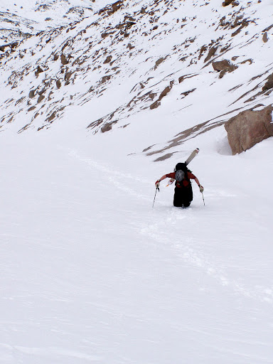
We struggled in knee to thigh deep snow to move higher. Once we reached the intersection with the Keyhole route, the snowpack thinned out and less energy was needed. On one hand we were glad to not have to work so hard, but on the other we knew the skiing wouldn't be as good as down lower.
photo by Jcwhite
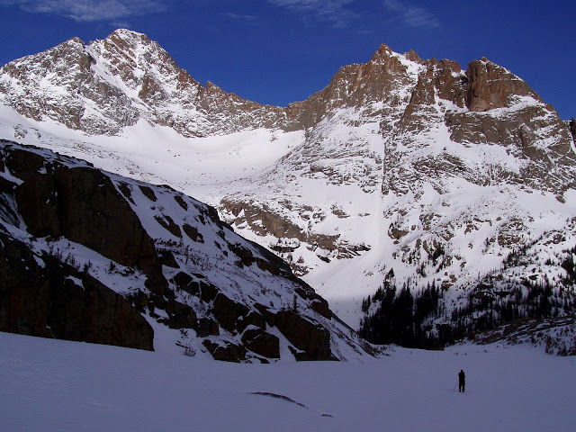
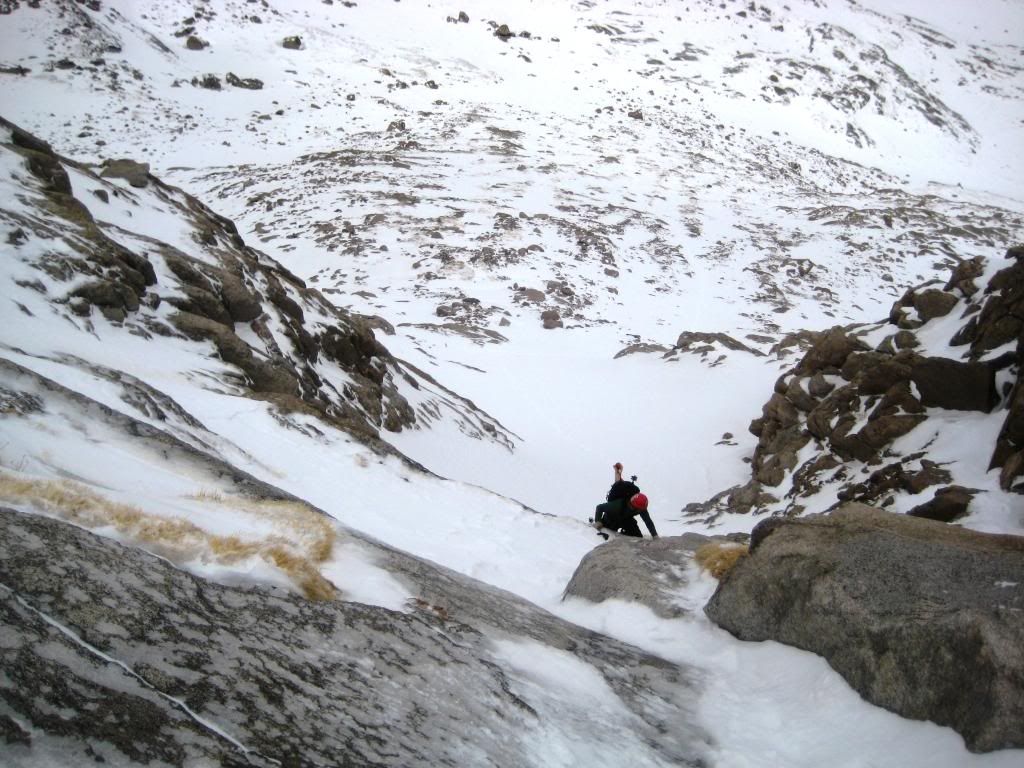
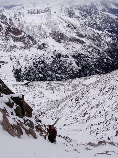
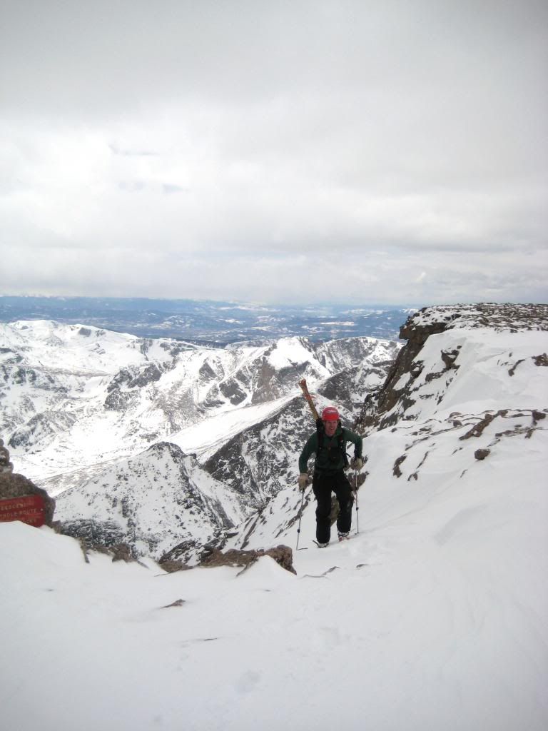
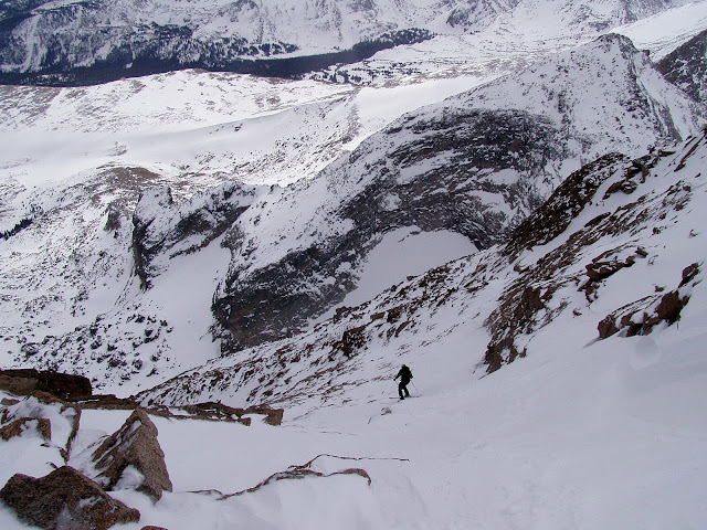
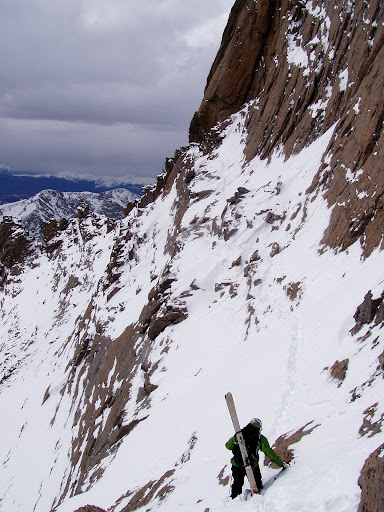
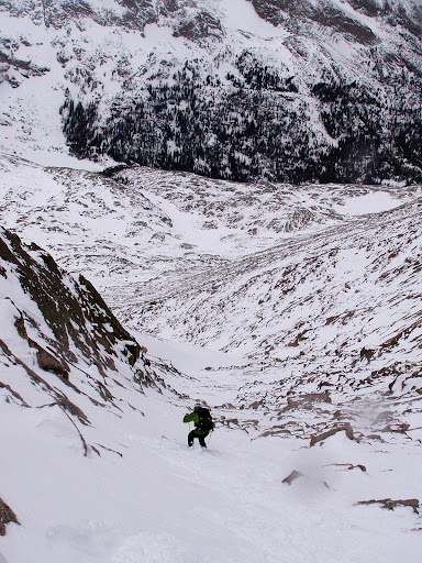
We both commented on how long the Trough is. It's only a ~30 degree slope but sustained for over 2,000 vertical. It seemed to just keep going. We were glad to put crampons to rock as we topped out above the Narrows.
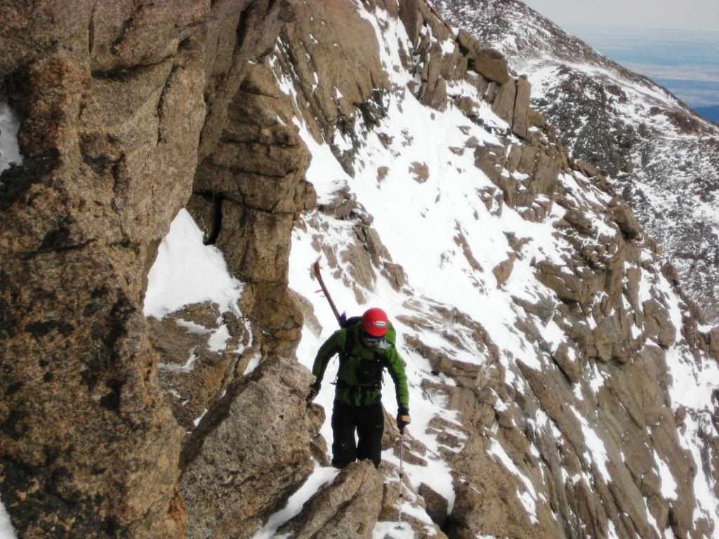
Now the Narrows lived up to its name for sure. In my book, a small ledge traverse at 14,000ft directly above a cliff that would certainly produce some serious injuries, qualifies as a dicey little section. With skis on your back, down right sketchy. We moved carefully across, with the occasional push as ski tips and tails met the rocks.
photo by Jcwhite
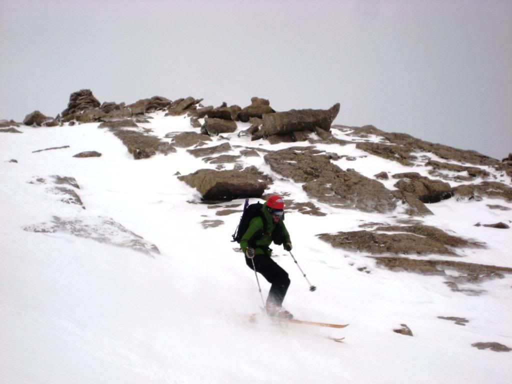
Then the moment of truth. Our speculation about the snow coverage on the last 250 vertical feet had continued all day. Jcwhite climbed the short little rock section at the end of the Narrows then turned to me and spoke a poetic combination of four letter words in a tone that made me smile. It was in. I scrambled up and saw for myself. Though it was a rock/snow combination below the Homestretch, it could obviously be pieced together. The Homestretch itself actually looked like it was going to offer a few nice turns.
The wind picked up a bit as we booted up the last few hundred feet to the summit.
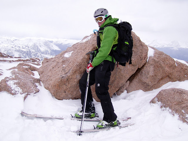
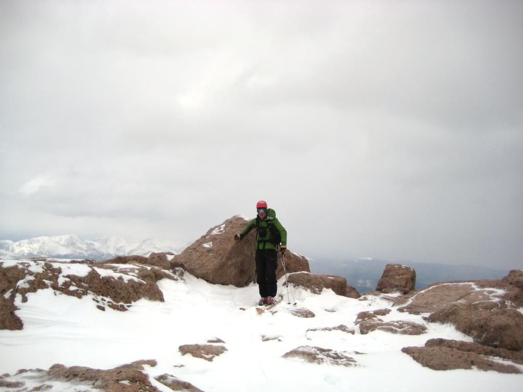
And the summit, well it happened to be well snow covered. Dragging skis up this mountain was going to be worth it after all.
photo by Jcwhite
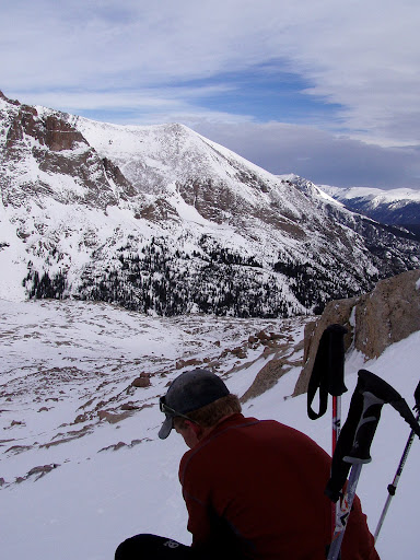
Jcwhite has the North Face of Longs high on his list and though it didn't look like it would go when we saw it from below, we went over to double check. After checking it from several angles we agreed that it probably wasn't ready, as it rarely ever is.
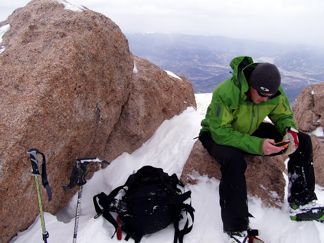
At the summit rock we ate, drank, and transitioned to ski mode. The weather was starting to deteriorate so we knew it was time to get down. We snapped a few summit pics and then skied over to the top of the Homestretch.
Photo by Jcwhite
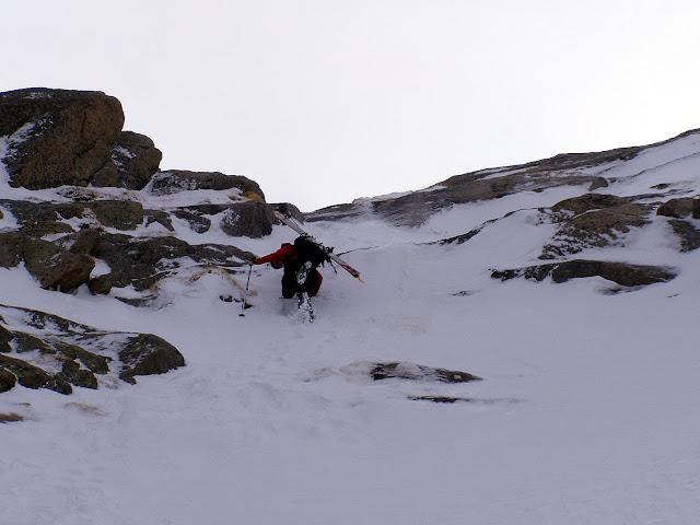
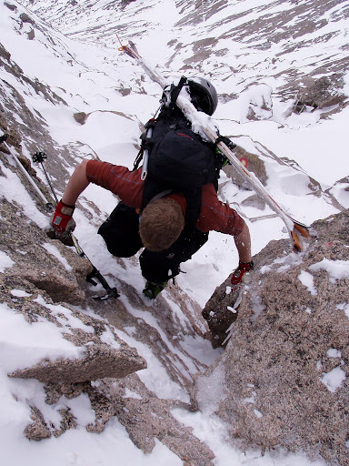
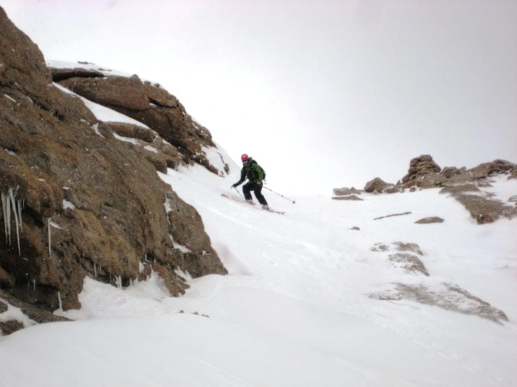
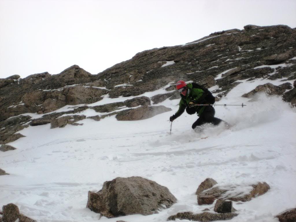
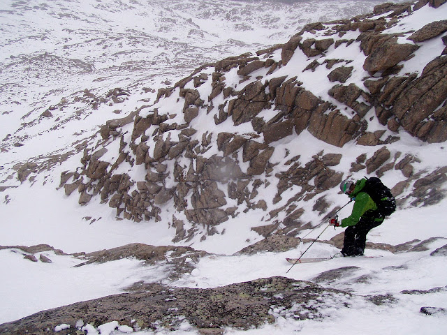
The first hundred feet were great. A few jump turns and then a traverse toward the Narrows. The traverse to the Narrows put the "rock" in rock skis. I learned a few new rock skiing techniques from Jcwhite, techniques that I am pretty sure aren't in any books.
photo by Jcwhite
photo by Jcwhite
photo by Jcwhite
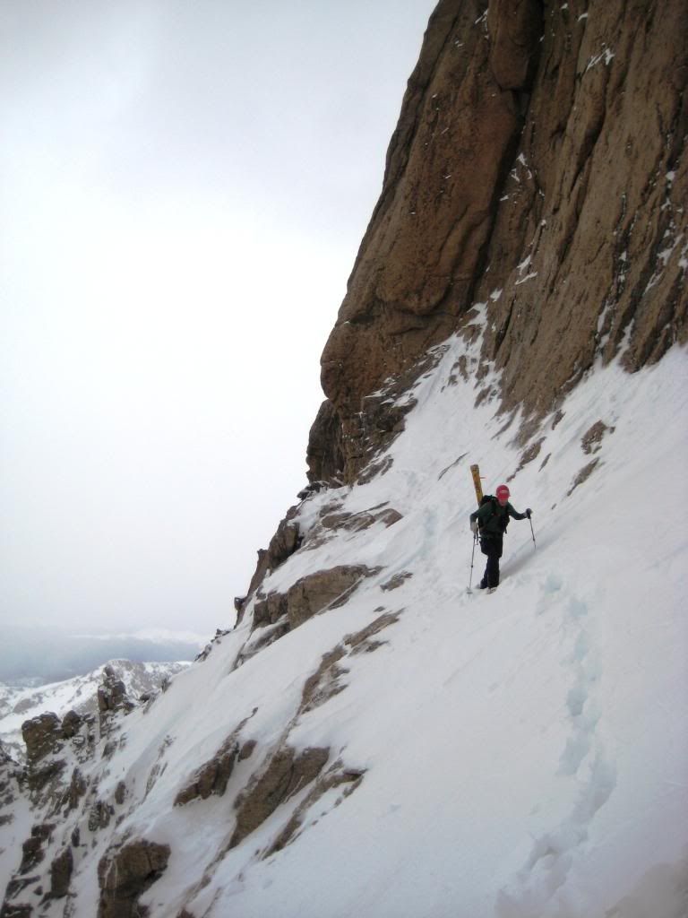
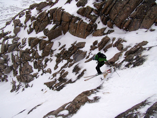
We discussed several possible routes to return to the top of the Narrows and the Trough. Jcwhite and his rigid ski descent ethics carefully contemplated each one I threw out. In the end, we settled on skiing to the low point of the Narrows and then putting crampons back on to ascend to the top of the Narrows. Reasoning that skis would go back on at a higher point than they were removed. I was happy with this decision, the thought of side-stepping up the Narrows on skis seemed like self inflicted torture.
photo by Jcwhite
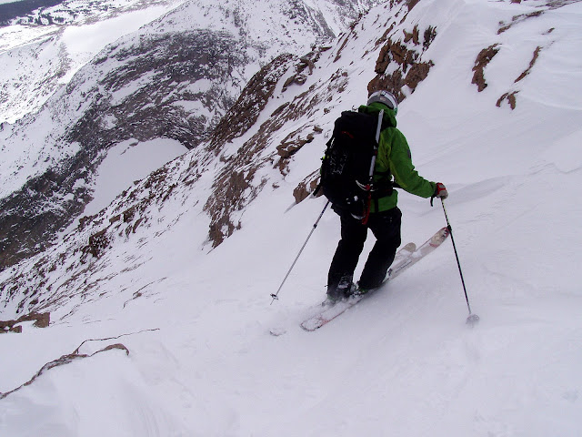
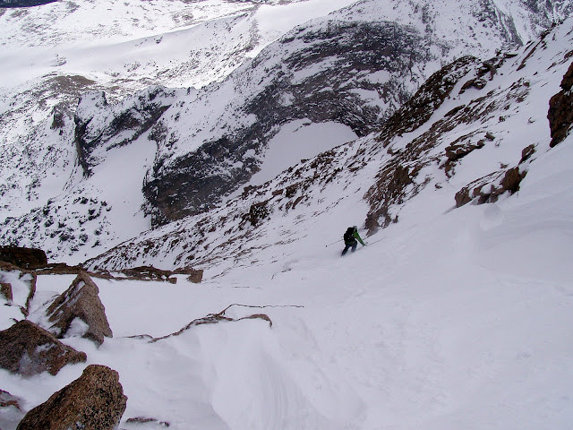
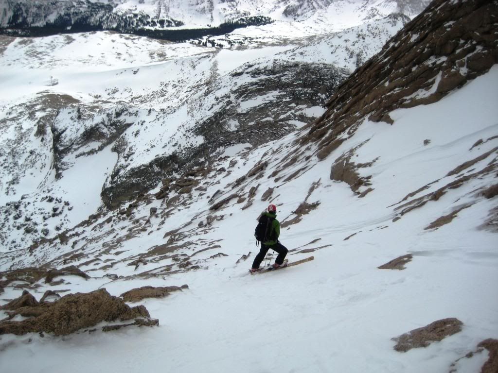
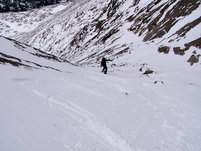
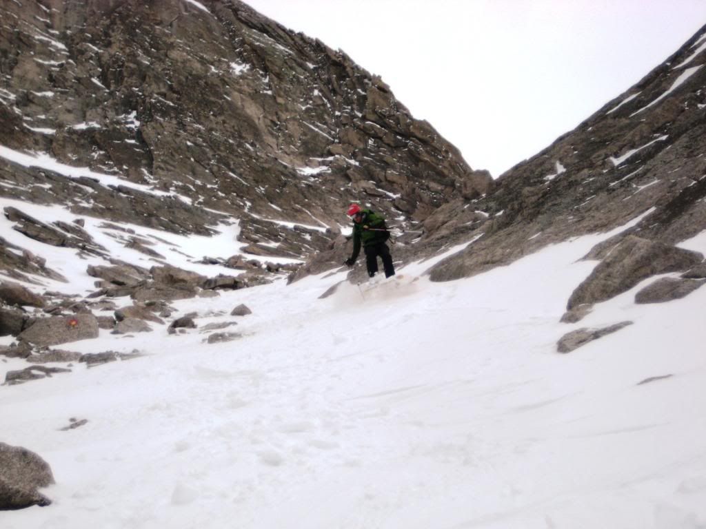
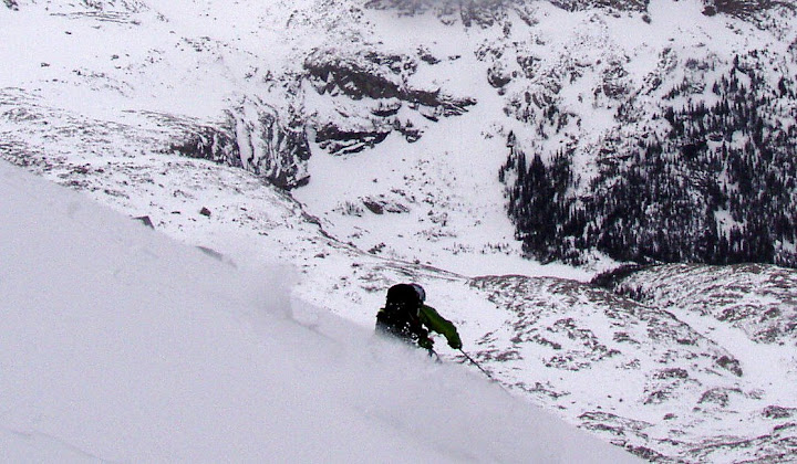
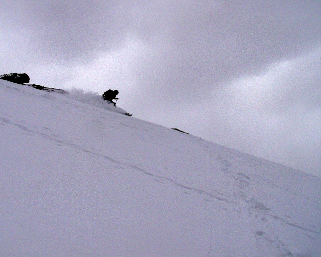
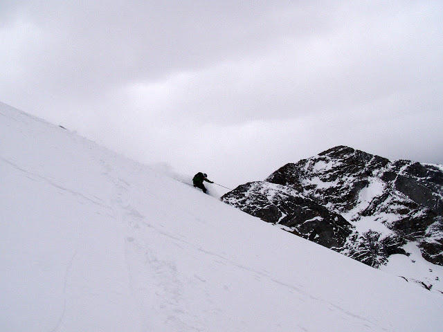
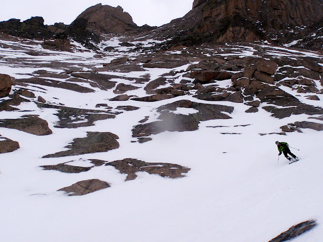
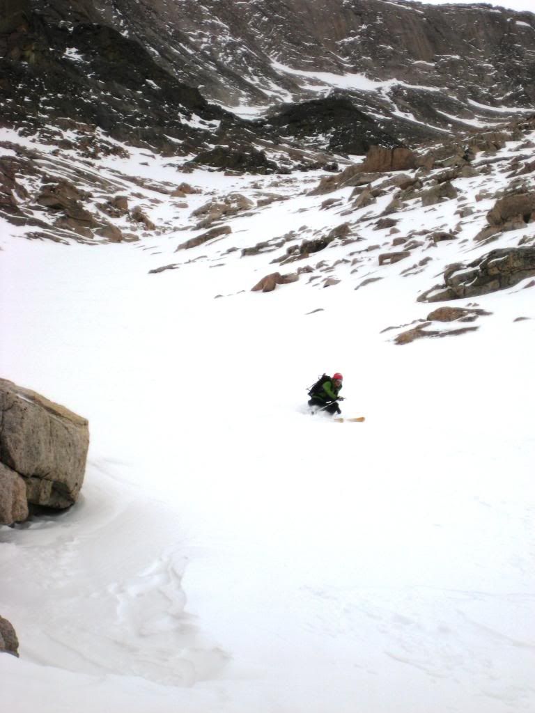
Once at the top of the Trough, the real fun began. A little bony and certainly some rocks were struck, but it was good enough to link turns in the upper section.
photo by Jcwhite
photo by Jcwhite
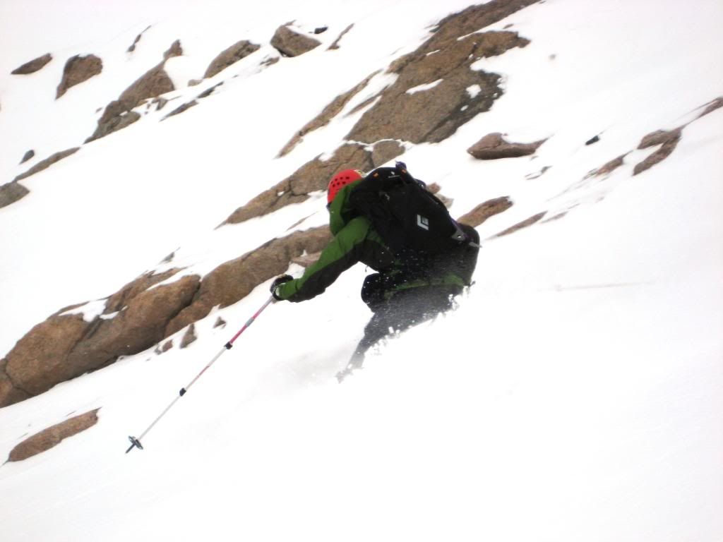
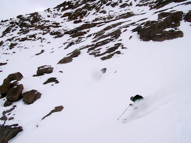
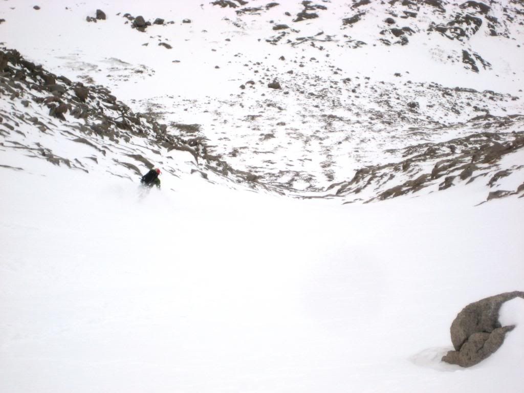
Once things opened up the snow gods delivered. I ski cut the slight rollover to see how the graupel layer would react. It held well, but we still treated this slightly steeper section with caution. The low angle of the slope and easy safe zone exits on both sides added peace of mind.
The remaining descent was creamy powder all the way down to the small cliff at the bottom.
photo by Jcwhite
photo by Jcwhite
photo by Jcwhite
photo by Jcwhite
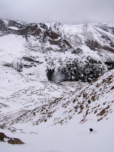
Then clouds moved in and snow started pouring. With skis on we picked our way down the cliff as far as we could and then dropped the last 5 feet.
We were glad to be off the mountain now that visibility had diminished.
We slowly skied through the thin snow and rocks to the bottom of the high basin and then enjoyed a few good turns to Black Lake. We found a group of 3 camped there planning to make an attempt the following day. We offered the beta, wished them luck, and skied back to the TH. As we shouldered our skis for the last few feet to the truck, the skies cleared once again.
photo by Jcwhite
We were both beat after a little less than 11 hours of work. Well worth it though. It was certainly a pleasure for me to accompany Jcwhite as he puts the final touches on a long and ambitious project.
Great climb and ski, Caleb & Jordan...glad the weather held for you guys. That trough snow looked delicious. A week and counting till this test is over and Im back at it with ya guys...
I think it‘s a toss up between Keplinger‘s and the Trough, I think Keplingers is a better ski since it‘s a more continuous line and you don‘t have to deal with the vagaries of the narrows. We were able to ski from the summit to about 9,000 feet in Wild Basin without taking the skis off once. The trough might be a better climb as the hike up glacier gorge is sublime and straightforward, and the hike up wild basin was freaking long and difficult. Either way it‘s a great TR and a great day on my favorite 14er in the whole world. Top notch. How many more peaks do you have left? The race is on!
on skiing this beast fellas. I haven't seen a TR linking the Homestretch to the Trough for a ski descent before, nice work getting creative with the ethics and making it happen! Excellent work on Tab the other day too, did either of you catch a glimpse of the coverage in Keplingers?
We considered Keplingers. But I had some information that it would not go. Unfortunately we didn't really get a look at it during our climb. It did appear that a line could be put together in that direction but we could only see a few hundred feet down. It would certainly be more straight forward if it is in.
Is a little bit deceiving. We both got back to the truck and couldn't believe the small amount of damage our skis had sustained...pretty good compared to a few of the sounds we heard on the way down...ssssccccccccrrrrrrrrraaaaaaaaappppppppeeeeeee...oh sh*t!
I made a video from the day that you can find on my site.
since I heard you guys were headed up there. Way to get it from the top. A whole lot more snow than last month. Benners, I like what you‘re thinking.
Caution: The information contained in this report may not be accurate and should not be the only resource used in preparation for your climb. Failure to have the necessary experience, physical conditioning, supplies or equipment can result in injury or death. 14ers.com and the author(s) of this report provide no warranties, either express or implied, that the information provided is accurate or reliable. By using the information provided, you agree to indemnify and hold harmless 14ers.com and the report author(s) with respect to any claims and demands against them, including any attorney fees and expenses. Please read the 14ers.com Safety and Disclaimer pages for more information.
Please respect private property: 14ers.com supports the rights of private landowners to determine how and by whom their land will be used. In Colorado, it is your responsibility to determine if land is private and to obtain the appropriate permission before entering the property.