Download Agreement, Release, and Acknowledgement of Risk:
You (the person requesting this file download) fully understand mountain climbing ("Activity") involves risks and dangers of serious bodily injury, including permanent disability, paralysis, and death ("Risks") and you fully accept and assume all such risks and all responsibility for losses, costs, and damages you incur as a result of your participation in this Activity.
You acknowledge that information in the file you have chosen to download may not be accurate and may contain errors. You agree to assume all risks when using this information and agree to release and discharge 14ers.com, 14ers Inc. and the author(s) of such information (collectively, the "Released Parties").
You hereby discharge the Released Parties from all damages, actions, claims and liabilities of any nature, specifically including, but not limited to, damages, actions, claims and liabilities arising from or related to the negligence of the Released Parties. You further agree to indemnify, hold harmless and defend 14ers.com, 14ers Inc. and each of the other Released Parties from and against any loss, damage, liability and expense, including costs and attorney fees, incurred by 14ers.com, 14ers Inc. or any of the other Released Parties as a result of you using information provided on the 14ers.com or 14ers Inc. websites.
You have read this agreement, fully understand its terms and intend it to be a complete and unconditional release of all liability to the greatest extent allowed by law and agree that if any portion of this agreement is held to be invalid the balance, notwithstanding, shall continue in full force and effect.
By clicking "OK" you agree to these terms. If you DO NOT agree, click "Cancel"...
Mt. Yale Summit Ski (Upper Silver Creek Bowl) - Denny Creek TH
Mt. Yale Summit Ski via the Davenport Route
Date: Saturday, April 11, 2009 Group: Carl, Lance, Ben, and I Route: West Slope standard ascent (~4mi.) and upper Silver Creek Cirque to West Slopes ski descent (~4.2mi.) from Denny Creek TH (Dav's Route) Stats: 8.2 miles (with a "shortcut" on the descent); 4,300' climbed; 4,100' skied; ~10 hrs RT
Our ski route of the upper Silver Creek Bowl (photo taken during a hike of Mt. Columbia, March 2007):
Our routes on the standard west side of Mt. Yale (red=climb; blue=ski):
I can't say it's been a great winter for climbing or Fourteener skiing for me with only three peaks climbed and skied this year, thanks to lack of snow or pure laziness. It was time to get out for something bigger. Originally we had planned on Mt. Bross, but those plans shifted to interest in Yale due to the high winds forecasted. Still, 80% chance of 4-8 inches of snow didn't have my hopes up high, but we remained optimistic. Carl and I entertained the idea of leaving one car at the North Cottonwood Creek TH road closure to enable a full ski of the Silver Creek Bowl, but we weren't certain that would have worked out. So we settled on Davenport's ski route. Obviously we would assess conditions when we got up there.
We met Carl and benners (and the rest of the 14ers.com group) at the Denny Creek TH Saturday morning at 6:00am and started hiking up the packed-down trail a half hour later. The skis went on around 11,100ft.; we skinned up to 11,600ft. where we took skis off (the snow was too icy to skin) and hiked the remaining 400ft. to the southwest shoulder plateau.
Carl, myself, and comin2getcha climb through the forest: Photo: benners
Ascent route up to the large southwest shoulder from 11,300ft.:
Carl, comin2getcha, and benners skin up to the shoulder:
Me climbing before a low fog approaching the shoulder (photo taken from ~12,100ft.): Photo: Carl
Taken from ~13,000ft., a look back at the route up to Yale's West Slope:
The boys skinning up towards the saddle:
Once on the West Slopes proper, we were able to put the skis back on near 13,100ft. and skinned up to 13,700ft. where, again, the snow was too slick to skin any farther. Skis back on our packs, benners and Carl alternated, setting the bootpack on the familiar west-facing varied snow conditions from hardpack to sugar snow up to the saddle. We climbed to about 13,950ft. to the summit ridge - climbers' right of the low-point of the saddle. bjohnson17 met up with our group here and would join us on the ridge scramble to the summit. Up to this point, we had a brief snow shower of little accumulation and pretty constant 10-15mph winds above treeline.
benners, myself, and comin2getcha follow Carl's bootpack up to the saddle: Photo: Carl
The summit ridge from the 13,900ft. saddle:
comin2getcha and I working across the ridge crest: Photo: benners
A few ridge-scrambling pictures...
Carl heads up to 14,000ft.:
benners makes his way up:
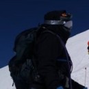
I scramble just below the summit:
Higher up on the ridge Wesley gave us the good news that there was nice snow coverage in Silver Creek Bowl. We summited around 1:00pm (in 6hrs. 35min. including all breaks; temperature: 20deg.). Skins came off and beacons went on.
A few summit shots (unfortunately due to cloud cover, I couldn't get any nice summit scenics)...
Our ski group on Yale (left to right: comin2getcha, me, benners, and Carl):
comin2getcha, me, and Carl (top photo); benners and comin2getcha bottom photos:
It was time to ski. From the summit, we headed north about 50 feet to drop northeast into upper Silver Creek Bowl (that way we wouldn't have had quite as long of a traverse back to the saddle). We left the summit at 2:00pm. Carl made the first few turns to a safety zone below the ridge. I dropped in after making a few ski cuts.
Carl dropping into upper Silver Creek Bowl: Photo: benners
I dropped in next... Photo: benners
Photo: Carl
benners' fine entrance off the summit:
And comin2getcha off the summit:
In this upper bowl, we found a nice few inches of powder on top of a solid base - it made for the best skiing we had all day. We dropped a few hundred feet into the bowl before cutting hard skier's left (north) and traversing back around to the saddle. We had about a 30ft. side-step back up to the saddle. During the ascent, we kept talking about how nice it would be if it cleared up a little bit for the ski descent. Guess what? It did.
From the safety zone, we were able to see most of the traverse to the saddle (red=climb): Photo: benners
Traversing north to the saddle: Photo: Carl
From the 13,900ft. saddle, Carl headed skiers' right (northwest) to keep the line continuous. This section required some billy-goating to get through the rocks. Back on the west side of the peak, ski conditions were typical wind slab with pockets of semi-sticky sugar to play in.
comin2getcha and benners work their way through the rocks (and benners gets some vertical, bottom photo):
Looking down the billy-goat section: Photo: benners
Carl gets some turns: Photo: benners
benners enjoying the wind slab:
comin2getcha getting his on the west side: Photo: Carl
I get my turns: Photo: Carl Photo: benners
We re-grouped at treeline and easily made our way down into the thicker forest. Here, we followed Wesley's "shortcut" which didn't quite turn out to be the case. We only had to take our skis off for 20 feet (photo below) until we met back up with the standard trail, where we made quick time skiing back to the trail register. Grateful for the cloud cover most of the day, we arrived back to the parking lot around 4:30pm. Great day guys - looking forward to many more!
Carl's shortcut through the forest led us to some tight trees and bare spots: Photo: Carl
Thumbnails for uploaded photos (click to open slideshow):
I was with the climbers on Saturday on Yale. Our group had 8 people that made the summit. I know of at least 2 other skiers along with the 4 in Caroline‘s group so I am thinking about 14 that got to the top on Saturday. I may be off by one.
West Face is a biatch. Turned my rock skis into scrap metal last year. Nice creative line you guys had off the summit. Finally got the AT package so I‘m down to join on some of these excursions.
And yes, finding the way back to the car below treeline can get interesting to put it politely.
Looked pretty thin on the upper west side. Did you guys get a look down the entire Silver Creek bowl? If so, how did the snow look? I‘m considering a climb/ski from Avalanche Gulch.
lordhelmut: I‘m so happy to hear you finally got your AT set-up! I definitely took some near-core shots to my skis. The people at Boulder Ski Deals like my business. You‘re welcome to ski anytime - when will you be good to go?
Wesley: You know exactly why your shortcut is in quotes! And, I do agree with Ben. Duh!
Bill: I peeked down the bowl and the snow looked nice - much better than the west side. I would have loved a ski of that entire NE side, but we needed more time to plan leaving a car there.
when one, my ankle stops getting agitated when compressed in a ski boot and two, when the a**hole who I paid the skis for on ebay actually gets around to sending them (its been nearly 3 weeks).
I always laugh when I read a report about lazy 20 something year olds who are only getting 15,000+ feet of vertical in an off winter season.
how steep were the slopes there? I like that one shot of you with the steep background
nice report - looks like you found a decent line around rocky areas . the other face sure looked tempting
sorry guys couldn‘t resist - as you link turns to the bottom
they can always come get you
I think Wesley measured a part of the West Slope to be around 38 deg. On the Silver Creek side, I would say it‘s about the same; not much steeper. A very intermediate ski descent IMO.
Carl I think your shortcut should become the standard route, not sure why they put the current trail where it is when there's such a marvelous alternative. I‘m sure Caroline would agree with me 8).
You put together a nice TR Caroline. Good getting out with you guys again, and meeting everyone else on the mountain. I don‘t know why my ”shortcut” is in quotes though
Steve I would guess at least 12 summited besides the skier group. It was easy for us because we just had to follow the trench you dug for us the week before. Thanks for doing that.
Caution: The information contained in this report may not be accurate and should not be the only resource used in preparation for your climb. Failure to have the necessary experience, physical conditioning, supplies or equipment can result in injury or death. 14ers.com and the author(s) of this report provide no warranties, either express or implied, that the information provided is accurate or reliable. By using the information provided, you agree to indemnify and hold harmless 14ers.com and the report author(s) with respect to any claims and demands against them, including any attorney fees and expenses. Please read the 14ers.com Safety and Disclaimer pages for more information.
Please respect private property: 14ers.com supports the rights of private landowners to determine how and by whom their land will be used. In Colorado, it is your responsibility to determine if land is private and to obtain the appropriate permission before entering the property.


")
")
")
")
")
")
")
")
")
")
")
")
")
")
")
")
")
")
")
")
")
")
")
")
")
")
")
")
")
")
")
")
")
")
")
")
")
")
")
")
")
")