Download Agreement, Release, and Acknowledgement of Risk:
You (the person requesting this file download) fully understand mountain climbing ("Activity") involves risks and dangers of serious bodily injury, including permanent disability, paralysis, and death ("Risks") and you fully accept and assume all such risks and all responsibility for losses, costs, and damages you incur as a result of your participation in this Activity.
You acknowledge that information in the file you have chosen to download may not be accurate and may contain errors. You agree to assume all risks when using this information and agree to release and discharge 14ers.com, 14ers Inc. and the author(s) of such information (collectively, the "Released Parties").
You hereby discharge the Released Parties from all damages, actions, claims and liabilities of any nature, specifically including, but not limited to, damages, actions, claims and liabilities arising from or related to the negligence of the Released Parties. You further agree to indemnify, hold harmless and defend 14ers.com, 14ers Inc. and each of the other Released Parties from and against any loss, damage, liability and expense, including costs and attorney fees, incurred by 14ers.com, 14ers Inc. or any of the other Released Parties as a result of you using information provided on the 14ers.com or 14ers Inc. websites.
You have read this agreement, fully understand its terms and intend it to be a complete and unconditional release of all liability to the greatest extent allowed by law and agree that if any portion of this agreement is held to be invalid the balance, notwithstanding, shall continue in full force and effect.
By clicking "OK" you agree to these terms. If you DO NOT agree, click "Cancel"...
Stats (as reported by mapsource after uploading my track logs):
Backpack into camp: 1.1 miles, 0:35, elevation gain 300'
Ascend Mt Lindsey from camp: 3.7 miles, 4:03, elevation gain 3540'
Descend Mt Lindsey with side trip up the Iron Nipple: 3.8 miles, 3:23, elevation gain 300'
Backpack camp to TH: 1.1 miles, 0:28, elevation gain 60'
Totals
Elevation gain: 4200'
Mileage: 9.7 miles
Summits: 2 (Iron Nipple, Mt Lindsey)
Total time: 20 hrs 48 min
Brian's wife and kid were out of town so he wanted to take advantage of the weekend to do another 14er. He wanted to do Lindsey since his regular hiking partner had already done it. We looked over the routes and decided doing the NW ridge would be more fun and probably safer than the gully. We also read some trip reports and decided we'd backpack in somewhere between 1-1.5 miles and camp there to avoid the possible gun-slinging drunken partyers that others had reported.
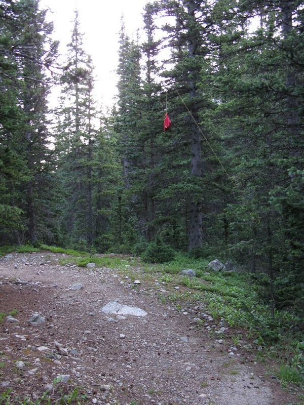
We left Friday, 8/1, about 3:30 PM from the Springs after stopping at Subway to grab dinner and King Soopers to grab some snacks for the next day's climb. The trip to the TH was pretty uneventful. Although, I would like to note that the road description on 14ers.com is spot on as far as the conditions. I think most of the road could be driven by a passenger car by a careful driver. The only difficult part was that big puddle with the culvert on one end. Brian's Nissan Pathfinder had no trouble with it. At one point on the 4WD section of this road, we had to back into a pullout to let 2 vehicles go by; the first was a pickup truck with, I believe, 12 high school age kids in the bed of the truck. The 2nd vehicle stopped to inform us that they saw a bear while they were there (more on this later). We arrived at the TH at approximately 6:30 PM. We put on our packs as the mosquitos started to bite, so, we sprayed on some OFF and hit the trail. A short while later, I looked at my GPS and realized we were at the one mile mark. Wow, that was quick. We saw a few campsites here, but kept going along the trail and met some backpackers coming down and stopped to converse a bit. Turns out, they were not planning on coming out this day, but had to because some bears ate all their food. They also mentioned they saw 3 bears and that they were pretty far out near the Blanca basin. It was at this point that Brian and I were second-guessing our decision to not camp at the TH, but we didn't change our plans. A few minutes later we were at the river crossing and found a really nice camping area just to the left of the trail, actually between the log jam and the log bridge (2 different river crossings). After a short look around, we decided to camp right there next to the river. After a dessert of cookies, we packed up anything that might give off an odor into a bear bag and searched for a spot to hang it. We settled on this spot with the bag hanging almost over the trail.
We started a small fire in the already established fire pit and did a little star gazing since it was a moonless night. We only had a small opening to view the sky between the trees, but we did see one satellite and a meteor before heading off to bed. Surprisingly, the sound of the river so close to my tent was actually very soothing and white-noise-ish and I was able to actually fall asleep (a rare occurrence for me in the wilderness).
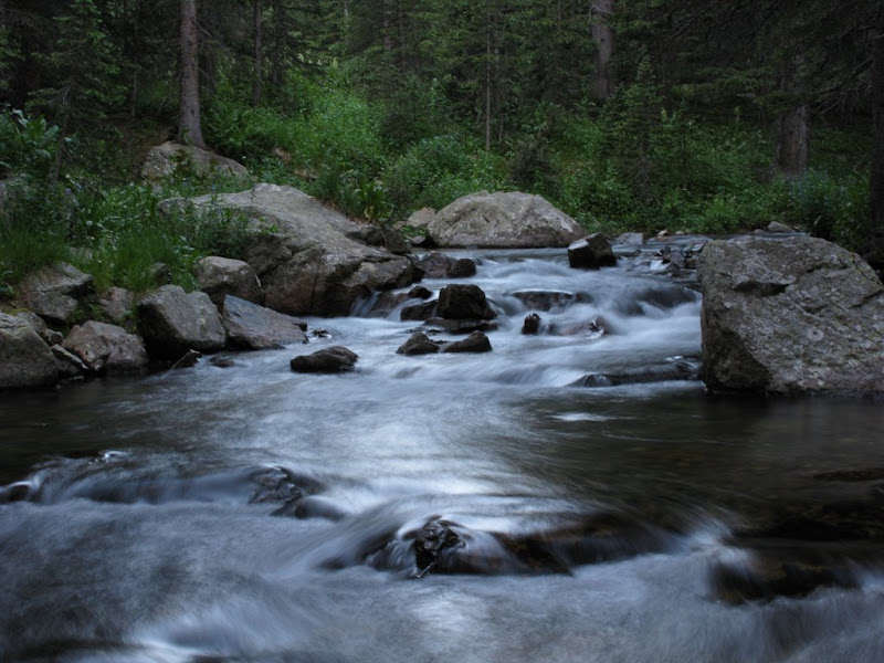
Saturday, 8/2, we both awoke about 5:45 AM without alarms. We saw the first group of hikers pass by our camp about 15 minutes later. We ate some breakfast and geared up for the day. I also took the opportunity to take some shots of the river in the morning light.
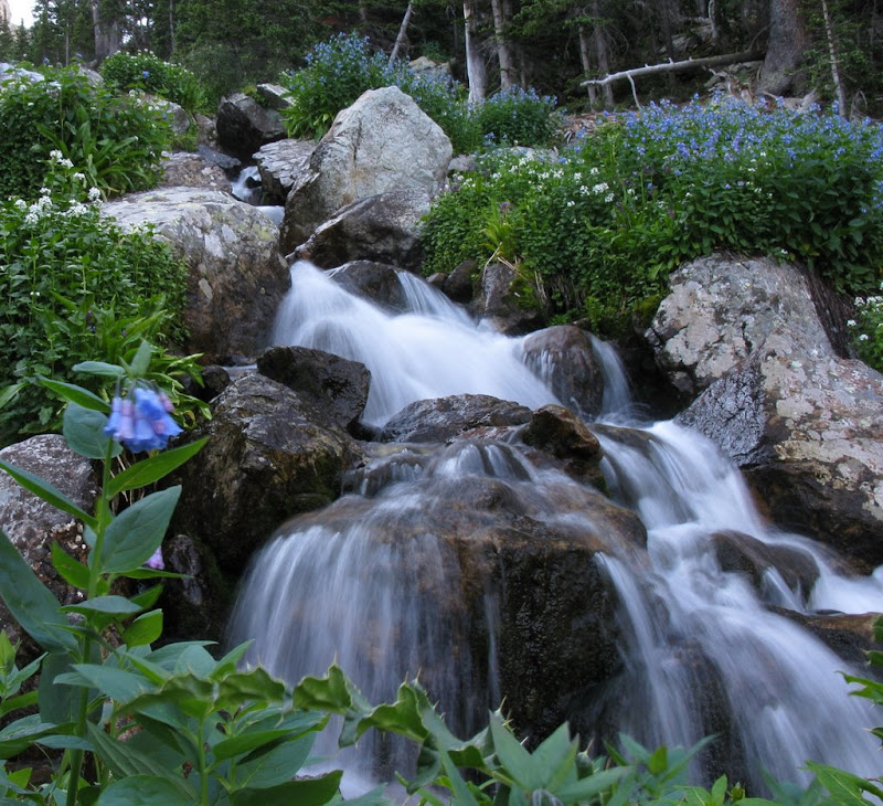
Two other groups of hikers passed our camp before we started out at ~6:45 AM. After a slight loss of the trail and reacquisition, we were headed up. And I mean up! This trail has a lot of felled trees and didn't seem to be as well travelled as other 14er trails. This is a steep climb that follows the beautiful cascade of waterfalls that make up the beginning of the Huerfano River. I again couldn't resist to take some photos. Unfortunately, I didn't have a real tripod -- only my tiny pocket tripod -- so most of these pics didn't turn out so great.
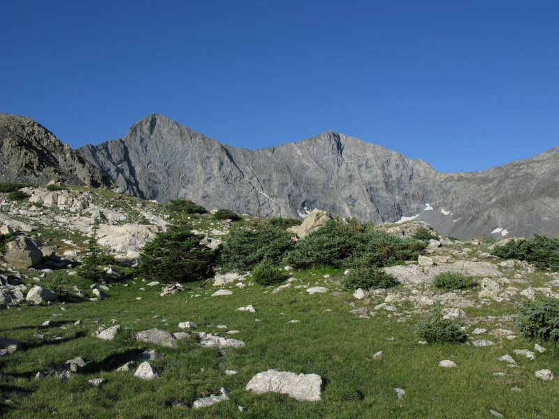
I caught back up to Brian and we eventually reached the ridge where we would turn East towards Lindsey. We took a short break here to put on sunscreen as it was definitely going to be needed on this nearly cloudless day. Here's a shot of Blanca and Ellingwood from this spot on the ridge.
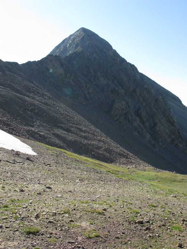
We kept leap-frogging one of the other groups of hikers. After descending a bit, we started climbing again to reach the NW ridge and stopped on a flat spot just before the talus started. Here's looking back across the high meadow.
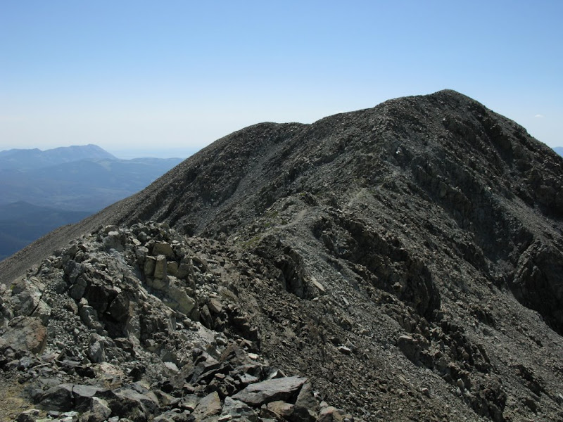
And a shot looking up the NW ridge towards Lindsey (our main goal for the day).
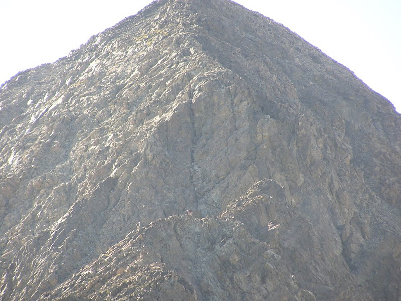
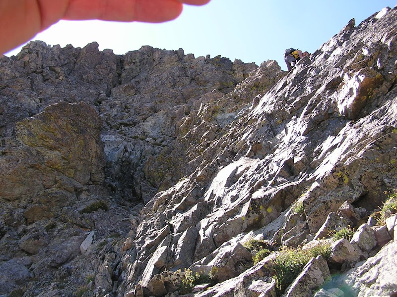
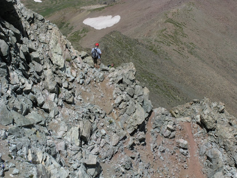
And Brian used his 10x zoom to take a picture of two climbers nearing the crux of the NW ridge route.
Here we separated from the other group since they were taking the gulley and we were going to take the NW ridge. As we started up the ridge, we were joined by another hiker, Uli (sp?), that wanted to also do the ridge route. He was having second thoughts as the crux of this route, in the morning light and from a distance, seems much more difficult than we had anticipated.
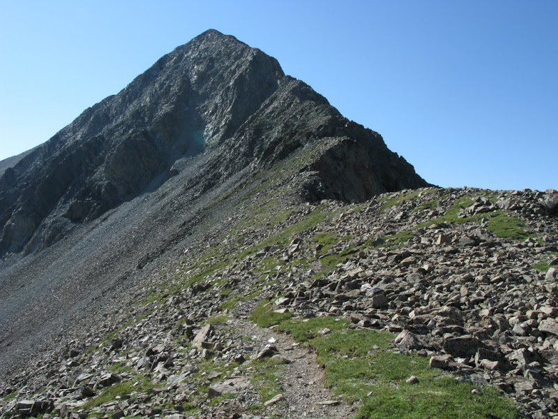
Nevertheless, we pressed on, assured that it would be easier once we got there. We followed the ridge crest up
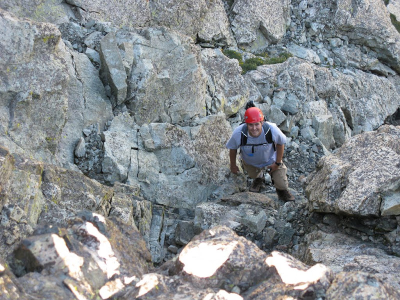
and I was on top of the last spire before the crux when I discovered I should be lower. I could have turned back, but I decided to just downclimb the spire to below the crux. Brian took this shot of me downclimbing.
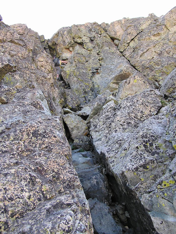
As we suspected, the crux wasn't as daunting up close. I took the direct route up the chimney which was fun climbing with lots of holds until I reached the top.
I wanted to just squeeze through the top, but with my pack on, that wasn't an option. So, I thought about going back down and taking an easier route, but then just decided to pull myself out of the chimney and climb the face up to the ledge above me. Here's a shot looking back down at Brian.
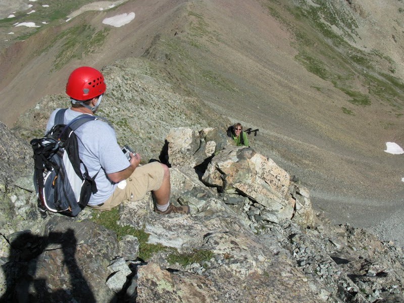
Brian and Uli took routes up the climber's left side. Here's Brian sitting on that left ridge of the crux and giving Uli some beta about the route up.
The rest of the climb up was fun and I reached the summit and realized it was just the false summit. A shot from the false summit looking towards the real summit.
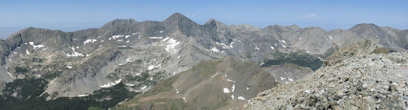
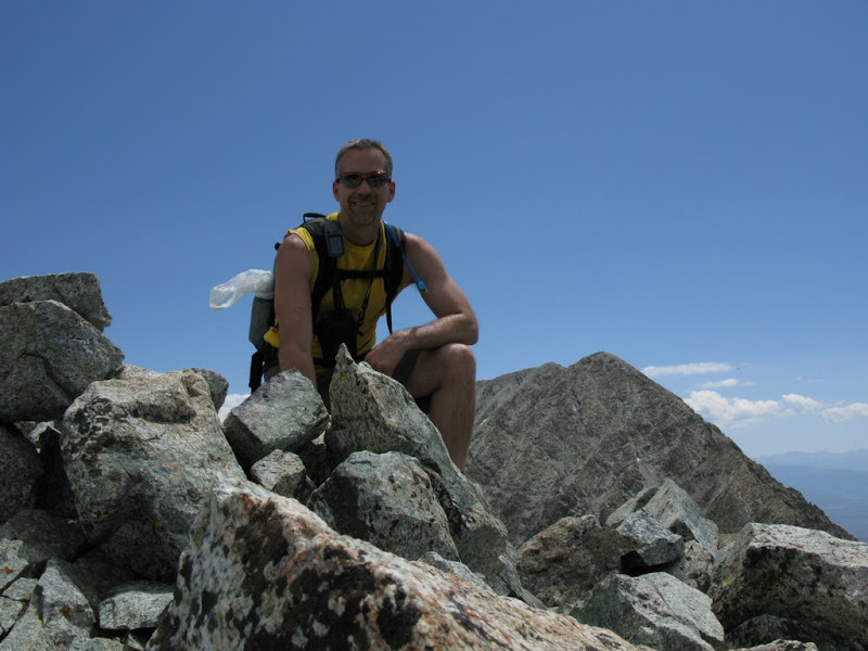
I waited here for Brian and Uli before we all hiked/hopped across the ridge to the real summit reaching it at 10:45 AM. The weather was still beautiful and we hung out on the summit for about 30 minutes before starting to descend. Here's a summit panorama
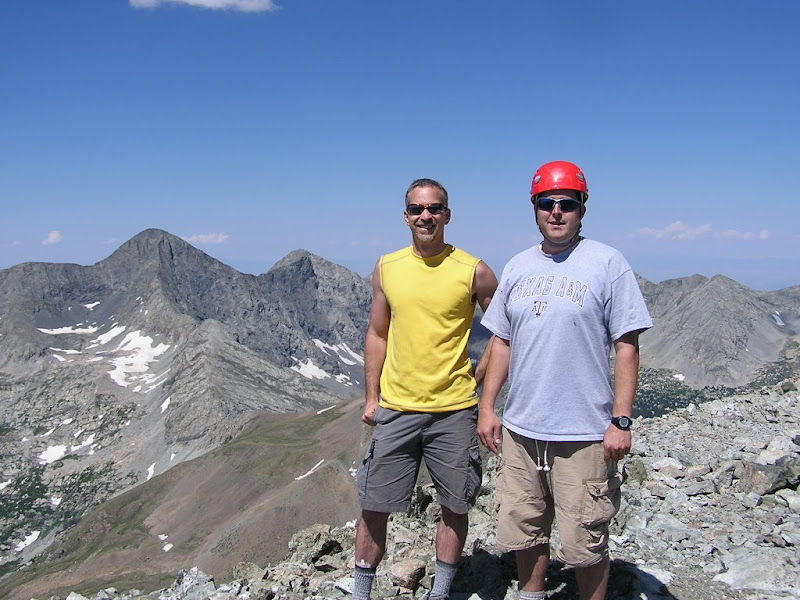
And the summit pic of Brian (right) and I (left)
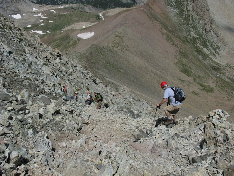
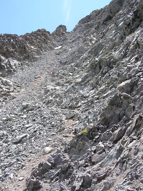
We thought going down the gulley would be easier and more fun than the ridge. There was another group of hikers that left the summit just a few minutes before us. We caught them at the gulley.
The gulley is very loose and Uli and Brian took off down ahead of the other group. Here's a shot of Brian and Uli reaching the top of the steepest part of the gulley.
I took a more solid route near the descender's left to try and avoid the loose stuff and to avoid letting loose rocks on the other group. This took me a little while longer to descend since I was basically downclimbing and Brian waited for me at the saddle. Here's a shot Brian took from the bottom of the gulley looking back up. The three other hikers are in this picture and I am the highest climber in the picture.
The weather was still great, so I decided to summit the Iron Nipple. Brian continued down. We planned to meet up again on the other side of the valley.
The Iron Nipple is a fun little scramble and once going through the spires, I stuck to the ridge and kept going until I reached the highest point, which was about 100' higher and 500' further than the summit coordinates in my GPS. I stayed only a few minutes, long enough to take a summit pic, and then headed down.
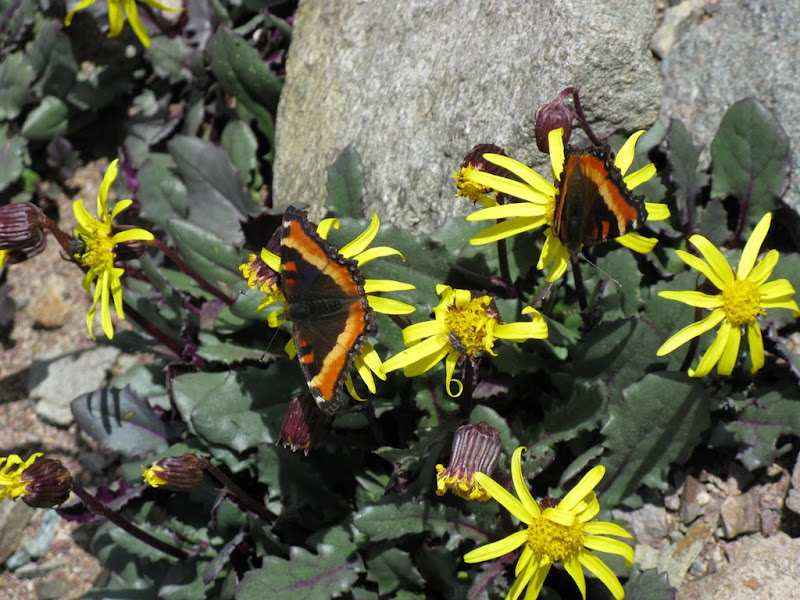
I thought I'd be the only one taking this extracurricular climb today, but as I was headed down, I heard the clanking of poles on the rocks above me on the ridge. Another group of 3 hikers decided to summit the Iron Nipple too. As I came closer to the saddle, I decided to take the scree field down to save my knees a bit. That was fun! In the middle of the scree field, there were some very colorful butterflies and I just had to stop and try to take a few pics of them.
As I crossed the rest of the valley towards the ridge, I thought the trail looked less worn than I remembered. My GPS shows that I was on a slightly different trail just north of the trail we ascended. As I reached the ridge, Brian called out and suggested we continued down the ridge across a snow field. This was quite easy and we intersected with the trail shortly after. After comparing my track log to the one on 14ers.com, I realized that the trail we descended was the one on 14ers. I guess the other trail was created to avoid the snow. Either trail will get you where you want to go. We stopped to walk inside the mine on the way down, but didn't go in too far.
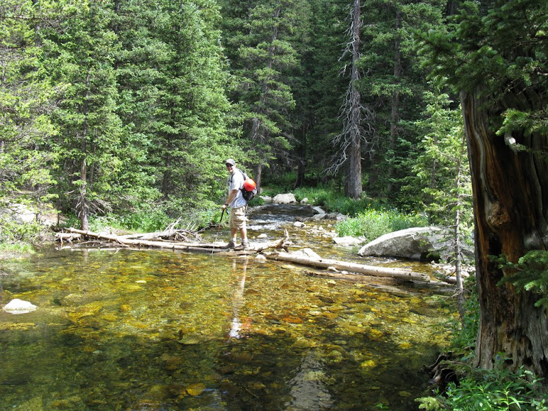
We reached the river crossing (and our camp) about 2:35 PM and decided we'd do the log jam to spice things up. Nobody fell in. Here's Brian crossing the log jam.
We packed up the rest of our gear and hiked back to the TH without seeing a bear, but we did see some bear scat right in the middle of the trail that wasn't there on the way in.
We had seen a bar/grill in Gardner and planned to stop there on the way home for some dinner. As we entered Gardner, there were cars parked along both sides of the road and as luck would have it, it was the Annual Garnder Chuckwagon Supper. Brian and I decided to try it for only $7 a person. The food was plentiful if nothing else and the lemonade was severely watered down and I'd have to say the highlight was the peach pie for dessert.
As Brian and I recollected the ridge, we were trying to figure out exactly what/where the 30' section of class 4 climbing was. The chimney I climbed was definitely class 4 and maybe one class 5 move at the top, but that was easily avoided by staying to the climber's left. I guess the definition of class 3 / 4 is still fuzzy in my mind. Oh well, we had fun and made it safely which is all that matters in the end.
The rest of the pics are
Finally, here's the topo with my track log.
Thumbnails for uploaded photos (click to open slideshow):
The NW ridge was a fun climb, we probably should have gone down the same way! Maybe someone can explain the difference between a Class 3 and Class 4, it‘s still a question in my mind (I would have rated the entire ridge as a Class 3 )....?
Caution: The information contained in this report may not be accurate and should not be the only resource used in preparation for your climb. Failure to have the necessary experience, physical conditioning, supplies or equipment can result in injury or death. 14ers.com and the author(s) of this report provide no warranties, either express or implied, that the information provided is accurate or reliable. By using the information provided, you agree to indemnify and hold harmless 14ers.com and the report author(s) with respect to any claims and demands against them, including any attorney fees and expenses. Please read the 14ers.com Safety and Disclaimer pages for more information.
Please respect private property: 14ers.com supports the rights of private landowners to determine how and by whom their land will be used. In Colorado, it is your responsibility to determine if land is private and to obtain the appropriate permission before entering the property.


")


