Download Agreement, Release, and Acknowledgement of Risk:
You (the person requesting this file download) fully understand mountain climbing ("Activity") involves risks and dangers of serious bodily injury, including permanent disability, paralysis, and death ("Risks") and you fully accept and assume all such risks and all responsibility for losses, costs, and damages you incur as a result of your participation in this Activity.
You acknowledge that information in the file you have chosen to download may not be accurate and may contain errors. You agree to assume all risks when using this information and agree to release and discharge 14ers.com, 14ers Inc. and the author(s) of such information (collectively, the "Released Parties").
You hereby discharge the Released Parties from all damages, actions, claims and liabilities of any nature, specifically including, but not limited to, damages, actions, claims and liabilities arising from or related to the negligence of the Released Parties. You further agree to indemnify, hold harmless and defend 14ers.com, 14ers Inc. and each of the other Released Parties from and against any loss, damage, liability and expense, including costs and attorney fees, incurred by 14ers.com, 14ers Inc. or any of the other Released Parties as a result of you using information provided on the 14ers.com or 14ers Inc. websites.
You have read this agreement, fully understand its terms and intend it to be a complete and unconditional release of all liability to the greatest extent allowed by law and agree that if any portion of this agreement is held to be invalid the balance, notwithstanding, shall continue in full force and effect.
By clicking "OK" you agree to these terms. If you DO NOT agree, click "Cancel"...
Uncompaghre Peak, Wetterhorn Peak
July 30th, 2008
Route: Uncompaghre (Nellie Creek), Wetterhorn (Ridgestock Driveway, Matterhorn shoulder, return via Matterhorn Creek)
Round Trip: ~15 miles
Elevation Gain: 5000+'
covfrrider(Solo)
After resting somewhat comfortably, I awoke Wednesday morning to frost on my tent! Needless to say, after the day Tuesday had been, I tried to go back to sleep and wait for the sun to hit the tent. That plan almost worked, but the overwhelming feeling of hunger drove me out of the tent and into the cooler. After a delicious skillet of eggs, sausage and cheese, I waited for the sun to come up and dry everything out. Today was a rest day, I moved slowly and methodically, organizing and preparing to move camp to Nellie Creek. Finally, around 10 I folded up the EZ-up, loaded it in the truck and headed off to Lake City.
Sunshine Peak from Shelf Road
I picked up some more ice for my cooler, and some Adventure Medical Ben's w/ DEET. I was fed up with the flies and wanted to be prepared. I leisurely drove on up to Nellie Creek, arriving at the TH around 1. I fixed some lunch, and decided to head back down the road a ways to find a camp site. I lucked out, as only a 1/4 mile or so down was an awesome site in the trees, at least 200 feet off the road. I set up my tent, grabbed my portable DVD player and settled in for a private screening of Bad Boys II.
Before dinner, I hiked up to tree line just to get a feel for the trail and catch a glimpse of what was ahead on Thursday morning.
With a 5:15 wakeup, I quickly made some hot oatmeal, and headed off. With a quick stop at the pit toilet, I was on the trail at 6:10. The mileage clicks off fast on this route, as the grade is gentle and steady.
First light on Uncompaghre Peak
Pano from the trail, peak is to the right of the frame
Wetterhorn Peak
I summitted at 8:40 and had the whole place to myself, except for some playful marmots that were sunning themselves and chasing each other around some rocks.
USGS Survey Marker
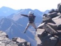
Sportin' 3 days growth
At about 9:10, just as I was leaving the summit I met a young man from Germany. We chatted for a few minutes and I asked him what he thought of our San Juans. He said they were comparable to the Swiss Alps. I'd heard that, but this really drove home how fortunate we are here in Colorado.
As I was descending I noticed an interesting anomaly. The profiles of Wetterhorn Peak and Mount Sneffels, as viewed from Uncompaghre are almost identical. Has anyone else noticed this?
Wetterhorn and Sneffels - Brothers apart?
I reached the junction of the Uncompaghre trail and Ridgestock Driveway at about 10:00. Up to the point it was cloudless sky, and the temperature on top of Uncompaghre had been a few degrees warmer. All indications were that high pressure was in control and we had a weak inversion. This meant that if we were going to have any T-storm activity, it would probably be very late in the day if at all. All systems were go for another big one! I made the right turn and headed down Ridgestock Driveway, Wetterhorn Peak and its class 3 fun in my sights.
A few minutes later, I encountered this unusual sight.
Sheep - not the mountain kind!
I circumnavigated the flock, and was kept at bay by this fella. He positioned himself between me and the flock and kept a close eye until I was clearly no threat. An amazing animal.
Sheep dog
I traversed the valleys/basins to Matterhorn and cut across its SW shoulder.
Ridgestock Driveway, Matterhorn and Wetterhorn ahead
Uncompaghre Peak from the ridgestock Driveway
Approaching the Matterhorn
As I arrived at the Matterhorn, I began a climbing traverse across it's lower flank, as I knew traveling further down Ridgestock Driveway and meeting up the Wetterhorn trail would be costly in vertical as well as horizontal energy.
Matterhorn flanks
The cirque between Matterhorn and Wetterhorn
Looking back at the shoulder of Matterhorn
Crossing the cirque, at first glance looked like a piece of cake, however, like many things in the mountains, looks can be deceiving. There were lots of cars size boulders, and some "gullies" (for lack of a better term) hidden amongst them. What appeared to be a simple boulder hopping exercise, actually turned into some class 3 scrambling. It took a good 30 minutes to cover a couple hundred yards in this stuff.
After completing the crossing, I came upon a trail segment, and started up towards the summit. It was now noon, and there still weren't any indication of over development. Even though I was feeling pretty tired at this point, I knew I was going to pull it off. I met a guy from Gunnison, shared some last minute beta, and headed up. The trail at this point is pretty neat. Kinda reminded me of something out of a movie. It just kinda winds around through interspersed boulders, with flowers and tundra grasses everywhere.
Looking back towards Matterhorn and Uncompaghre from just below the ridge
The transition from class 2 to class 3 high on the ridge
It took about 45 minutes to an hour to climb the last 800 feet. I had a copy of Bill's route description, and it was extremely helpful in identifying certain key features.
Rocks! Lots of Rocks!
I summited at 1:45, had the whole place to myself, and just soaked in the amazing, mild weather. I took some pics, drank half my Gatorade, and had a quick snack. Probably 10 minutes later, I was negotiating the down climb. I personally didn't think this was as exposed or treacherous as some have made it out to be. It certainly demands your attention and focus, but it didn't seem overly difficult to me. I just took my time and really enjoyed it.
Panorama from the top of Wetterhorn Peak (click for BIG version)
Just as I was about to transition back to class 2 trail, a fellow by the name of Michael came up the trail. We chatted for a few minutes, and I gave him my route description. I also told him I was about to run out of water, but for safety, I'd wait a ways down the trail for him, as it looked like he was last up for the day.
Michael negotiates some of the class 3
Columbines and Wetterhorn Peak
At this point I was feeling pretty beat, but the exhilaration of completing Wetterhorn buoyed my spirits. I took off down the trail, in search of water (it was quite abundant). I stopped, filtered a couple of liters and then headed down to the trail junction, where you find the first shade. I took off my boots and soaked my feet for about 15 minutes. One of the high points of the day!
Michael came down the trail just after 4, we hung out, he soaked his feet, and we headed off to the Matterhorn TH. We arrived there at 5:30, and he gave me a ride down to the Nellie Creek turnoff. Just as we stopped, a truck came around the corner and put his turn signal on to turn up Nellie Creek. I flagged him down and bummed my second ride of the day. It was Tim from Castle Rock (never caught your screen name) and we chatted all the way up to my campsite. He dropped me off, I quickly broke down my tent, and he went up to the TH. A few minutes later, he returned and took my campsite, as I was off for lower elevations. My work in the San Juans was complete.
I spent that night at Blue Mesa reservoir. On Friday, I decided to play tourist and drove up to Crested Butte for the day. A little biking and some lunch was just what I needed. It was a very relaxing day. Friday night I stayed at the Black Canyon. This would be my last night on the ground. I awoke to another amazing sunrise.
Sunrise over the Black Canyon
I checked in to a hotel in Grand Junction Saturday night, met up with a friend for dinner and just chilled.
Overall, it was a great and very rewarding trip. I was blessed with great weather and got to pull off some pretty big stuff. I look forward to more time in our "Swiss Alps"...
These pictures are amazing! I was in the San Juan‘s for 6 days at the end of July, and I noticed the similarities between Sneffles and Wetterhorn as well.
IMO, the San Juan‘s are the most beautiful range in the Rockies - and your pictures did them a great justice. Thank you for sharing.
Thanks for a great report-your pictures are very helpful! I have read in several reports that people do frequently take their dogs up that Class 3 of Wetterhorn. What are your thoughts? It would be my first Class 3 climb. My dog is very agile and hikes/climbs with me a lot.
Caution: The information contained in this report may not be accurate and should not be the only resource used in preparation for your climb. Failure to have the necessary experience, physical conditioning, supplies or equipment can result in injury or death. 14ers.com and the author(s) of this report provide no warranties, either express or implied, that the information provided is accurate or reliable. By using the information provided, you agree to indemnify and hold harmless 14ers.com and the report author(s) with respect to any claims and demands against them, including any attorney fees and expenses. Please read the 14ers.com Safety and Disclaimer pages for more information.
Please respect private property: 14ers.com supports the rights of private landowners to determine how and by whom their land will be used. In Colorado, it is your responsibility to determine if land is private and to obtain the appropriate permission before entering the property.