Download Agreement, Release, and Acknowledgement of Risk:
You (the person requesting this file download) fully understand mountain climbing ("Activity") involves risks and dangers of serious bodily injury, including permanent disability, paralysis, and death ("Risks") and you fully accept and assume all such risks and all responsibility for losses, costs, and damages you incur as a result of your participation in this Activity.
You acknowledge that information in the file you have chosen to download may not be accurate and may contain errors. You agree to assume all risks when using this information and agree to release and discharge 14ers.com, 14ers Inc. and the author(s) of such information (collectively, the "Released Parties").
You hereby discharge the Released Parties from all damages, actions, claims and liabilities of any nature, specifically including, but not limited to, damages, actions, claims and liabilities arising from or related to the negligence of the Released Parties. You further agree to indemnify, hold harmless and defend 14ers.com, 14ers Inc. and each of the other Released Parties from and against any loss, damage, liability and expense, including costs and attorney fees, incurred by 14ers.com, 14ers Inc. or any of the other Released Parties as a result of you using information provided on the 14ers.com or 14ers Inc. websites.
You have read this agreement, fully understand its terms and intend it to be a complete and unconditional release of all liability to the greatest extent allowed by law and agree that if any portion of this agreement is held to be invalid the balance, notwithstanding, shall continue in full force and effect.
By clicking "OK" you agree to these terms. If you DO NOT agree, click "Cancel"...
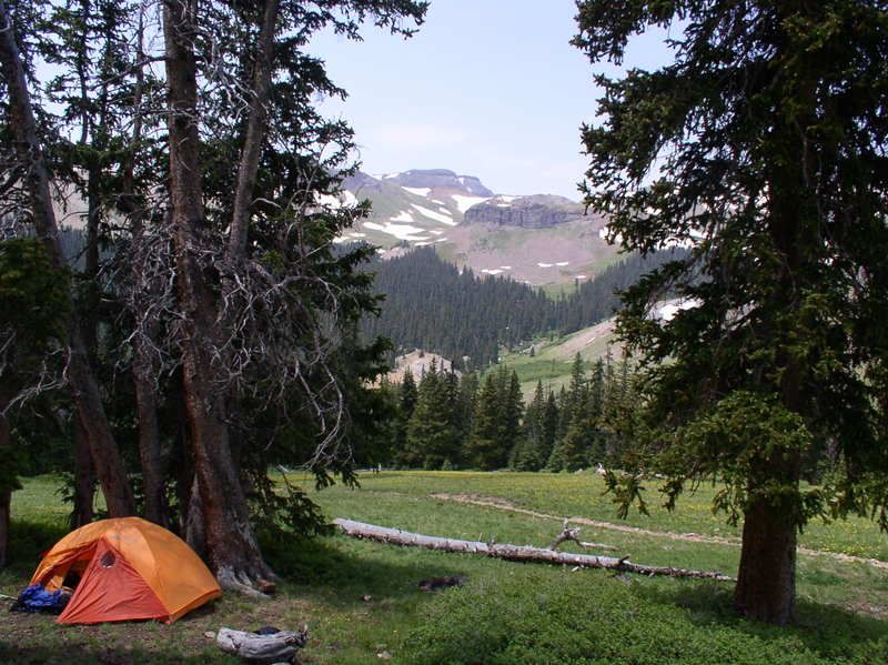
Somehow I thought it would be a good idea to push up our trip to friday night rather than leave saturday afternoon as planned. Phil and I readied ourselves quickly as possible and made our way to silverton. The approach awas the same as redcloud and those similar area peaks but we had to pass the cinammon pass turn and continue on to engineer pass. The road was bumpy but the 4runner is always continuing to impress me..We finally hit the Matterhorn TH and made our way up to a campsite. We pitched just east of the trail about a 1/2 mile after entering the uncompahgre wilderness, we saw others camped down lower in the basin aswell. We arrived at this spot just as it became dark we set-up the tent, made dinner and went to bed.
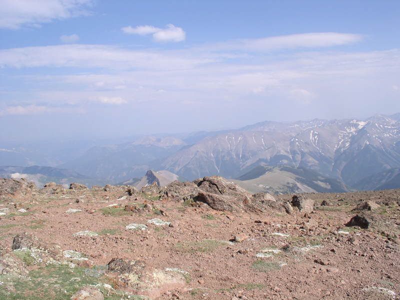
(shot of camp taken the following day)
5:00 am
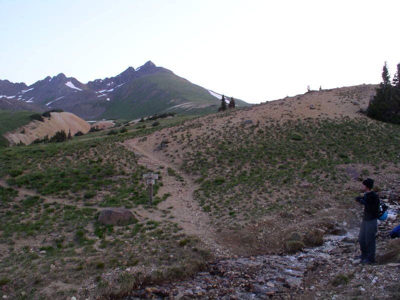
I had still to get my bag ready for Wetterhorn and as usual i packed more than was needed. I lingered in my bag for a few momwnts and we werent finally hiking until 6:00am. We stopped to filter water here where the trail splits. Later we would go right and around the ridge to uncompahgre but we didnt think of that yet...
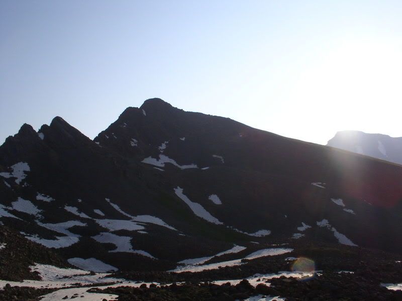
(Wetterhorn in the background)
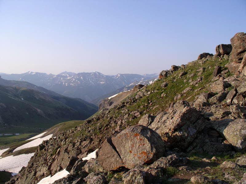
We hiked up past the meadow section into a pleasant boulder field just covered in marmots. We reached the top of the bouldery hill and came to the ridge.
last bit of grass, rock from here.
a different view of the ridge
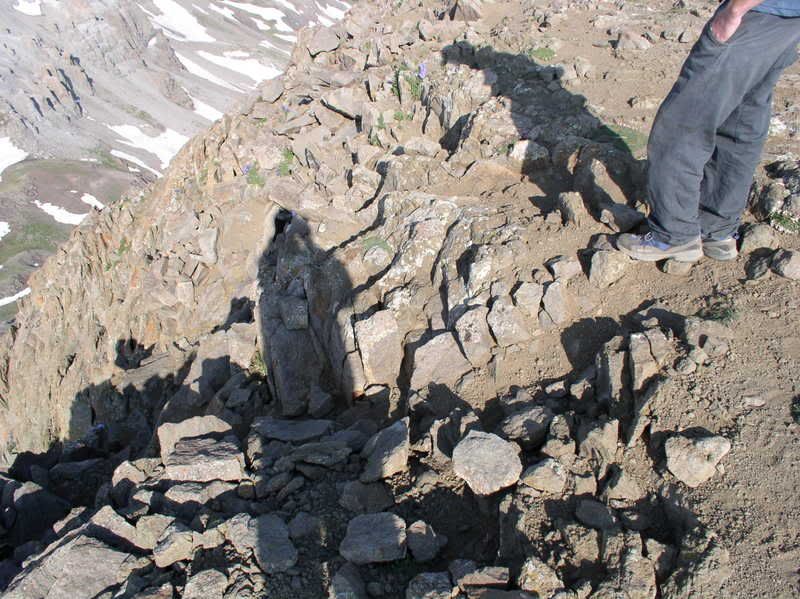
Well there wasnt much more picture taking unil we reached the top.
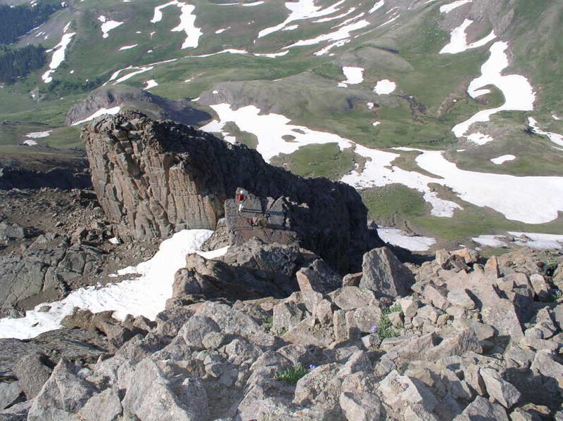
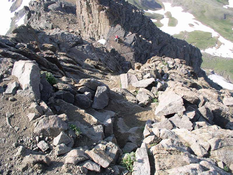
I did however get alot of pictures from the top of the final pitch that everyone looks at the Wetterhorn TR's for..
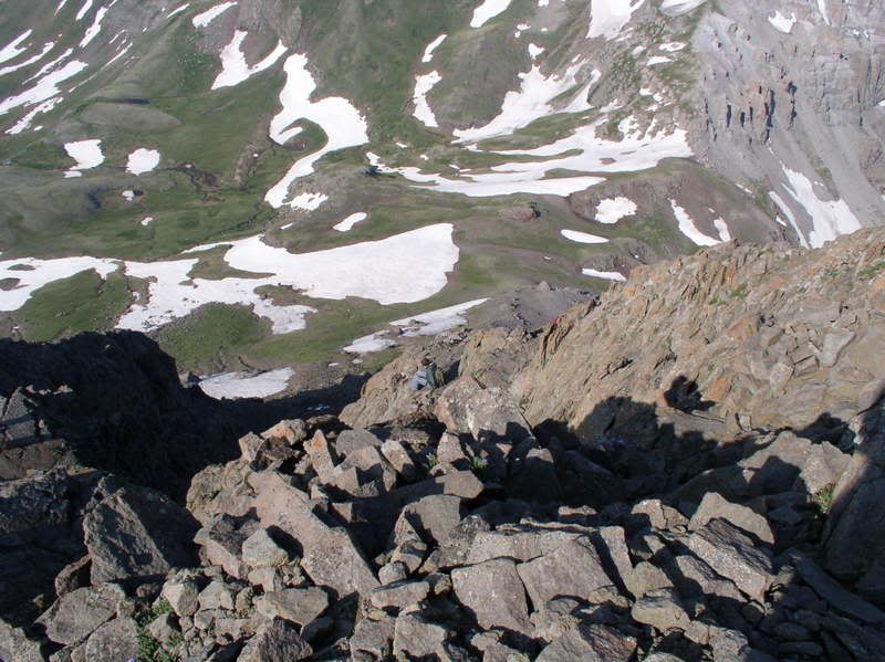
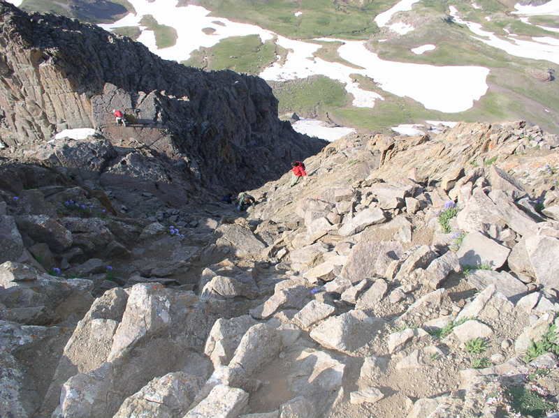
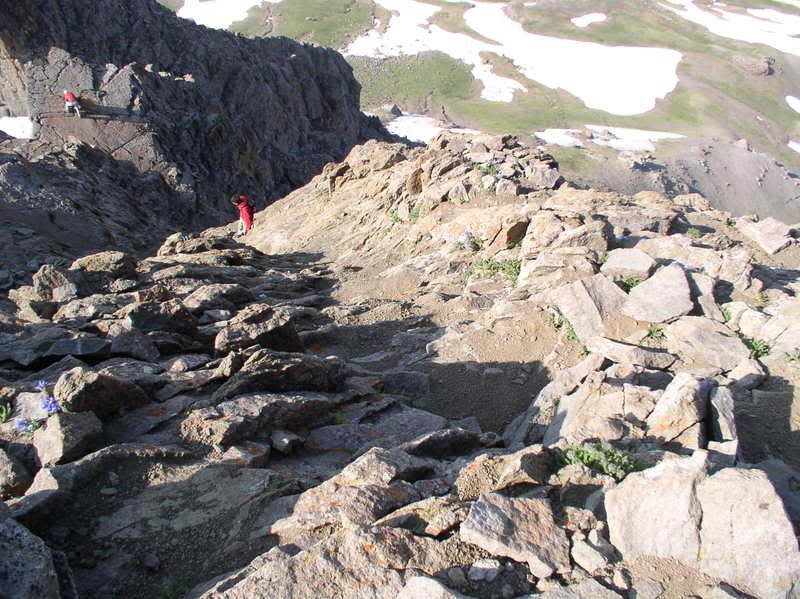
a shot of the ramp that connects you tot he cat-walk for the final climb. look for the guy in the red shirt, hes on it. From that point go right in this pic.
here in far left you can see the ramp and over right a climber descending on the route.
the final part of the ascent
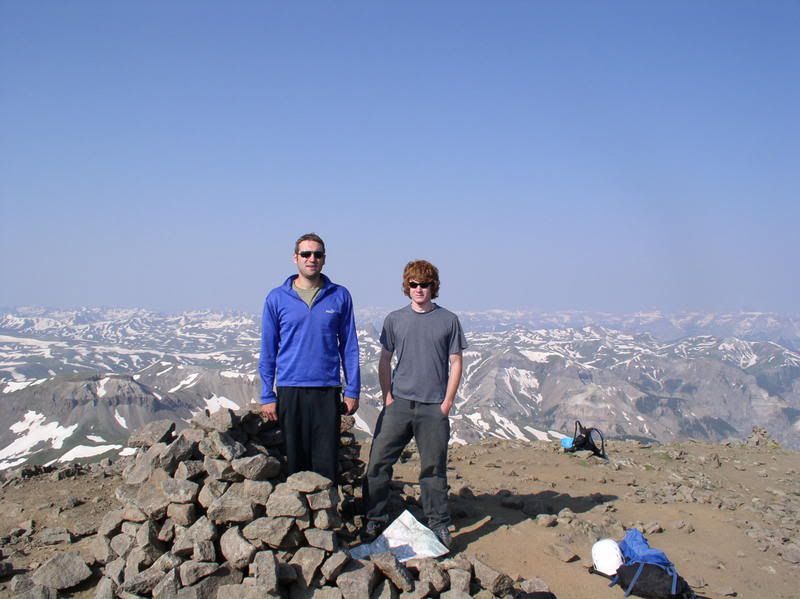
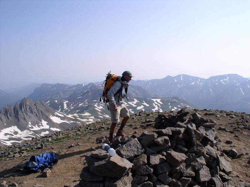
summit views
Nelson a fellow climber who we were to learn as we hiked was quite experienced and gave us a few mountaineering and alpine routes/trips to consider for the future. I wish you well in your future adventures!
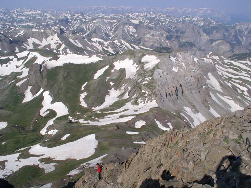
Heres THE SHOT:
ramp, cat-walk, climb, and down-climbing climbers as to provide a measure of angle/difficulty.
i think if you have even twice rock climbed in your life. Wetterhorn will not be a problem. Not because you need the rock climbing moves, they will just make you more comfortable. Let me say this, Wetterhorn has exposure but its really pretty easy. And yes I am talking about the final pitch. Really.
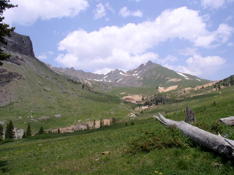
A few hours later we were back at camp w/ the view of wetterhorn we just climbed.
We sat around for a few and felt restless...we examined the map and finally we made our decision. We were going to hike 10 miles roundtrip from our camp and do Uncompahgre right now. It wasnt a hard hike and the terrain was quite pleasant being the usual ups and downs as we approached the base of UC peak. To follow the route requires going around the mountain and coming up the backside from where you first see the peak. UC was pretty easy hiking, definately sustained but a dirt path the whole way. I was surprised to find out the route is a class two but i suppose there are a few scamble sections but routefinding makes these problems very minimal. i took a few shortcuts (unintentionally) and might have made a few thrid clas moves on this easier hike. Not lots of time to enjoy the summit as it was getting close to 5pm.
We hiked down and made it back to camp w/ just enough time to pack up and hike out before it got completely dark. it was a full day..
...for the killer pictures of Wetterhorn! Those are some of the best I‘ve seen, and I‘m less apprehensive everytime someone posts a report. Looks like you had a great day for an awesome hike.
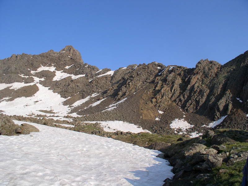
Great report. Doing both Wetterhorn and Uncompahgre in a day isn‘t easy. I do feel the need to point out though that in your pictures #2 and #16, that‘s Matterhorn Peak in the background, not Wetterhorn. In both pictures, Wetterhorn is out of view to the left. If you‘re ever up in that basin again, I would suggest climbing Matterhorn. It‘s a fun one.
Caution: The information contained in this report may not be accurate and should not be the only resource used in preparation for your climb. Failure to have the necessary experience, physical conditioning, supplies or equipment can result in injury or death. 14ers.com and the author(s) of this report provide no warranties, either express or implied, that the information provided is accurate or reliable. By using the information provided, you agree to indemnify and hold harmless 14ers.com and the report author(s) with respect to any claims and demands against them, including any attorney fees and expenses. Please read the 14ers.com Safety and Disclaimer pages for more information.
Please respect private property: 14ers.com supports the rights of private landowners to determine how and by whom their land will be used. In Colorado, it is your responsibility to determine if land is private and to obtain the appropriate permission before entering the property.