Download Agreement, Release, and Acknowledgement of Risk:
You (the person requesting this file download) fully understand mountain climbing ("Activity") involves risks and dangers of serious bodily injury, including permanent disability, paralysis, and death ("Risks") and you fully accept and assume all such risks and all responsibility for losses, costs, and damages you incur as a result of your participation in this Activity.
You acknowledge that information in the file you have chosen to download may not be accurate and may contain errors. You agree to assume all risks when using this information and agree to release and discharge 14ers.com, 14ers Inc. and the author(s) of such information (collectively, the "Released Parties").
You hereby discharge the Released Parties from all damages, actions, claims and liabilities of any nature, specifically including, but not limited to, damages, actions, claims and liabilities arising from or related to the negligence of the Released Parties. You further agree to indemnify, hold harmless and defend 14ers.com, 14ers Inc. and each of the other Released Parties from and against any loss, damage, liability and expense, including costs and attorney fees, incurred by 14ers.com, 14ers Inc. or any of the other Released Parties as a result of you using information provided on the 14ers.com or 14ers Inc. websites.
You have read this agreement, fully understand its terms and intend it to be a complete and unconditional release of all liability to the greatest extent allowed by law and agree that if any portion of this agreement is held to be invalid the balance, notwithstanding, shall continue in full force and effect.
By clicking "OK" you agree to these terms. If you DO NOT agree, click "Cancel"...
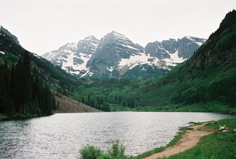
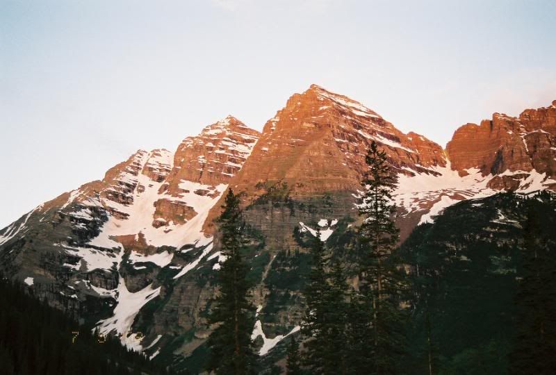
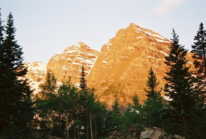
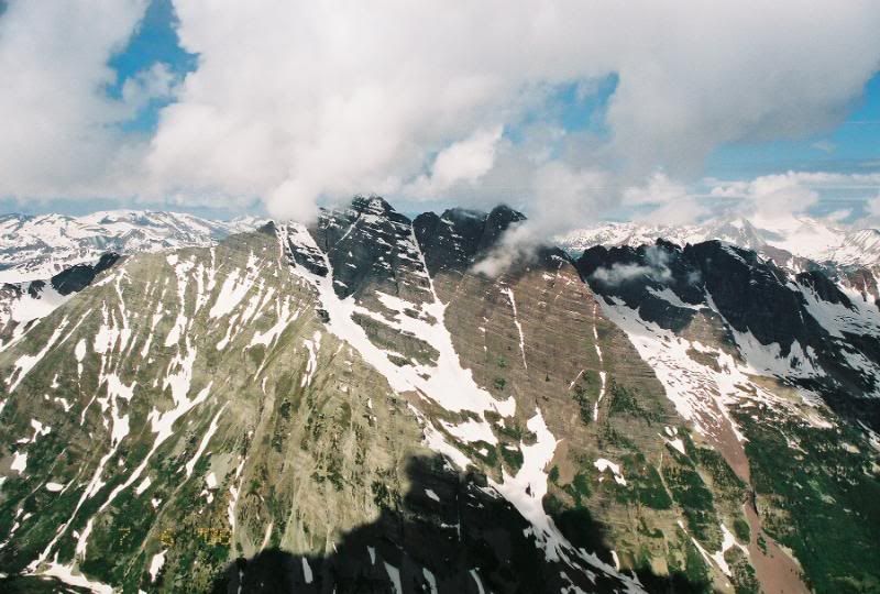
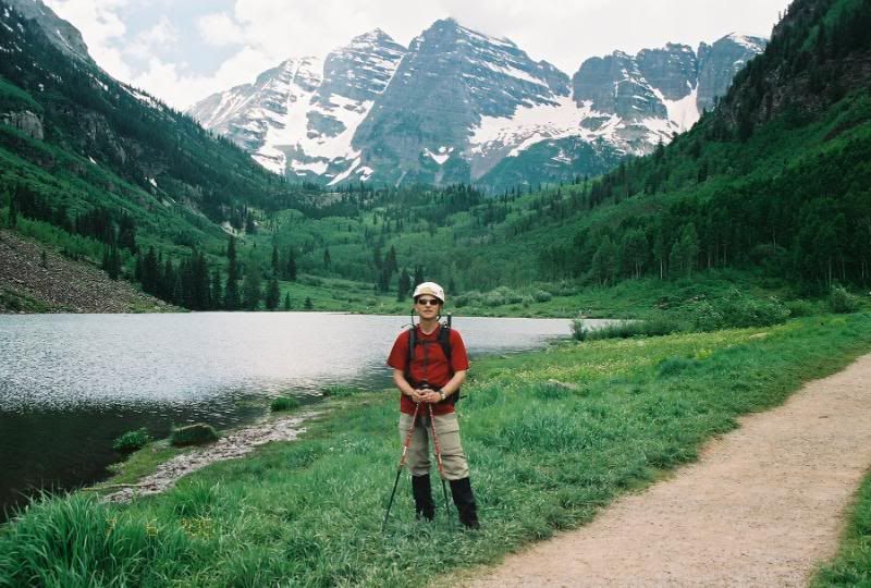
After completeing Holy Cross on Saturday, I made the 80 mile trip to Aspen to finish the second part of my planned weekend climbs. I arrived in a wet Aspen around 6pm. It had been obviously raining for some time but the skies were clearing. I grabbed some grub and started off down towards Maroon Lake Road. Paid my $10 car fee....ugh and parked in the overnite parking lot. The Bells looked pretty incredible with the combination of clearing clouds and sunlight. I walked down the trail aways and snapped some very nice photos of the Bells. After returning to my car and setting up my in car sleep quarters, I retired around 8:30pm for a scheduled 4:15am alarm.
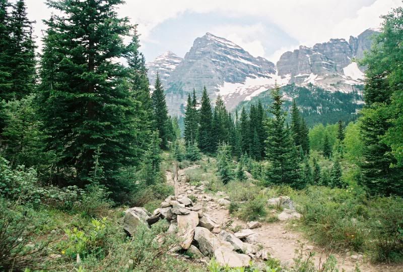
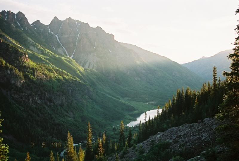
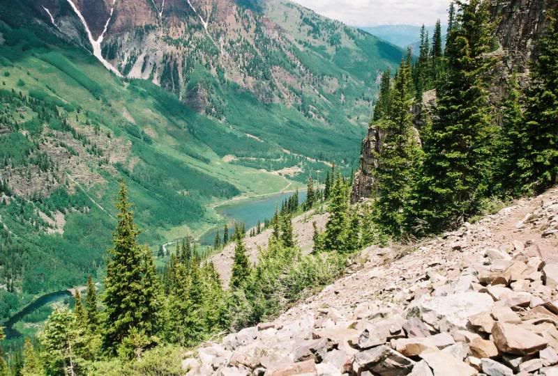
After my usual 2 snoozes I ate breakfast and geared up and was on the trail at 5:05am. I have to be honest, I approached this hike with a little anxiety. Noy overly sure of the trail conditions up high, and the actual route complexity, throw in the fact I was also hiking solo caused me to be a little anxious. Nevertheless, I started off down the Maroon Lake trail. I arrived at the trail junction in about 40 minutes. This junction is right at 1.2 miles into the hike located on the left of the trail. It could be easily missed if your not looking for it. The cairn is about 3ft tall with a wooden stake in the middle of it. After this turn off the trail is pretty easy to follow. They have done some major work on this part of the trail as it was extremely easy to find and follow. I have read the opposite of the trail. The trail continued all the way up the hill into the Pyramid amphitheatre. There were a few spotted snow fields along the trail through this point but nothing to worry about. They were easily skirted or packed down for crossing.
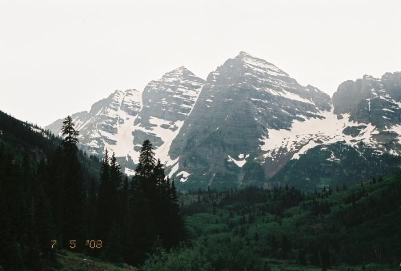
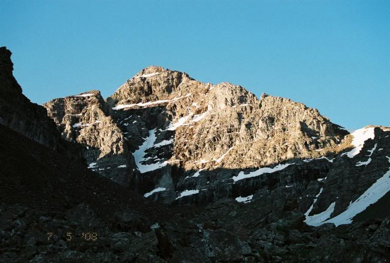
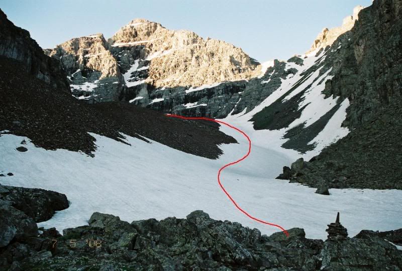
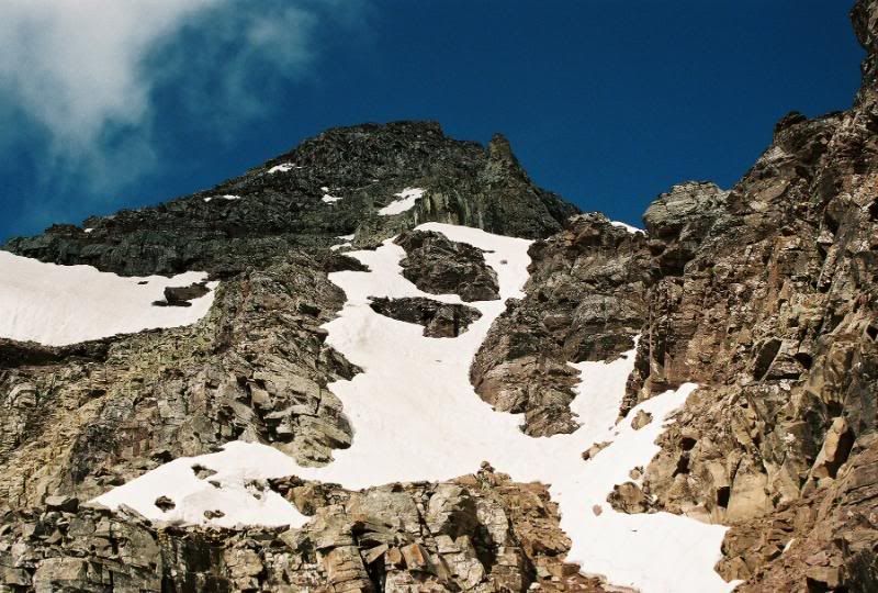
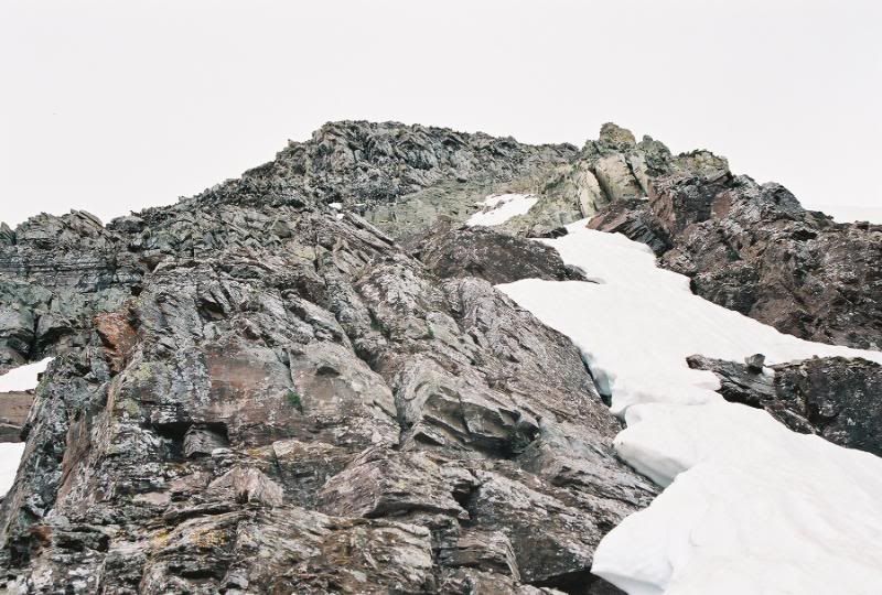
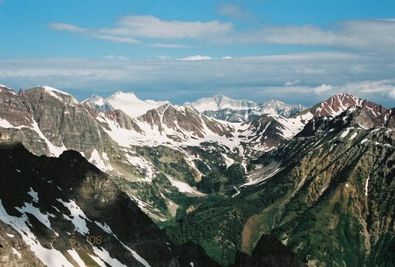
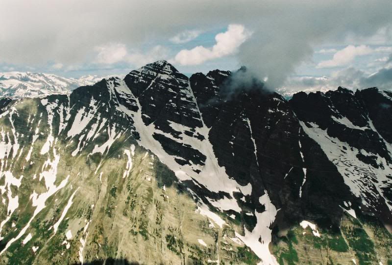
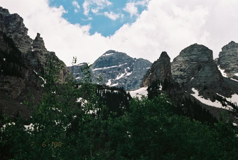
Upon reaching the amphitheatre, there were some 5ft tall cairns that showed the direction up into the basin under Pyramid. This area was almost totally covered in snow. It was very hard and compact and I just booted and used my poles all the way up to the base of Pyramid. The class 3 section leading up to the saddle had several snow filled gulleys. I decided to climb the class 3 section of rock upward towards the 13k ft saddle. I met a solo hiker returning from the summit during this portion of my hike. He told me he was a resident of Aspen and had summited Pyramid over 20 times. He gave me advice and general route descriptions and told me I could most likely follow up the path in his tracks. He advised me of several snow filled gullies that might require crampons. Upon reaching the saddle, I took a small break and readied myself for the real climbing. The weather was still superb and the views of the Bells and surrounding Elks were incredible.
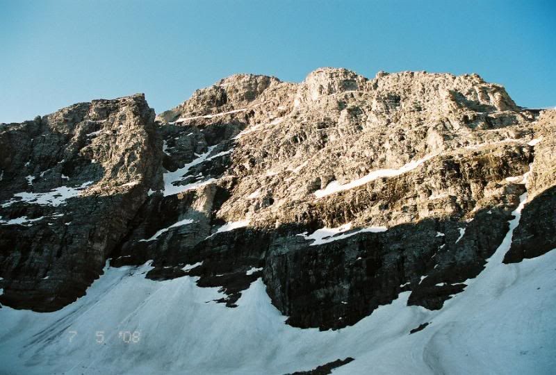
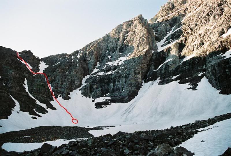
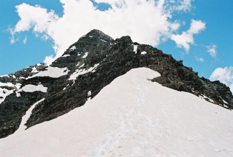
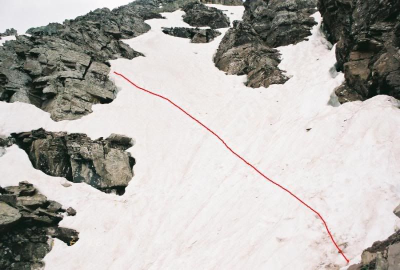
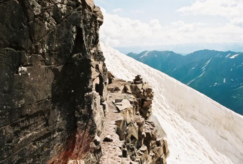
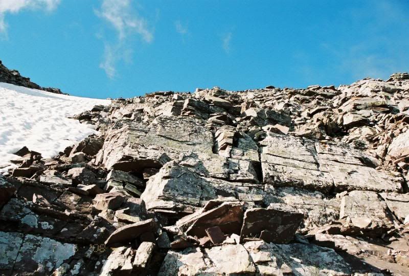
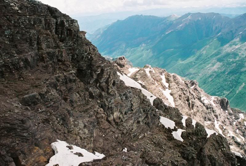
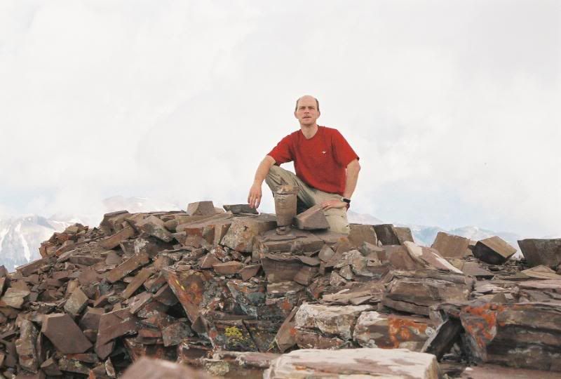
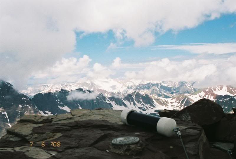
I started up the saddle towards the direction of the tracks and trail. I quickly encountered the first gulley that was filled with snow. It was extremely steep and angled upwards towards the trail. It was about 30 feet across and took alot of concentration. I decided not to use my crampons, but I did use the previous hikers steps and securely placed my axe before any movement forward. It was to say the least in my opinoin the crux of the route thus far. Immediatley after crossing this gulley I encountered the infamous ledge crossing. It was pretty exposed but not as bad as I thought it would of been. I continued up into the general direction of the summit and "green rock." The cairns were very difficult to spot because of the steep pitch and color of rock. After crossing the 2nd snow filled gulley I reached the green rock section I was told about. I picked the easiest path up and went straight up towards the summit. This section required alot of class 4 climbing. Occassionally I would spot a cairn or so and head in that general direction. After reaching 13800ft. I picked a general path straight up towards the summit. I eventually summited at 10:30am. A total ascent time of 5 hours and 25 minutes. I was pretty happy with the time considering the conditions and route.
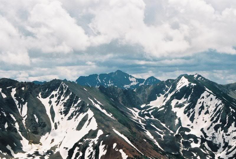
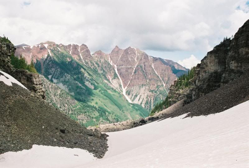
The weather to the North and East was partly cloudy. There was however a huge cloud bank that was forming and stayed to the East. You literally could not see more than 20 ft in that direction. Pretty weird to say the least. The Bells and surrounding mountains looked fantastic. I shot some pictures, ate some lumch and started back down at 11:00. I was dreading the descent and finding the route. It quickly became apparent to me that going down was going to be easier than coming up. The route could be seen pretty easy staring down. Looking down the face you could easily see the cairns and route path. I quickly made it back to the gulleys and traversed back across carefully. I made it all the way back to the saddle in about 50 minutes. After reaching the saddle, I again refueled and started back down the class 3 section to the amphitheatre. I had spotted and followed the snow filled gullies that went all the way to the saddle on my ascent. I decided to equip my axe and gloves and attempt glissading instead of the downclimb. It proved to be a good decision as I made it down this part of the climb in petty quick order. I was able to glissade two different times for a total of about 1000ft. After reaching the amphitheatre, I put my axe away and re-equipped with my poles and started down the amphitheatre. I was able to make pretty quick time in this snow filled section. I eventually made it back to the Maroon Lakes trail at around 1:45. I made it back to the lake at 2:30 where I took a few pictures, conversed with some tourists and just enjoyed and took in the sights of the Bells and surrounding areas.
All in all it was a great day to hike in this area. The clouds began to form and distant thunder could be heard. Just goes to prove once again, to start early and give yourself enough time to complete your objective. It was a great weekend in the mountains. I climbed a little over 10k ft in 2 days, and felt great. Pyramid definitely ranks as one of the most challenging peaks for me to date. Only 3 more trips planned to hopefully finish off the 14er's this season. It's going to be a great summer.
I hope this report helps those enquiring about the conditions up there right now. Thanks for reading.
Thanks for the informative report! I‘m heading up there this weekend and you did a great job of describing the current conditions. I‘m planning to head up the NW ridge and down the NE ridge, so it was great to hear that the NE ridge is easier to follow on the way down than the way up.
Kirk. Great job!!! Mentally this is so much tougher to do alone in current conditions. Thanks for your help in preparing us for Pyramid a few days later. Conditions up there are so wet and loose - probably like late May in most years. For anyone attempting in the next 10 days or so, PLEASE, take it easy!
Dude, I'd say Pyramid, solo, in conditions like that is a sweet achievement for the lesser mortals like us. I bet you're pretty proud. How was route finding around those gullies?
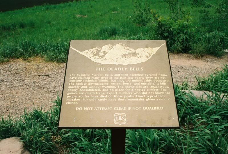
Caution: The information contained in this report may not be accurate and should not be the only resource used in preparation for your climb. Failure to have the necessary experience, physical conditioning, supplies or equipment can result in injury or death. 14ers.com and the author(s) of this report provide no warranties, either express or implied, that the information provided is accurate or reliable. By using the information provided, you agree to indemnify and hold harmless 14ers.com and the report author(s) with respect to any claims and demands against them, including any attorney fees and expenses. Please read the 14ers.com Safety and Disclaimer pages for more information.
Please respect private property: 14ers.com supports the rights of private landowners to determine how and by whom their land will be used. In Colorado, it is your responsibility to determine if land is private and to obtain the appropriate permission before entering the property.