| Peak(s): |
Mt. Shavano - 14,230 feet |
| Date Posted: | 06/09/2008 |
| Date Climbed: | 05/31/2008 |
| Author: | Greenhouseguy |
| Peak(s): |
Mt. Shavano - 14,230 feet |
| Date Posted: | 06/09/2008 |
| Date Climbed: | 05/31/2008 |
| Author: | Greenhouseguy |
| I‘m No Angel |
|---|
|
Mount Shavano 14,229 Feet (17th highest in Colorado) Angel of Shavano Route Shavano/Tabeguache Trailhead (9,700 Feet) Grade II, Class 2 Snow May 31st, 2008 About 8 Miles Roundtrip Elevation Gained: Approximately 4,600 Feet Solo I'm No Angel  The Angel of Shavano viewed from the east. Look for the Angel with her outstretched arms in the center of the image below and to the viewer's left of the highest peak. The Angel of Shavano is a relatively safe and popular early-season fourteener route. This non-technical snow climb has a unique character and is reputed to be one of the most fun routes in the Sawatch Range. The steepest part of the snowfield only reaches about a 30� angle, but the slope seems to go on and on relentlessly. Depending on the condition of the snow, there can be a thousand feet or more of tundra and talus above the Angel. The grueling ascent rewards the hiker in many ways, not the least of which is the world-class glissade down the Angel. The Angel has one of the most curious legends of any of the fourteeners. According to the legend, an Indian maiden prayed for rain at the foot of the mountain. She sacrificed herself to the gods in order to provide rain for her drought-stricken people. To honor her, the gods placed her image on the slopes of Mt. Shavano. As she melts in the spring, her tears provide water for her people's crops below. I made the long, long drive down Hwy. 285 as per Bill Middlebrooks' directions. I turned off near Salida, and headed for the Shavano/Tabeguache Trailhead. Quite a few people had the same idea, and the main parking lot was already full when I arrived. Fortunately, there is overflow parking available nearby. The snow on the access road is long gone, and the trailhead is easily accessible by most 2WD vehicles.  Overflow parking at the Shavano/Tabeguache Trailhead It was sunny and warm at the trailhead, and the forecast called for clear skies. The trail starts beside the unisex pit toilet; if you need to use the facilities, be sure to bring your own supplies. There was no toilet paper, but some helpful person left a nice pile of pinecones in the outhouse.  The Shavano/Tabeguache Trailhead A short connector trail led from the parking lot to the Colorado Trail. There was a long stretch of rail fence beside the Colorado Trail. The adjacent meadow was lush and green. After about a quarter of a mile, I came to the junction with the Mt. Shavano Trail.  The rail fence along the Colorado Trail  The junction of the Colorado Trail with the Mt. Shavano Trail I turned left (northwest) onto the Mt. Shavano Trail, which was fairly rough in the lower stretches. The countless rocks in the trail were roughly the size of cannonballs. I didn't want to abort my spring hiking season with a turned ankle, so I stepped carefully.  The rocky lower stretches of the Mt. Shavano Trail The rocks in the trail soon gave way to deep snowdrifts. It was early in the day, so the snow was still fairly firm. However, I could see knee-deep postholes that were left by hikers in recent days. Stepping from one posthole to the next got to be tedious in a hurry; I'm not down wit' O.P.P. (Other People's Postholes). I watched other people struggling through the pockmarked snow, and decided to put my snowshoes on. I was able to glide right over the craters while other hikers exhausted themselves by slogging along on the rough surface.  Lumpy mounds of snow on the Mt. Shavano Trail The trail joined a creek at about 10,800 feet, and started to switchback north (right) out of the drainage at about 11,100 feet; I followed the creek to the west. There was no trail, but the numerous tracks in the snow made the course obvious. The high ridges to the north and south made it unlikely that anybody could accidentally wander out of the basin. I met 14ers.com member BadgerNick and his group in the basin while we were adjusting our gear for the final push. Tree cover became sparse at about 11,500 feet, and the Angel came into view.  The Angel as seen from the basin at about 11,500 feet Several people were already in the body of the Angel, and none of them were moving very quickly. A few had moved to the far right to hike on rock instead of snow, and a few had moved to the far left. I came for a snow climb, so I stayed on the snow close to the right (north) side. My snowshoes started to lose traction as I entered the lower part of the Angel's body at 12,000 feet. I suspected that the snow might have been too soft for crampons, but I had to give it a try. The snow was firm enough, and the crampons worked well. They were lighter than the snowshoes, and had a much better bite. The slope did not seem steep enough to use my ice axe, but I used my trekking poles for balance. One clumsy move, and I would have had a quick ride to the bottom.  The Angel's body at about 12,000 feet  Looking up the Angel from about 12,400 feet At about 12,800 feet I turned right (north) to head up the Angel's "right" wing. It's actually to the hiker's right, not the Angel's. The snow was still deep in the center of the gully, and it was starting to soften. I stuck to the right edge of the snow to avoid the occasional deep posthole. It was not steep compared to other snow climbs, but it was steep enough to deplete my energy. Other hikers were not faring much better, and not many seemed to have been following the snow route.  A view of the Angel's "right" wing from about 12,700 feet The "right" wing was in for about 450 vertical feet. As I approached the top of the wing, I could see people laboring near the summit. Some had gone straight up to the saddle between Mt. Shavano and "Esprit Point" and caught the trail on the standard route. I followed the snow to the bitter (extremely bitter!) end and angled towards the southeast slope of the summit cone. The off-route rockhopping was tedious and involved crossing a few snowfields.  Mt. Shavano's summit seen from the top of the "right" wing at 13,100 feet  A dizzying look down the Angel's "right" wing from 13,100 feet I chatted with a pair of hikers several times as we worked the southeast slope. There seemed to have been no logical route through the talus, so we just zigzagged towards the summit. I was running on empty when I topped out.  A lone hiker on Mt. Shavano's rocky summit I stood on the highest boulder for a moment, and then found shelter from the burgeoning wind. A marmot kept a low profile on a nearby rock. A pair of hikers returned from an unsuccessful attempt on Tabeguache Peak complaining about the deep, soft snow. I was not even close to having enough energy to head over to Tabeguache, and I didn't have the presence of mind to tag "Esprit Point" while I was so close.  My summit shot. Note the marmot sunning himself on a rock behind my left shoulder  Tabeguache Peak viewed from Mt. Shavano's summit  Rocks, more rocks, and Mt. Antero (the pointy peak in the center of the image) I signed the summit register and exchanged pleasantries with several other summiters. When I dropped down off of the summit block, I decided to head south towards the standard route. I was able to find (and lose) several sections of trail, which made the descent much easier than it would have been had I retraced my steps on the southeast slope.  Looking down toward the Angel from the south slope I descended to the saddle and angled southeast towards the Angel's "left" wing. Mt. Shavano looked large but rather nondescript from below the saddle.  Mt. Shavano as seen from just below the "Esprit Point"-Mt. Shavano saddle The view of the Angel from above was somewhat more inspiring. I knew that this would be a knee-grinding slog unless I could catch a good glissade. The early-afternoon snow was of questionable quality.  Looking down the Angel from just above the "left" wing I only had to descend a few feet into the wing to find glissadeable snow. It looked steep enough to cause serious trouble if I glissaded out of control. I stowed my crampons and poles to avoid injury, and pulled out my seldom-used ice axe. All it took was a gentle push to set myself in motion, and I was gone! The sun-cupped snow pounded my posterior like a thousand mini-moguls. I found somebody else's glissade track, and things smoothed out considerably. The wet snow suited me well; I had enough momentum to keep moving, but enough friction to keep my speed at a reasonable rate. The glissade of at least 1,300 feet exhausted me, but it shaved a lot of time off of my descent. My glutes were numb from the cold and I was thoroughly soaked as I headed back down the basin. 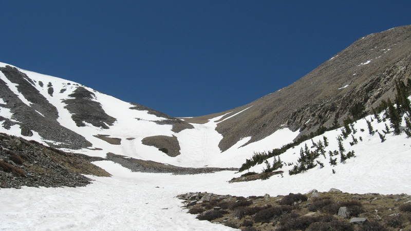 Looking over my shoulder at the Angel as I headed back down the basin The snow in the woods was soft and miserable. Most of the other hikers had passed this way in boots, and the postholes were awful. I kept my snowshoes on, and moved through the mush with relative ease. Water ran beneath the rapidly-melting snow in some places, and I had to cross a small stream a couple of times. I fell through a snow bridge into the creek, but managed to crawl out before I got too wet. Thank goodness for quick-drying nylon! 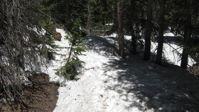 Soft snow in the woods I was relieved to get back to a decent trail at about 10,800 feet. I just wasn't possible to make very good time in the slushy snow. 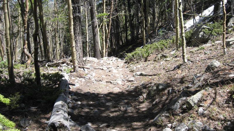 The Shavano/Tabeguache Trail at about 10,800 feet I had grumbled about the rocky trail earlier in the day, but hiking on the "baby heads" now seemed like the easiest part of my journey. The weather was great, and I enjoyed the sunshine as I approached the Colorado Trail. 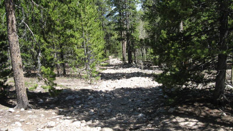 Approaching the Colorado Trail on the Shavano/Tabeguache Trail at about 10,000 feet The section of the Colorado Trail that led back to the parking lot was pleasant, and presented no difficulties. I geared down, and headed for home. I stopped on the Forest Service roads several times to check out colorful wildflowers such as milkvetch, locoweed, and fleabane. The showiest was probably the fringed puccoon (Lithospermum incisum). 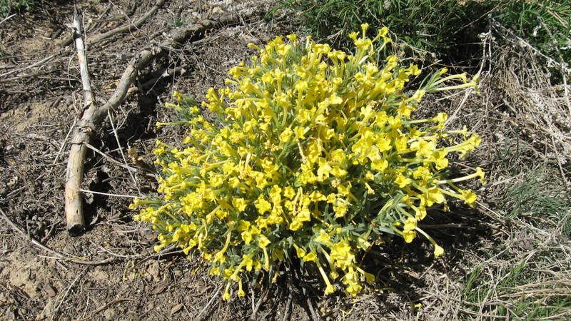 The fringed puccoon, Lithospermum incisum Gerry Roach wrote that the Angel of Shavano is the finest route on a fourteener in the southern Sawatch Range. This was only my fifth Sawatch fourteener, but I suspect that he may have a point. The roundtrip distance and elevation gained are pretty typical for the Sawatch Range. But the route - straight up the belly of a scenic, shallow couloir - is virtually unique. The mystique of the Angel's legend adds to the interest of this snow climb. The Angel of Shavano is a must-do spring hike, and it is certainly the best way to summit Mt. Shavano. Thumbnails for uploaded photos (click to open slideshow): ")
")
")
")
")
")
")
")
")
")
")
")
")
")
")
")
")
")
")
")
|
| Comments or Questions | |||||||||||||||
|---|---|---|---|---|---|---|---|---|---|---|---|---|---|---|---|
|
Caution: The information contained in this report may not be accurate and should not be the only resource used in preparation for your climb. Failure to have the necessary experience, physical conditioning, supplies or equipment can result in injury or death. 14ers.com and the author(s) of this report provide no warranties, either express or implied, that the information provided is accurate or reliable. By using the information provided, you agree to indemnify and hold harmless 14ers.com and the report author(s) with respect to any claims and demands against them, including any attorney fees and expenses. Please read the 14ers.com Safety and Disclaimer pages for more information.


