Download Agreement, Release, and Acknowledgement of Risk:
You (the person requesting this file download) fully understand mountain climbing ("Activity") involves risks and dangers of serious bodily injury, including permanent disability, paralysis, and death ("Risks") and you fully accept and assume all such risks and all responsibility for losses, costs, and damages you incur as a result of your participation in this Activity.
You acknowledge that information in the file you have chosen to download may not be accurate and may contain errors. You agree to assume all risks when using this information and agree to release and discharge 14ers.com, 14ers Inc. and the author(s) of such information (collectively, the "Released Parties").
You hereby discharge the Released Parties from all damages, actions, claims and liabilities of any nature, specifically including, but not limited to, damages, actions, claims and liabilities arising from or related to the negligence of the Released Parties. You further agree to indemnify, hold harmless and defend 14ers.com, 14ers Inc. and each of the other Released Parties from and against any loss, damage, liability and expense, including costs and attorney fees, incurred by 14ers.com, 14ers Inc. or any of the other Released Parties as a result of you using information provided on the 14ers.com or 14ers Inc. websites.
You have read this agreement, fully understand its terms and intend it to be a complete and unconditional release of all liability to the greatest extent allowed by law and agree that if any portion of this agreement is held to be invalid the balance, notwithstanding, shall continue in full force and effect.
By clicking "OK" you agree to these terms. If you DO NOT agree, click "Cancel"...
Part II
I know this is a long read, but a lot can transpire on untamed mountains over the course of 20 hours.
Woke up at midnight on Monday, 3/24. We had our packs and skis ready from the night before. But my dog could not come with us due to the long hike and her potential danger to herself and us in avalanche and exposed terrain. We knew it would get much colder before morning but once the sun rose, the car would take a lot of direct light. Solution: fill a Nalgene with boiled water and toss it in her kennel, line the floor with a towel and fill with some extra clothes as insulation.
Our previous 2 unsuccessful 14er attempts had both started with a swig of Jim Beam. I‘m sure many other people were enjoying whiskey at midnight that night, but not us, we were all business.
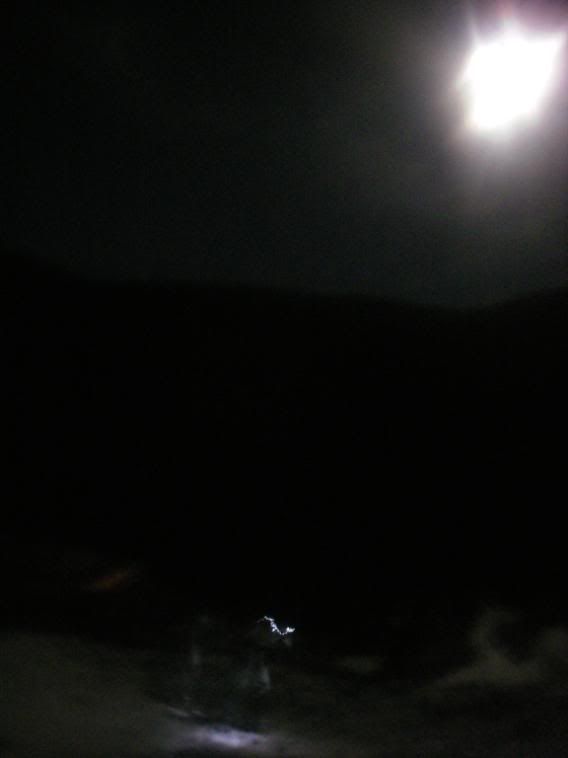
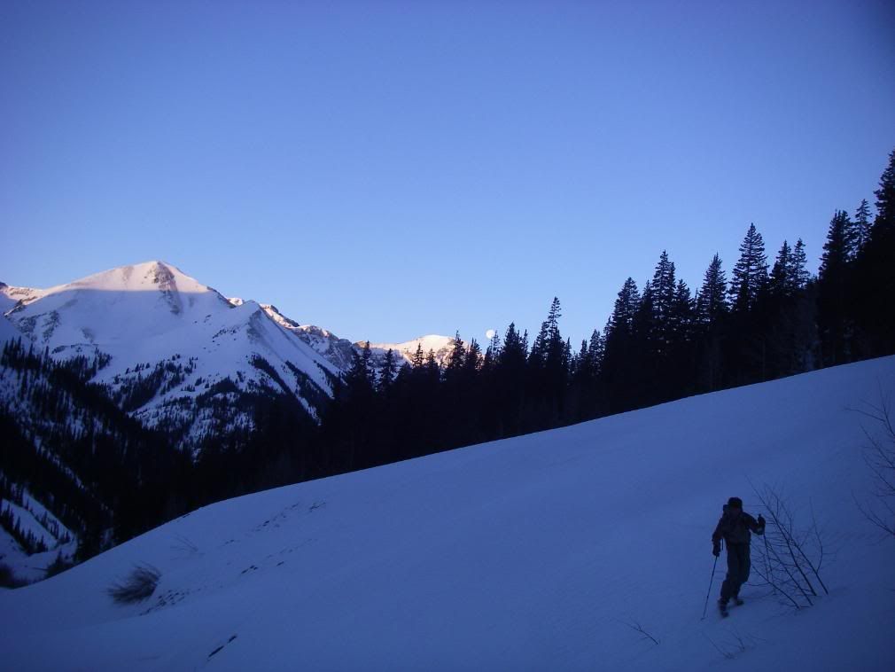
Robby and I left the road closure at 1:55am under the brightness of the moon
The Cinnamon Pass road closure added approximately 3.5 miles to reach the actual trailhead. Our bodies woke up quick and we made fast time up the flat but constantly uphill shelf road.
By 4am, we were at the trailhead.
The steady pace worked up a sweat on me and when we stopped in the hut at the trailhead, the sweat cooled quickly.
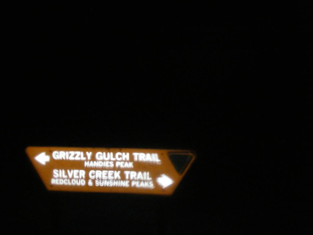
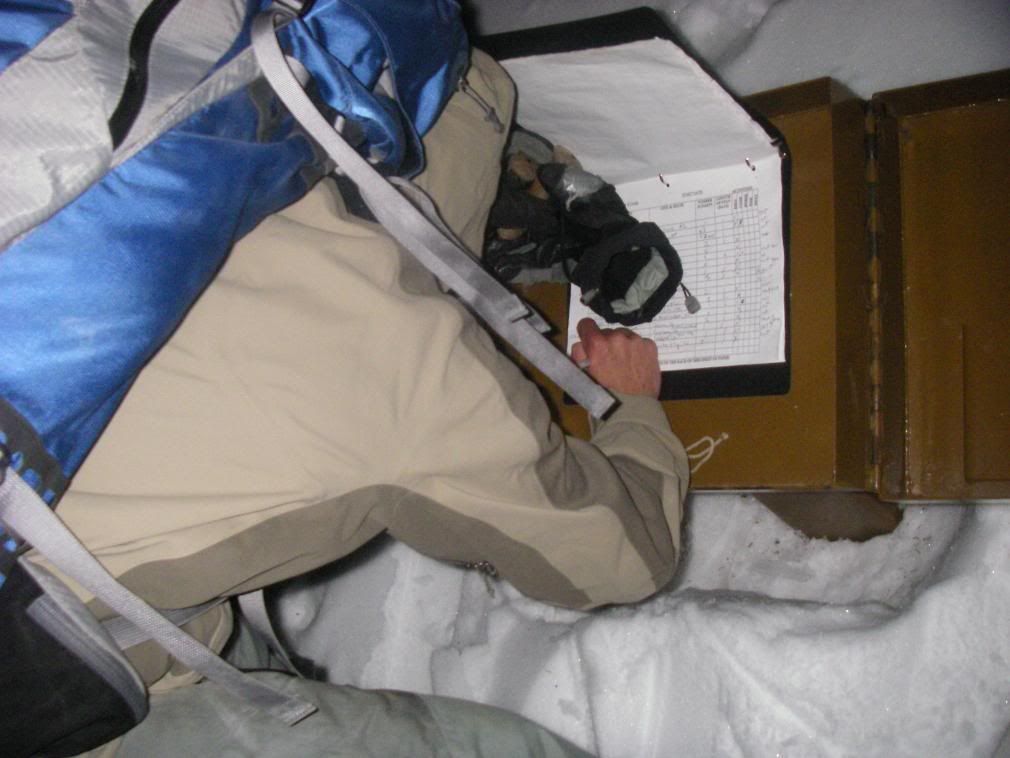
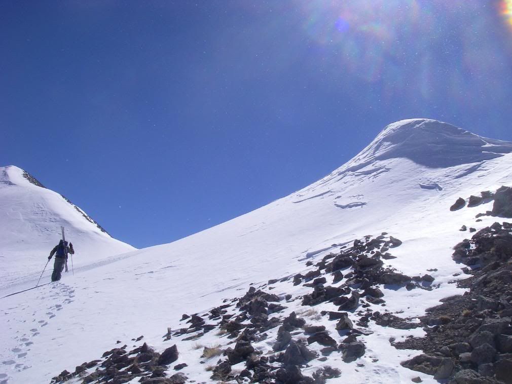
The temp at 4am was probably low single digits-very cold. I placed my sweaty gloves down the front of my snowpants to dry and warm and replaced them with my second pair but this wasn‘t enough. All fingers on both hands were extremely, scary, cold and I realized we were miles from the car and hours from the sunrise. We kept moving, hoping the movement would spread warmth to my fingers but they kept getting colder and losing feeling, especially in pinkies and ring fingers. I took the extra pair of wool socks out of my pack and put them over the top of my gloves and this provided enough layer to warm my hands until we got higher in the forest and temps neutralized. Soon they regained feeling and were sweating in no time. Robby signed the register for both of us. Cool to see that we were the only people to sign in since November 27th.
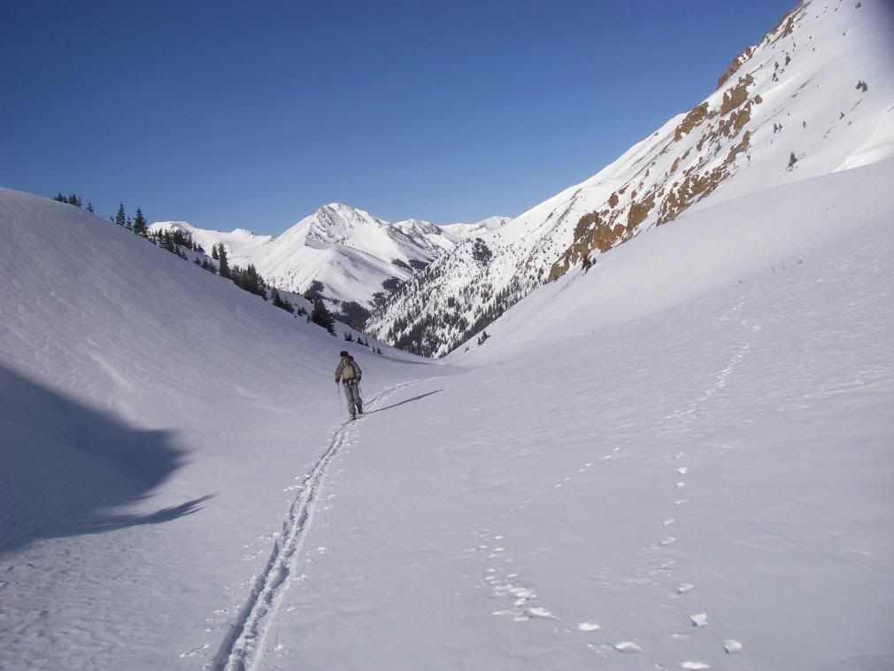
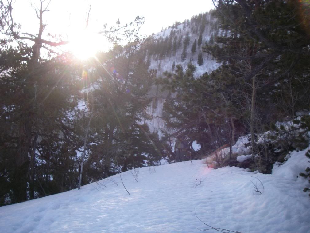
We lost the trail quickly in the woods but knew what direction we were heading-uphill
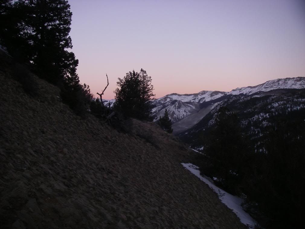
Sun began painting distant peaks around 7:15am
Really liked the G3 skins. Far superior adjustability and attachment than the BD Ascensions and BCA skins I've used.
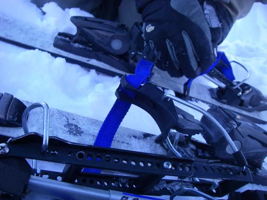
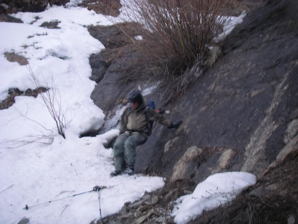
8:30am we were traversing a slope on the left side of Silver Creek when Robby ran into a binding problem. His Alpine Trekkers had fallen apart, losing 2 of the 4 screws that keep it in place on one side of his binding.
If anyone saw our Naxo problem on Sherman, you would know I was thinking the worst and we would have to turn back at 12,000 feet on a bluebird day again.
I scoured the snow but no screw could be found. The moment of desperation gave way to problem-solving and we realized the other binding still had all 4 screws. We'll take one of those and run em both on 3. But we had no Phillips head screwdriver or any other tools with us. I tore apart my pack, searching for anything that would work. Finally noticed that the rivet in my BCA shovel's shaft could be removed and use it as a flathead to remove, insert and tighten all screws with.
Does anyone know if front or rear screw would bear more force (be more vital to keep in place) during use? We removed the one closer to the toe figuring heel has more leverage.
Crisis averted; Trekkers held up for rest of the trek.
We felt our first rays at 9am
Handies looming over Robby's shoulder
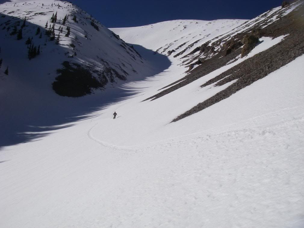
Onward and upward
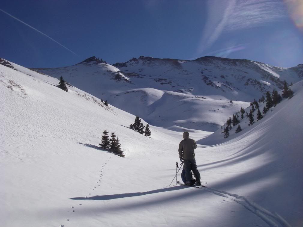
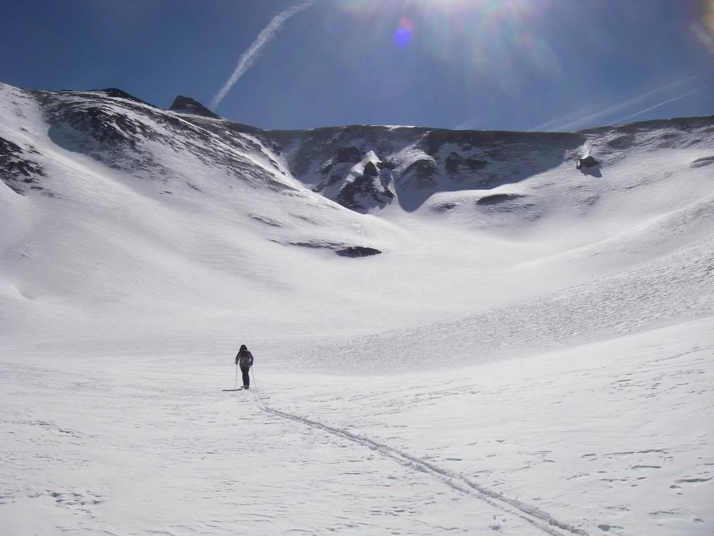
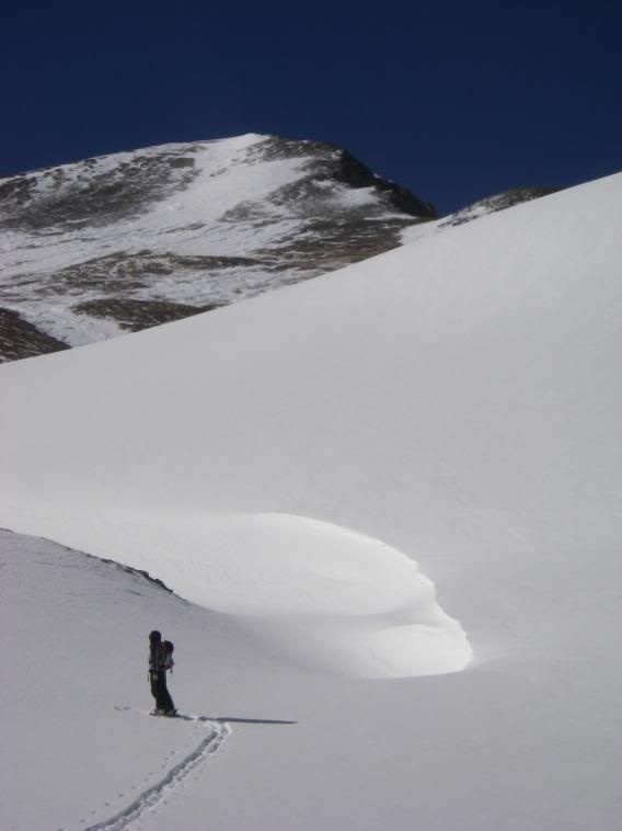
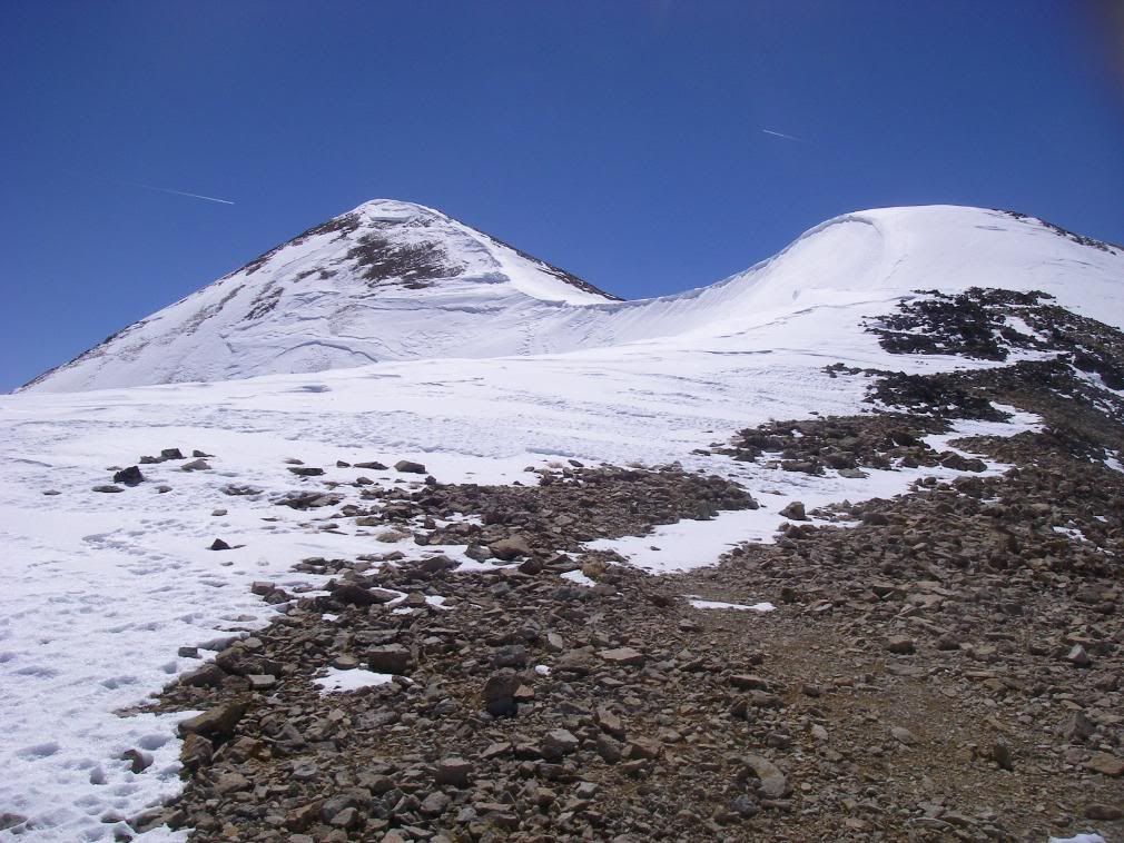
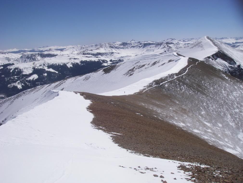
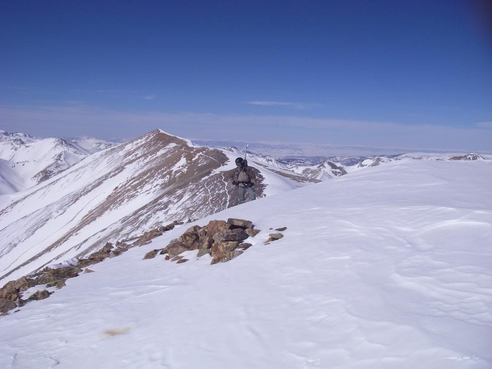
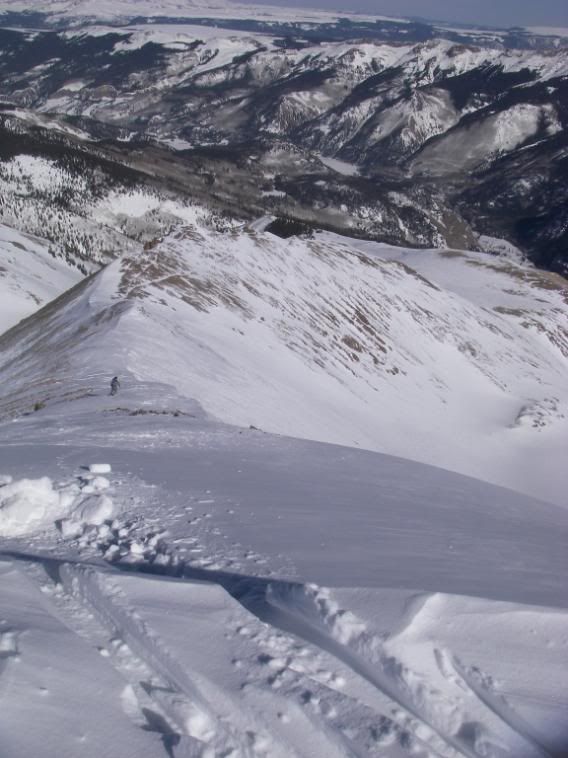
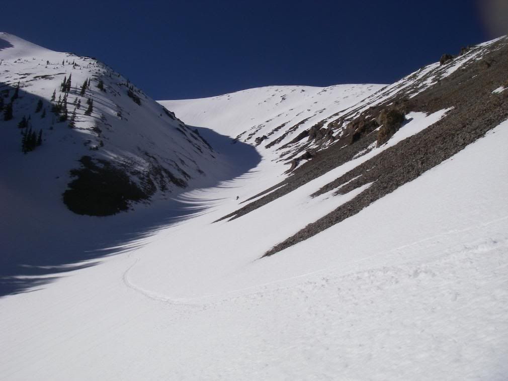
In previous TR's, parties have gone up South Fork drainage and up steep couloirs that are prone to rockfall. With the extra mileage to begin the day, I though a gradual, even if longer, ascent would be easier. So we pushed all the way up Silver Creek and aimed for Redcloud's western shoulder. This is our first view of (f^@#ing) false summit.
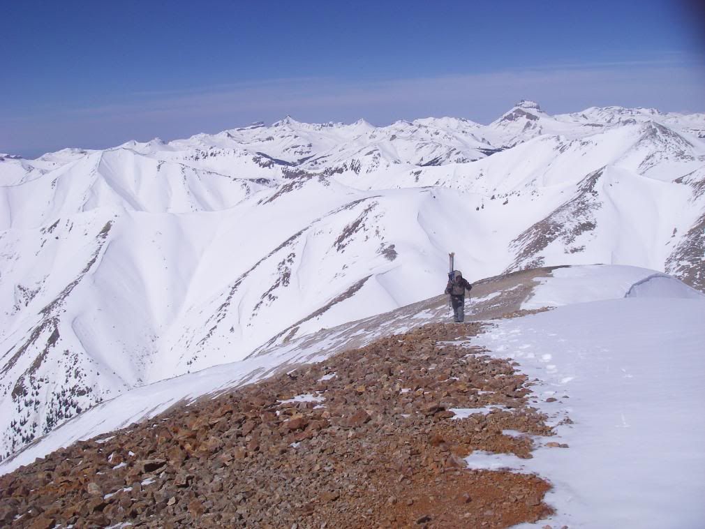
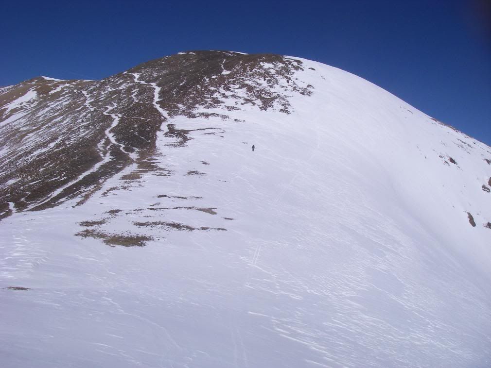
Maxed out skin track and switched to boot pack
Redcloud's face was steep and at that elevation, we took many short breaks
(f^@#ing) false summit
Robby about to top out at 14,034'. 2pm, about 12 hours into the day.
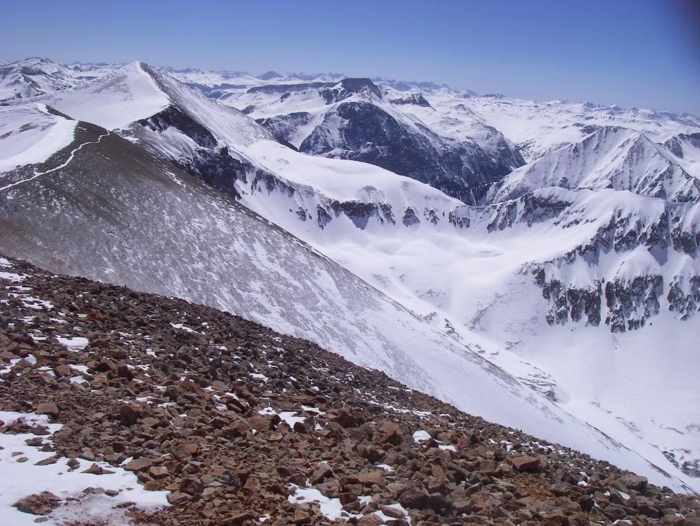
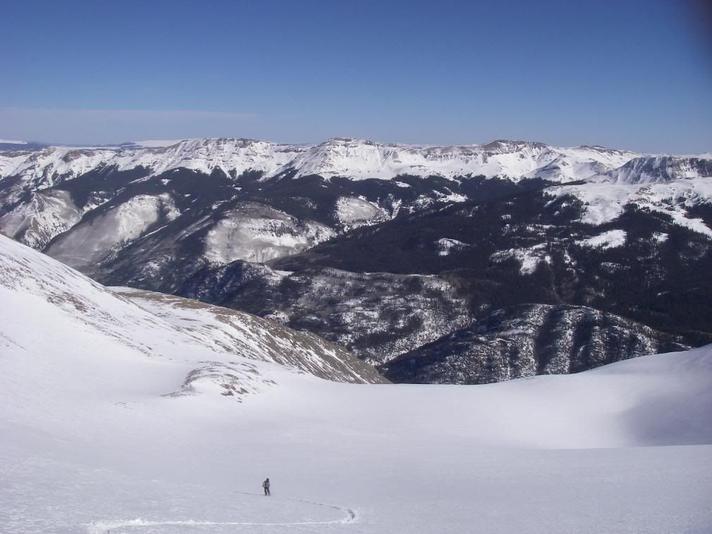
Across the saddle sits Sunshine. I believe one of the gullies down to the right is the rockfall chute.
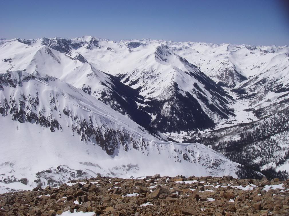
Handies and American Basin
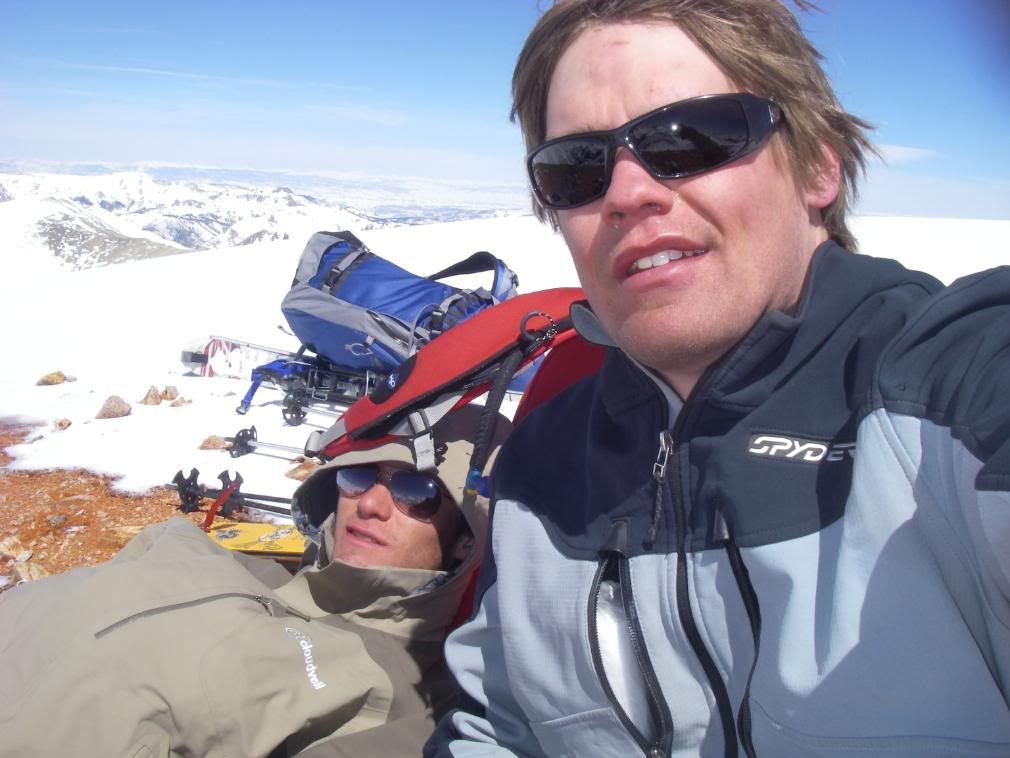
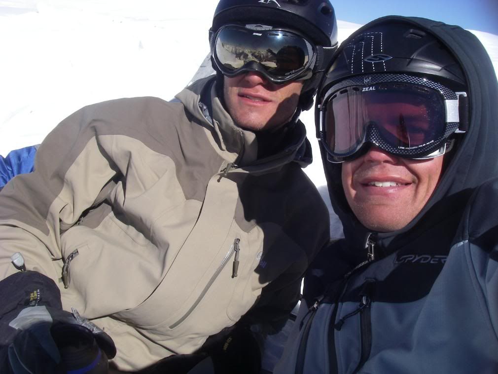
Take my picture!
Robby dropping in on the Redcloud-Sunshine saddle
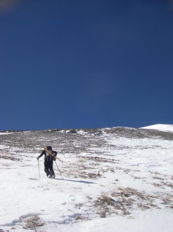
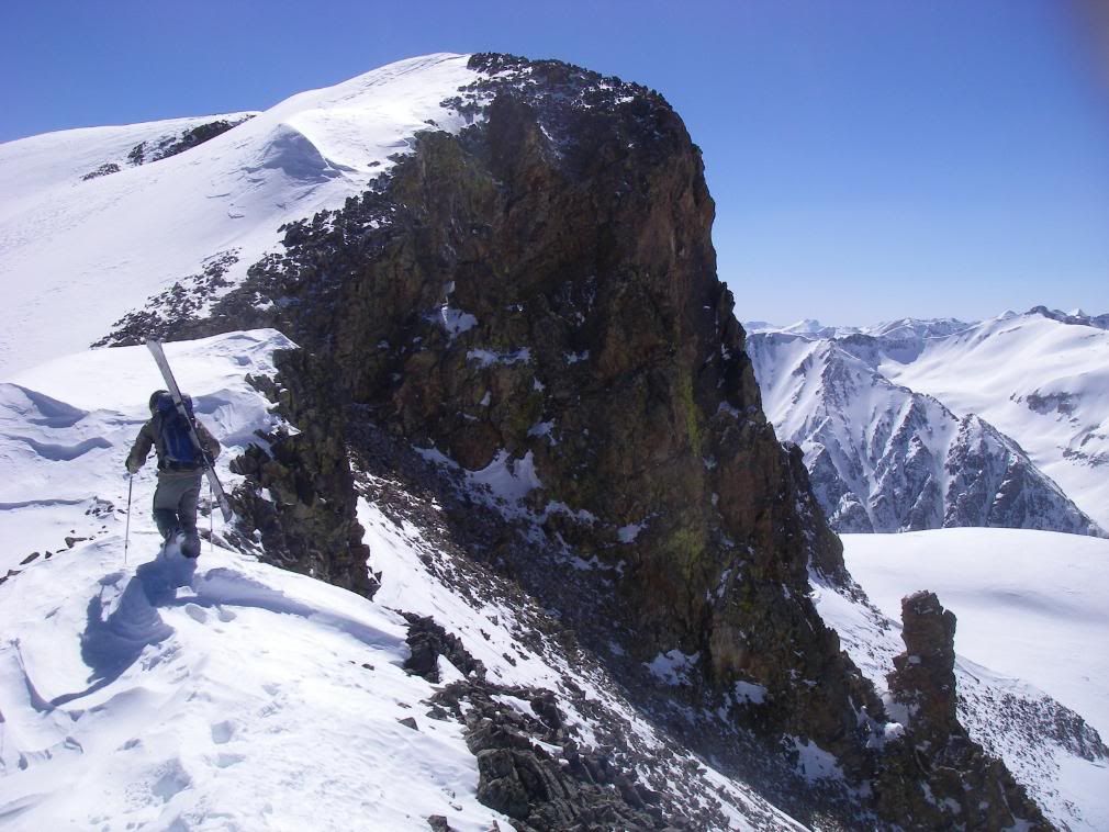
Robby went hiker's right of this on the trail, I went left. This is the final downhill before 500' elevation gain towards Sunshine's summit.
Robby is a hardman. He hauled Karma's with alpine boots, bindings and Alpine Trekkers up two 14ers in a day! The kid is beastly strong, physically and mentally. I rented Mt. Baker Superlite's w/ Freeride's for this trip and they made huge weight/fatigue difference.
14er #2 for the day by 4:15pm, Sunshine at 14,001.
Windy summit register shot
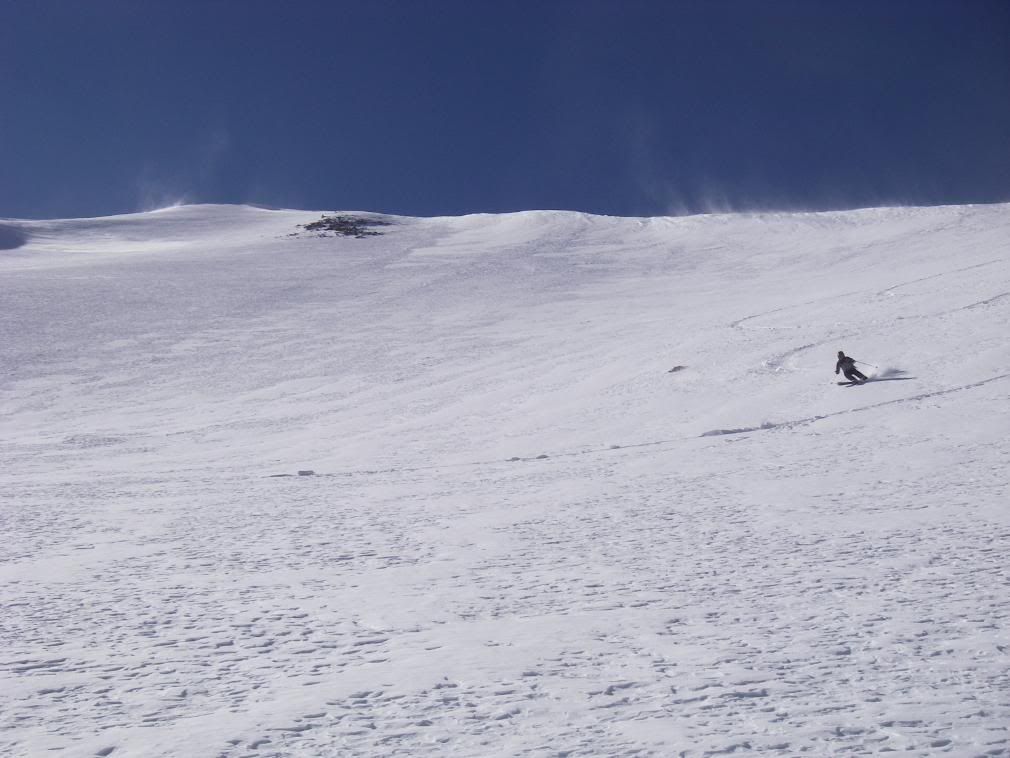
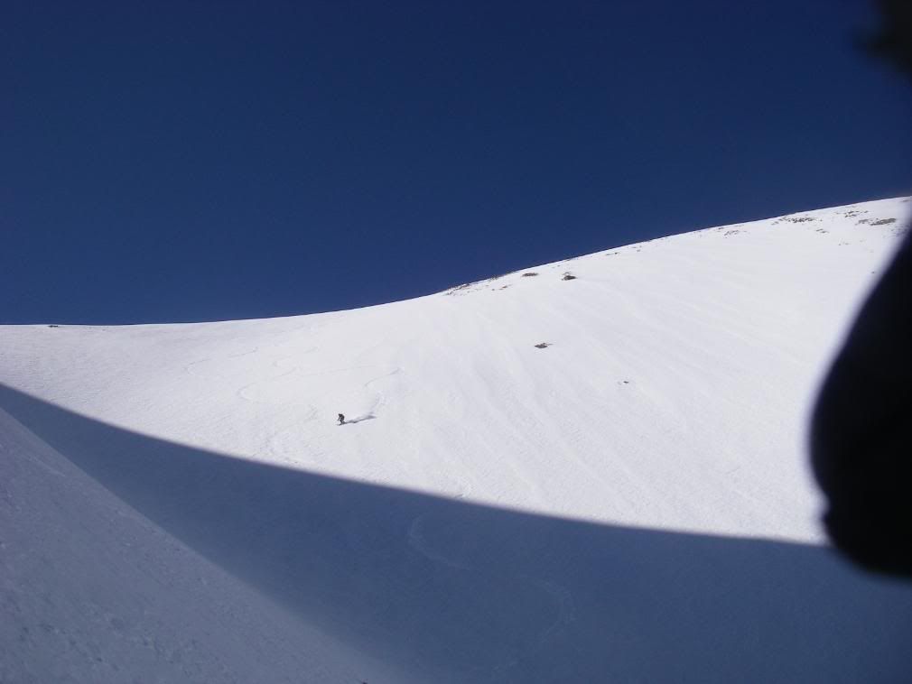
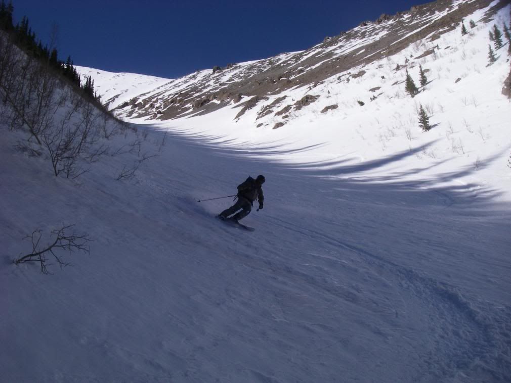
Finally, the skiing action!
We assessed our options from the top and decided to head for a bowl on the SE side for a direct ski off the summit. RockPaperScissors champ, Robby, drops in first.
Me dropping in from the ridge onto our first buttery smooth bowl pitch
I like going downhill a lot better than up
The ULTIMATE graffiti
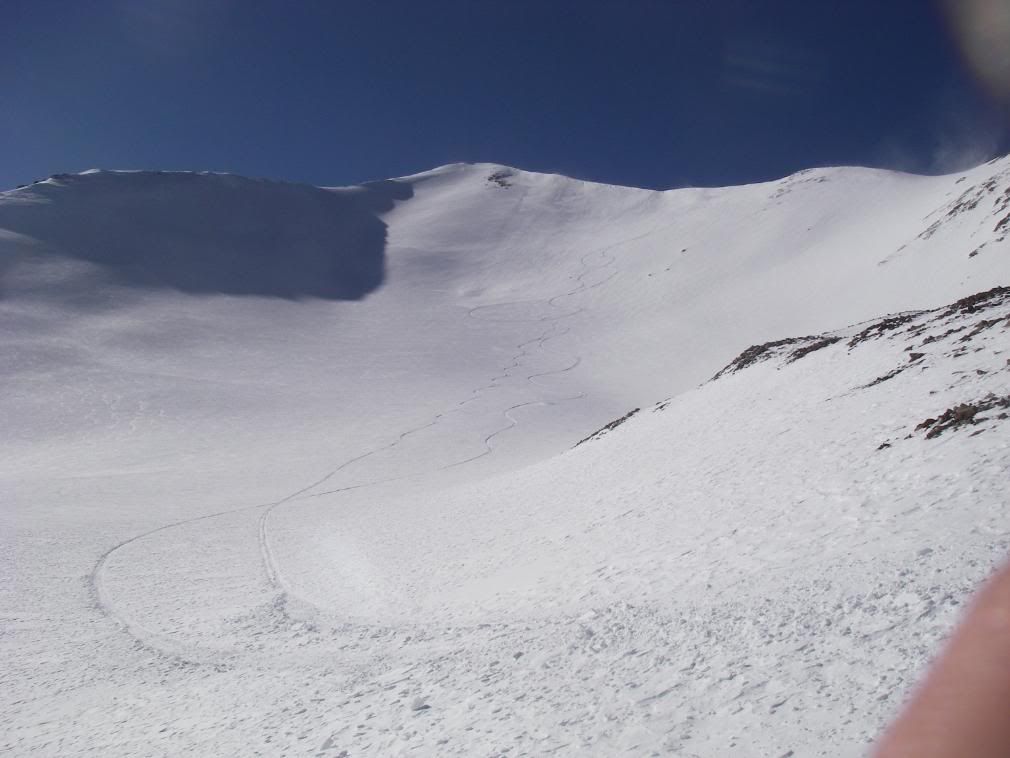
Robby rippin the second steep pitch
Superlite Dav shot
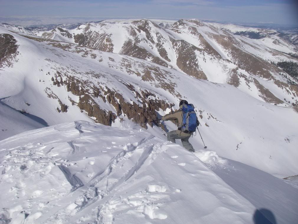
Robby showing the gully who's boss (not us)
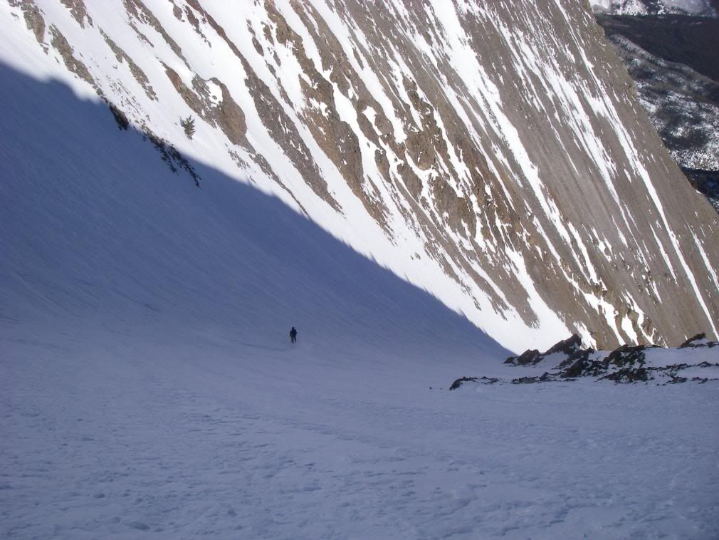
Robby again. The gully continued to narrow, walls steepened, and snow cover get thinner.
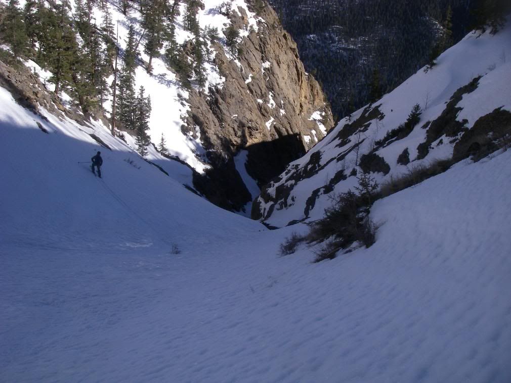
We kept working our way down from safe spot to safe spot on excellent, stable, spring corn until we eventually saw the gully we had been skiing choke out.
Hmm. We saw it coming from a ways above. However, by 5pm (13 hours after take off), a stubborn, internal refusal and never-ending hope inside me said "It will go. We will succeed. We will not get cliffed out on top of the 200 foot waterfall that drops straight to the road we need to be home safe."
This gut feeling was wrong. The snow narrowed and was eventually split in 2 due to the spring rush carelessly free falling down the drainage. I tried descending in ski boots, hoping that the next corner would yield an escalator ride to the car but the further down I got, the more it looked like a slip-n-slide of death. The snow patch that I was maneuvering down turned into bullet-proof, waterfall ice. Even with huge swings, the toes of my ski boots would take no purchase. My hand holds were the finger crack created by the space between the steep rock wall and the mini-glacier I stood upon.
This was it. The end of the line.
The internal stubborn refusal quickly dissipated to anger, fear and self-pity. The next few hours were very trying and tested my will in ways that I haven't been tested before. The anger, fear and self-pity could not stay, they were useless.
I felt a switch go off in my mind. The best I can explain it is Survival Mode. In my mind, I took stock of what we had that could be useful and what the worst case scenario's would be. We both had emergency blankets; I had spare pairs of gloves, socks and a base layer, lighters, a few Nature Valley's (thanks Vail) and a Clif Bar. Robby had half a sandwich and crucial iodine. He smartly filled water bottles in the stream and dropped in some tablets so we would have safe water soon.
We looked back up our descent and thought about our next move, a move that would determine whether we spend the night on the mountain or not. The unspoken truth was that if we got cliffed out again, we would be spooning for our lives as the bitter coldness chased away the setting sun. We knew that to the east, looking back up, to the right, somewhere, sat Bent Creek, a rarely traveled route that supposedly goes safely summit to valley floor. It was one of the few things we knew for sure but we had no idea how near or far away that was.
We choose the slope to the east and slowly started booting. Our mode of travel up this steep wall was punch punch, kick kick, going straight up. For every 2 steps we'd take, we would slide down 1. The snow was sketchy, very heavy sugar and still in direct afternoon sunlight with hundreds of exposed rocks just waiting to trigger. The path we had to ascend was filled with young trees sticking out parallel to the valley floor, obviously battered by previous slides. Also, our punched hand holds were soaking our gloves and the warm snow was getting everything wet. If we did have to wait out the night, our wet, cold clothes would have frozen and we were very aware of the possible consequences.
I made for an exposed rock band to get out of the snow. This turned out to be one of the sketchier parts of the afternoon. Robby hid for cover with his helmet on, under a tree while I kicked and scratched my way up this choss pile.
I would compare the difficulty to the 3rd Flatiron, except steeper and not a single solid rock on the entire scramble plus awkward skis, poles and packs on our backs and ski boots on our feet. Even with a full trad rack and sticky rubber, this would have been sketchity sketch sketch.
After the choss pile, it was an exposed, sunny snow face and previous slide path. I was moving faster than Robby because of his heavy load and could see the light at the top of the ridge so I pushed on ahead to scout and also to keep it one at a time on this slope full of rocks. At one point, I started out across a snow face, maybe 30 horizontal feet to the next solid looking aspen and just got too sketched out. I re-traced my steps and choose another path, this one up a choss outcropping and then diagonally across the face, exposed for only about 20 feet. Everything held firm and soon I was on top of the ridge, catching my breath and finishing the last of my water. It was getting late in the day and we would lose our light soon.
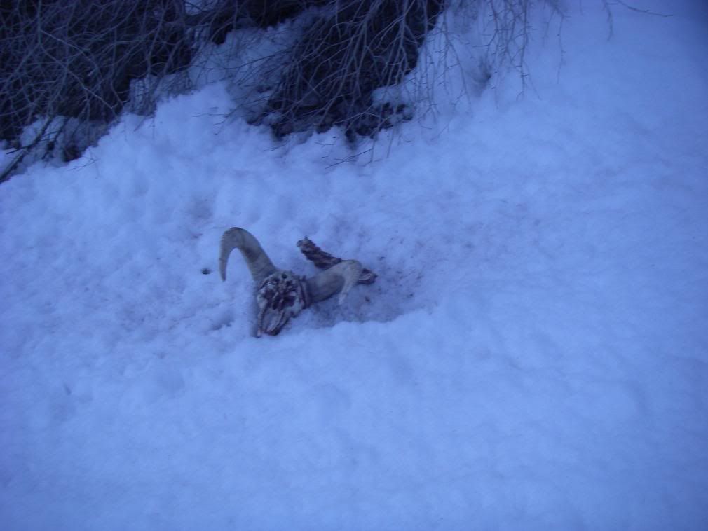
The ridge we stood atop didn't offer a continuous view of what lay beneath in the gully because of tight trees and a steep pitch. The next gully over looked much more prominent and the internal stubbornness convinced me that this was Bent Creek or another large drainage that would go, even though we knew it wasn't BC. So we traversed to the top of large gully and dropped in, knowing this was our last chance to get off the mountain before nightfall.
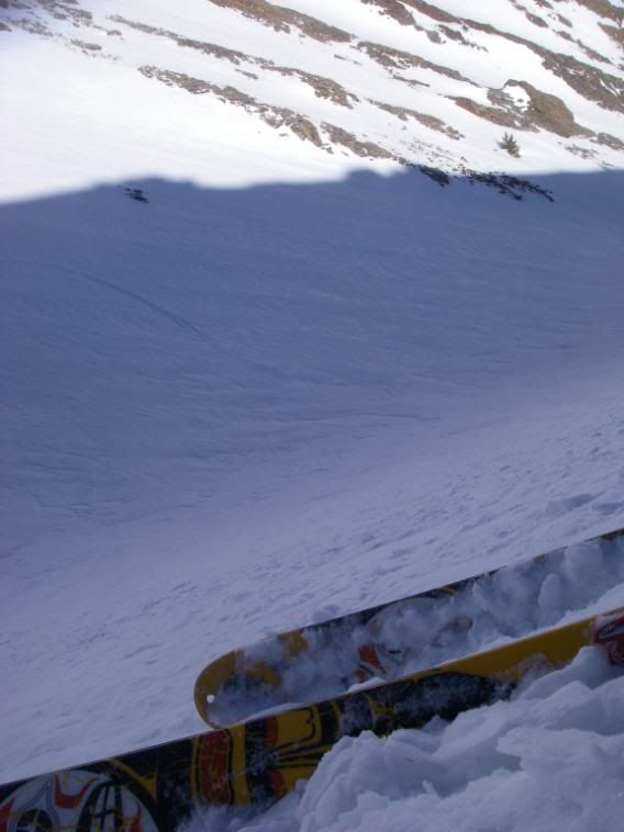
The snow was terrible, breakable ice crust that I pretty much side-slipped down. We couldn't see a clear path but kept working our way lower into the gully, hoping for a glimpse of the road. Instead we saw this.
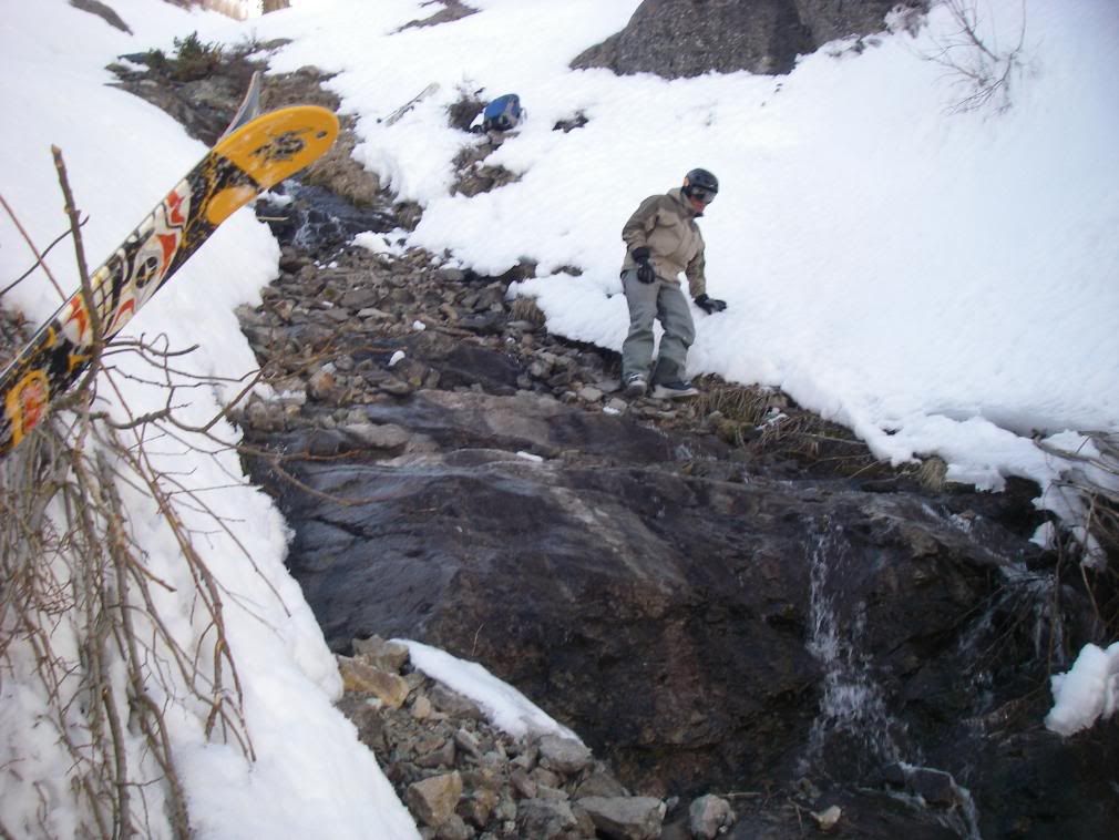
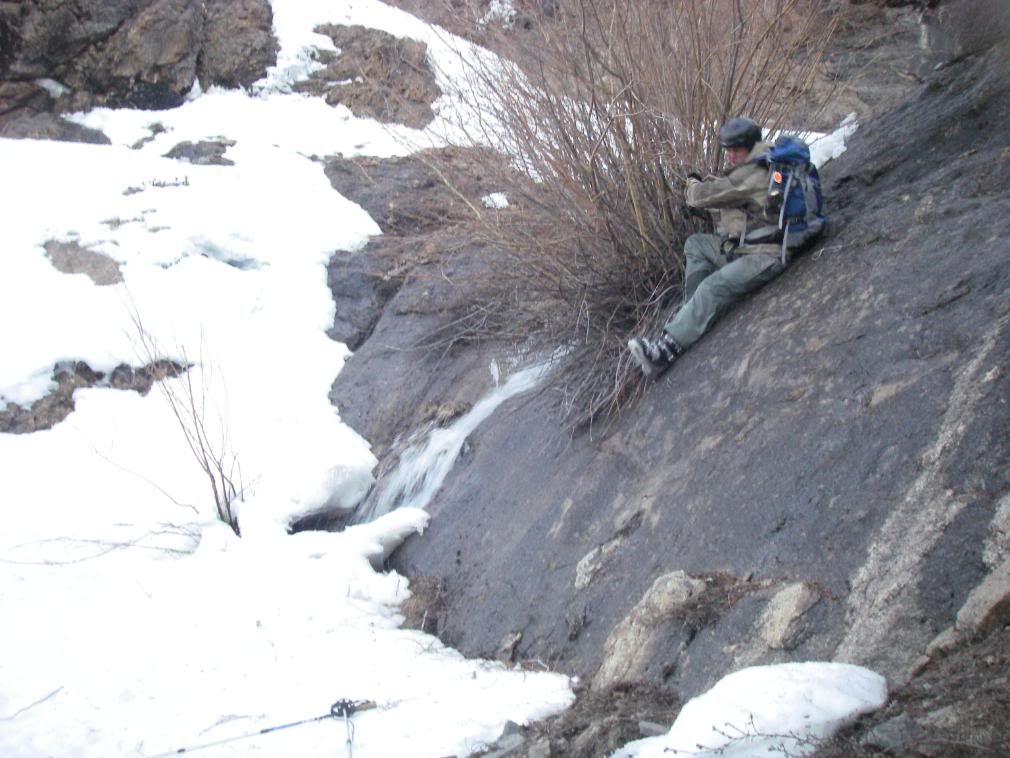
Shortly after that bad omen, we had to take off our skis and down climb a mix of rock, snow, and creek. Here's Robby executing a graceful fall down a wet rock face.
Finally we stumbled upon a game trail littered with deer pellets and a little thing inside of me jumped for joy. We kept following the fall line until the cliffs opened up and I saw the most beautiful view of the day:
This open meadow ran down to a horse trail, past a mountain ranch and to the road.
Robby and his heavy pack were moving slow so I told him I would haul down to the road, ditch my gear, and sprint up to the car to let my dog out. She was happy to see me! She had eaten all the food and drank all the water and had peed on the towel. It actually worked out well because the towel absorbed it all and she kicked it to the side.
8:05pm, back at the car, darkness.
Taking off my ski boots and wet base layers was one of the most glorious, relieving feelings of my life. Survival Mode switched off, adrenaline dwindled and the mental and physical exhaustion that had been suppressed and ignored finally set in like a brick wall. I drove the � mile down the road to pick up Robby and our gear and then into town where we finally got reception and called our relieved contact people. Never again am I telling my parents I'm doing something like this! We drove off the main street of Lake City and immediately passed out in the front seat of my car.
When we finally woke up in the middle of the night, I saw 100x more deer than cars on the road home.
This trip was a lot more for me than bagging a couple of peaks. I proved to myself what I was capable of doing and experienced a clear headed Survival Mode like I've never known before. I learned a lot about my personal limits and also Robby's.
Of every piece of gear I have when I head into the mountains, nothing is more valuable than a motivated, strong, experienced, prepared, educated and aware partner. I know we had some luck on our side and a whole army of guardian angels watching us, but we were also prepared and stepped up to the opportunity to push on and survive in an environment that could care less about the speck of time that is my life. Those mountains have towered there for millions of years and will continue to do so for millions of more years after our time on this earth is done. The mountain allowed us to pass safely that day and we will live to ski another day.
Stats:
Distance hiked to summits= about 9 miles as the crow flies
Elevation gained to summits= approx 4355'
After that, descent stats get fuzzy. Here's our routes, up and down.
If you were planning on skiing off the south side of Sunshine why did you climb the standard route up Redcloud instead of Sunshine‘s east ridge route? Its much shorter and to the point and is a polular choice this time of year when the road to the standard TH is closed. Seems like you put in a lot of extra effort for nothing. That south face of Sunshine is a well known trap and Roach warns about staying away from it in his book. Nice effort guys, but a little more research beforehand next time might save you another epic like this, or worse, having to spend a night out with wet clothes.
JC said it well, if every outing was perfectly planned the trip reports would get kind of boring. somethings gotta be said for just going for it, as long as we end up alive.
although Sarah does manage a few ”interesting” trips herself on occasion.
Thanks for the report, I didn‘t know the south face was a trap either, until now.
Great report and I like the pics that show just how steep those are. I‘ve never been able to capture the essence of the incline angles you see on the mountains. Looks like a lot of hard but rewarding work. Be safe out there!
I see that you stumbled on the greatest little ski resort unknown to the world. You can rent skis and ski all day for less than $10. Of course, it‘s not exactly black diamond skiing.........SJ Ron
Good to see that you summited. We were leaving when these fellas arrived in the afternoon. We couldn‘t make water until 11 AM (fuel bottle wouldn‘t pressurize), so we peaced out after things warmed up. We‘re going back on 16 May, tentatively.
You might have been the first to sign the register since November, but you weren‘t the first to get to it... had to follow our tracks all the way there! So ha!
We've all had epics. But thats a pretty good one. Sarah makes a good point, but there is certainly something to be said for learning the hard way. Sometimes it is more effective. I'm glad you guys made it out alright. And with alpine trekkers to boot... Nice write up though, and the skiing looked pretty good.
Sarah T- as quoted from the report,
”In previous TR's, parties have gone up South Fork drainage and up steep couloirs that are prone to rockfall. With the extra mileage to begin the day, I though a gradual, even if longer, ascent would be easier. So we pushed all the way up Silver Creek and aimed for Redcloud's western shoulder.”
And contrary to your statement, nothing in the San Juan‘s is well known to us, especially this terrain trap! I had looked at both Roach and Dawson‘s guides but focused primarily on Dawson‘s because of winter ascent/descent info. O well, it‘s a lesson and experience we‘ll remember forever.
Sometimes I wonder what adventures would be like before detailed topos, multiple guidebooks, internet research, previous trip reports and all the other luxuries we have today. True untamed adventure. I‘m guessing in these situations, we‘d have a lot more Alfred Packer situations so maybe they‘re a good thing! Actually, as we were just starting up out of the gully with a long steep uphill slog ahead of us, I looked at Robby and said, ”No matter what happens, you can‘t eat me!” Now, reflecting back, maybe that seems a little selfish? Let‘s hope none of us are ever faced with that decision!
I usually don‘t read real long reports, but I especially found yours very inviting. Looks like an incredibly long day. Congratulations and thanks for the pictures on the conditions up there.
Caution: The information contained in this report may not be accurate and should not be the only resource used in preparation for your climb. Failure to have the necessary experience, physical conditioning, supplies or equipment can result in injury or death. 14ers.com and the author(s) of this report provide no warranties, either express or implied, that the information provided is accurate or reliable. By using the information provided, you agree to indemnify and hold harmless 14ers.com and the report author(s) with respect to any claims and demands against them, including any attorney fees and expenses. Please read the 14ers.com Safety and Disclaimer pages for more information.
Please respect private property: 14ers.com supports the rights of private landowners to determine how and by whom their land will be used. In Colorado, it is your responsibility to determine if land is private and to obtain the appropriate permission before entering the property.