Download Agreement, Release, and Acknowledgement of Risk:
You (the person requesting this file download) fully understand mountain climbing ("Activity") involves risks and dangers of serious bodily injury, including permanent disability, paralysis, and death ("Risks") and you fully accept and assume all such risks and all responsibility for losses, costs, and damages you incur as a result of your participation in this Activity.
You acknowledge that information in the file you have chosen to download may not be accurate and may contain errors. You agree to assume all risks when using this information and agree to release and discharge 14ers.com, 14ers Inc. and the author(s) of such information (collectively, the "Released Parties").
You hereby discharge the Released Parties from all damages, actions, claims and liabilities of any nature, specifically including, but not limited to, damages, actions, claims and liabilities arising from or related to the negligence of the Released Parties. You further agree to indemnify, hold harmless and defend 14ers.com, 14ers Inc. and each of the other Released Parties from and against any loss, damage, liability and expense, including costs and attorney fees, incurred by 14ers.com, 14ers Inc. or any of the other Released Parties as a result of you using information provided on the 14ers.com or 14ers Inc. websites.
You have read this agreement, fully understand its terms and intend it to be a complete and unconditional release of all liability to the greatest extent allowed by law and agree that if any portion of this agreement is held to be invalid the balance, notwithstanding, shall continue in full force and effect.
By clicking "OK" you agree to these terms. If you DO NOT agree, click "Cancel"...
Mt. Lindsey (NW Ridge) & UN 13828 ("Huerfano") - Huerfano/Lily Lake TH
A Sangre Centennial Twofer
Date: September 2, 2007 Team: USAKeller and comin2getcha Route: Northwest Ridge ascent and descent for Mt. Lindsey, traverse to South Slopes up "Huerfano Peak" (UN 13,828') Total mileage: ~10.1 miles from Upper Huerfano/Lily Lake TH Total elevation gain: ~4,020ft. from the TH
Lance and I left Boulder Saturday afternoon and arrived at the Huerfano TH at 9:00pm. We quickly converted the bed of the truck into an RV and went to sleep. We decided to sleep in- the alarm went off at 6:00am and we were on trail at 6:45am. Being Labor Day weekend, several other parties were out. This would be my second time climbing the NW Ridge on Lindsey; the first time last summer was my first class 4 climb, so I was excited to see what I thought of it now that I've gained more experience.
We crossed the meadow, weaved through the trees, and climbed up the steep approach to the upper part of the basin, in what took us 2 hours to reach the Iron Nipple-Mt. Lindsey saddle (~13,200ft.). We followed the standard trail for a few hundred yards to a faint turn-off and headed up east to the ridge (N37deg 35m15.9s W105deg 27m2.8s). This trail is not cairned so we picked a line that would take us to the bottom of the black chimney.
This photo shows the turn-off and main route in red, staying to the left of the ridge. The route in yellow is what we ended up taking - not recommended because you will have to do a slightly tricky down climb to get back over to the bottom of the chimney. And, the blue arrow shows the entry/exit point for the class 2 scree gully (some forum members were interested in this):
The crux of this route is near the chimney. To keep it a class 3+ scramble, it's best to stay to the left of the chimney; we wanted some excitement so we climbed up the chimney - class 4+.
A closer look at the class 4 crux of this route (taken from ~13,550ft.)- the blue line is the route we took;
the red line is the easier class 3/3+ scrambling; and, the yellow line is an easier (and recommended) way
to get to the crux wall. The summit cannot be seen from here:
After the crux wall, the climb turns back into a class 2 walk over the ridge to the summit, as seen in the photo below.
The final hike to the summit (taken from above the crux wall); the elevation gain is only about 50 feet from here:
We reached the summit in 3hrs 45min (at 10:30am) and other parties started to join us shortly after. Some clouds started to gently roll in, but nothing threatening.
We started back down the NW Ridge with intentions of hitting UN 13,828 ("Huerfano Peak"), but with the clouds coming in, we would reassess the situation when we returned back to the Iron Nipple-Lindsey saddle. When we got there (at 12:00pm), we decided to make a run for Huerfano Peak, bypassing Iron Nipple. To do this, we dropped way below the right side of Iron Nipple, and crossed over a rock rib.
Taken from the saddle, this photo shows our route to bypass Iron Nipple:
Once past the rock rib, you will see a few cliff bands that you will have to skirt around before re-gaining the ridge (South Slopes Route) to UN 13,828. The photo below shows the un-cairned route back up to the ridge.
A shot of the route after the second (and final) drop-down point- this is the section that skirts around the cliff bands:
Taken from 13,500ft., this picture looks back at the route we took from the saddle:
From the Iron Nipple-Lindsey saddle, it took us 1 hour to summit UN 13,828 (at 1:00pm).
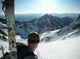
California Peak (13,849ft.) from the summit of Huerfano Peak:
We spent a quick 15 minutes on the summit; when we heard thunder coming our way, we knew it was time to get down. A long hail/thunder/lightning storm accompanied us as we made our way back towards Iron Nipple and wouldn't let up until near treeline down in the basin. After a muddy hike back down the steep approach, we made it back to the car in 3 hours (at 4:15pm) from the summit of UN 13,828. It was definitely a long day for us, but re-visiting the NW Ridge on Lindsey only reconfirms how excited I get when it comes to scrambling!
Thumbnails for uploaded photos (click to open slideshow):
Looks like a really fun scramble! Thanks for the TR: Excellent job as usual! Also, thanks for the TR on Capitol...your photo of the traverse just under the ridge definitely helped Ben and I have a bit more fun
USAKeller - another fun climb and a great trip report. I really enjoyed the scrambling. Of course if we had started when I wanted to we would have missed the hail!
Hey - we were up on California Peak that day! I was going to say that we might be in your picture of it, but I think we were further down than that at 1pm. The hail caught us, too, though. Yikes! Looks like you had a great time in spite of the Sangre weather.
Lance- WHATEVER- Mr. "I Need To Sleep In"! You know I always pick the start time and we haven't had any weather problems up until Capitol when I did not pick the time . From now on: alarm goes off at 4am, on trail by 4:30am at the latest.
Bill- I laughed when I read that! Some of us don't need an hour to get ready in the mornings so we can use the 10 extra minutes sleeping (like myself!) .
Mots010, KirkT, and Mark- We missed you this weekend! But I'm glad you all got in some good peaks.
USAKeller - Both Bill and I know the truth about who says they need to sleep in or at least have a few more minutes. You can try to deflect the responsibility but it just won't work.
you guys were dodging some weather?? You truly missed an epic climb on the Bells... however it looks like yall had a great climb yourselves. Congrats!
Kirk
Caution: The information contained in this report may not be accurate and should not be the only resource used in preparation for your climb. Failure to have the necessary experience, physical conditioning, supplies or equipment can result in injury or death. 14ers.com and the author(s) of this report provide no warranties, either express or implied, that the information provided is accurate or reliable. By using the information provided, you agree to indemnify and hold harmless 14ers.com and the report author(s) with respect to any claims and demands against them, including any attorney fees and expenses. Please read the 14ers.com Safety and Disclaimer pages for more information.
Please respect private property: 14ers.com supports the rights of private landowners to determine how and by whom their land will be used. In Colorado, it is your responsibility to determine if land is private and to obtain the appropriate permission before entering the property.


")
")
")