Download Agreement, Release, and Acknowledgement of Risk:
You (the person requesting this file download) fully understand mountain climbing ("Activity") involves risks and dangers of serious bodily injury, including permanent disability, paralysis, and death ("Risks") and you fully accept and assume all such risks and all responsibility for losses, costs, and damages you incur as a result of your participation in this Activity.
You acknowledge that information in the file you have chosen to download may not be accurate and may contain errors. You agree to assume all risks when using this information and agree to release and discharge 14ers.com, 14ers Inc. and the author(s) of such information (collectively, the "Released Parties").
You hereby discharge the Released Parties from all damages, actions, claims and liabilities of any nature, specifically including, but not limited to, damages, actions, claims and liabilities arising from or related to the negligence of the Released Parties. You further agree to indemnify, hold harmless and defend 14ers.com, 14ers Inc. and each of the other Released Parties from and against any loss, damage, liability and expense, including costs and attorney fees, incurred by 14ers.com, 14ers Inc. or any of the other Released Parties as a result of you using information provided on the 14ers.com or 14ers Inc. websites.
You have read this agreement, fully understand its terms and intend it to be a complete and unconditional release of all liability to the greatest extent allowed by law and agree that if any portion of this agreement is held to be invalid the balance, notwithstanding, shall continue in full force and effect.
By clicking "OK" you agree to these terms. If you DO NOT agree, click "Cancel"...
Pikes Peak 14,110 Feet (30th Highest in Colorado)
Northwest Slopes II
Crags Campground Trailhead, 10,100 Feet
August 25th, 2007
11.5 Miles Roundtrip
4,200 Feet Elevation Gained
Greenhouseguy, KeithK, and Elims
Pikes Peak is by far the most commercialized fourteener in Colorado - perhaps in the country. Tourists from around the world ride the cog railway to the summit or drive the toll highway. The large gift shop and restaurant on the summit detracts from the scenic beauty of the mountain. However, it continues to draw hikers by the thousands by virtue of its reputation and high visibility throughout the Front Range.
Lt. Zebulon Pike was the first European to attempt to climb the mountain in 1806. He failed in his attempt due to bad weather and a lack of proper equipment. Dr. Edwin James, who was a botanist on the Long Expedition, successfully reached the summit in 1820. Maj. Long initially named the peak for Dr. James, but it became known as Pikes Peak through common usage.
The standard hiking route on Pikes Peak begins at the Crags Campground, which is several miles to the northwest of the summit. To get to the Crags Campground, take Hwy. 24 to Divide. Turn south on Hwy. 67 at Divide, and continue for 4.3 miles. Turn east on FS Rd. 383, and continue 1.5 miles to the Mennonite Camp. After another 1.5 miles, turn left into the Crags Campground. This turn is easy to miss in the dark! Follow the road all the way to the upper parking lot. Some people may be grateful for the outhouse at the parking lot. The road is in good condition, and is accessible to 2WD vehicles.
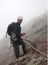
KeithK, Elims, and I met in Parker at 3:30 a.m. on Saturday. After taking a few minutes to get our gear together, we hit the road and arrived at the trailhead shortly before 5:30. It was still quite dark, so the first gear that we broke out was the headlamps.
Gearing up for an early start
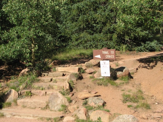
The Crags Trail starts at the upper east end of the parking lot.
Crags Trailhead marker (Image taken later in the afternoon)
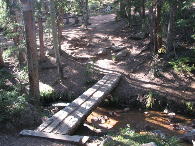
After moving through the darkness for several hundred yards, my headlamp shone on three pipes on the left hand side of the trail. A few yards beyond these pipes, the Crags Trail (#664) and the Devil's Playground Trail (#664A) diverged. We took the Devil's Playground Trail, which was on the right. Shortly thereafter, we came to the first of three stream crossings.
Footbridge over the first of three streams (image taken later in the afternoon)
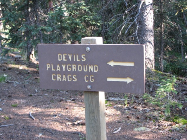
Not too far past the first bridge, a sign confirmed that we were headed towards the Devil's Playground.
Trail sign directs hikers towards the Devil's Playground or back towards the Crags Trail (image taken later in the afternoon)
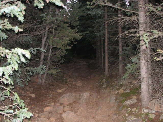
We were still hiking with our headlamps on, but the first rays of light began to appear in the sky.
Pre-dawn conditions on the lower portion of the Devil's Playground Trail
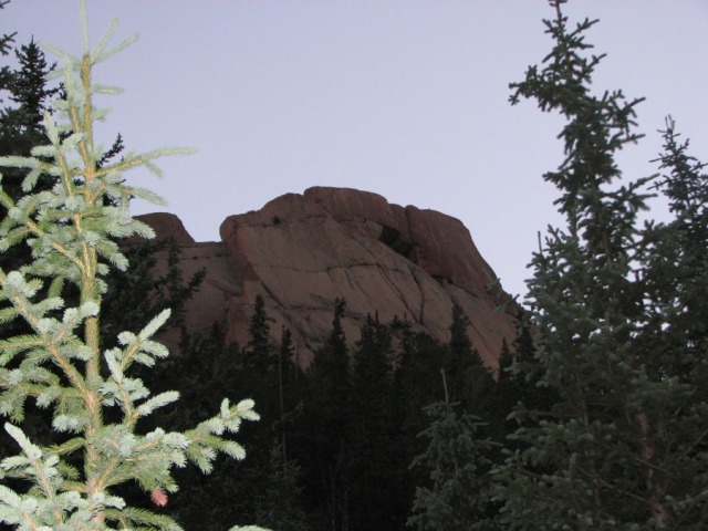
We crossed over a second log bridge, and crossed the third stream on steppingstones. An interesting rock formation on the left (north) side of the trail caught my eye. I initially thought that this might have been the Crags, but a quick look at my GPS showed that we were nowhere near the Crags.
This interesting rock outcropping is composed of billion-year-old pink granite
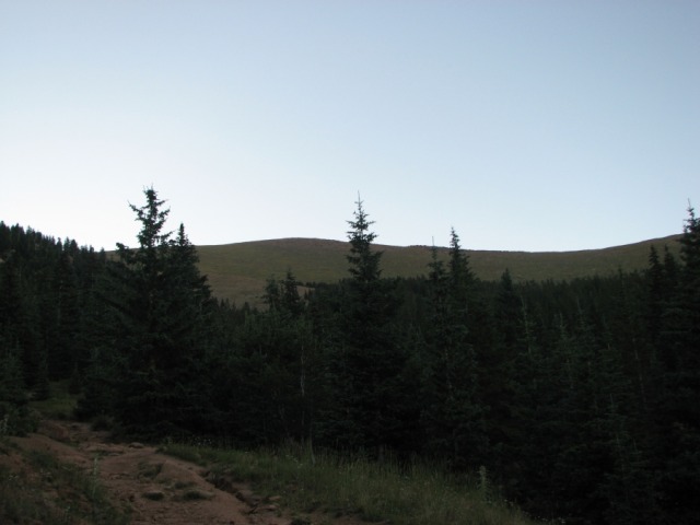
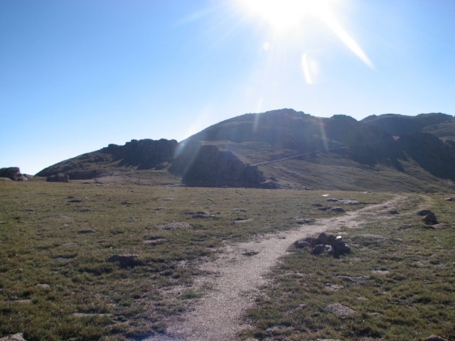
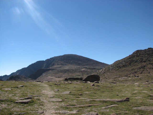
We continued to slog uphill at a reasonable pace. At about 10,850 feet, the trail leveled off as it passed through a meadow.
The easy stretch of trail through the meadow with the high ridge looming in the background
Although we enjoyed the easy stretch of trail, it became obvious that we would have to traverse the high ridge that appeared in the distance.
We were still in the trees as we pressed on towards the ridge
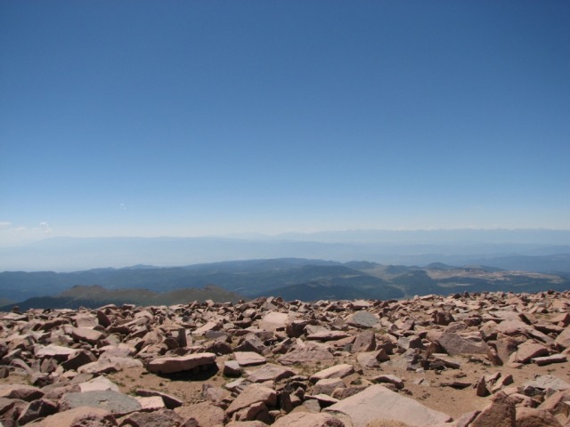
The terrain started to get steep at about 11,300 feet. This would prove to be the first crux of the route. As we worked our way up the side of the ridge, I looked over my shoulder and noticed that we were up above the clouds.
Looking down on the clouds
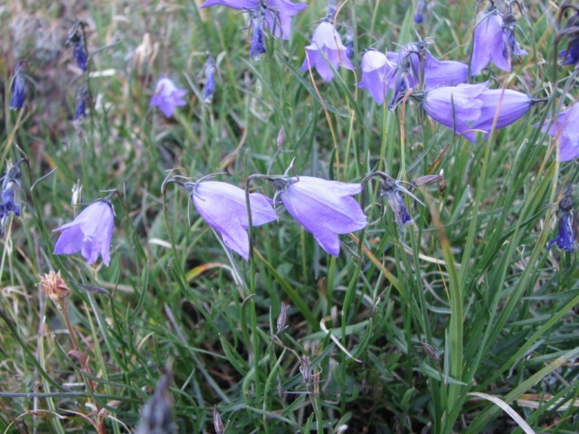
The peak wildflower season has long since passed, but a few flowers were still blooming. The lacy white flowers of the Yarrow were nearly ubiquitous, and scattered specimens of Fireweed and Mountain Harebells added color.
Mountain Harebells (Campanula rotundifolia)
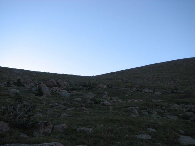
About halfway up the ridge, we came out of the trees. The trail headed straight for a shallow notch in the ridge.
Looking up towards the notch in the ridge
Lisa and Keith on the trail with much of the long steep ridge behind them
As we neared the ridge's crest at 12,700 feet, Pikes Peak's summit came into view. Although we had just ascended more than 1,400 feet on the ridge, the summit was still high above us and far away.
First glimpse of the summit from the crest of the ridge
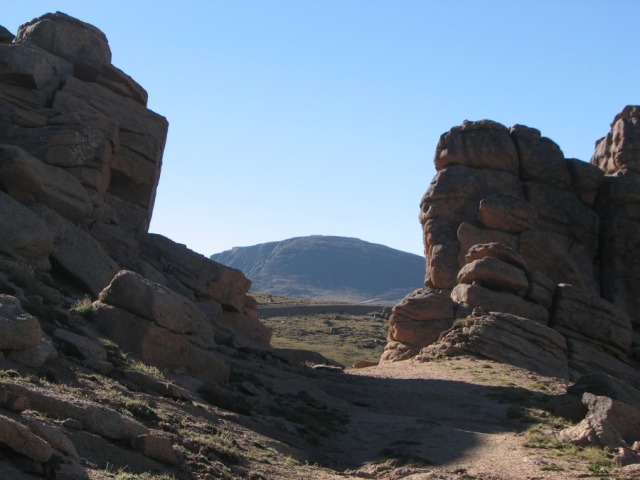
We found some relief on the other side of the ridge. The trail was broad and nearly level for about � of a mile. The Devil's Playground was visible in the distance. A sign beside the trail states that this area received its name because lightning flashes from rock to rock during electrical storms.
Moving towards the rocky Devil's Playground
The rock formations in the Devil's Playground provided some scenic interest. They have vertical and horizontal fissures that probably result from the relief of pressure when the formerly-buried rocks were pushed to the surface from a depth of several miles. I had some fun scrambling in the rocks while I waited for my partners to catch up with me.
Pikes Peak summit bracketed in a notch in a band of rocks at 12,850 feet
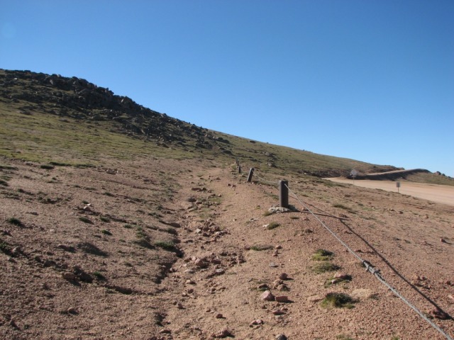
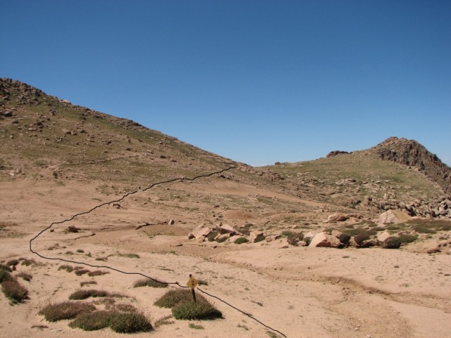
There is a parking lot at the eastern edge of the Devil's Playground. This is a popular spot for spectators to park to watch the Pikes Peak Hill Climb auto race. The trail passes through the parking lot and crosses to the east side of the Pikes Peak Toll Road at about 12,950 feet. The scenery in this area cannot compare to the lush green forest that we had passed through at lower elevations. The tundra was sparse, the soil was sandy, and we had to deal with the noise and dust from the road. The trail ran parallel to the road for more than � a mile before it turned away.
A steel cable separates the trail from the road at about 13,000 feet
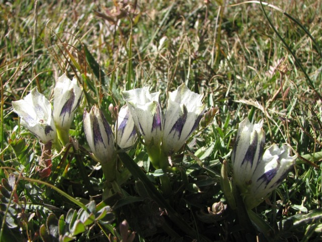
While this stretch of the trail was not particularly scenic, a few wildflowers managed to flourish. The Arctic Gentian flowers, which close at night, were just opening in the bright sun. These are among the last flowers to bloom in the summer, and they serve as an indicator that the snow will soon be falling.
Arctic Gentian (Gentianoides algida), a late-blooming wildflower
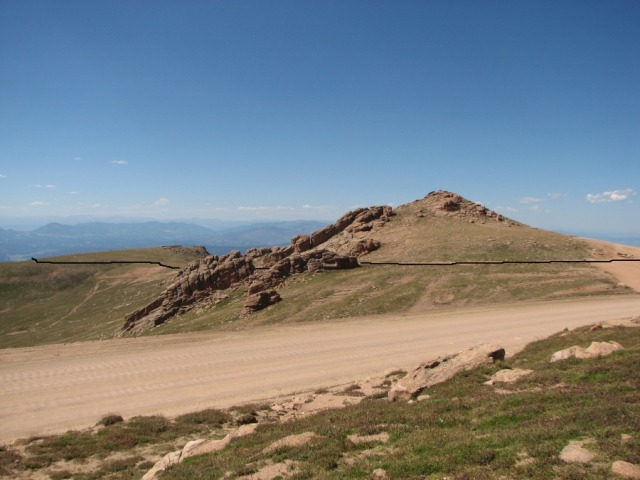
After we ascended for about � of a mile, the trail descended slightly and passed close to a curve in the road. There is a retaining wall on the edge of the road, and it is tempting to hike on the road to get past a deep gully. Hikers are not allowed on the road, and rangers strictly enforce this rule. We dropped down below the road level and passed through some very sketchy scree to circumvent the retaining wall. We continued to travel to the southeast, and after a short distance the trail turned away from the road. The terrain was nearly level as we hiked a sandy section of trail on the east side of Point 13,363.
The summit looms in the distance. Note that there is a low but steep ridge between the vantage point and the peak
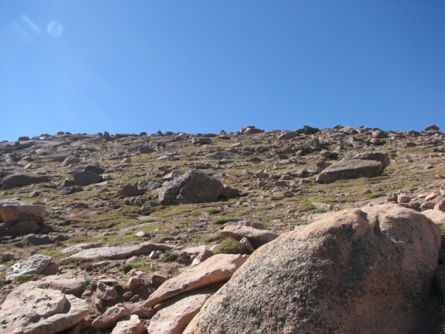
At about 13,200 feet we had to ascend about 200 feet on the side of a steep ridge. Once we crested the ridge, the second crux confronted us - a 700-foot rock hop on a winding trail through the talus to the summit. It was steep and intimidating, but the goal was clearly in sight.
To understand the scale of the ridge and boulders, look for two hikers in this image
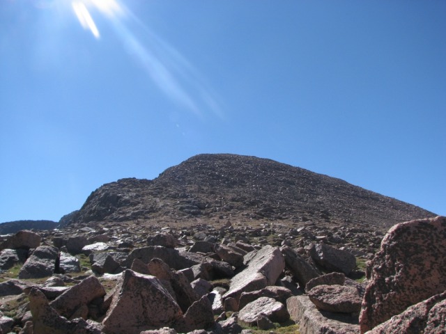
The summit viewed from the trail at 13,400 feet
The summit push was easier than I had expected. The trail through the talus was clearly marked with stone cairns. Some particularly bad spots had been filled in with crushed rocks. The talus was stable, and did not move when we stepped on it. Switchbacks in the trail kept the grade to a manageable level. Some hikers ahead of me simply ignored the cairns and took a more direct tack to the summit. This section of the trail is undoubtedly what earned it a Class 2 rating. The temperature had dropped as we gained altitude, and the wind was uncomfortably brisk.
The summit was unlike any other that I had seen on a fourteener. It was broad and flat, and almost entirely paved. There was a gift shop and restaurant at the cog railway station, and an outbuilding for maintenance. Hundreds of people milled around the premises; most had either driven or taken the cog railway. The Barr Trail reached the summit from the opposite side, and some of the hikers had obviously taken this route. Cars in the parking lot bore license plates from many distant states. The summit is also apparently popular with international tourists. The restaurant was moving large quantities of their famous donuts. Enjoy them while trans-fats are still legal! The gift shop had a plethora of t-shirts and made-in-China baubles. I refrained from spending any money and just stood in the doorway to take in some heat. The temperature had dropped to 44 degrees.
KeithK, Elims, and Greenhouseguy on the summit
Tourists boarding the Pikes Peak Cog Railway
We all had something to eat and walked a lap around the summit to take in the views from every angle.
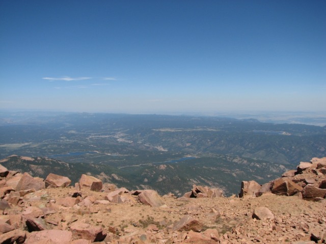
View to the north from Pikes Peak's summit
View of the Sangre de Cristo Mountains to the south from Pikes Peak's summit
The skies were clear, and we could see no sign of any impending storm activity. We departed from the summit at a leisurely pace, and had only traveled a few yards when we met fellow 14er member SlowMovingFunSeeker. We had a lively chat, and wound up hiking back to the trailhead with him and his partners. This made for an enjoyable hike on the way down.
Descending through the talus is rough on people with bad knees, but we made good time through the first part of our descent. I could see two trails on the east side of Pt. 13,363; we took the lower trail to minimize any altitude gain.
The gritty trail and sparse vegetation on the east side of Pt. 13,363
I was glad to return to the easy trail through the Devil's Playground.
The Devil's Playground viewed from the east
After we passed through the Devil's Playground area, we began the extremely long and slow journey down the infamous ridge. Sections of loose rock and scree made us miserable as we descended. We slid quite a bit, but we all managed to remain vertical. We didn't really feel that the trail had relented until we passed through the small meadow at 10,850 feet. The trail seemed much longer than the 11.5 miles that Bill Middlebrooks mentioned in his route description. In fact, my GPS read 13.5 miles and another hiker's read 13.4 miles. I cannot vouch for the 5,300 feet in elevation gain that showed on my GPS.
It was exciting to hike such a well-known peak, but we were all disappointed that it was not as scenic as most of the other fourteeners. It was certainly an exhausting workout. We had dinner at a burger joint in Colorado Springs and returned to the Metro area with mixed emotions about our day on Pikes Peak.
You left out the ManBearPig ambush at the first large rock outcropping! Hikers need to be cautious of this cereal beast...
Great job on the report, as always!!!
BTW, Goatman, you are right. There is no need to drop below the retaining wall, as it is only about a 50 yard jaunt along the road to get back on the trail. Cars are allowed to park on the other side of the road and use this area as a scenic overlook, so there's not much way the rangers could have a problem with hikers here...
I'm planning on doing this route sometime soon and plan on printing this out for reference. Interesting geological and historical comments! Looked like great weather.
Up until you start crossing the road, this is one of my favorite routes on any mtn in colorado, you can see the Sangres, the Sawatch, Longs, Evans and even the Elks on a really clear day. If you hit this in early Spring before the road is open, its a pleasure, my brother and I saw maybe 4 people on the trail the whole day.
When it was open, we found amusement in watching this women get right off the Cog, try and find some privacy and then yack all over the place from the altitude. Sorry if I have no pity for tourists. And we wouldnt share our water with some guy from Kansas who didn't want to pay for some in the store. We actually told him to f**k off.
Since we live in Woodland Park, we spend lots of time around the Crags. We've done this route a few times and find it most enjoyable when the road is closed. However, since they try to keep it open year round now, that means climbing right after "bad" weather... at least too bad for cars to be on the road, but not too bad for climbers to be on the trail!
I must have missed the overlook bypass route? Me and my goats just walked along the wall dodging tourist, kids and dogs until back on the trail. The ranger/peak patrol who was sitting in his truck said nothing? ...here's my TR
BTW Nice report! Good photos and trail description! I agree about the summit being over run with humanity ...so are most easily accessed points of interest.
Cheers, Steve
Caution: The information contained in this report may not be accurate and should not be the only resource used in preparation for your climb. Failure to have the necessary experience, physical conditioning, supplies or equipment can result in injury or death. 14ers.com and the author(s) of this report provide no warranties, either express or implied, that the information provided is accurate or reliable. By using the information provided, you agree to indemnify and hold harmless 14ers.com and the report author(s) with respect to any claims and demands against them, including any attorney fees and expenses. Please read the 14ers.com Safety and Disclaimer pages for more information.
Please respect private property: 14ers.com supports the rights of private landowners to determine how and by whom their land will be used. In Colorado, it is your responsibility to determine if land is private and to obtain the appropriate permission before entering the property.