| Peak(s): |
Mt. Shavano - 14,230 feet Tabeguache Peak - 14,158 feet |
| Date Posted: | 05/01/2007 |
| Modified: | 12/03/2009 |
| Date Climbed: | 04/27/2007 |
| Author: | doumall |
| Peak(s): |
Mt. Shavano - 14,230 feet Tabeguache Peak - 14,158 feet |
| Date Posted: | 05/01/2007 |
| Modified: | 12/03/2009 |
| Date Climbed: | 04/27/2007 |
| Author: | doumall |
| Shavano and Tabeguache Summit Ski Descents |
|---|
|
Route: Blank Cabin Trailhead 9,750' Angel of Shavano Ascent Traverse to Tabeguache Summit Ski Descent of Tabeguache - South Face Direct to 12,400' - A first? Ascent back to Shavano Summit Ski Descent of Shavano - East Shoulder Direct to Angel of Shavano Stats: -Elevation Climbed: 6,520' -Vert skied: 5,220' -Mileage RT: 10.9 miles The Up: Prakash Manely and I headed out the door Friday night thirsty for some mountain air. After a delicious meal at Pho 79 in Broomfield and nearly a 3 hour drive we were at the Blank Cabin TH on the southern end of the Sawatch. It was 12:30 am, time to hit the sack for a brief recharge. By 3:45 am we were on the march following the Colorado Trail then the Shavano Trail toward the Angel of Shavano. Snow was continuous from 10,550' on. A faint snowshoe trail was detected and followed, although the large snowfall in the area the week previous had nearly erased any sign of human activity. Sunrise came just as we crested tree line in the small basin below the Angel. 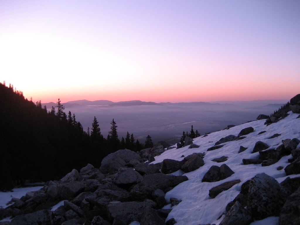 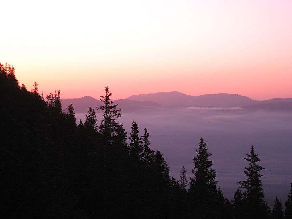 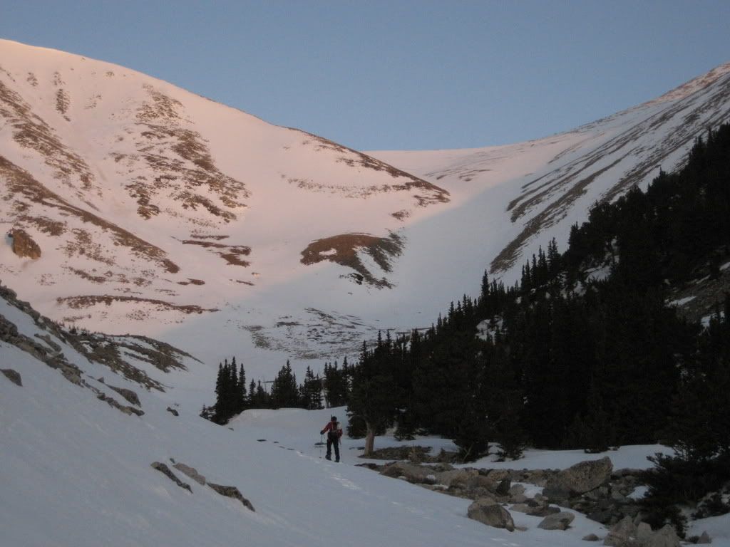 Sunrise and the Angel Couloir I am more impressed with the 'Grinch' snowfield on this face. Can you spot it? The climbing on the Angel was quick and easy, fast vertical. Skins were adhering well. 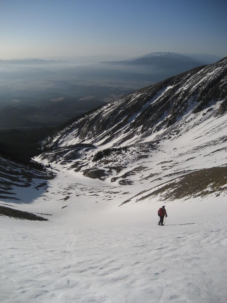 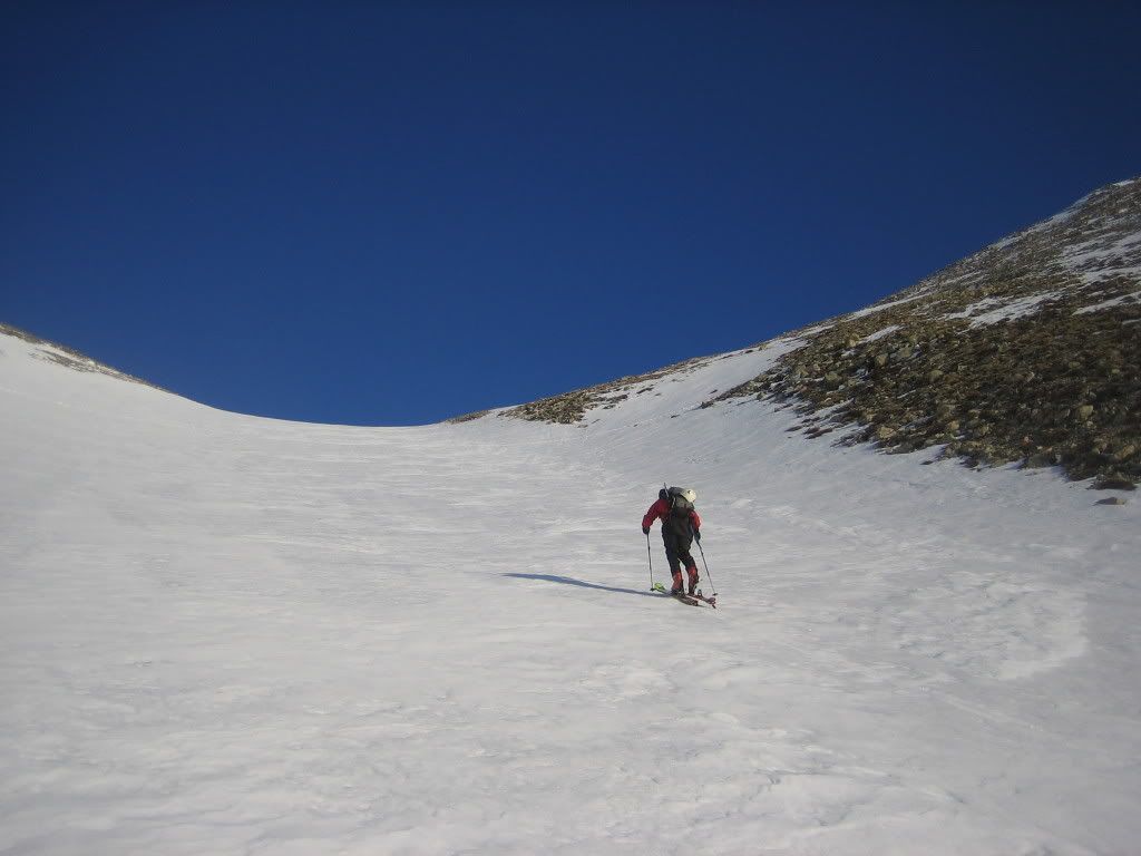 Climbing the Angel We took a brief break in the right arm. I was super happy to see all the snow on the upper slopes. The right arm was continuous all the way to within 150 feet of the summit. Prakash was hiking much more consistently and faster than ever before, it was a break-through day for him. It's awesome to your partner progress right before your eyes. 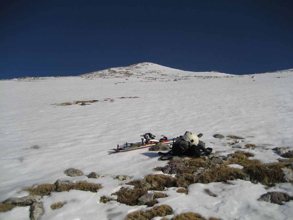 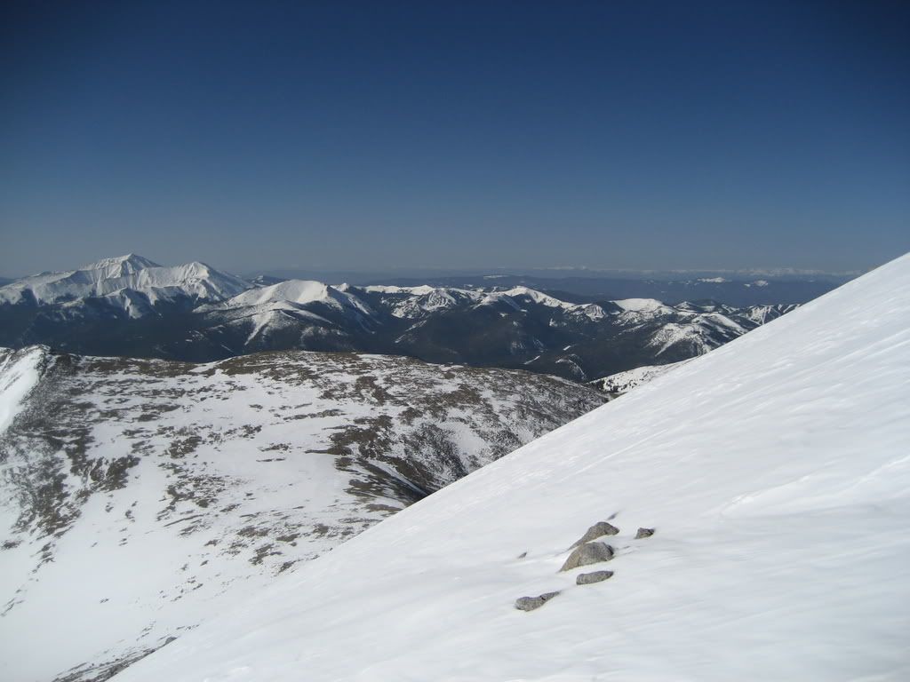 In the lookers right arm of the Angel, great snow conditions for this mountain I usually don't mind waiting for my buddies through most of a climb, but it seems every time I get within a few hundred feet of the top I have to just go. A continuous line direct from the summit was in. I was able to skin all the way to the summit. The Sangres caught my eyes over and over again, nice views round here. 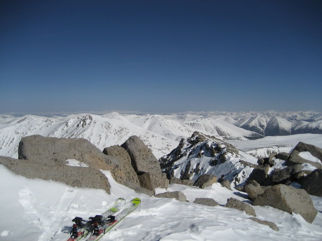 Summit of Shavano The original plan was to head over to Tabeguache with Prakash and have him watch me ski the standard descent route, the North Face. I would hike back up to the summit and catch him on the Shavano descent. Well, the view of the south face started to put doubt in my mind. 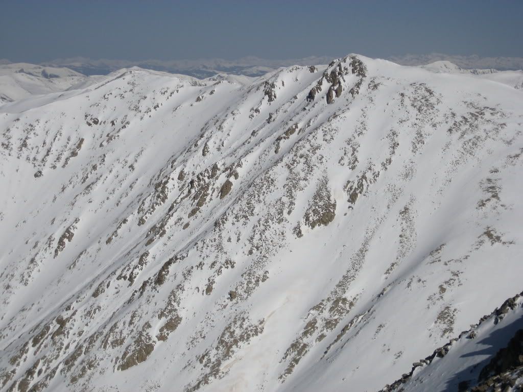 Tabeguache South Face from Shavano I knew if I were to ski that, I would have to be fast as the snow was warming. It was 9 am. As Prakash neared the summit of Shavano, I told him the new tentative plan, which entailed me high tailing over to Tabeguache and skiing the south face as he began the traverse. This of course depended upon the condition north face. 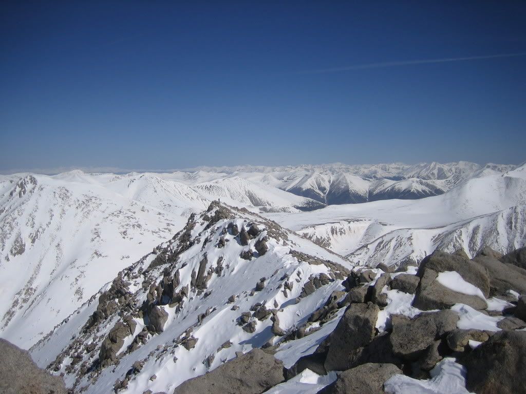 Starting the traverse to Tabeguache, can you spot me? 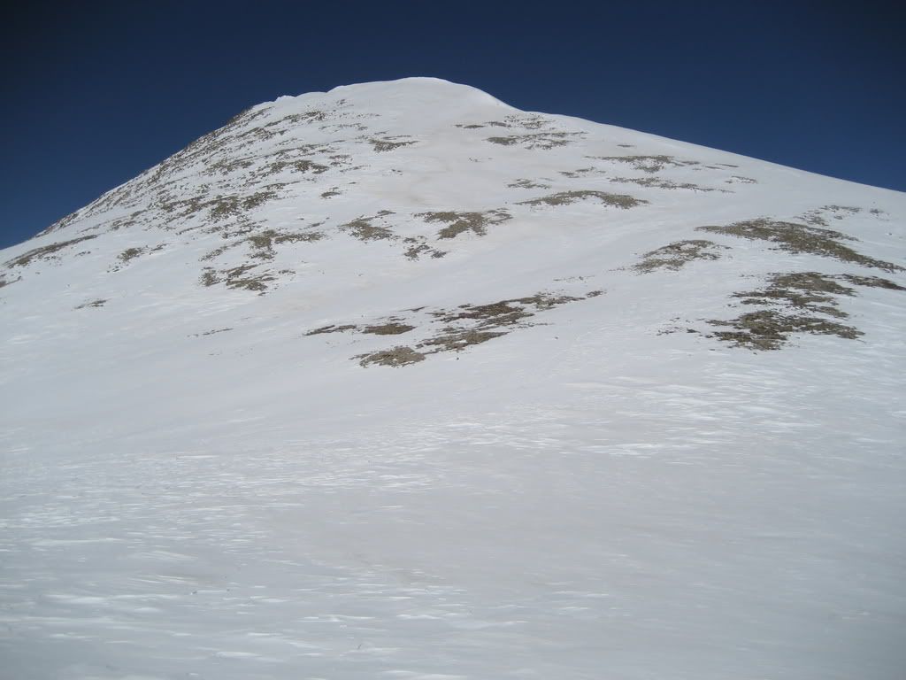 Ascent to Tabeguache from the saddle In 20 minutes I was on Tabeguache. Here is what I saw looking down to the north. 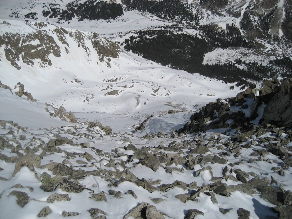 Direct line off the summit of Tabeguache to the north Somehow this gets an extreme rating in Dawson's guide. I don't get it, as it doesn't seem to exceed the mid 40 degree range and has very little technical challenge. Maybe it's a rating for something off the ridge out to the west of the summit but he says in his book that's the gentler terrain??? Hmmm. Tabeguache Ski Descent: Well, that solves it; the south face was my line and would save me 300' of climbing. I have a feeling the reason why there is no public disclosure on this ever being skied is it rarely holds enough snow. This last storm dropped the white stuff on generally dry aspects in the central mountains, timing is everything. This may be a first descent 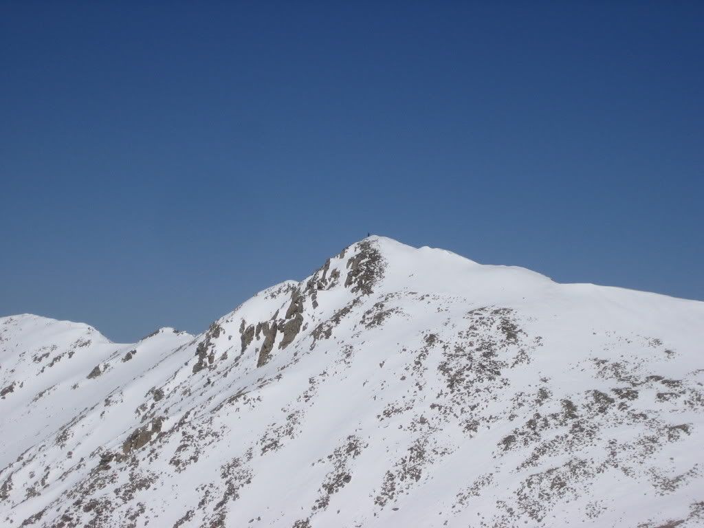 Prakash's shot of me skiing from the summit 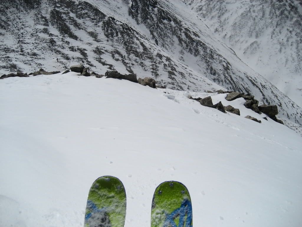 Looking over the top of the line from the summit 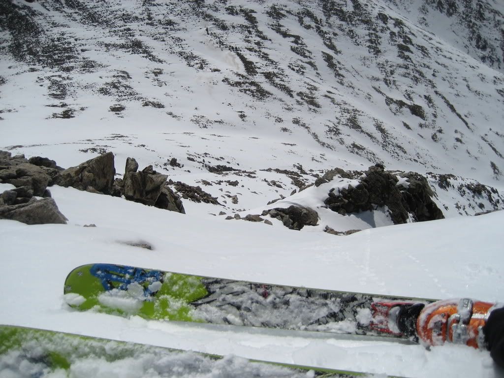 Skiing through cliffs direct from the summit of Tabeguache The middle section of the face provided enjoyable corn turns over low 40 to high 30 degree terrain and the lower section was a low 30 degree half pipe like gully which ran all the way to tree line. I stopped at 12,400'. 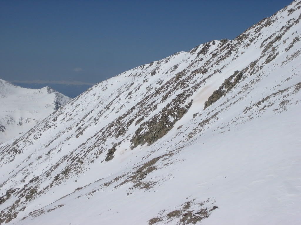 Skiing the south Face, wheres waldo? 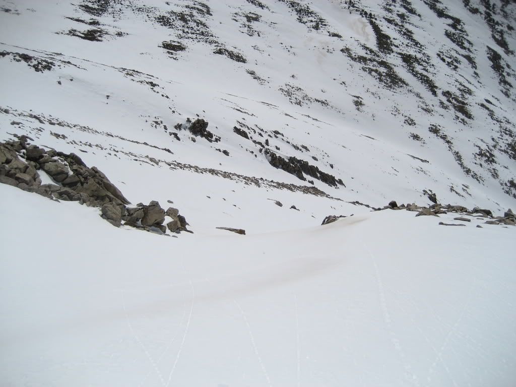 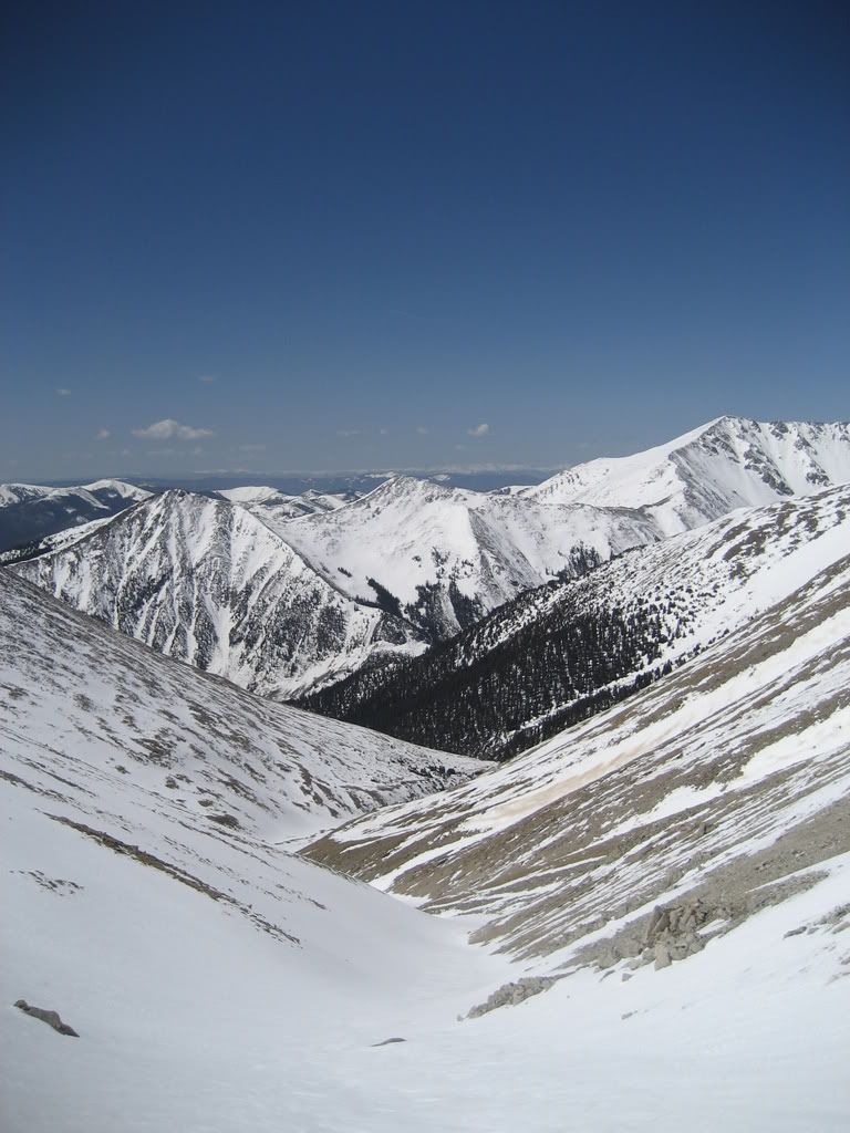 The remaining vert on the south Face 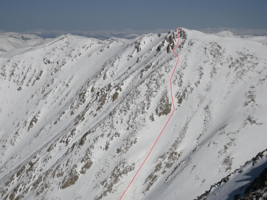 The line Time to skin back up to the Tabeguache/Shavano saddle. 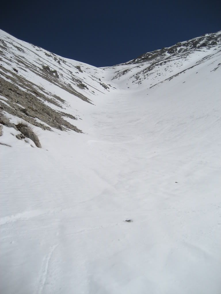 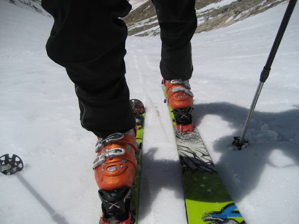 Beginning the skin I had a brief and much needed break at the saddle before Prakash arrived back from tagging Tabeguache. The solar intensity was just that, intense. 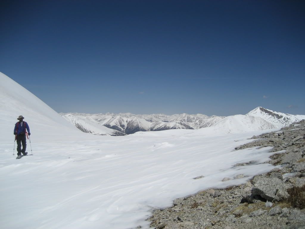 Reunited at the saddle The hike back up to Shavano was a slog for both of us, I think I was running on half a brainstem. 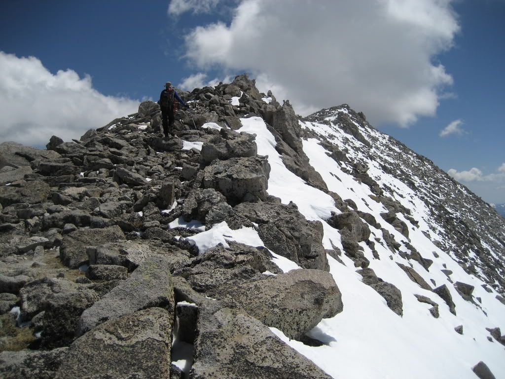 Hiking back up to Shavano's summit The view of the Sangres was sweet! 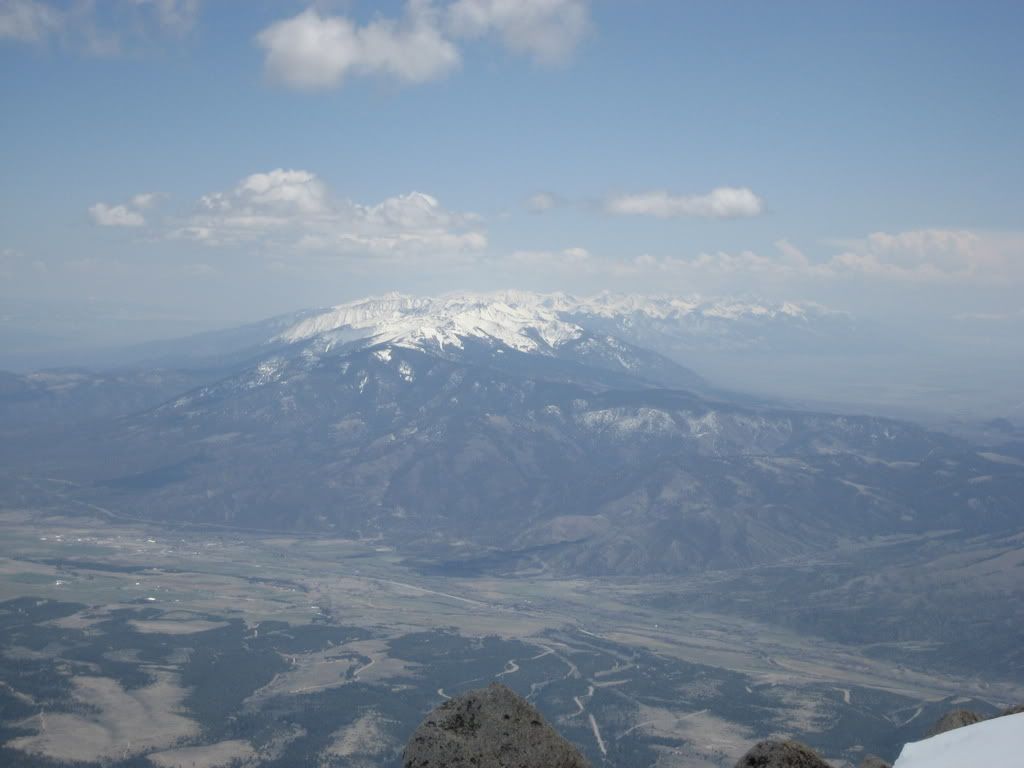 Shavano Ski Descent: The skiing off the summit of Shavano was quite good... 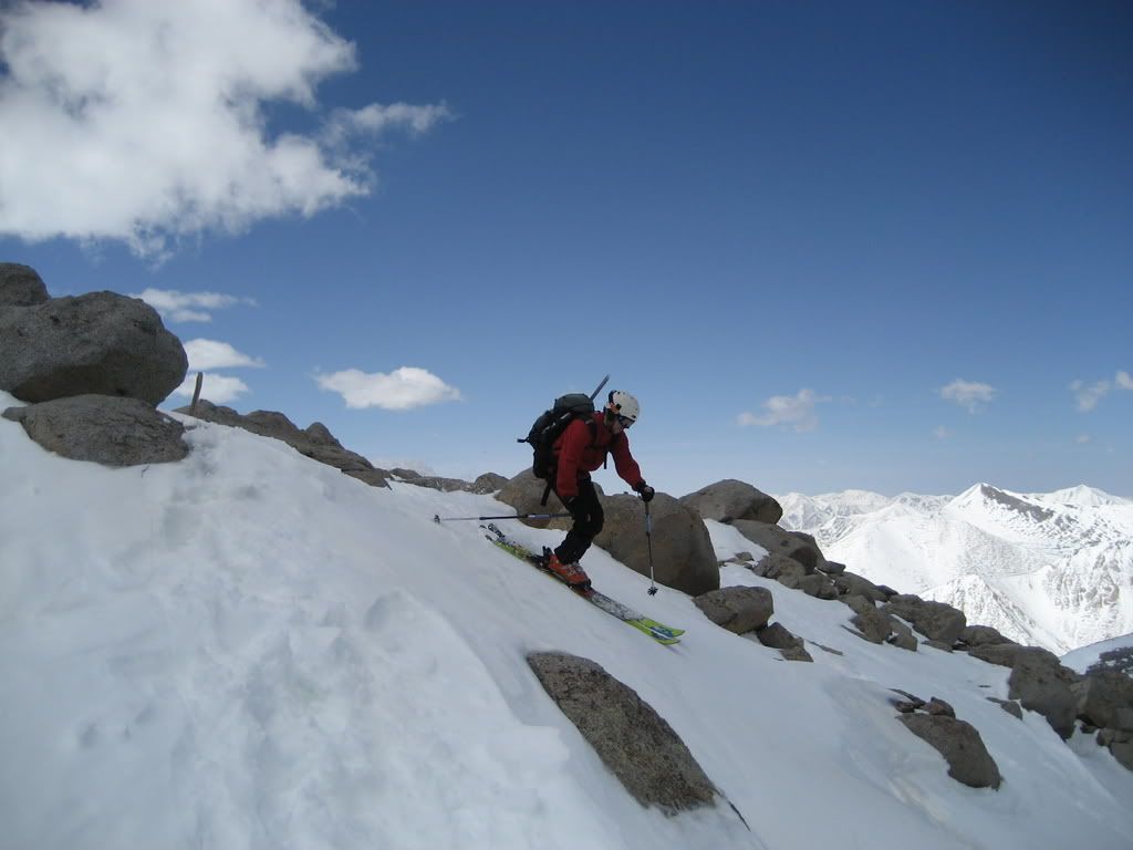 Skiing off the summit of Shavano ...and continuous through the sparsely covered east shoulder... 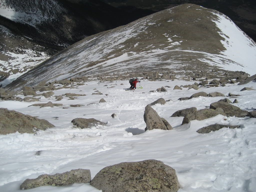 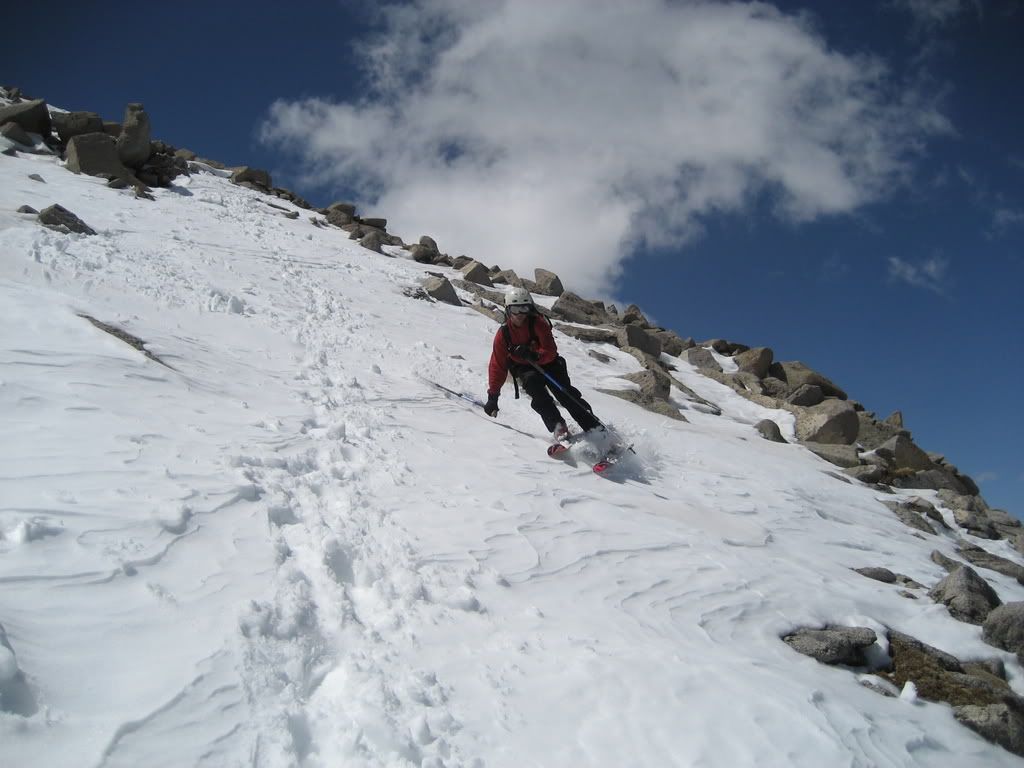 Skiing through rocky terrain toward more continuous snow ..onto and over the right arm of the angel. 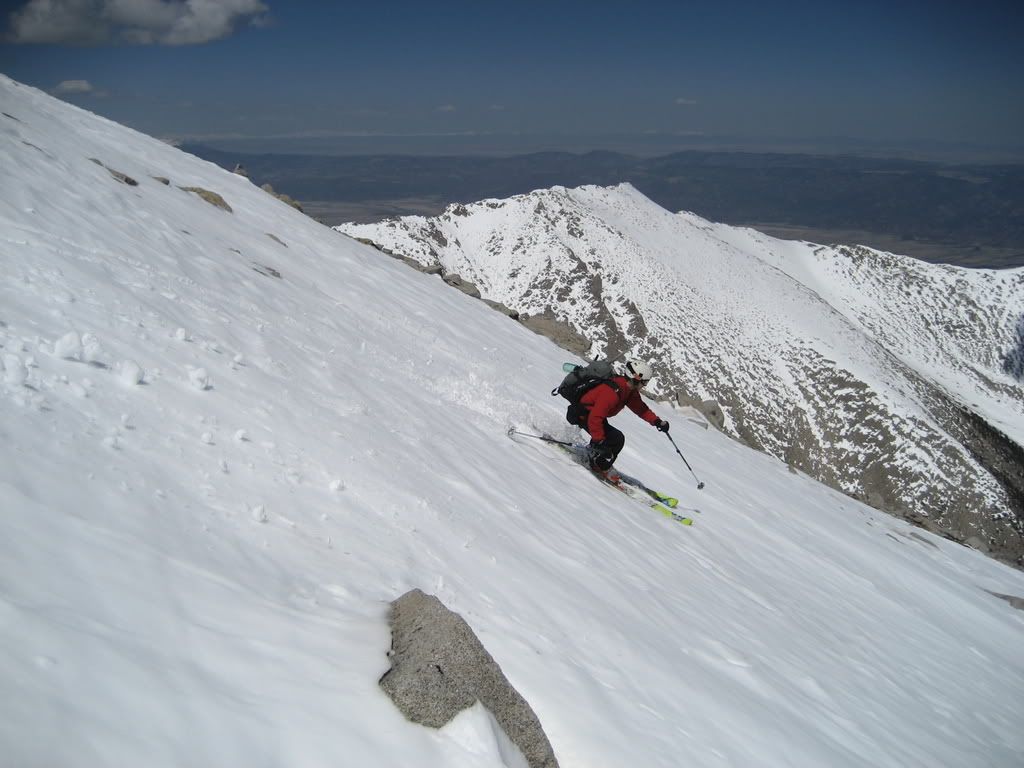 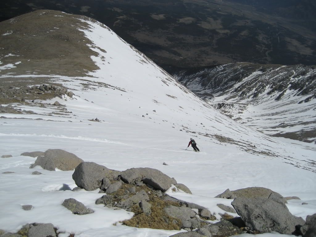 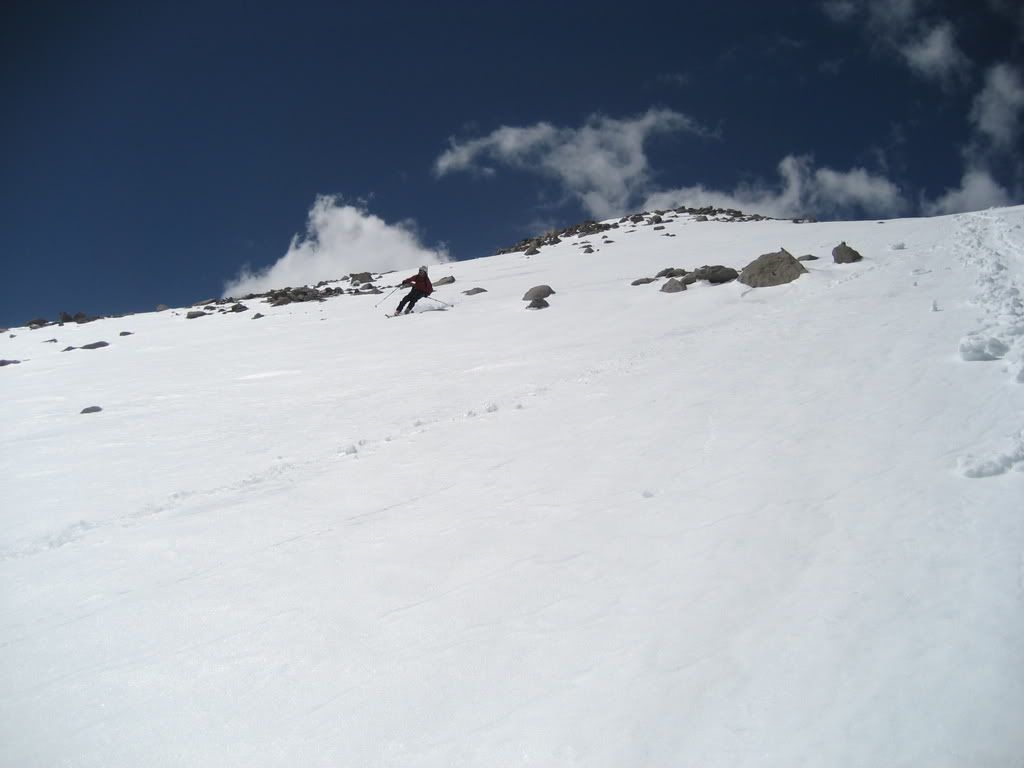 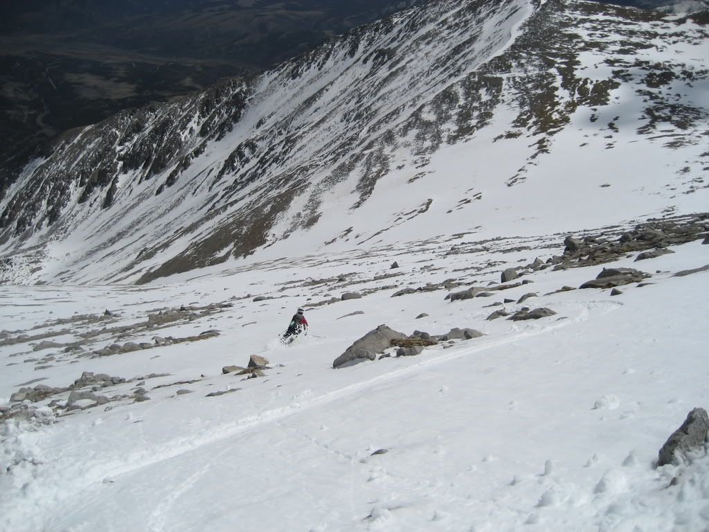 The right arm held some fun turns: 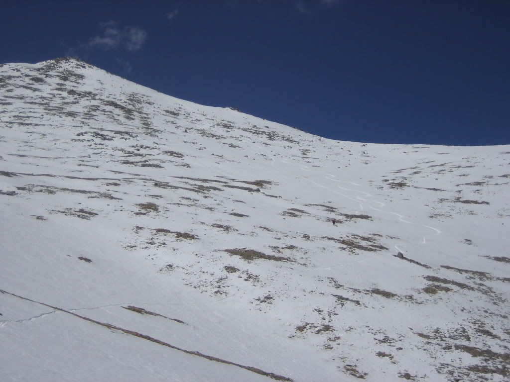 Turns on the upper right arm of the angel I crossed over to the left arm of the angel for better snow. 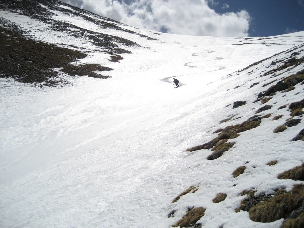 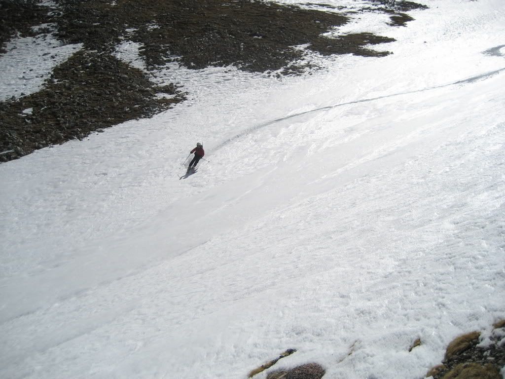 Final tidings to a successful day. 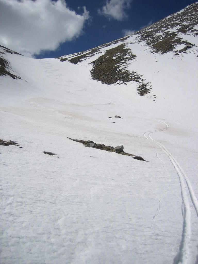 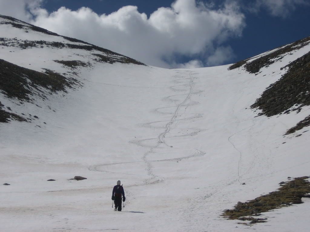 Our lines down the body A fine day to be in the hills. We were lucky to have found these mountains in such fine shape snow wise. I kept thinking this day would have been nowhere near as enjoyable in a few weeks due to the rapidly disappearing snow pack. Tomorrow, Sunday, the goal was to get some easy Tenmile Peaks skied. |
| Comments or Questions | |||
|---|---|---|---|
|
Caution: The information contained in this report may not be accurate and should not be the only resource used in preparation for your climb. Failure to have the necessary experience, physical conditioning, supplies or equipment can result in injury or death. 14ers.com and the author(s) of this report provide no warranties, either express or implied, that the information provided is accurate or reliable. By using the information provided, you agree to indemnify and hold harmless 14ers.com and the report author(s) with respect to any claims and demands against them, including any attorney fees and expenses. Please read the 14ers.com Safety and Disclaimer pages for more information.


