Download Agreement, Release, and Acknowledgement of Risk:
You (the person requesting this file download) fully understand mountain climbing ("Activity") involves risks and dangers of serious bodily injury, including permanent disability, paralysis, and death ("Risks") and you fully accept and assume all such risks and all responsibility for losses, costs, and damages you incur as a result of your participation in this Activity.
You acknowledge that information in the file you have chosen to download may not be accurate and may contain errors. You agree to assume all risks when using this information and agree to release and discharge 14ers.com, 14ers Inc. and the author(s) of such information (collectively, the "Released Parties").
You hereby discharge the Released Parties from all damages, actions, claims and liabilities of any nature, specifically including, but not limited to, damages, actions, claims and liabilities arising from or related to the negligence of the Released Parties. You further agree to indemnify, hold harmless and defend 14ers.com, 14ers Inc. and each of the other Released Parties from and against any loss, damage, liability and expense, including costs and attorney fees, incurred by 14ers.com, 14ers Inc. or any of the other Released Parties as a result of you using information provided on the 14ers.com or 14ers Inc. websites.
You have read this agreement, fully understand its terms and intend it to be a complete and unconditional release of all liability to the greatest extent allowed by law and agree that if any portion of this agreement is held to be invalid the balance, notwithstanding, shall continue in full force and effect.
By clicking "OK" you agree to these terms. If you DO NOT agree, click "Cancel"...
Date: April 13
Trailhead: Ashcroft - winter closure
Mileage: 10.83
Elevation Gain: 4,500'
Route: SE couloir
Partners: Joel
Joel and I have been wanting to ski Cathedral for at least 3 years now. The snow looked like it was going to be great, but it wasn't. This is a peak ski I will have to repeat, just for my desire to have good memories and not bad ones. We kept our skis on from summit to car, but neither Joel or I really "count" this one. Good thing there are other lines that also looked great on this peak.
So, I'll just let the photos do the talking for this one, since at least we had stunning views! Type II or III fun on this one
Sunrise - moonset
Booting up the apron Looking down What Joel thinks of the ~52 degree choke Sill more up Don't look down traverse. So I looked down - GULP! Castle North Face looking too thin to ski Pyramid and the Bells, with Capitol
Castelabra ski tracks
The traverse off the summit to the couloir. A good turn at the top So much down to go Well, we "skied" that! Till next time Cathedral
Mt Buckskin
Date: April 14
Trailhead: a mile or so from Kite Lake
Mileage: 4.73
Elevation Gain: 2,341'
Route: North face
Partners: Solo
After a long tough day in the Elks, I decided to go for an easy peak in the Mosquito Range. I was able to drive pretty far on the road, so that made this day even shorter and nicer. After a lazy sleep in morning (nice after only getting 2 hours the night before Cathedral), I got started up the road well after sunrise. I angled up and got onto the ridge so I could get a view of the north face. I hoped there was some snow. What I saw looked like a labyrinth. It would take some effort to get this one as complete as possible.
Buckskin native
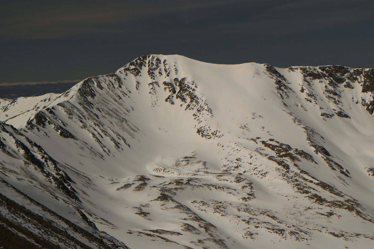
So the peak ski will be a challenge...
Even taking a glacial pace to the summit, the snow was still not warming up. The wind was howling out of the SW and my patience to sit on the summit and wait it out was not there.
The Decalibron Looking down the route Completing the maze
Skiing off the face was interesting. The sustrugi was mostly soft and I even found some pockets of reworked powder. Within the maze, I only had to billy goat for 2', so I consider that quite a success, given the options. Skiing off the bench was soft but a bit punchy. Still the turns were nice, since the line was fully filled in.
I decided to ski across that basin to get to a more solar aspect for the ski down to the road. Side hilled a bit up the slope and got great turns all the way down until it got flat. But from there, it was only a short distance back to where I parked.
Done with the cool north facing slopes The Buckskin Maze Creamy corn turns Looking back on the best turns of the day, from the car
Cronin Peak
Date: April 16
Trailhead: Baldwin Gulch
Mileage: 11.64
Elevation Gain: 4,433'
Route: NE face
Partners: Zach and Bill
Zach and I have wanted to ski Cronin's East Face for a while now. Likely after seeing it from our super "fun" day on Antero a few years back. So thankfully with the season finally getting going, I am willing to spend more time skiing than working. Ski while it's good, since soon it will melt away and be summer!
I rolled up to the 2WD trailhead after both Bill and Zach had arrived, and grabbed a decent nights rest. With the wind and cool temps, we were having a nice start time of 5ish. A fairly quick skin up the mostly continuous road, an easy stream crossing, and we were looking at the line through the trees. It looked wonderfully smooth and ready to be skied.
Moonset behind Cronin
First view of the objective, after we left the road
We were able to mostly skin all the way up to the ridge. Both Bill and Zach made it up, while I decided to boot the last bit. A moment of inattention to form, had me sliding face first down the slope. Thanks to the whippet, I only lost 10-20' or so (and my lens cap). So not wanting a repeat, I transitioned to boot up, and quickly caught the guys as they started up the ridge.
Skinning to the ridge - almost.
This ridge seemed to last forever. On the map, it looked like a short distance. But false summit after false summit presented itself, and I could hear the cursing coming from behind me. At least we weren't in too much of a rush today. A solo skier was skiing down, as we approached the final summit push. From his tracks, the snow was still on the firm side, so that was good.
Start of the booter up the never ending ridge
So much ridge
Zach booting up the ridge, Princeton behind Nearing the summit, as the solo skier starts down
Grizzly looking delightful!
Almost done with the never ending ridge!
How Zach feels about the climb today
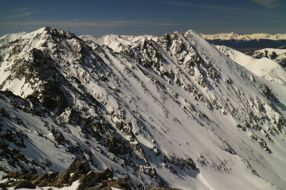
Princeton
Antero
Shavano and Tab
After a nice break, we started skiing down off the summit. The first pitch was the steepest, and then mellowed out quite nicely to a fun slope angle. The snow was really good, especially after what I had experienced recently.
Starting the descent
Off the summit turns
After getting into the chosen line, it was a great descent all the way down to the valley below.
Back to the trees, it was an expedient exit down to the cars below. Only a few dry sections requiring either an easy billy goat or 2 ski portages. Finally, a ski worth remembering this "spring".
Such lovely turns! Looking back on a great day!
Atlantic Peak
Date: April 23
Trailhead: Quandary
Mileage: 11.41
Elevation Gain: 3,327'
Route: up Tradewinds couloir, down V Couloir
Partners: Zach and Bill
Zach and I attempted to ski Atlantic 3 years ago, but turned around due to extreme winds. So we have been planning our revenge for a while.
We had hoped to be able to either drive to the McCullough Gulch TH or sled there. But there's a gate at the start of the road. Drat! There's an extra 4 miles! For once this season, I made a good call and chose to wear hiking boots for the approach on the road. Zach and Bill had hoped to skin it. But the FS had plowed the road, so it was mostly dry all the way to the trailhead. At least the approach went quickly, and we found ourselves on the trail itself for sunrise.
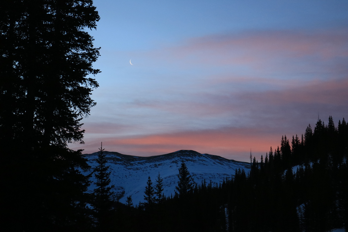
Sunrise
Pink clouds and moonsicle over Hoosier Ridge
Contemplating our route
It was a familiar skin up into the drainage, where a bunch of lines presented themselves on the nearby peaks. Soon we had to decide wether to climb the line we wanted to ski, or to go the easier route up to the saddle. With the new snow, we were concerned that we may end up wallowing up the couloir, and waste considerable time. So we chose the Trade Winds route, and made quick time up into the gusty wind above. From there it was a short booter to the summit.
Fletcher's NE face looking steeply inviting
Boot up the Trade winds route
Wind blown Trade Winds route
Boot to the summit
Took a nice break on the summit, were a couple came up the west ridge route from Mayflower Gulch. Been 8 years since I went that way up to the summit!
Fletcher and Drift
Pacific got some traffic today and yesterday
Summit lounging, with Quandary in background
Off the summit the snow was soft but slightly punchy where I was. We chose skiers right branch of the V, since it would likely have more powder and be less sun effected. The snow itself was more on the hot pow side than desired, but the turns were still good!
Skiing off the summit Summit turns Bill skiing down to the top of the V Bill dropping into the V Zach dropping in Bill skiing the line Looking down the lower V Jump! My off chute I took Zack finishing out the V Big turns down the apron
Zach coming in hot
Bill zooming by
The hot and bothered V
Such a great line!
Atlantic Summit zoom - photo credit: Bill
Once down in the valley below, we enjoyed the nice corn back to the lake. We did a short reclimb to ski a chute above the trail we had done 3 years ago as the consolation prize. Great turns again!
Sweet redemption on Atlantic
My GPS Tracks on Google Maps (made from a .GPX file upload):
You always show a great variety of pictures (that appeal to us non-skiers too). The picture leading up to Cronin's summit pitch makes it look pretty sweet with the wind drifted snow.
Good times. 13ers are the best. Loved the redemption on Atlantic
Caution: The information contained in this report may not be accurate and should not be the only resource used in preparation for your climb. Failure to have the necessary experience, physical conditioning, supplies or equipment can result in injury or death. 14ers.com and the author(s) of this report provide no warranties, either express or implied, that the information provided is accurate or reliable. By using the information provided, you agree to indemnify and hold harmless 14ers.com and the report author(s) with respect to any claims and demands against them, including any attorney fees and expenses. Please read the 14ers.com Safety and Disclaimer pages for more information.
Please respect private property: 14ers.com supports the rights of private landowners to determine how and by whom their land will be used. In Colorado, it is your responsibility to determine if land is private and to obtain the appropriate permission before entering the property.


 Booting up the apron")
 Looking down")
 What Joel thinks of the ~52 degree choke")
 Sill more up")
 Don't look down traverse. So I looked down - GULP!")
 Castle North Face looking too thin to ski")
 Pyramid and the Bells, with Capitol")
 The traverse off the summit to the couloir.")
 A good turn at the top")
 So much down to go")
 Well, we \"skied\" that!")
 Till next time Cathedral")
 So the peak ski will be a challenge...")
 The Decalibron")
 Looking down the route")
 Completing the maze")
 Done with the cool north facing slopes")
 The Buckskin Maze")
 Creamy corn turns")
 Looking back on the best turns of the day, from the car")
 First view of the objective, after we left the road")
 Zach booting up the ridge, Princeton behind")
 Nearing the summit, as the solo skier starts down")
 Almost done with the never ending ridge!")
 Starting the descent")
")
")
")
")
")
")
")
")
 Such lovely turns!")
 Looking back on a great day!")
 Boot up the Trade winds route")
 Summit lounging, with Quandary in background")
 Skiing off the summit")
 Summit turns")
 Bill skiing down to the top of the V")
 Bill dropping into the V")
 Zach dropping in")
 Bill skiing the line")
 Looking down the lower V")
 Jump!")
 My off chute I took")
 Zack finishing out the V")
 Big turns down the apron")
 The hot and bothered V")
 Atlantic Summit zoom - photo credit: Bill")


